Abandoned & Little-Known Airfields:
California: Central Los Angeles Area
© 2002, © 2026 by Paul Freeman. Revised 7/10/26.
This site covers airfields in all 50 states: Click here for the site's main menu.
For a 10th year, the CA pages of this website are sponsored by the California Pilots Association:
____________________________________________________
Please consider a financial contribution to support the continued growth & operation of this site.
Ardis Airport (revised 2/24/20) - Compton Central Airport (revised 11/21/23) - Dominguez Field (revised 2/20/26)
EMSCO Field / Baker Field / Vultee Field / Downey Field (revised 7/10/26)
Goodyear Factory Airship Base (revised 11/15/25) - Montebello Airport / East Los Angeles Airport (revised 6/7/22) - Vail Field / Western Air Express Airport (revised 10/14/22)
____________________________________________________
Goodyear Factory Airship Base, Huntington Park, CA
33.979, -118.259 (East of Los Angeles International Airport, CA)
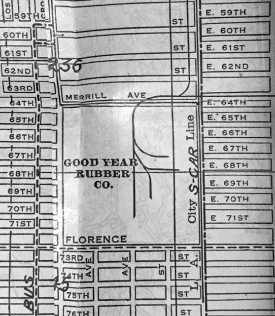
The “Good Year Rubber Co.”, as depicted on a 1930 street guide (courtesy of Kevin Walsh).
This facility within Los Angeles was a large Goodyear manufacturing complex.
According to Mark Lincoln, “The first blimp hangar erected at the Goodyear Tire Plant was a wooden structure erected to house the small (35,300 cu-ft) Type AA 'Pony' blimp in 1920-21.
The next Goodyear blimps to be operated on the West Coast were the much larger type TZ (GZ-3) Volunteer (I through V),
all using control car C-41 & registered NC-8A between 1929-39.”
The earliest depiction which has been located of the Goodyear facility was on a 1930 street guide (courtesy of Kevin Walsh).
It depicted the “Good Year Rubber Co.” as a square block with several rail lines, but it did not depict any buildings.
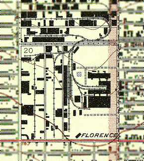
The earliest topo map depiction which has been located of the Goodyear facility was on the 1937 USGS topo map.
It depicted several large factory buildings in the center of the property,
with open areas (airship fields) on the north & south sides, on the west side of which were several hangars.
According to Mark Lincoln, “The blimp based in Los Angeles from 1939 until it was transferred to the US Navy in 1942
was the Resolute III, type TZ (GZ-10) control car C-46, registration NC-15A.
The blimp hangar at the tire factory was next used for a blimp when the Volunteer VI, type L, using control car 138, was erected in the hangar.”
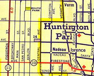
A 1940 Shell street map (courtesy of Gary Alexander) labeled airport #14 on the map as “Goodyear Airship Base”.
According to Charles Irvin, “The main building faced Central Avenue,
and from what I can recall from my childhood, the only hangars I knew of
were the ones at the northwest / southwest corners of the plant (the angled buildings).
The southwest one had 'Goodyear' painted across the rooftop along with the winged shoe logo,
and was visible (the rooftop & logo) from the Harbor Freeway that runs west of the plant.
I can remember the one hangar, I can remember the administration building.
The main manufacturing building was massive, and pretty much all the buildings were concrete
except for the hangars, which I think were sheet metal - but again, huge.”
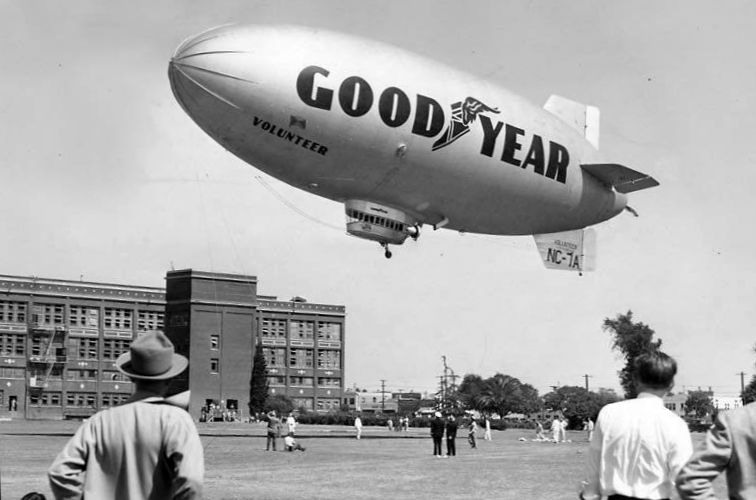
The only photo which has been located of a Goodyear blimp at the LA Goodyear factory complex was a late 1940s photo of the Goodyear airship Volunteer landing.
According to Mark Lincoln, “By 1948 Goodyear blimp operations had moved to NAS Santa Ana.”
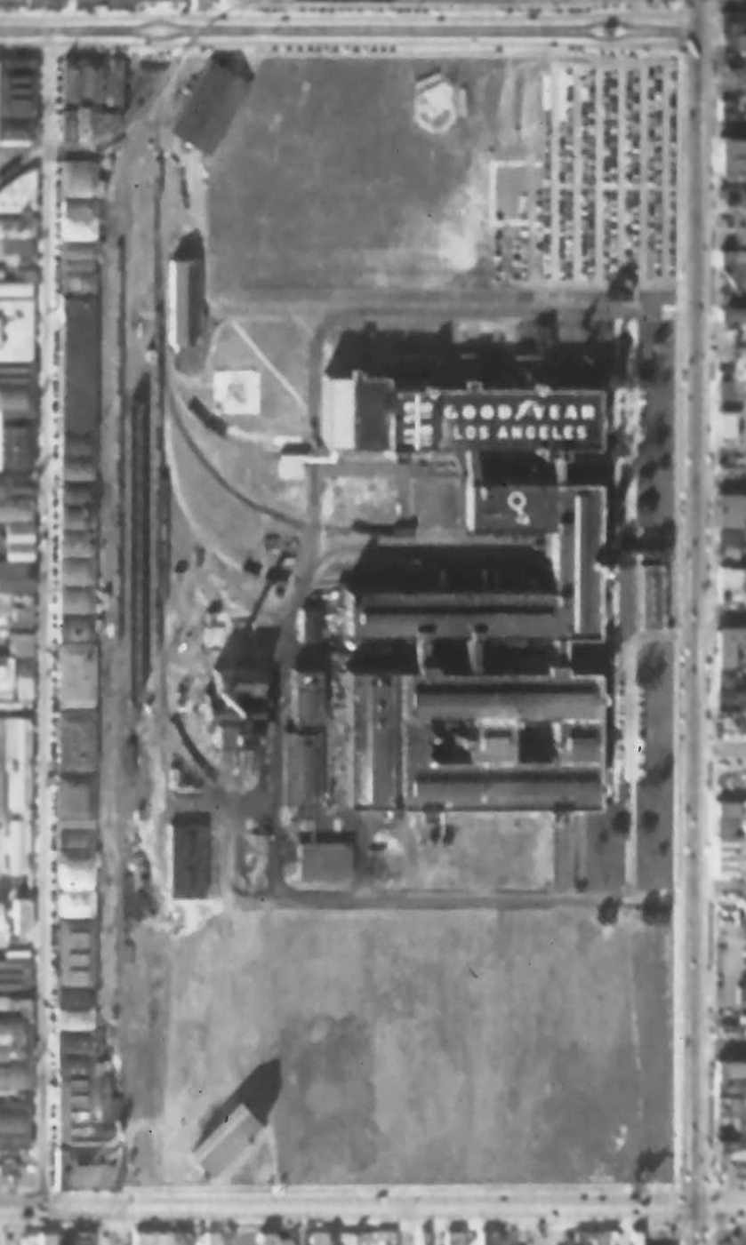
A 12/4/52 aerial photo flown by Fairchild Aerial Surveys (courtesy of Robert Pope) showed the Goodyear factory complex & its blimp hangar.
One large building had “Goodyear Los Angeles” painted on the roof.
According to Mark Lincoln, “The Los Angeles hangar was used only briefly in 1953 when NAS Santa Ana was crowded with US Navy blimps.”
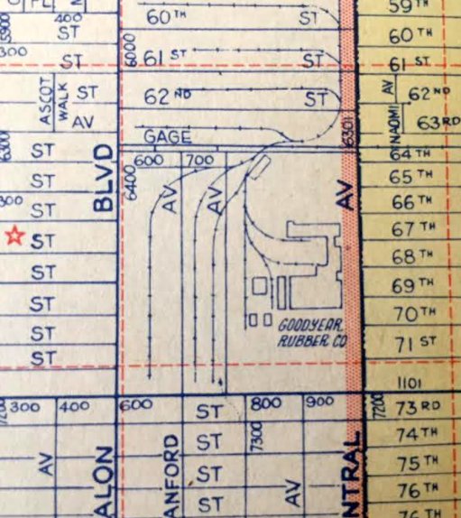
A 1955 street atlas (courtesy of Kevin Walsh) depicted “Goodyear Rubber Company”.
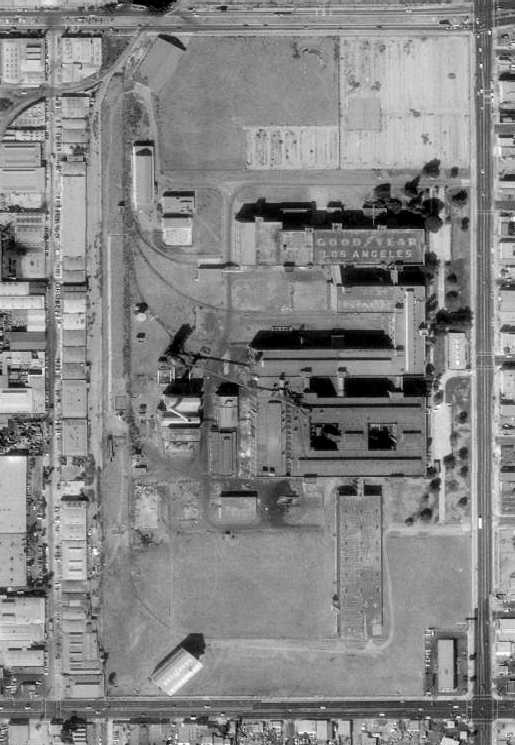
A 1980 aerial view showed that the former Goodyear Airship plant was not much changed compared to as seen in 1952,
with the hangar still standing on the southwest corner,
and “Goodyear Los Angeles” still painted on the roof of one large building.
According to Charles Irvin, “There was a LOT of 'bad blood' over this plant: it had become a tire re-capping plant in later years,
and operations were moved out of state in an attempt to help clean up the air in L.A.
When it was time to demolish buildings, several groups tried to get at least one hangar listed as a historical building / national landmark,
and all attempts failed - Goodyear wanted nothing to do with the place anymore,
and refused to help (seems they were forced out of L.A. against their will, and were/are still very bitter over it).”
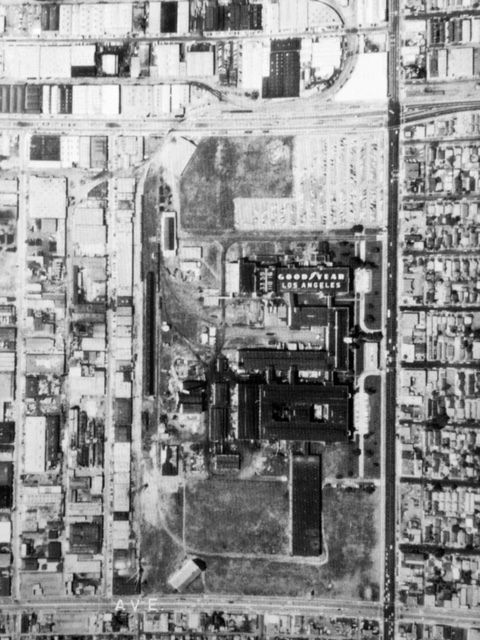
Amazingly a 1983 aerial view (courtesy of Kevin Walsh) showed that the former Goodyear Airship plant was not much changed compared to as seen in 1952,
with the hangar still standing on the southwest corner,
and “Goodyear Los Angeles” still painted on the roof of one large building.
Ironically, the former Goodyear factory had some aviation reuse long after it was abandoned.
According to Charles Irvin, “If you look at the film 'Blue Thunder' [1983],
a good portion of the end of the film was shot at the old plant:
it's the chase scene with Schieder & McDowell & their respective helicopters,
and they shoot up the plant pretty good (you can tell in the film that it had been abandoned for quite some time).
But - they stayed away from the hangar (only the southwest hangar remained until the plant was demolished).”
The 1994 USGS aerial photo showed that the site of the former Goodyear factory had been covered by a large new building
(the Central Los Angeles Post Office) at some point between 1980-94,
and it did not appear as if any remnants of the Goodyear complex had survived.
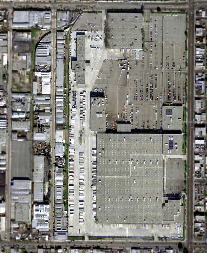
As seen in the 2004 USGS aerial photo, the former Goodyear factory & hangars were replaced by the Post Office building, leaving no trace of them.
However, the row of smaller buildings along the west side of the property (visible in the 1952 photo) still remain intact.
Charles Irvin reported in 2007 that he went to Goodyear's Airship Operations in Carson
to look for photographs of the Goodyear Los Angeles factory airship facility,
“Only to find they had none at all, except for a close-up of a prototype blimp:
the photo was taken from the doorway of the south hangar,
looking towards the main administration / production building (it was a huge concrete building).
Goodyear's corporate offices also do not have any photographs of the plant,
nor was the late Hal Fishman of KTLA News (a record-holding pilot who had covered L.A. most of his life)
able to find anything in their archives about it - seems everybody wanted to forget that it ever existed.”
The site of the Goodyear factory was bounded by Florence Avenue on the south,
Central Avenue on the east, Gage Avenue on the north, and McKinley Avenue on the west.
____________________________________________________
33.86, -118.25 (South of Los Angeles, CA)
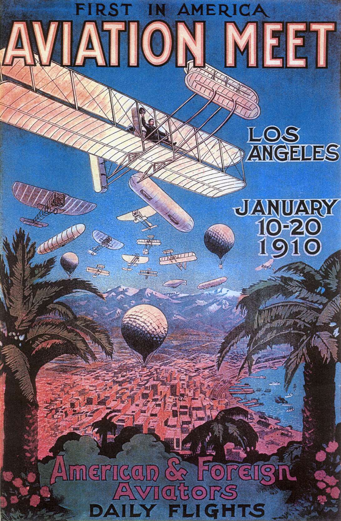
A poster promoting the 1/10/10 Aviation Meet at Dominguez Field.
According to Wikipedia, The Los Angeles International Air Meet of January 10-20, 1910 was among the earliest airshows in the world & the first major airshow in the United States.
It was held at Dominguez Field, southwest of the Dominguez Rancho Adobe in present-day Rancho Dominguez, CA.
Spectator turnout numbered approximately 254,000 over 11 days of ticket sales.
The Los Angeles Times called it "one of the greatest public events in the history of the West."
Shortly after the 1909 Reims France, airshow, Charles Willard & Roy Knabenshue resolved to stage the first such show in the United States, targeting the winter of 1909 - 1910 for its occurrence.
Knabenshue & Willard selected the Los Angeles area for its favorable winter weather.
After receiving a promise of participation from Glenn Curtiss, Knabenshue contacted Los Angeles promoter Dick Ferris, who in turn mobilized local businesses & formed an organizing committee.
A field near Santa Anita Park was considered, but physical obstructions such as tall trees led the aviators to search elsewhere.
By December 1909, they selected Dominguez Field atop a small hill that had been developed by Manuel Dominguez on land once part of Rancho San Pedro, an early Spanish land grant.
Once the site was finalised, promotion of the meet began & grandstands with a capacity of between 50,000-60,000 were erected,
and an aviators' camp was also constructed nearby.
Organizers invited pilots of monoplanes, biplanes, balloons, and dirigibles.
To reinforce the event's "international" billing, French aviator Louis Paulhan, a notable from the 1909 Reims meet, was invited.
Paulhan was guaranteed a small sum of money as encouragement to attend. Cash prizes were allotted for competitive events in altitude, speed, and endurance.
The 1910 Air Meet drew many famous aviators, most of whom were American.
Glenn Curtiss, American aviation pioneer & founder of the Curtiss Aeroplane & Motor Company was the most famous.
Other participants included Roy Knabenshue, Charles Willard, Lincoln Beachey, Charles Hamilton, Howard Gill, and Clifford Harmon, many of whom are listed among the Early Birds of Aviation.
French aviators at the event included Louis Paulhan & Didier Masson.
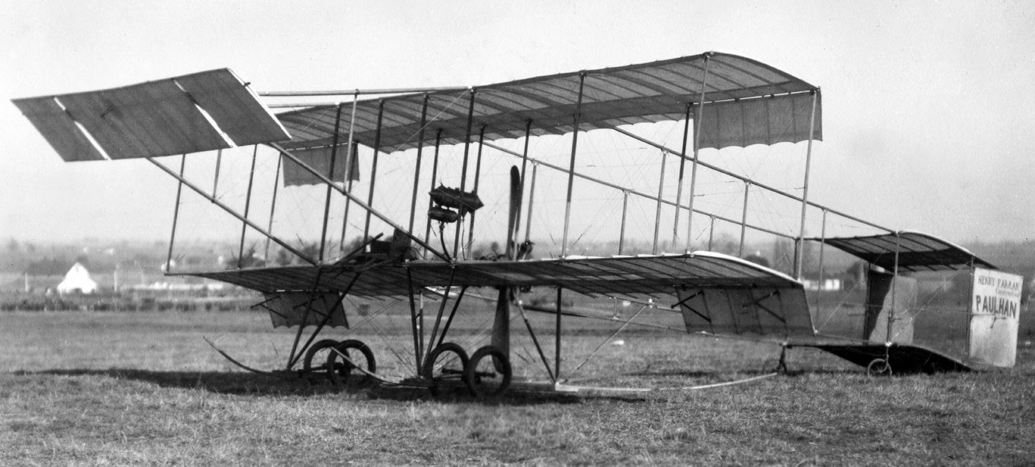
A January 1910 photo of the Farman III biplane at the Dominguez Field Air Meet.
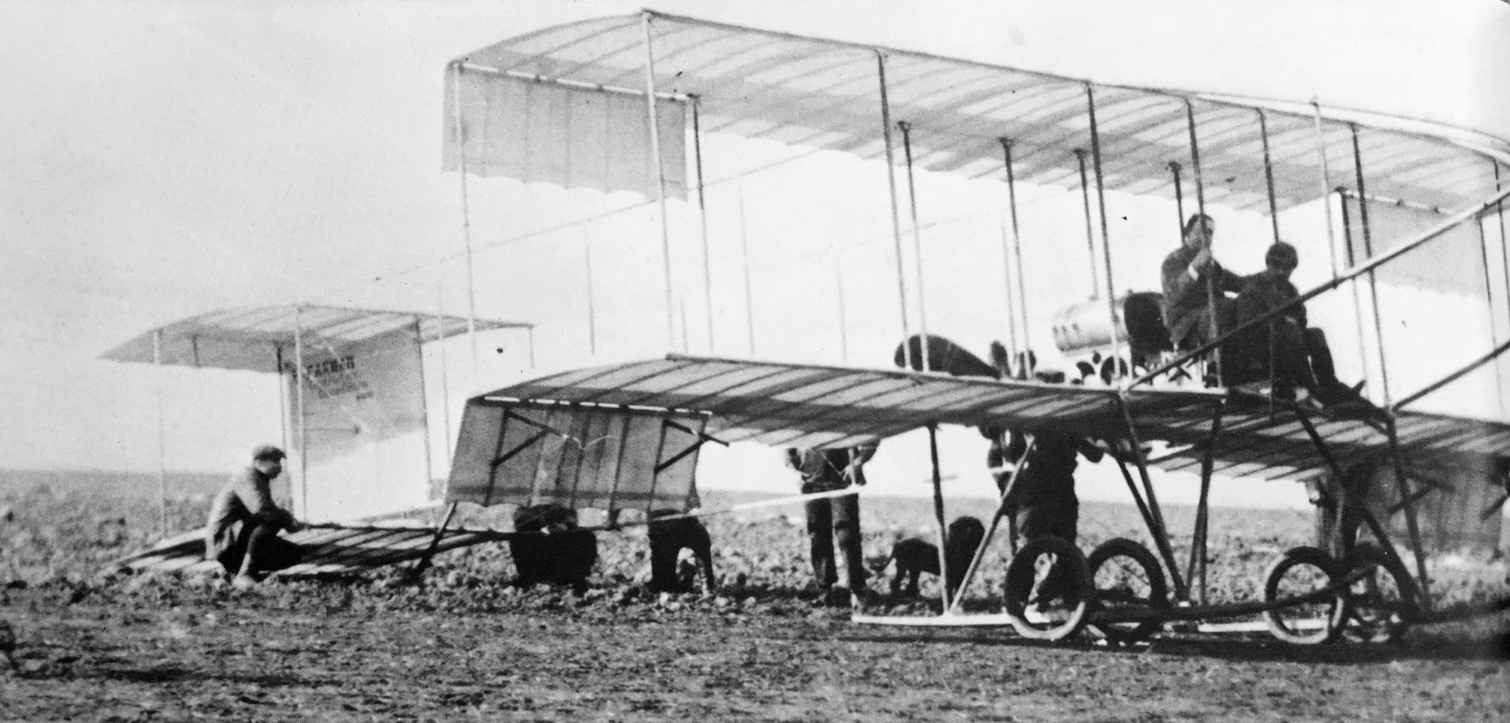
A 1910 photo of a William Randolph Hearst being taken for his first airplane ride by Louis Paulhan in his Farman III biplane at the Dominguez Field Air Meet (courtesy of Kevin Walsh).
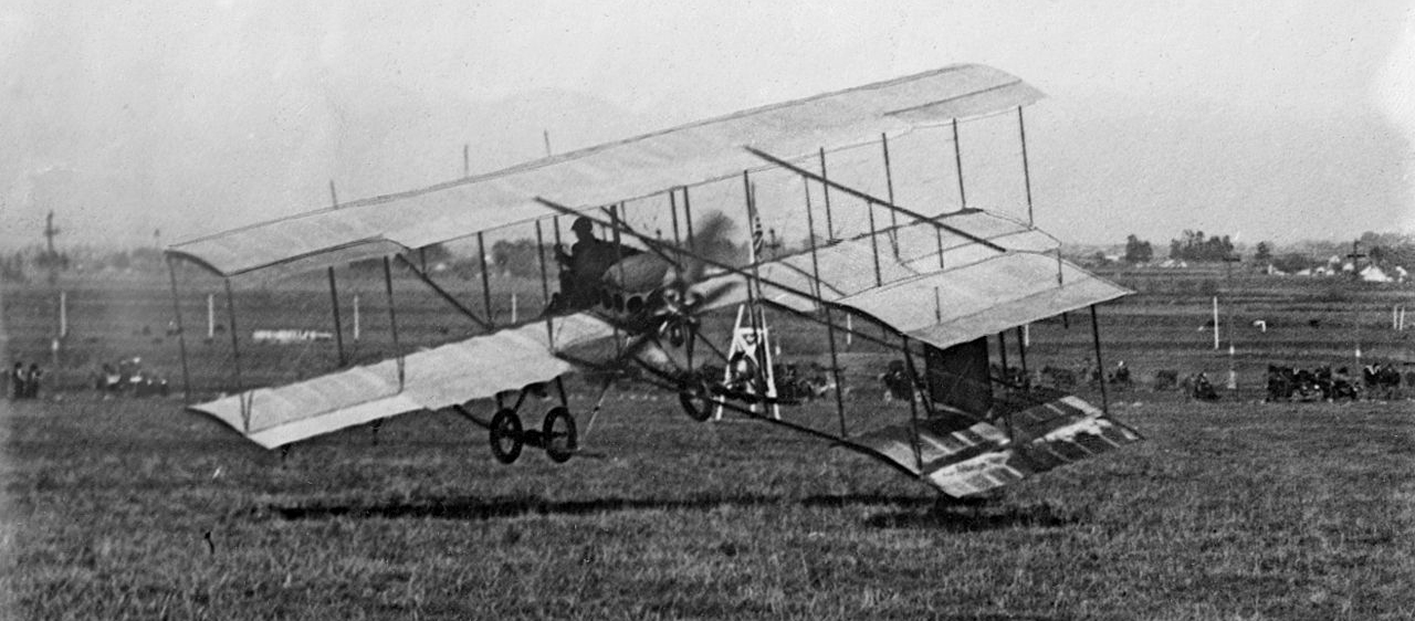
A 1910 photo of Louis Paulhan taking off in his Farman III biplane at the Dominguez Field Air Meet.
The Wright brothers did not take part in the event, but were there with their lawyers in an attempt to prevent Paulhan & Curtiss from flying.
The Wrights claimed that the ailerons on their aircraft infringed patents. Notwithstanding their allegations, Paulhan & Curtis still made flights.
However, William Boeing, who had been enthused by the new invention of the airplane, was unable to get a ride on any aircraft at the air meet.
As part of the larger Wright brothers' patent cases, the Wrights actually won monetary damages in U.S. courts for Paulhan's public performances that day.
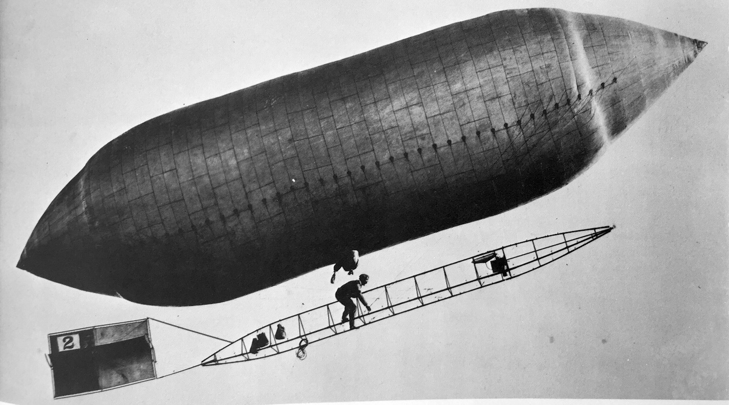
A 1910 photo of a Lincoln Beachey scampering up the open fuselage of a Knabenshue dirigible at the Dominguez Field Air Meet (courtesy of Kevin Walsh).
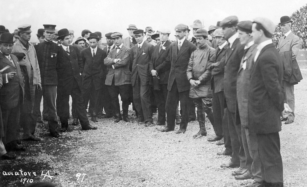
A 1910 photo of prominent participants of the Dominguez Field Air Meet, including Charles Miscarol, Hillery Beachey, Frank Johnson, Glenn Curtiss, Louis Paulhan, Charles Willard, Roy Knabenshue, and Charles Hamilton.
It is not known if Dominguez Field was ever used for aviation again after the 1910 Air Meet.
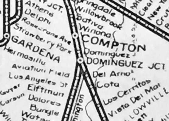
The last depiction which has been located of Dominguez Field was on a 1919 Pacific Electric system map (courtesy of Kevin Walsh), which labeled “Aviation Field” as a stop south of Dominguez Junction.
On 12/2/59 the site of Dominguez Field became a California Historical Landmark, #718.
The commemorative plaque near the site read: “About one half mile southeast of this spot, on Dominguez Hill in historic Rancho San Pedro,
the first air meet in the United States was held during January 10–20, 1910.
Subsequently, this area has evolved into one of the world's leading aviation-industrial centers.”
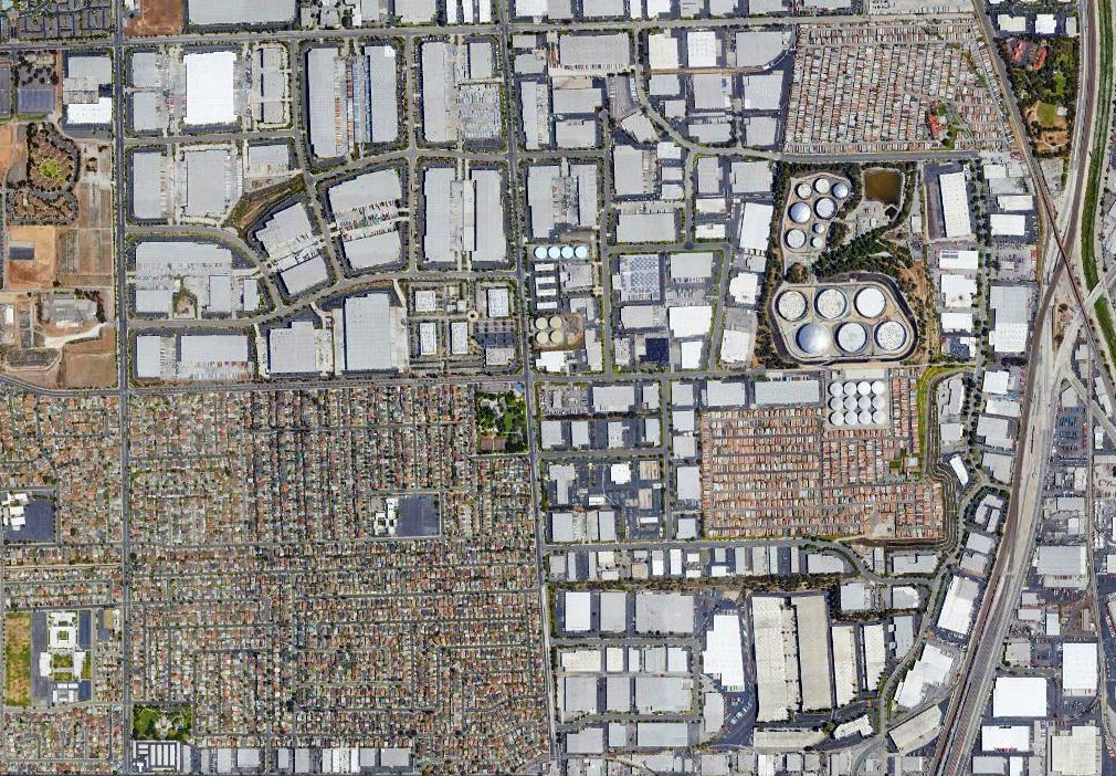
A 2018 aerial view shows no trace of Dominguez Field, with the area having been heavily developed.
The precise location of Dominguez Field has not been determined.
It was reportedly located east of the present-day campus of California State University Dominguez Hills,
which would be roughly northwest of the intersection of East Del Amo Boulevard & South Wilmington Avenue.
____________________________________________________
EMSCO Field / Baker Field / Vultee Field / Downey Field, Downey, CA
33.92, -118.13 (North of Long Beach, CA)
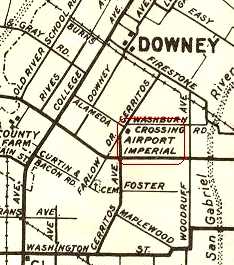
A 1931 street map (courtesy of Gary Alexander) labeled the Downey airfield simply as “Airport”.
This former industrial facility & airfield is a site which is steeped in American aviation & space history,
and yet is largely unknown outside of the immediate local area,
in spite of the tremendous milestones in American aviation & space history which were accomplished on its property.
In 1929, the Downey property was a ranch owned & operated by James Hughan.
E. M. Smith, a local industrialist & founder of the EMSCO company, purchased a 73-acre parcel from Hughan.
Smith’s EMSCO company had a division called Albatross, which manufactured small aircraft.
In addition to manufacturing aircraft, Smith saw the former farm land in Downey as a perfect landing field.
The oldest buildings on the Downey Site were built in 1929 to support the aircraft manufacturing effort.
The earliest depiction which has been located of the airfield in Downey was a 1931 street map (courtesy of Gary Alexander),
which labeled the Downey airfield simply as “Airport”.
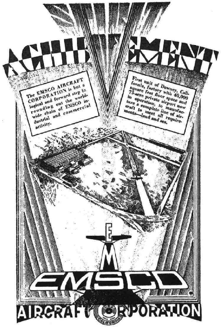
A circa 1929-32 advertisement for Emsco Aircraft Corporation's new Downey facility (from the Fall 2003 Downey Aviator),
describing it as a 40,000 square foot factory & 75 acre private airfield.
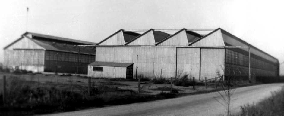
A 1932 photo of the back of the EMSCO aircraft factory buildings at Washburn Crossing facing Cerritos (Lakewood Blvd), (from the Spring 2009 Downey Aviator).
In 1932, with the Great Depression looming, causing poor sales,
EMSCO leased the site to Champion Aircraft Corporation, who manufactured small, inexpensive 2-seat aircraft.
EMSCO Airfield was not depicted at all on the 1932 LA Sectional Chart.
Seven months later, Champion also left the site due to poor sales,
and the site was leased to Security National Aircraft Corporation.
Security was owned by Walter “Bert” Kinner, who designed & built 2 planes for Amelia Earhart.
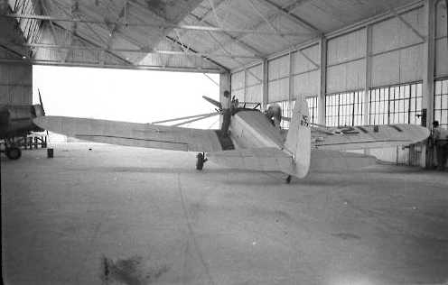
A circa 1933 photo of the Security-National Aircraft Co prototype S-1 Airster, X/NC217Y in Downey (believed to have been taken in Building 1).
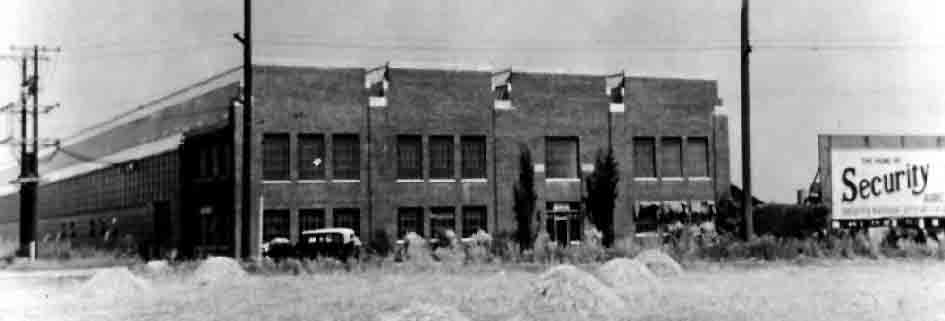
A 1933 photo of what was originally the Security Aircraft building on Lakewood Boulevard
(which still stands as part of Building 1, as of 2005).
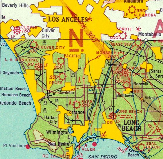
The field was still labeled “EMSCO” on the 1934 San Diego Airway Chart (courtesy of Roger Connor).
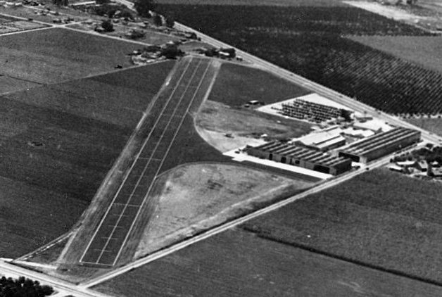
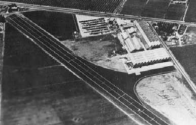
A 1935/36 aerial view (from the Library of Congress) looking south depicted Vultee Field as having a single paved northeast/southwest runway, and the Vultee plant on the northwest side.
The airfield name was misspelled as “EMSO” on the August 1936 LA Sectional Chart.
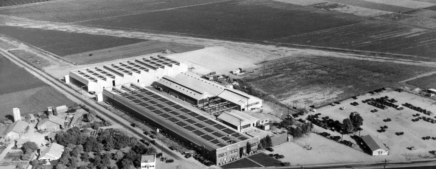
A 1936 aerial view looking northeast at the Vultee plant, with a single unpaved runway visible in the background.
Strangely, the 1936 USGS topo map didn't depict any airfield at this site.
Ownership continued to change hands, and in 1936, Aviation Manufacturing Corporation
moved their Vultee Aircraft Division from Glendale into the Downey Site at the suggestion of Gerard “Jerry” Vultee,
who once worked for EMSCO as their chief design engineer.
The airfield was renamed Vultee Field.
Vultee primarily manufactured large military aircraft & sold planes to the governments of China, the Soviet Union, Turkey and Brazil.
Vultee was working on a contract with the United States government
and was flying back from Washington DC when he & his wife were killed in a plane crash in 1938.
The company forged on without him.
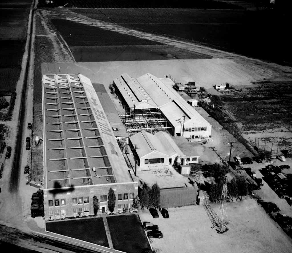
A circa 1937 aerial view looking northeast at the Vultee plant, with “Vultee” written in large letters on the roof,
and a single unpaved runway visible in the background.
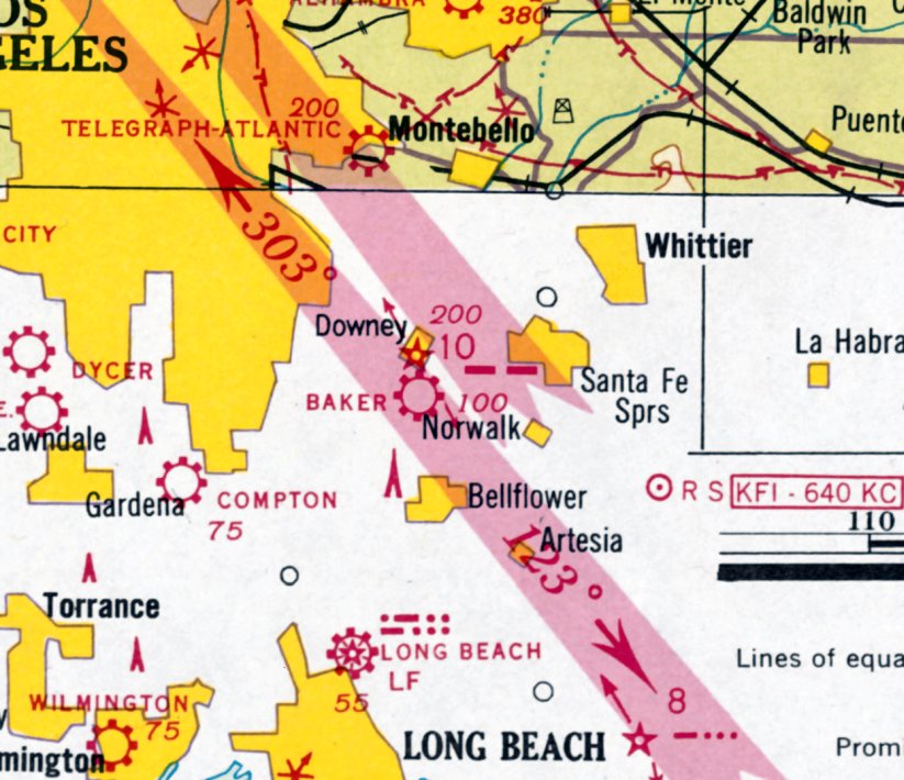
Inexplicably, the former EMSCO Field was labeled “Baker” on the January 1938 LA Sectional Chart.
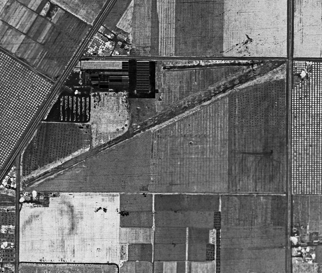
A 5/24/38 aerial view (from the UCSB Library) depicted Vultee Field as having a single unpaved northeast/southwest runway, and the Vultee plant on the northwest side.
By 1938, the Vultee Aviation Manufacturing Company has 1,500 employees
and was producing planes for several countries.
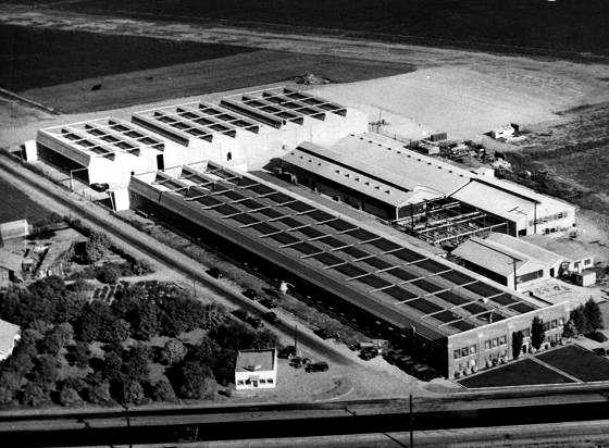
A circa late 1930s aerial view looking east at the Vultee factory, with the runway in the background.
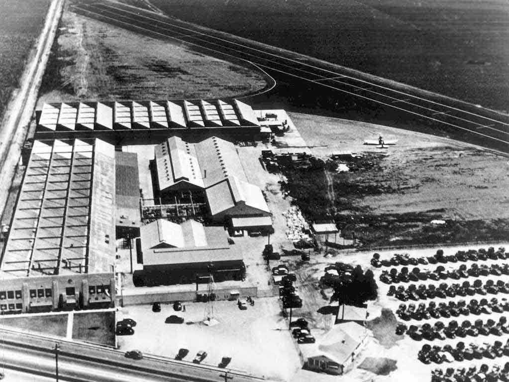
A circa 1930s aerial view looking north at the Vultee factory, with one single-engine aircraft visible next to the the runway, which had been recently paved.
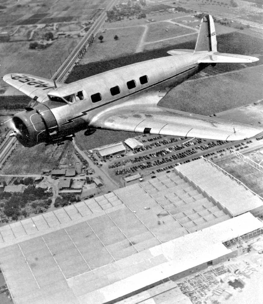
A circa 1930s aerial view of a Vultee V1-A overflying the Downey plant (from the Fall 2009 Downey Aviator).
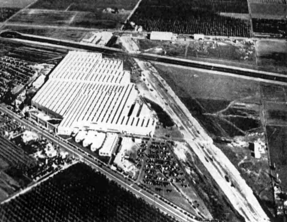
A circa 1930s aerial view looking east at Vultee Field, including the Vultee plant & 2 runways (from the Summer 2008 Downey Aviator).
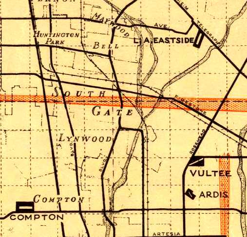
The 1939 LA County Airports Map depicted Vultee Field as having a single northeast/southwest runway.
Strangely, no airfield in Downey was depicted on the 1939 LA Sectional Chart.
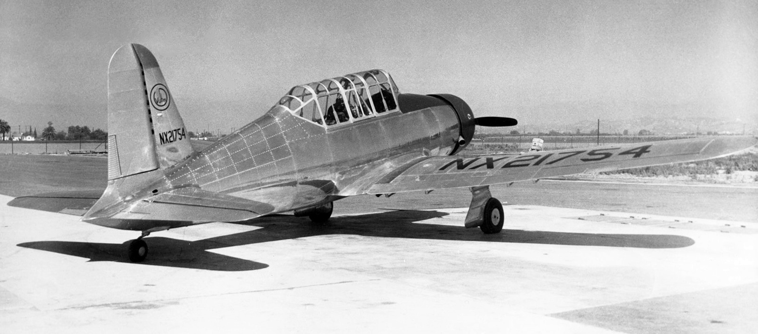
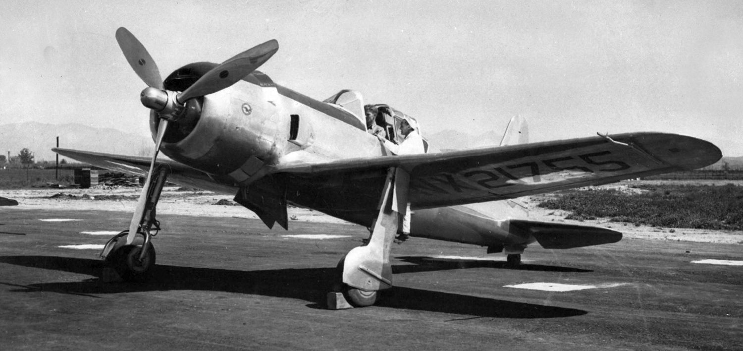
A circa 1940 photo of Vultee V-54A, NX21753, C/n 141, the BT-13 Valiant prototype, at Downey's Vultee Field.
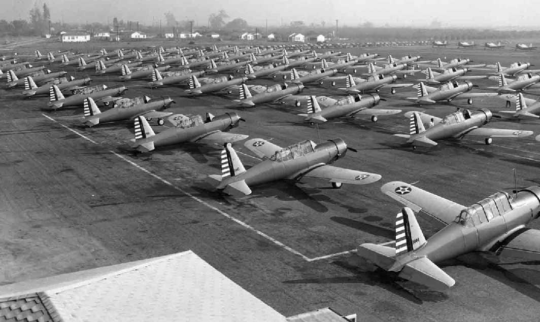
A 1940 photo of huge numbers of BT-13 trainers ready for delivery at Downey's Vultee Field.
The site was labeled “Vultee Feld” on a 1940 LA street map (courtesy of Dan MacPherson).
A circa 1940s logo of Vultee Aircraft, Downey, CA.
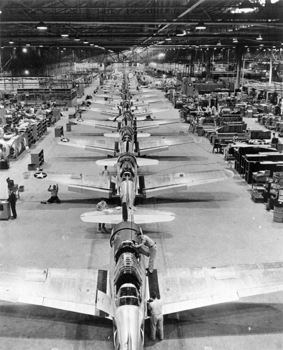
What was at the time "The world's fastest production line", at Vultee in Downey.
In the 1940s the Army Air Corps awarded Vultee Aircraft a contract to make a basic training plane, the Vultee Valiant.
The contract was the largest order ever placed by the Army Air Corps.
In need of additional space, LA Architect Gordon Kaufman designed space which would double Downey’s size.
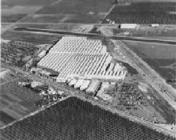
A circa 1940s aerial view looking northeast at the Vultee plant (greatly expanded since the 1930s photos), with 2 runways visible in the background.
Note how undeveloped the surrounding area was.
Strangely, no airfield in Downey was depicted on the October 1941 LA Sectional Chart.
Due to the value of the Vultee industrial facility to the war effort, was this a case of intentional concealment?
Then came World War II & security at the plant was further increased.
In addition to the anti-aircraft gun which was mounted on the roof,
the entire plant was camouflaged to blend in with the surrounding farmland.
By 1941, the plant’s output represented 15% of all the military aircraft produced in the U.S.
and boasted the first powered assembly line in the aircraft industry.
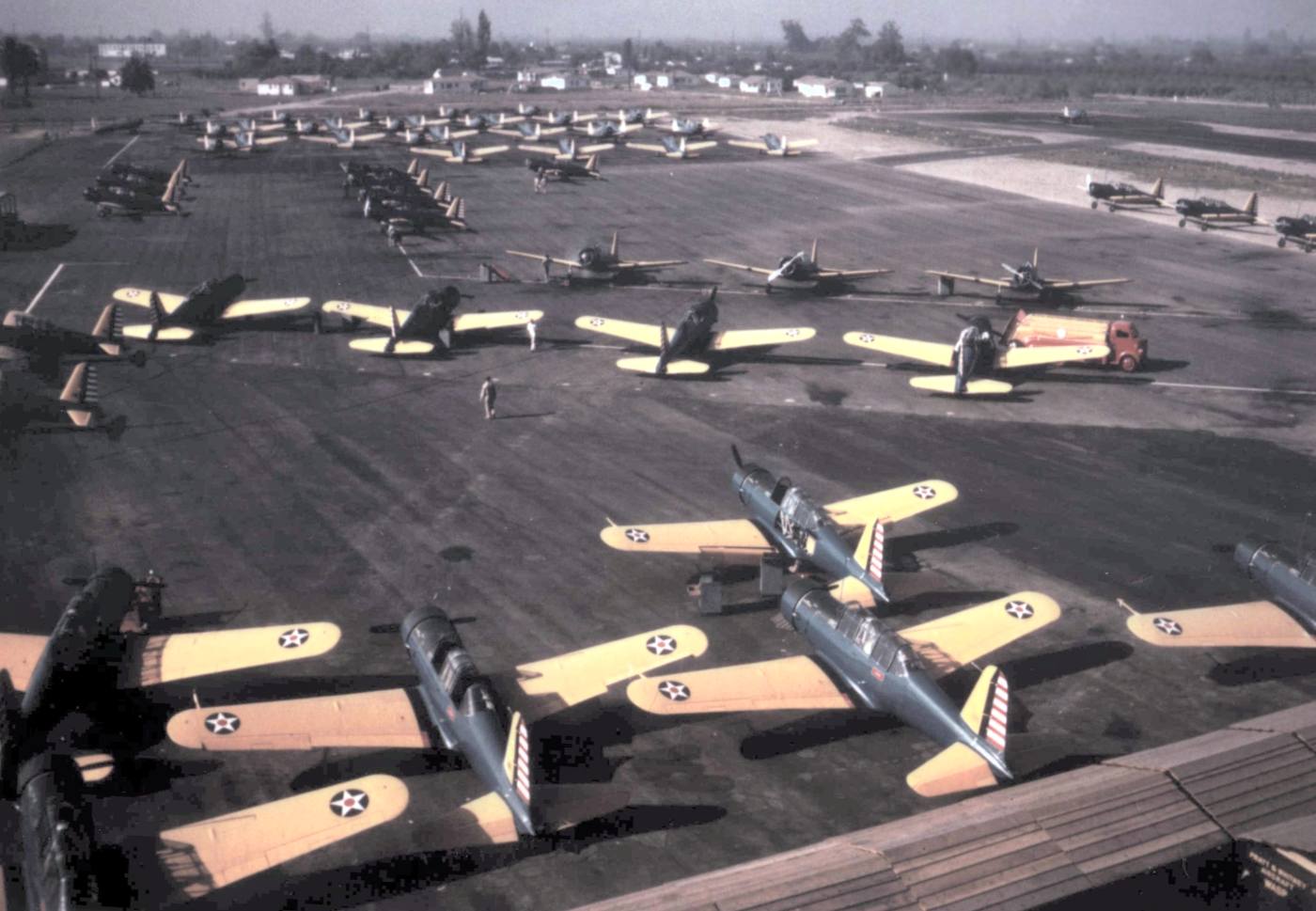
A circa 1941 colorized photo of huge numbers of Vultee BT-13 trainers ready for delivery at Downey's Vultee Field.
Just after Pearl Harbor, Vultee bought 34% of Consolidated Aircraft in San Diego.
Vultee's Downey facility produced Valiant basic trainers, the Vanguard P-66 pursuit plane, and the Vengeance A-31 dive bomber.
Vultee became famous for its ability to produce planes in large numbers quickly. It did this by constant retooling.
To support this unprecedented production at Downey, the Army Air Corps & Vultee greatly expanded the plant in the early 1940s.
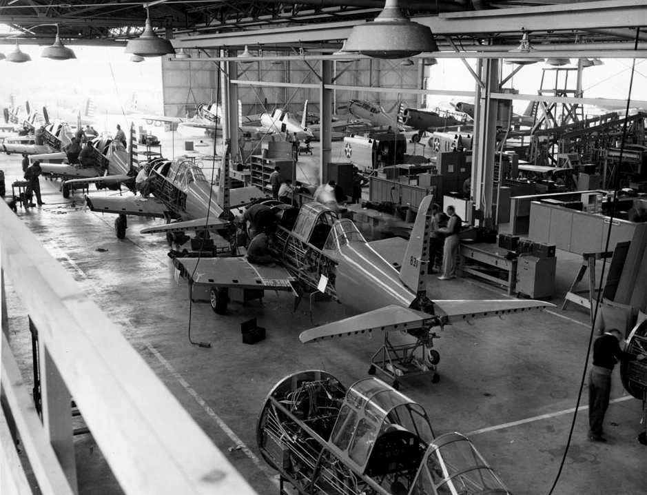
A circa 1940-45 photo of the interior of the Vultee Aircraft Company's plant, showing a production line of U.S. Army Air Corps BT-13 Valiant trainers.
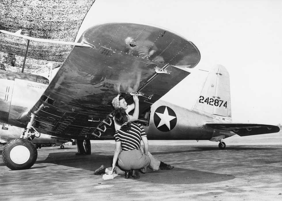
A 1942 photo of 2 Vultee employees inspection an aileron hinge on a BT-13 at Downey.
Note the camouflage netting suspended over the front of the aircraft.
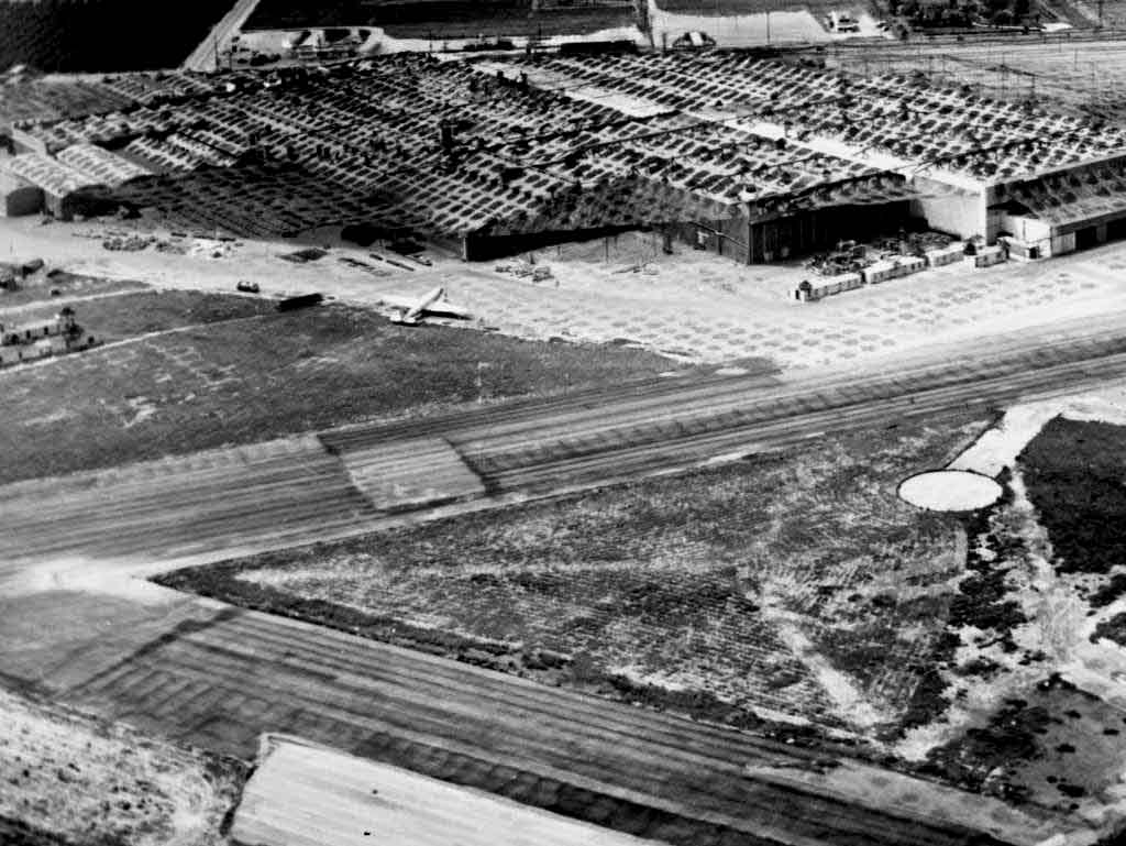
A 1940s aerial view looking northwest at Vultee Field, with camouflage netting suspended over the entire factory complex.
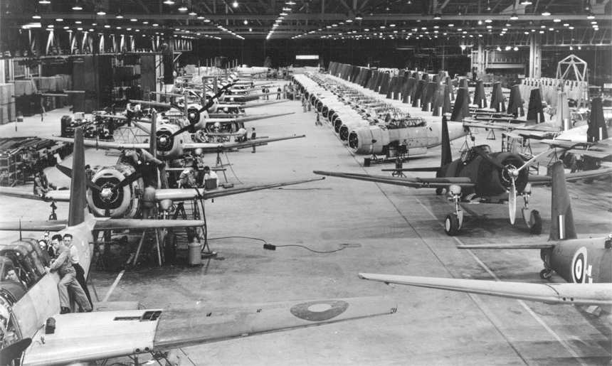
A WW2 view of the Vultee Vengeance assembly line.
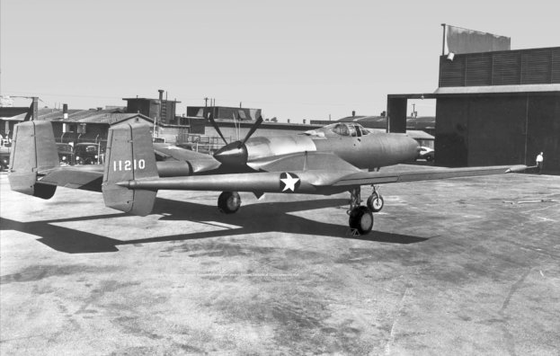
A circa 1943-45 photo of the 1st prototype of the unorthodox Vultee XP-54 Swoose Goose fighter at Vultee Field.
Vultee Field was described by the 1944 US Army/Navy Directory of Airfields (courtesy of Ken Mercer)
as having a 4,000' hard-surface runway.
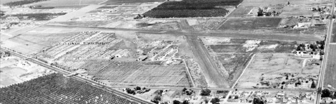
A circa 1944 aerial view looking northeast at Vultee Field.
The 2 paved runways were plainly apparent, but the Vultee factory on the northwest side had been camouflaged, making it much less recognizable.
The Vultee airfield was still not depicted at all on the March 1945 San Diego Sectional Chart.
The Vultee plant had a USAAF Code of “VU” during WW2,
and built a staggering total of 11,537 BT-13 & BT-15 trainers.
It had a peak employment of over 30,000 people – back when Americans actually manufactured things.
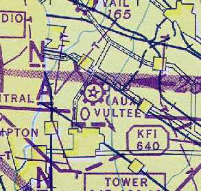
"(Aux)" Vultee" was depicted as a civil airfield
on the August 1945 San Diego Sectional Aeronautical Chart (courtesy of Chris Kennedy).
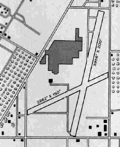
The 1945 AAF Airfield Directory (courtesy of Scott Murdock) described Vultee Airport
as a 165 acre irregularly-shaped field within which were 2 asphalt runways, measuring 3,956' NNW/SSE & 2,962' ENE/WSW.
The field was not said to have any hangars, although the diagram depicted a taxiway leading to what appeared to be a hangar west of the runway intersection.
The airport was described as being privately owned & operated.
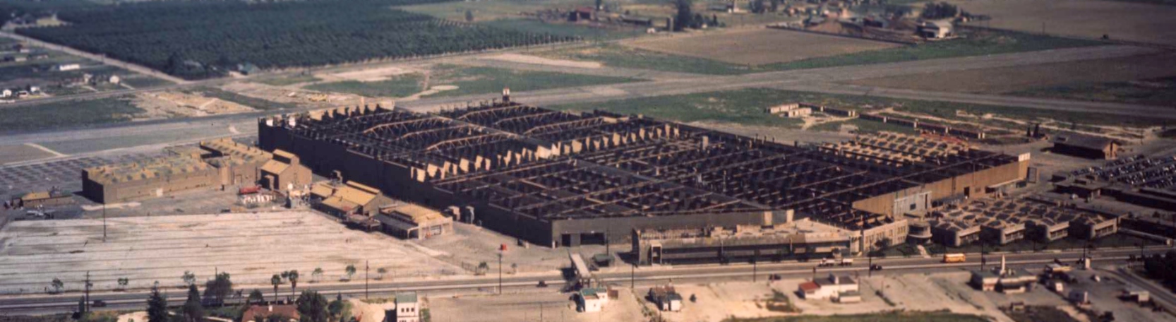
A circa 1940s aerial view looking northeast at the Vultee plant, with the airfield behind it.
As the Second World War wound down, so did the Downey facility.
The Vultee Field Division of Convair won a Navy contract for LARK surface-to-air missiles in 1945.
Turning to the missile industry, the Vultee field division of Convair
was awarded a $1.2 million contract to study long-range missile weapons systems,
and focused on the ballistic missile concept, using the German V-2 as a model.
The government canceled this contract in 1946 for economic reasons,
With wartime contracts dried up, Vultee turned to peacetime products including pre-fabricated homes using plastic & aluminum.
In 1947, North American Aviation, which had a number of jet military contracts to fill,
leased a portion of the Vultee assembly line in Downey.
North American used Downey to produce its AJ-1 Navy bomber & T-28 Trojan post-war trainer.
A 1947 street map (courtesy of Kevin Walsh) labeled the property as “Vultee Aircraft Inc.”
All Vultee use of the Downey facility ceased by 1948.
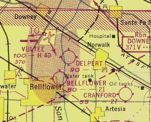
Vultee Field was depicted on the September 1948 San Diego Local Aeronautical Chart (courtesy of Chris Kennedy)
as having 2 hard surface runways, with the longest being 4,000'.
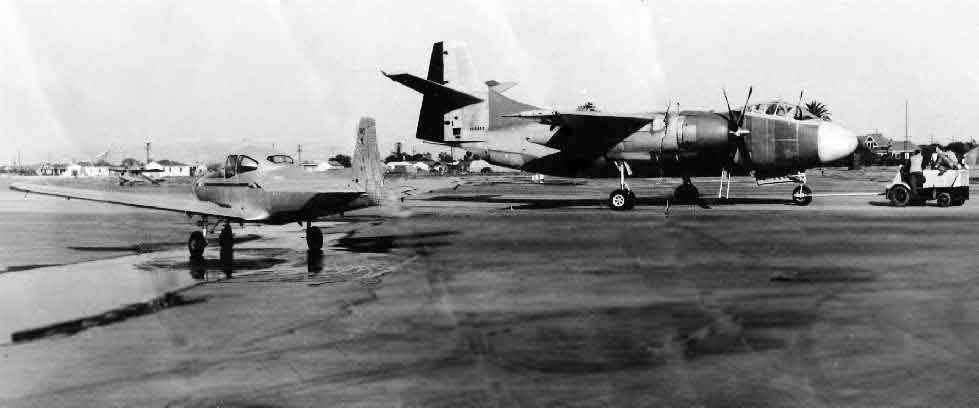
A circa 1949 photo of an Aeronca 65TC, a North American Navion, and the 1st prototype North American AJ-1 Savage at Downey
(courtesy of Nick Glavinich, who worked for many years at the Downey site under North American & Rockwell, via Nick Taylor).
Nick observed, “The photo shows a North American Navion (NC4998K) running its engine
while the very first production AJ-1 Savage is being towed in the background.
The 1st Savage (BuNo 122590) had its first flight in May of 1949. I would assume this is close to the date of the photo.”
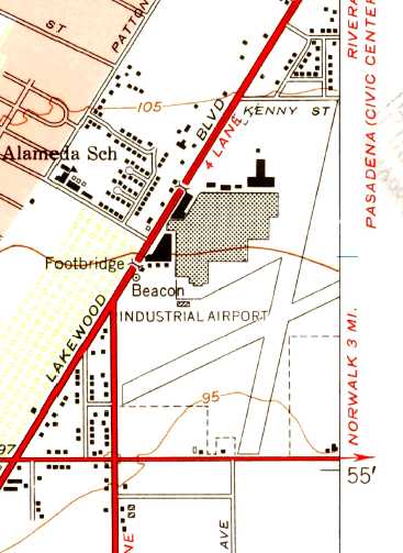
The 1949 USGS topo map depicted the Downey “Industrial Airport” as having 2 paved runways, with the factory & other buildings at the northwest corner.
North American Aviation needed more research space, and in 1950 purchased the Convair portion of the Downey plant.
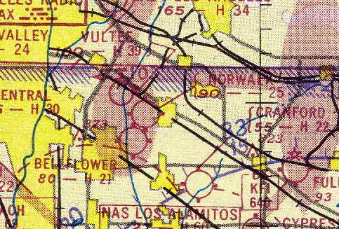
Vultee Field was evidently closed at some point between 1948-51,
as the Aerodromes table on the March 1951 San Diego USAF Sectional Chart (courtesy of Chris Kennedy)
described “Vultee Field” as "Closed", even though the field was still depicted on the chart.
The Downey facility developed the Navaho intercontinental cruise missile in 1953-54,
whose technology would give birth to our first space vehicles.
A 1952 aerial view showed the field as having a paved Runway 17/35.
Two closed crosswind runways still remained, and dozens of aircraft lined both sides of the western end of the southern crosswind runway.
At some point between 1951-54 the field may have been reopened as a private airfield, now named "Downey",
as that is how it was depicted on the September 1954 USAF LA Sectional Chart (courtesy of Chris Kennedy).
It was described as having a 3,900' hard surface runway & its own control tower.
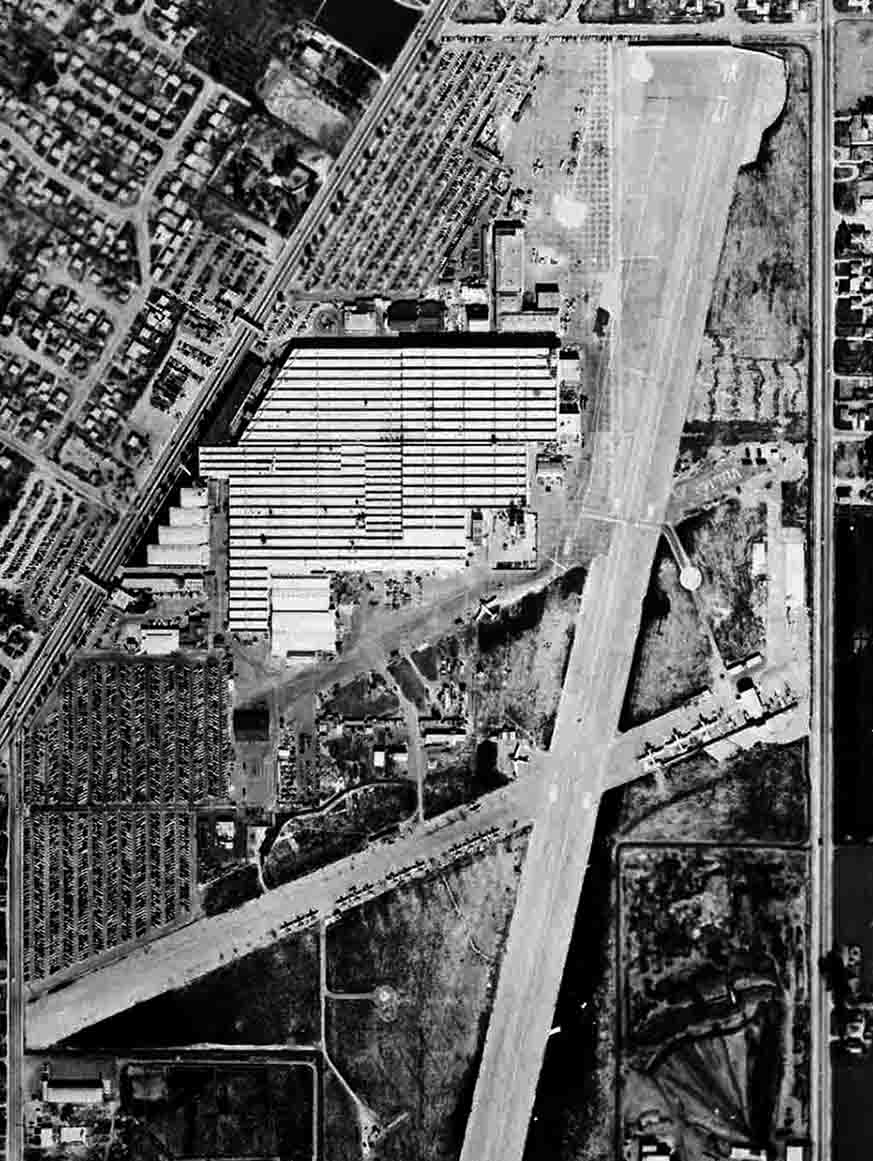
A 1954 aerial view of Vultee Field, captioned as “USAF Plant 16”.
Both runways were still intact, the crosswind runway was being used to store a large number of aircraft.
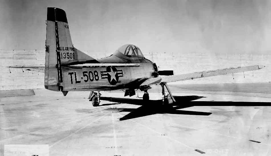
A circa 1950s photo of a North American North American T-28D sitting on the Downey compass rose after production
(courtesy of Nick Glavinich, who worked for many years at the Downey site under North American and later Rockwell, via Nick Taylor).
Nick observed that “T-28D 51-3508 according to online sources is S/N 174-46.”
The 1955 San Diego Sectional Aeronautical Chart (courtesy of John Voss)
described "Downey" as a private airfield having a single 3,928' asphalt runway.
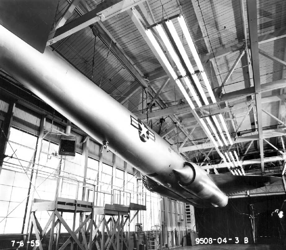
A 7/6/55 photo of a mockup of the North American G-38 Navajo III (XB-64A/XSM-64A) cruise missile,
most likely taken inside the Downey plant (from the Summer 2008 Downey Aviator).
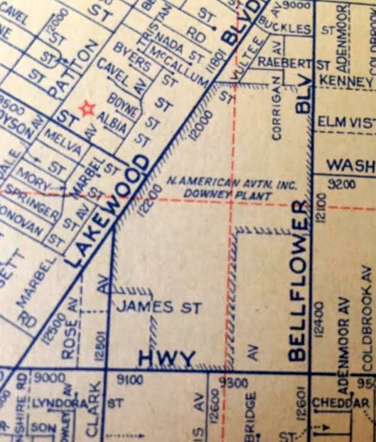
A 1955 street atlas (courtesy of Kevin Walsh) labeled the property as “North American Aviation Inc. Downey Plant".
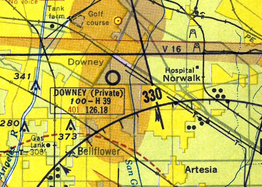
The last aeronautical chart depiction which has been located showing Vultee Field as an active airfield
was on the 1956 LA Local Aeronautical Chart (courtesy of Tim Zukas),
which depicted "Downey" as a private airfield having a 3,900' paved runway.
In the late 1950s North American's Downey plant became the location for developing the AGM-28 Hound Dog supersonic nuclear air-to-ground missile.
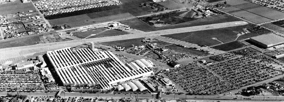
A 1958 aerial view looking southeast at the Vultee factory, with at least one aircraft visible on the far side of the primary runway.
The majority of the crosswind runway had been taken over for employee parking.
Vultee Field was apparently closed at some point between 1956-60,
as it was labeled "Abandoned airport" on the 1960 LA Local Aeronautical Chart.
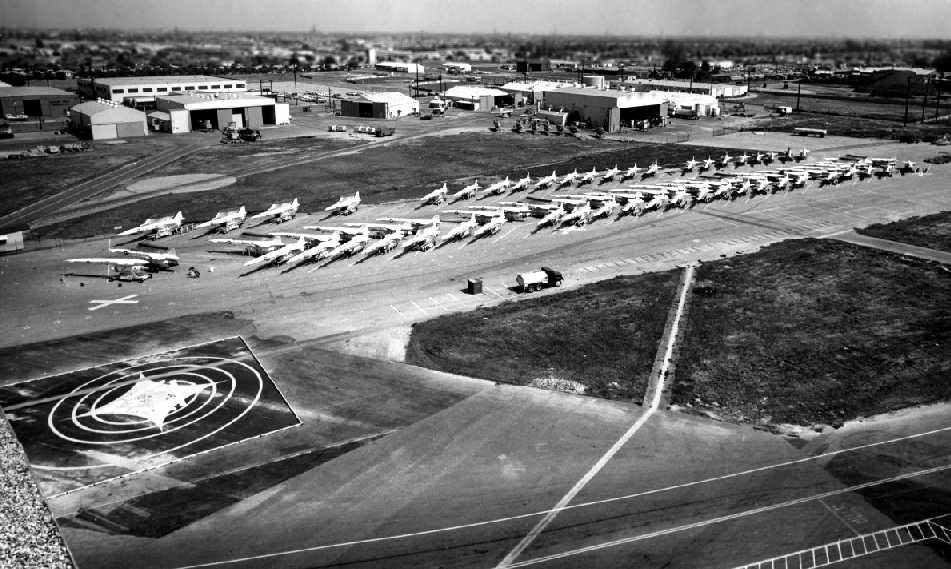
A circa early 1960s aerial view of rows of North American AGM-28 supersonic cruise missiles on the Dowey ramp (from the Fall 2009 Downey Aviator).
North American's Downey plant went on to become a major contributor
in developing the technology that was central to the Space Race.
The company won the contract to make the “Little Joe Launch Vehicle” to test the Mercury capsules.
In 1960, North American was working on the development of the X-15 aircraft, truly a pioneer in aviation history.
The X-15 aircraft was the first winged craft to reach 4, 5 and 6 times the speed of sound,
and fly at altitudes greater than 100,000 feet.
In 1961 North American was awarded 2 contracts from NASA:
the Saturn SII launch vehicle & the Project Apollo Spacecraft Development program.
With that, Downey became the hub of America’s lunar mission.
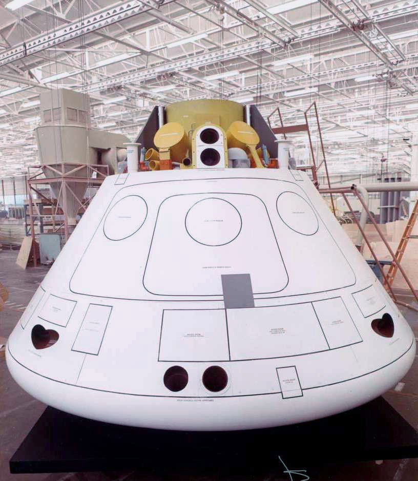
A circa 1960s photo (enhanced by David Waters) of an Apollo Command Module mock-up or prototype inside Downey's Building 1.
According to Wikipedia, a total of 722 Hound Dog nuclear cruise missiles missiles were produced by North American Aviation by the time its production ended in March 1963.
Dan recalled, “In 1963 the runway & some hangar buildings still existed but the airstrip had not been used for some time.”
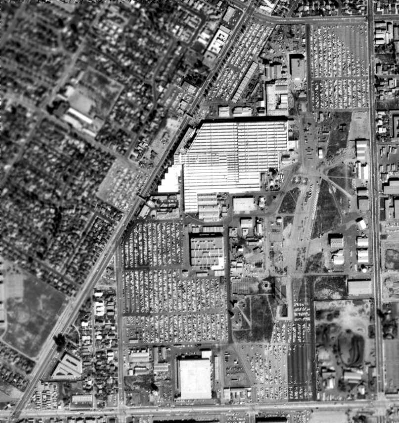
A 2/28/63 USGS aerial view showed the dramatic transformation of the Downey site compared to the 1958 photo,
with most of the airfield having been covered by parking lots & other buildings related to the site's bustling activity for its new role for the space program.
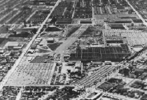
but the southern half of the runway still remaining intact.
In 1964, the North American Downey AFP16 facility was transferred to NASA, thence being known as NASA Industrial Plant, Downey.
North American merged with Rockwell in 1967, becoming North American Rockwell Corporation.
A 1972 aerial view showed only sections of runways still recognizable,
with the majority of the former airfield having been covered by various industrial buildings.
In July 1972, at the end of the Apollo program,
Downey was given the job of assembly & component manufacture of the Space Shuttle Orbiters.
According to the Spring 2006 Downey Aviator, “In the early 1970s Rockwell built a full-scale mock-up of the orbiter
in the DEI Room of Building 1 at the Downey plant.
Built with steel framing, a plywood skin & a variety of other materials representative of each of the shuttle’s components.”
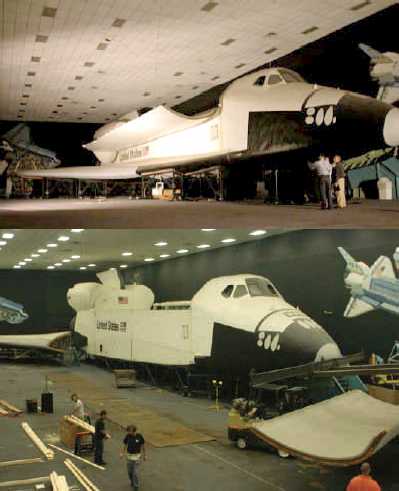
Two circa 1970s photos of the full-scale Space Shuttle mockup inside the DEI room of Downey's Building 1 (from the Spring 2006 Downey Aviator).
This massive artifact of American spaceflight history would remain hidden in storage in the Downey buildings for most of the next 30 years.
North American Rockwell changed its name to Rockwell International in 1973.
From 1975-90, a total of 5 Space Shuttle Orbiters (Columbia, Challenger, Discovery, Atlantis, and Endeavor) were constructed at Downey,
perhaps being one of the site's most prominent accomplishments in aviation history.
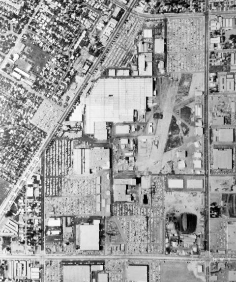
A circa 1983 aerial view (courtesy of Kevin Walsh) showed the majority of the Downey airfield had been covered by parking lots & other buildings,
but a few small sections of runway remained recognizable.
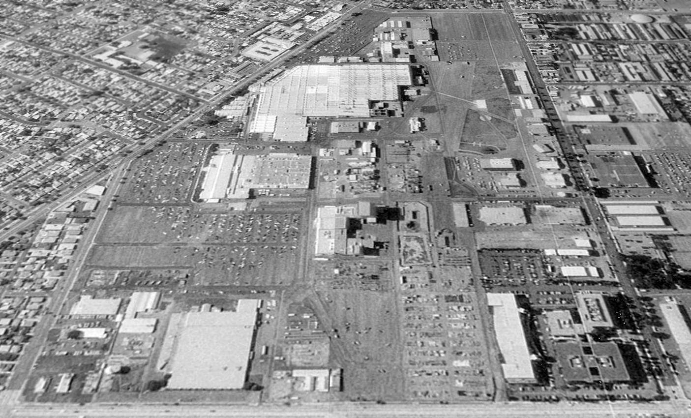
A 1994 aerial view looking north at the Vultee Field site showed a 1,400' long piece of remaining runway pavement was still very evident,
east of the factory building, running north-northeast/south-southwest, along with at least 3 other smaller intersecting portions of runways or taxiways.
At some point before 1994 the southeast corner of the former Downey airfield property (previously the location of Vultee Building 288)
was reused as the site of a Kaiser Permanente medical complex, with several multi-story buildings.
During the 1990s, the North American Rockwell workforce at Downey was decreased.
According to Rockwell employee Ryan Pierson, “Boeing purchased the aerospace & defense divisions of Rockwell in 1996.
Technically, it was a merger using a Reverse Morris Trust.
Hence, the merger-sounding name of Boeing North American was given to those divisions, resurrecting the North American name.”
Boeing began consolidating its space operations shortly after the purchase.
On the 1998 USGS topo map, the Downey facility was still labeled "NASA Industrial Site".
According to the Spring 2006 Downey Aviator, the full-scale mockup of the Space Shuttle in the DEI Room of Downey's Building 1
“was continually updated & was in active use until the Downey facility was officially closed in 1999.”
Boeing announced that it would close the Downey plant permanently by the end of 1999.
According to the Spring 2006 Downey Aviator, the full-scale mockup of the Space Shuttle in the DEI Room of Downey's Building 1
“was officially deeded to the City of Downey in December 1999 as a unique artifact of the space shuttle program.”
According to the Spring 2006 Downey Aviator, “In the summer of 2003, in order to protect the mock-up [Downey's full-scale mockup of the Space Shuttle]
from encroaching development activities at the former engineering and manufacturing facility,
the City engaged a team of professional museum conservators & movers to evaluate, inventory, partially disassemble,
and move the shuttle to a nearby storage facility where it can be better protected & stabilized until it can be moved to a new, permanent home.”
At some point between 1999-2005, most of the former Vultee / North American complex was reused as “Downey Studios”,
the largest independent film facility in Los Angeles.
Downey Studios was managed by Industrial Realty Group,
which is among the country’s largest private owners of commercial & industrial properties.
The Downey Studios had extensive production facilities,
including the biggest undeveloped back lot (20 acres of open space – the former airfield area),
over a million square feet of production space (inside the former factory buildings),
and a 5 million gallon indoor water tank (the largest in North America).
The “back lot” included a “suburban street”, with facades of 17 houses.
Major movies which have been shot at Downey Studios include Spider-Man 2, Catch Me If You Can, Van Helsing, and The Italian Job.
All former Vultee buildings to the north of Building 1 were evidently torn down at some point between 2004-05
to make way for a retail development.
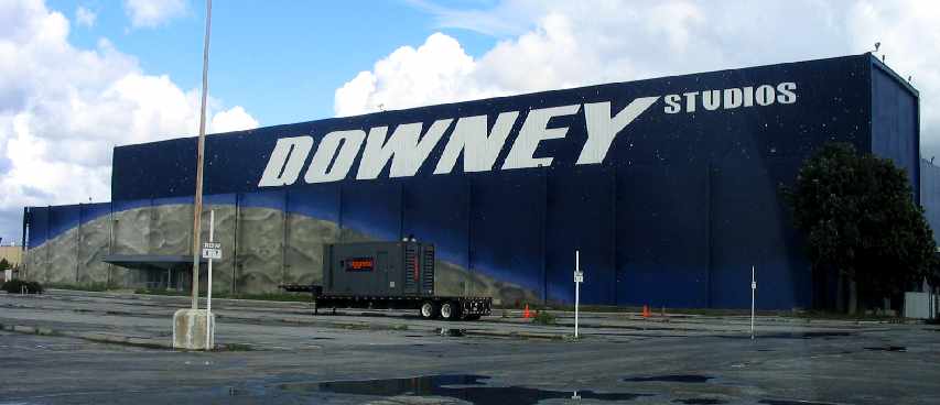
A February 2005 photo by Paul Freeman looking east at the front of Building 290,
a 122,000 square foot former North American factory building at the southwest end of the Downey complex.
It had been repainted “Downey Studios”, with a huge mural of the moon along the front face of the building.
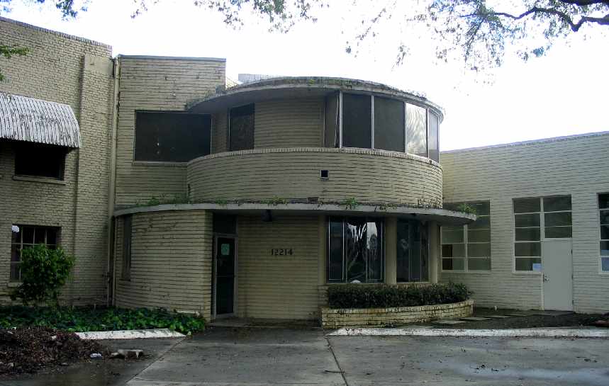
A February 2005 photo by Paul Freeman looking east at the main entrance of the 300,000 square foot former Consolidated Vultee headquarters building.
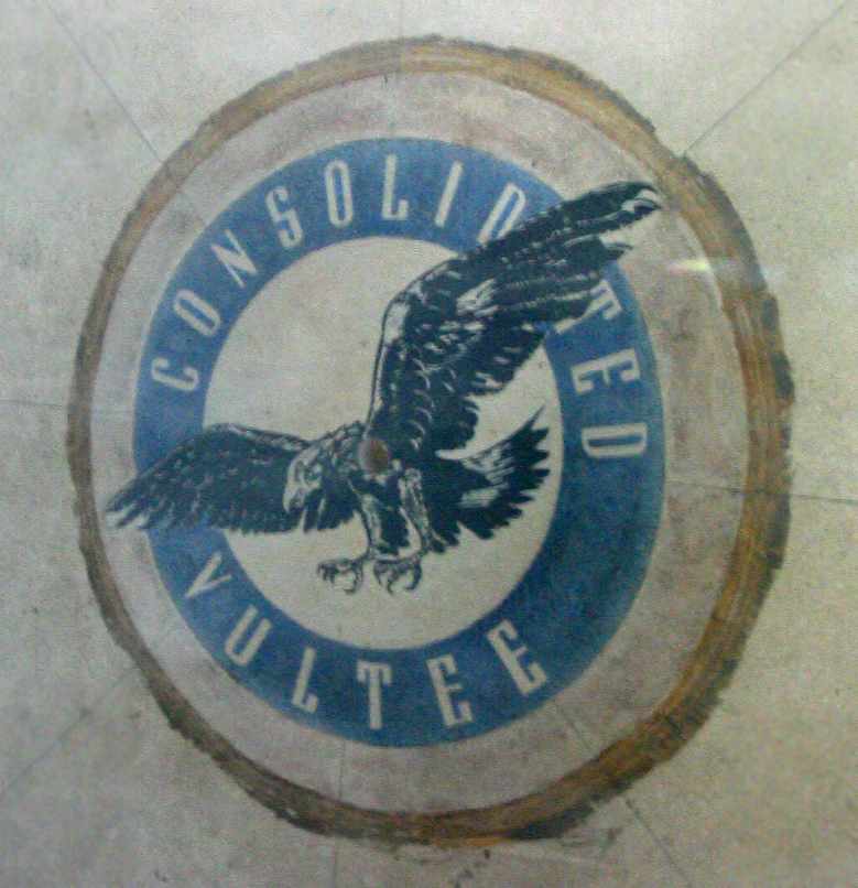
A February 2005 photo by Paul Freeman of the “Consolidated Vultee” logo
which sits in the center of the lobby of the company's headquarters.
According to former Rockwell employee Ryan Pierson, “The Consolidated Vultee logo on the floor of the lobby of the Building 1 Annex
was part of the linoleum or ceramic tile floor.
That logo was covered by carpet for years.
I believe the plan is to move that logo to the museum that is being built on the site by the Aerospace Legacy Foundation.”
Behind the headquarters building sits the massive (627,000 square foot) former Vultee factory (Building 1).
A Kaiser Permanente medical complex occupies the southeast end of the former airfield.
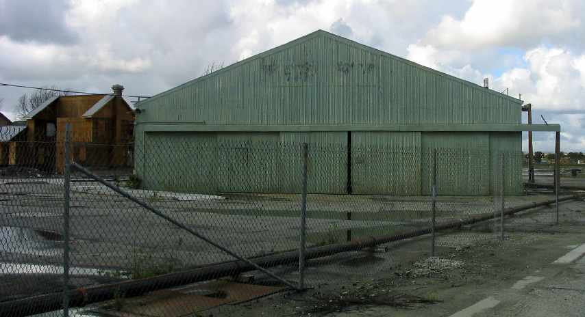
A February 2005 photo by Paul Freeman, looking northwest at one of the number of smaller hangars
which remained on the eastern side of the former airfield area.
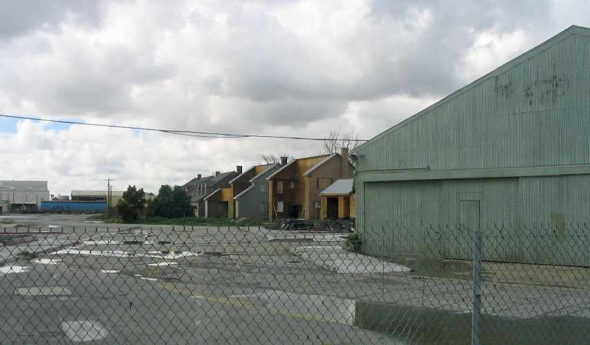
A February 2005 photo by Paul Freeman, looking west across the former airfield area.
In the center of the photo are visible some of the facades of the front of “houses”
which have been constructed on the site (presumably for TV/movie filming work).
One of the WW2-era small hangars is on the right.
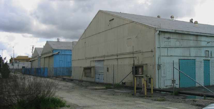
A February 2005 photo by Paul Freeman, looking southwest at a few of the number of smaller hangars
which remained on the eastern side of the former airfield area.
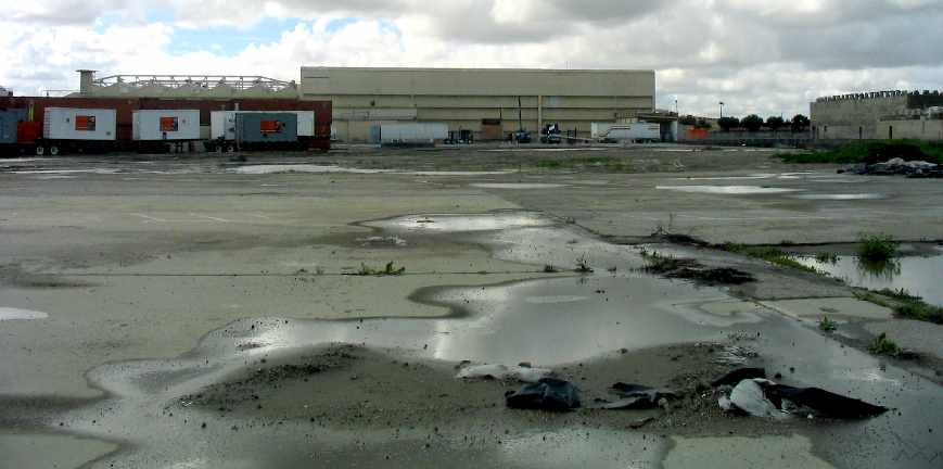
A February 2005 photo by Paul Freeman, looking west at the rear
of the former Vultee factory (Building 1) in the middle of the west end of the site.
The former runway pavement in the foreground still remained intact.
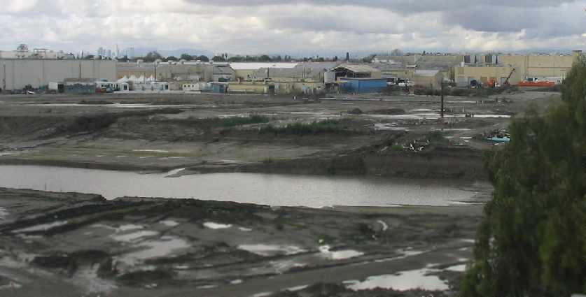
A February 2005 photo by Paul Freeman, looking northwest across the former airfield area,
toward the rear of the former Vultee factory (Building 1).
The former runway area in the foreground was excavated at some point between 2004-05.
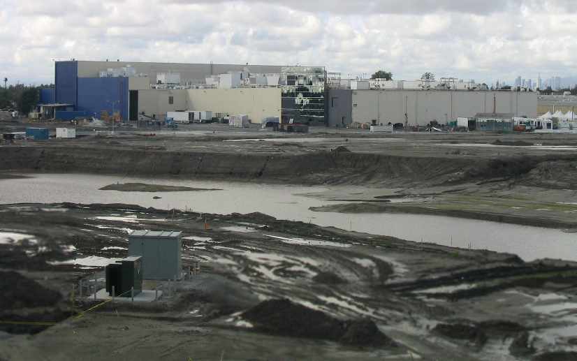
A February 2005 photo by Paul Freeman looking northwest at the rear
of Building 290 (presumably the former North American factory building) at the southwest end of the Downey complex.
What appears to be a “mirror wall” was constructed at the southeast end of the building (presumably for movie filming work).
The former runway area in the foreground was evidently excavated at some point between 2004-05.
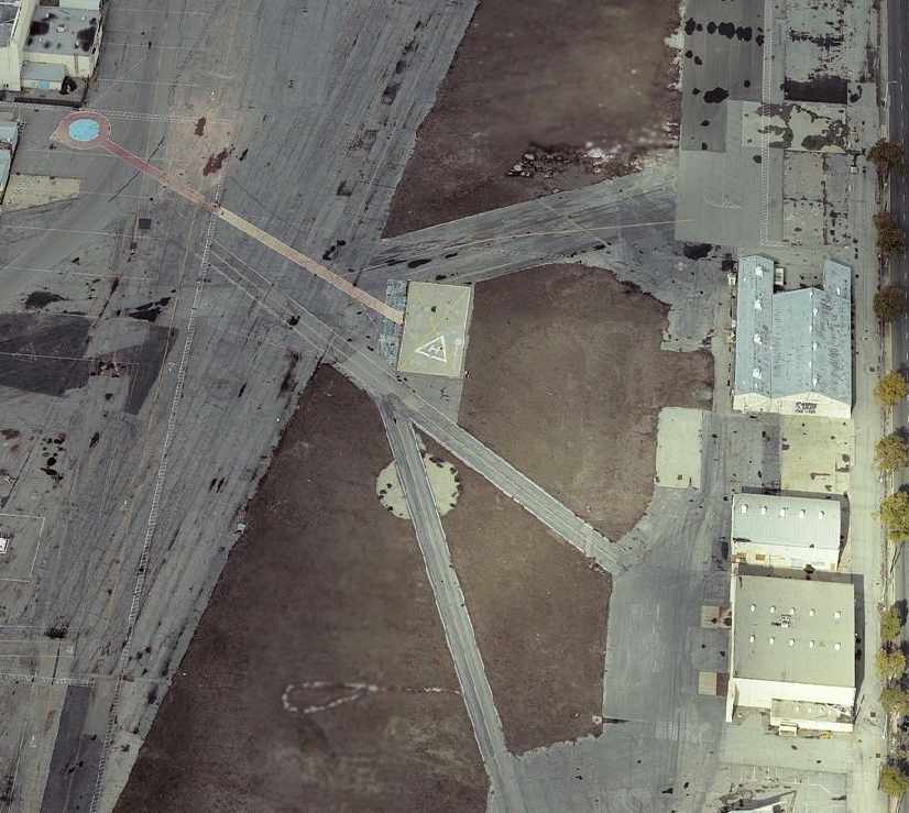
A circa 2005 aerial photo looking north at a former helipad as well as several vintage hangars on the east side of the Downey facility.
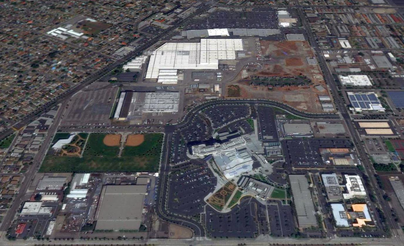
The last photo which has been located showing the Vultee factory complex still intact was a 2011 aerial view looking north.
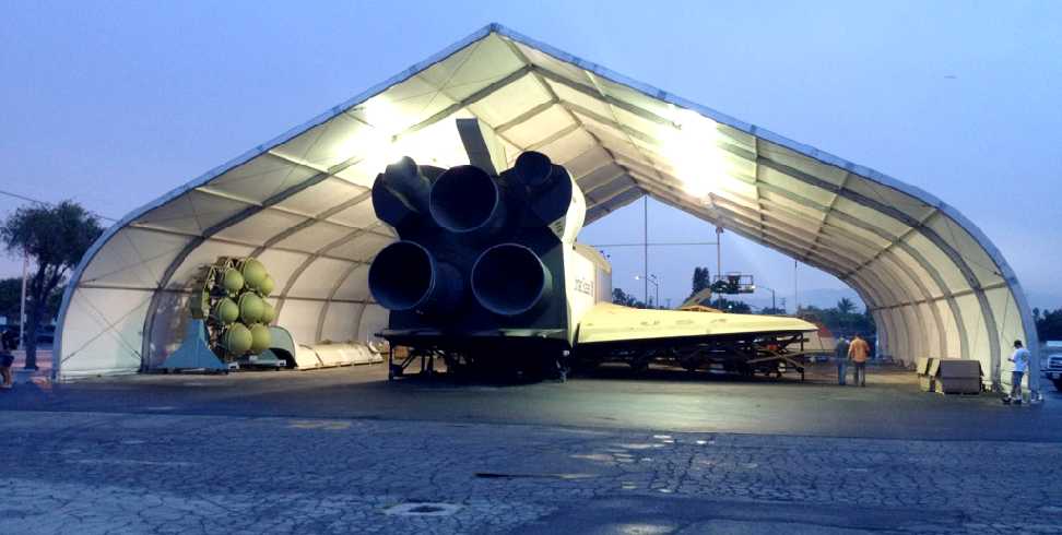
A 7/12/12 photo of the original full-scale Space Shuttle mockup,
after finally seeing the light of day after 30 years of being hidden in storage inside a former North American Downey building.
This priceless artifact of America's technological history has been temporarily moved to an outdoor tent,
until the Columbia Memorial Space Center can construct a building to properly display it.
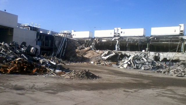
A sad November 2012 photo of the former Vultee / North American factory buildings, the site of so much American aviation technological development,
being demolished to make way for the new Tierra Luna shopping center.
A 2013 aerial photo showed that 95% of the historic Vultee / North American buildings had been completely removed,
with only the former Vultee headquarters building remaining along Lakewood Boulevard.
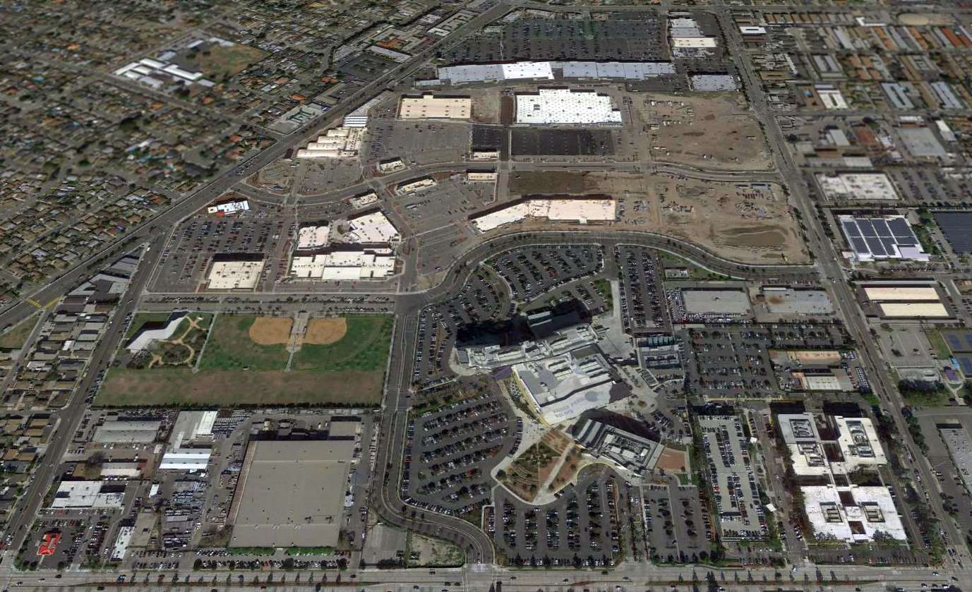
A 2016 aerial view looking north at the Vultee Field site showed the Vultee headquarters building along the northwest side is the only remaining trace of this former airfield & aircraft manufacturing complex.
The massive factory buildings have been completely removed, replaced by big-box retail stores.
Not a good trend for our country: high-pay engineering & manufacturing jobs replaced by low-pay retail jobs selling imported goods.
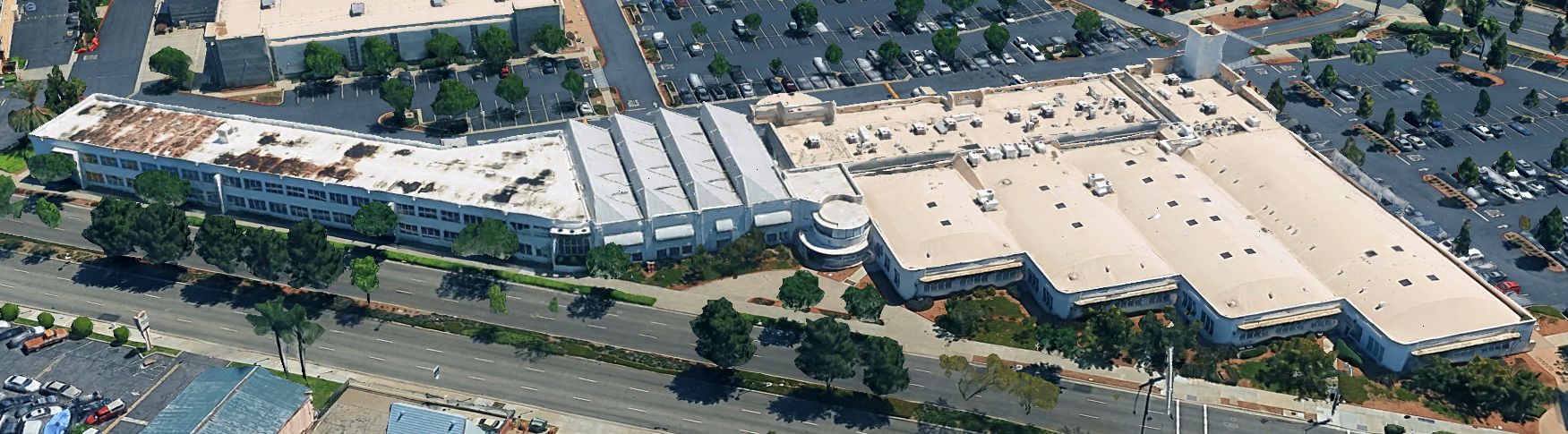
A 2024 3-D aerial image looking east at the former Consolidated Vultee headquarters building.
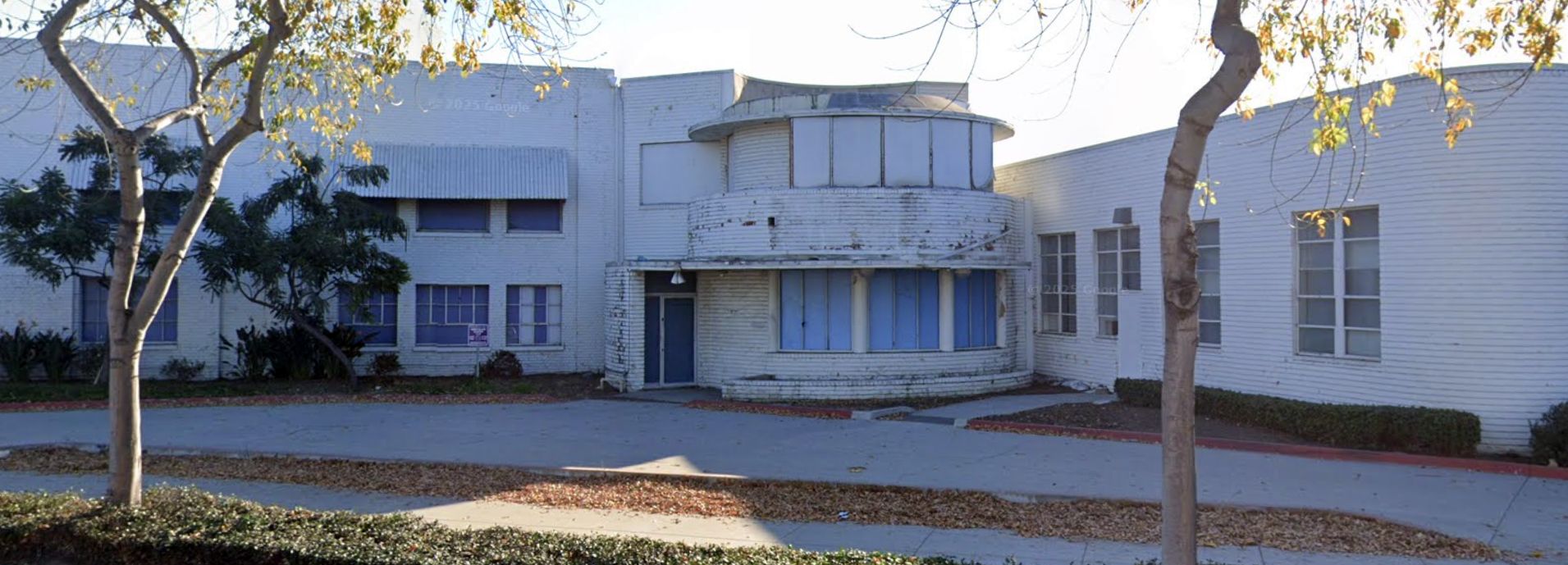
A 2025 photo looking east at the main entrance of the abandoned former Consolidated Vultee headquarters building.
The site of Downey Field is located northeast of the intersection of Imperial Highway & Lakewood Boulevard.
See also:
http://www.b25.net/bt13/bt13.html
http://thepaperink.com/1994/94tt0909.htm
http://thepaperink.com/1993/93tt1126.htm
____________________________________________________
33.88, -118.132 (Southeast of Downtown Los Angeles, CA)
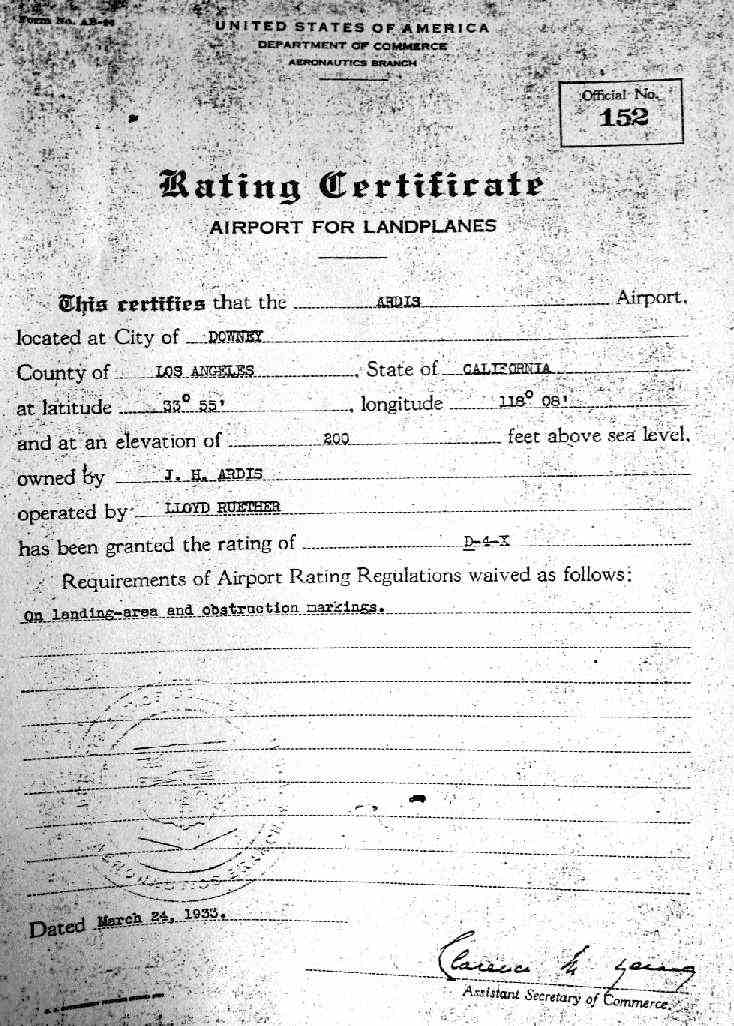
A 3/24/33 Commerce Department Ratings Certificate awarded to Ardis Airport (courtesy of Mark Gebert).
This short-lived little general aviation airport was not yet depicted on the June 1932 LA Sectional Chart.
The earliest reference which has been located to Ardis Airport was its 3/24/33 Commerce Department Ratings Certificate (courtesy of Mark Gebert).
It granted Ardis Airport the rating of D-4-X, and indicated that it was owned by J.H. Ardis, and managed by Lloyd Ruether.
According to an article by John Adams (courtesy of Mark Gebert),
Arids Airport “ran between Clark Avenue & Lakewood Boulevard north of what is now Somerset.
Access was by way of a now defunct road called Cerritos.
Dorothy Ruether flew an OX-5 Eaglerock with her husband, Lloyd.
The plane was based in the mid-1930s at an airfield (actually a pasture) owned by the Ardis family.
The land was rented to a dairy which sublet portions that were used as an airstrip.
What the cows thought of all the goings-on is pure conjecture.
The pilots who used the field called themselves the Clearwater Flying Club.”
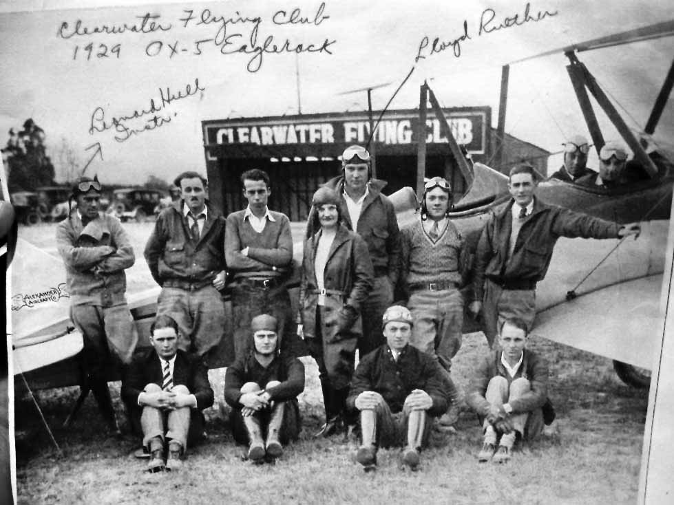
The only ground-level photo which has been located of Ardis Airport was a circa 1930s photo (courtesy of Mark Gebert)
of the members of the Clearwater Flying Club in front of their 1929 Eaglerock OX-5 biplane.
Among those pictured was Leonard Hull (instructor) & Lloyd Ruether (airport manager).
A hangar labeled “Clearwater Flying Club” was visible in the background.
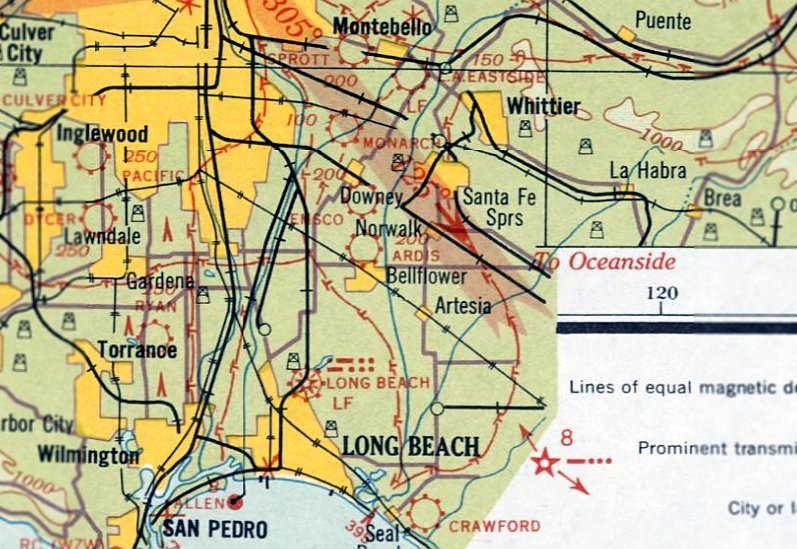
The earliest aeronautical chart depiction which has been located of Ardis Airport was on the June 1933 LA Sectional Chart.
It depicted Ardis Airport as a commercial/municipal airport.
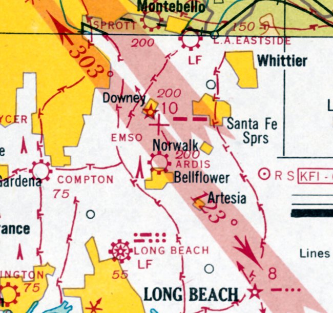
The last aeronautical chart depiction which has been located of Ardis Airport was on the August 1936 LA Sectional Chart.
It depicted Ardis Airport as a commercial/municipal airport.
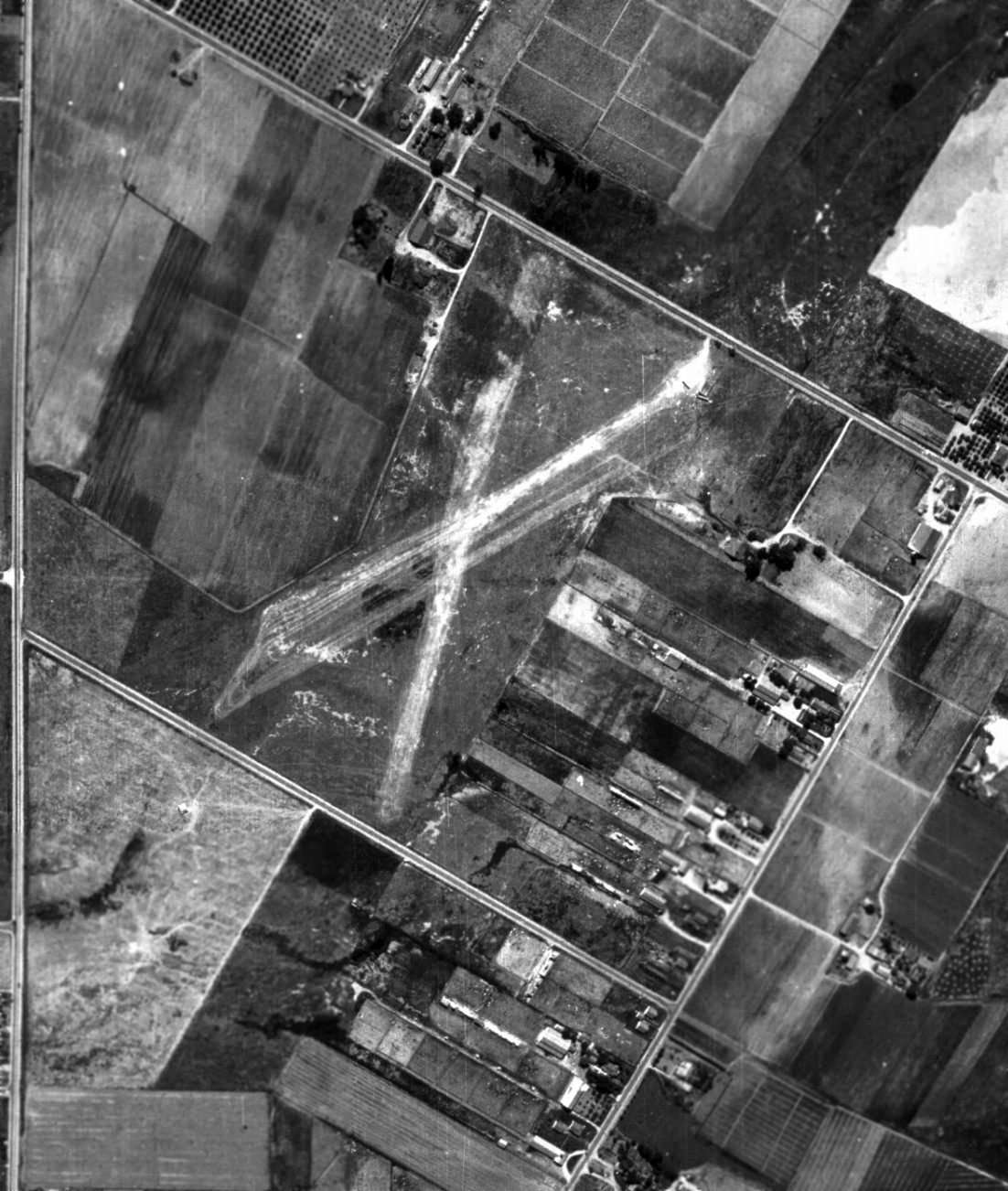
The only dated photo which has been located of Ardis Airport was a 7/2/38 aerial view (from the UCSB Library).
It depicted Ardis Airport as having 2 unpaved runways in an X-shape.
The airport may have already been abandoned by that point, as there were no aircraft visible or other signs of recent aviation use.
The 1939 LA County Airports Map depicted Ardis Airport as having a single northwest/southeast runway.
Ardis Airport was evidently closed (for reasons unknown) at some point between 1936-38,
as it was no longer depicted on the January 1938 LA Sectional Chart.
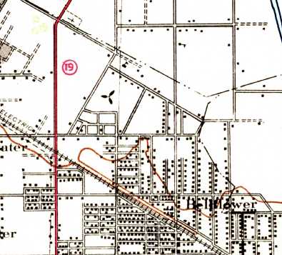
Ardis Airport was evidently still depicted on the 1942 USGS topo map (the unlabeled propeller symbol),
even though it had evidently already been closed for several years by that point.
Ardis Airport was no longer depicted on the 1943 USGS topo map.
The 1949 USGS topo map showed that Clark Avenue had been cut through the site of Ardis Airport.
A 1952 aerial photo showed that the site of Ardis Airport had been densely developed with housing,
with no trace remaining of the airport.
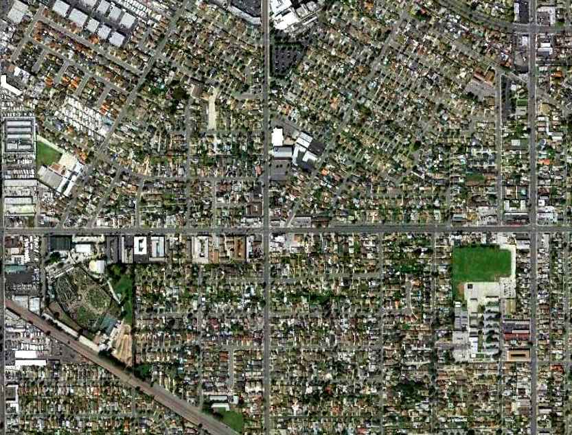
In a 3/8/11 aerial photo of the site of Ardis Airport, not a trace of the airfield appears to remain.
____________________________________________________
Vail Field / Western Air Express Airport / Vail Airport, Montebello, CA
34.004, -118.134 (Southeast of Downtown Los Angeles, CA)
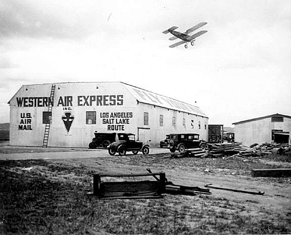
The caption for this photograph from the Los Angeles Examiner reads:
Western Air Lines in 1926 began operations from Vail Field.
Vail Field was historically important as one of the first airmail contractors, Western Air Express, had its origins there.
Western Air Express was incorporated during 1926 by Los Angeles entrepreneurs
for the purpose of bidding on airmail contracts to be awarded under the 1925 Kelly Air Mail Act
which provided for the transfer of airmail routes from the Post Office's Aerial Mail Service to private carriers.
WAE initially purchased 6 Santa Monica-built Douglas M-2 mail planes.
They also purchased land to build the airport from some well-known cattle ranchers, the Vail brothers.
The property was by Ferguson Drive on the north, Telegraph Road on the south,
Yates Avenue on the east, and Tusbway Avenue on the west.
The enormous field had 2 unpaved runways, one of which ran directly along Yates Avenue.
The length of the runways is unknown, but the total length of the property along Yates Avenue was approximately 6,000'.
A converted movie studio became the main hangar.
According to Dan MacPherson, in addition to the original hangar, Vail eventually had a large 4 building hangar complex.
Years later, these hangars were moved to Alameda Street, and occupied by the Belyea Trucking company.
They may still exist, could not be located.
The first CAM-4 contract airmail service to Las Vegas & Salt Lake City by WAE began in 1926,
with the first flight being piloted by Maury Graham.
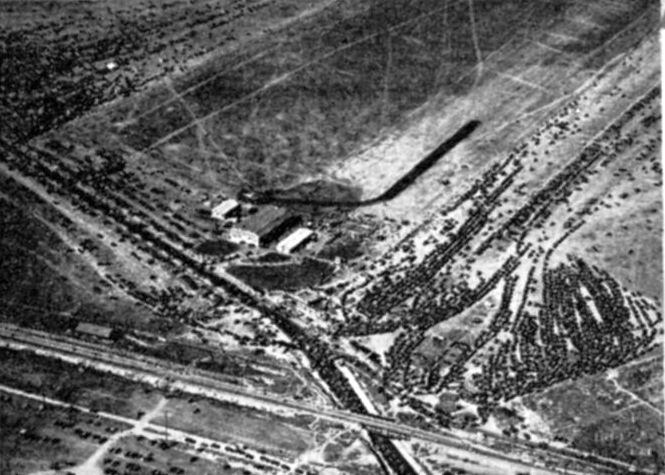
A 1927 aerial view of the crowd viewing Charles Lindbergh's landing of The Spirit of St. Louis at the Vail Field
while on a nationwide tour following his transatlantic flight,
from an LA Chamber of Commerce brochure “Los Angeles County Spreads Her Wings, History of National Air Races, 1928” (courtesy of Tom Heitzman).
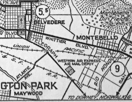
Western Air Express Air Mail Depot Airport, as depicted on a 1927 ACSC map (courtesy of Kevin Walsh).
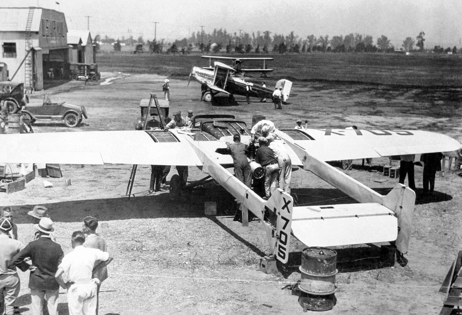
A July 1927 photo of the Bryant M-1 Angel of Los Angeles NX705, built at Vail Field in 1927.
It was a push-pull configuration with 2 Bristol Lucifer engines, and was built to compete in the Dole Air Race, but it crashed on August 12, 4 days before the race start.
A Western Air Express Douglas M-2 mailplane & a hangar are in the background.
The Lone Eagle CM-1 was built at Vail Field in 1928 by the Ryan Mechanics Monoplane Company.
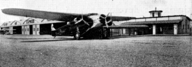
An undated photo of a trimotor (model undetermined) in front of the Western Air Express hangars at Vail Field,
from an LA Chamber of Commerce brochure “Los Angeles County Spreads Her Wings, History of National Air Races, 1928” (courtesy of Tom Heitzman).
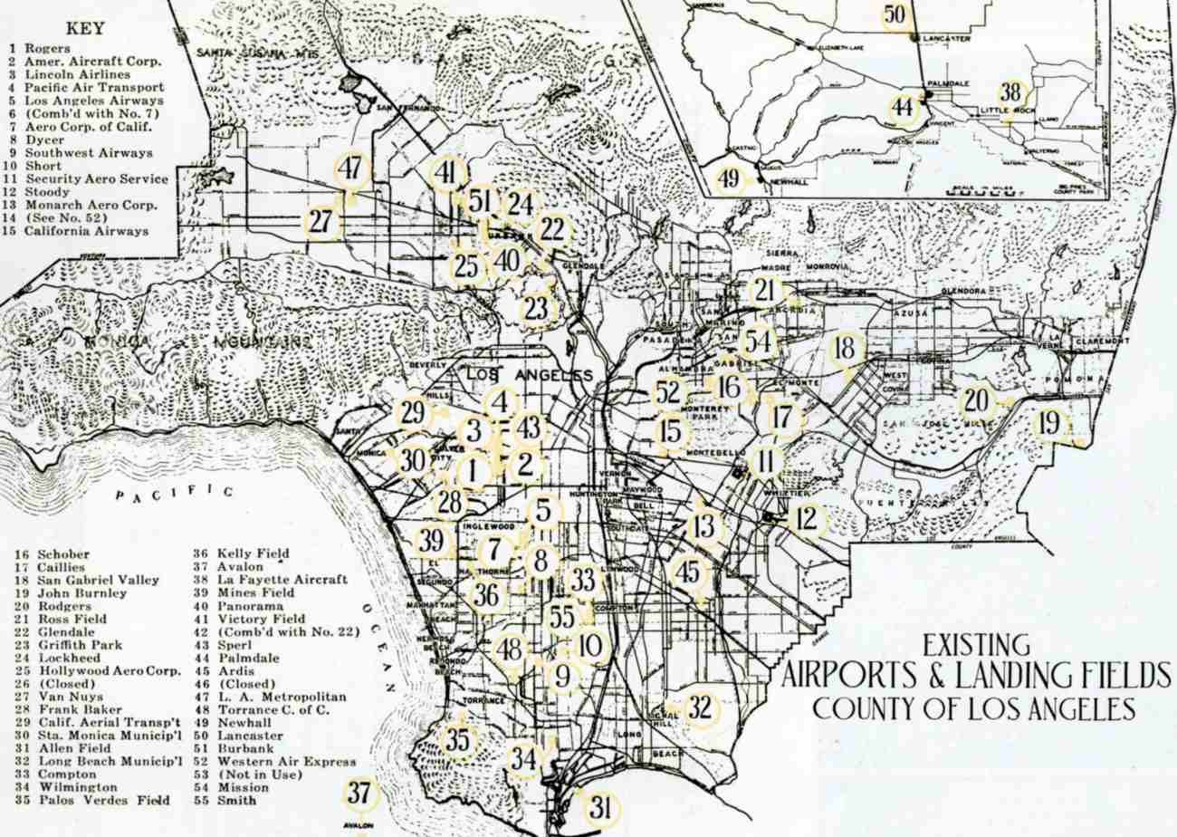
Western Air Express Airport, as depicted among an amazing total of 55 LA-area airports on a map from an LA Chamber of Commerce brochure
“Los Angeles County Spreads Her Wings, History of National Air Races, 1928” (courtesy of Tom Heitzman).
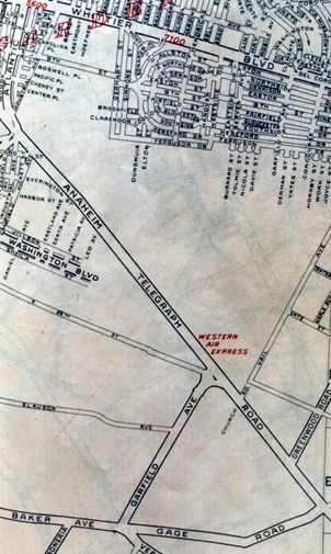
Western Air Express Airport, as depicted on a 1929 Gillespie's Guide & Atlas of LA (courtesy of Kevin Walsh).
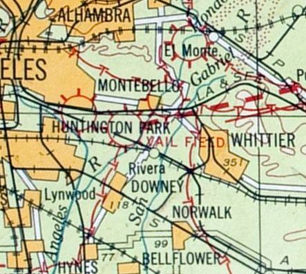
The earliest aeronautical chart depiction which has been located of Vail Field was on the 1929 LA – Las Vegas Air Navigation Map.
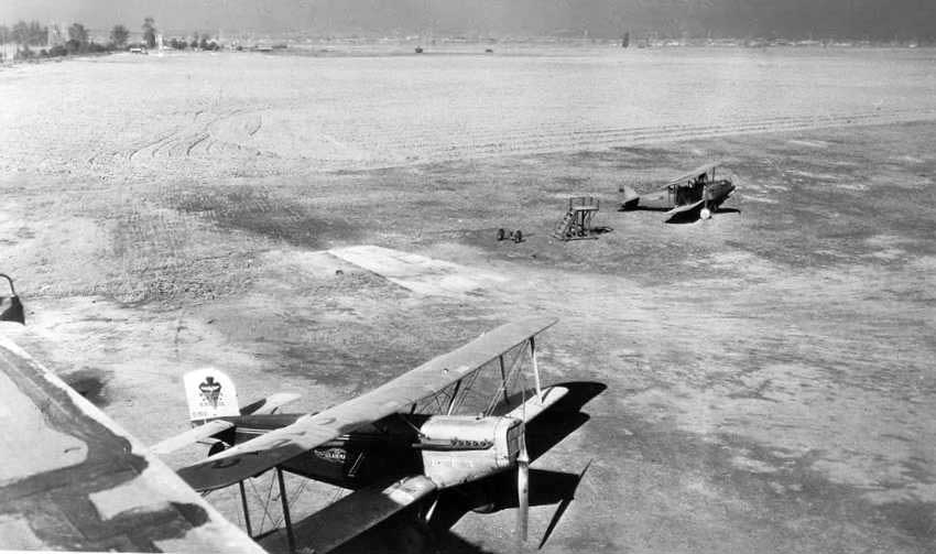
A 1929 photo of 2 biplanes at Vail Field, showing a large open expanse of land.
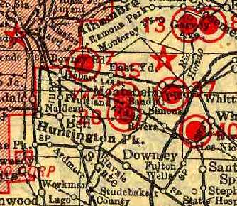
Vail Field (along with a dense grouping of other vintage airfields),
as depicted on the 1929 "Rand McNally Standard Map of CA With Air Trails" (courtesy of Chris Kennedy).
The directory described "Air Mail Airport (Vail Field)" as being operated by Western Air Express, and measuring 4,767' x 3,176'.
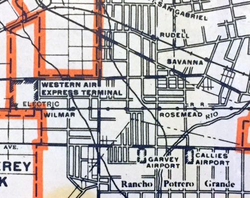
“Western Air Express Terminal”, as depicted on a 1930 LA County Rand McNally street map (courtesy of Kevin Walsh).
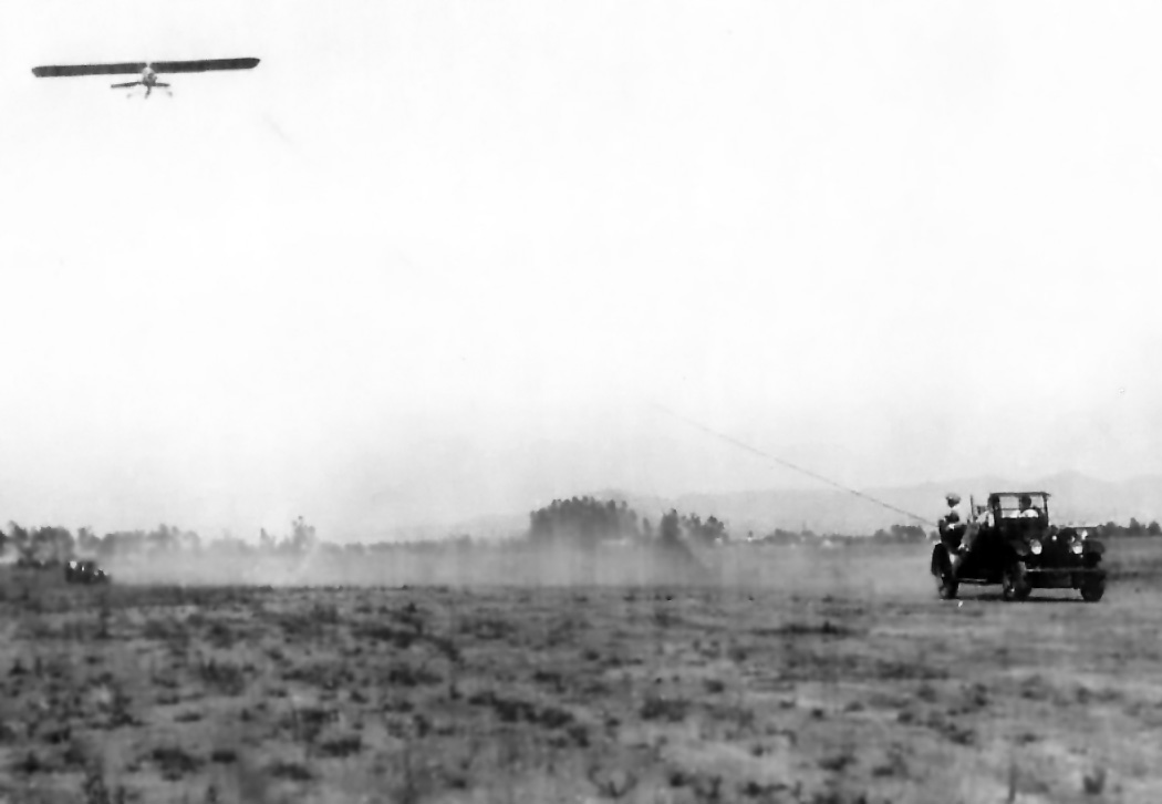
A circa 1930 photo (courtesy of Ken Meade) of his father's (C.S. Meade) 1918 Buick towing a glider at Vail Field.
Ken Meade recalled of Vail Field, “My Father learned to fly automobile-towed gliders there in 1929 or 1930 that belonged to a club sponsored by Union Oil Company.
They had 2 gliders there.”
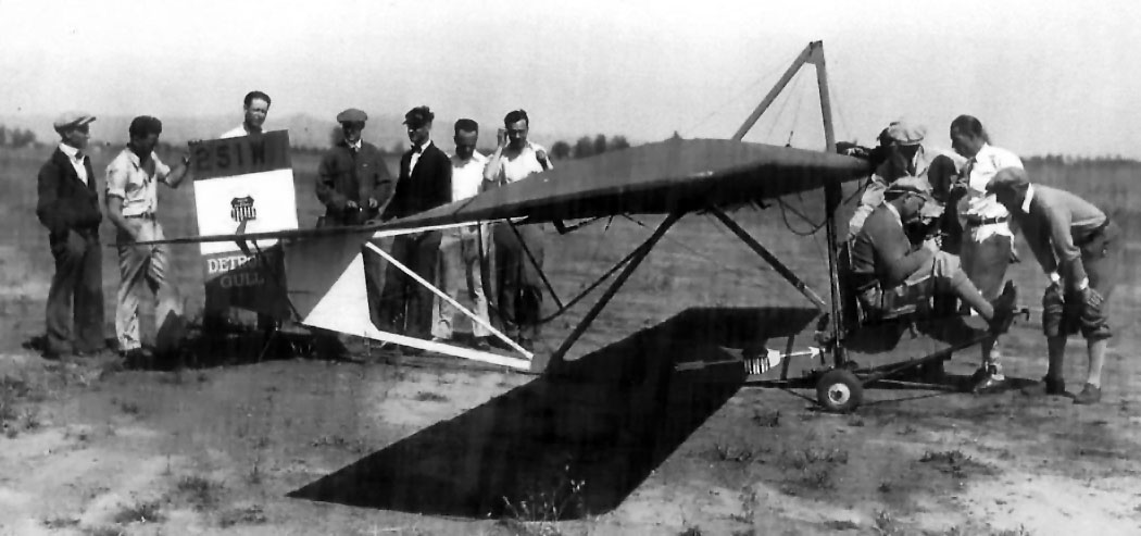
A circa 1930 photo (courtesy of Ken Meade) of a Detroit Gull glider trainer at Vail Field.
Ken observed, “My Father, C.S. Meade, is on the far left. Dad held Gliders Pilots License #234 after he soloed in the aircraft.
All paid for by Union Oil for the employees in the Glider Club flying off of Vail Field. roit Gull Trainer.
The date, shortly after the Lindbergh flight & the subsequent attention to aviation,
may have been the motive for Union Oil to support a Glider Club!
Considering how it got in the air burning lots of good Union Gasoline!”
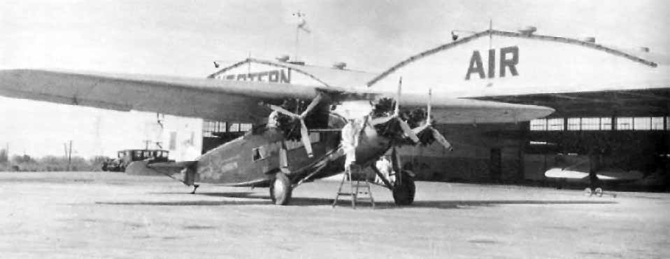
An undated photo of a Fokker F-10 in front of the Western Air Express hangars at Vail Field (courtesy of Dan MacPherson).
The original Vail Field ceased being an airport when Western Air Express moved to Alhambra Airport in 1930.
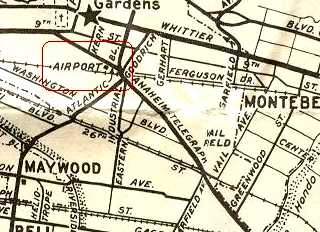
A 1931 street map (courtesy of Gary Alexander) still depicted Vail Field,
even though it had evidently ceased as an operating airport the year before.
Will Adams recalled, “In 1939, I signed up for & got my private pilot's license at Helen Hudson's flying school at Vail Field in Montebello.”
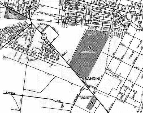
A circa 1939-40 Mobil map (courtesy of Dan MacPherson) showing Vail Airport,
as well as 3 other nearby fields: Telegraph Atlantic Airport to the northwest, Los Angeles Eastside Airport to the South,
and Whittier Airport to the east (penciled in).
According to Dan, the map is not entirely correct: The property shown as "Vail Airport" is actually the scope of the original Vail Field.
Vail Airport was eventually built within a northern subset of the original Vail Field property. Montebello airport had not been built yet.
Vail Field sat idle until 1940.
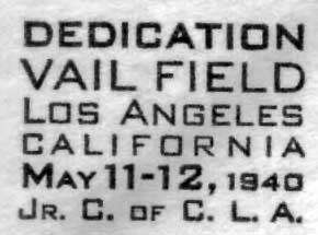
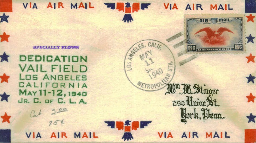
A postmark commemorated the 5/11/40 Dedication of Vail Field.
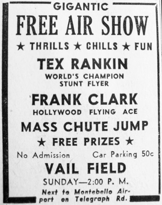
A 1940 advertisement for an airshow at Vail Airport (courtesy of Kevin Walsh).
The history of this field gets confusing at this point, as Vail Airport (as opposed to the original Vail Field) was built in 1940.
Vail Airport occupied a subset of the original Vail Field property, roughly the northern half.
It was located adjacent to a Chevron oil tank farm (which remains there today).
The airfield consisted of a single 3,200' oiled runway, a taxiway, a large ramp, and at least 2 hangars.
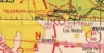
Vail Airport (along with nearby Telegraph-Atlantic & Montebello Airports),
as depicted on the 1941 LA Sectional Chart (courtesy of Chris Kennedy).
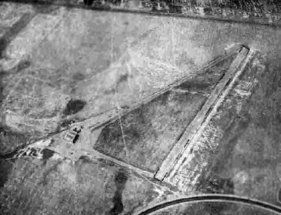
A 7/20/43 aerial view looking north at Vail Field from the 1945 AAF Airfield Directory (courtesy of Scott Murdock)
depicted the field as having a single runway, with a taxiway leading to a ramp & hangar on the west side.
"Vail" was described by the 1944 US Army/Navy Directory of Airfields (courtesy of Ken Mercer) as having a 3,000' surface runway.
The remarks said, "Civil operation subject to 4th Fighter Command Requirements."
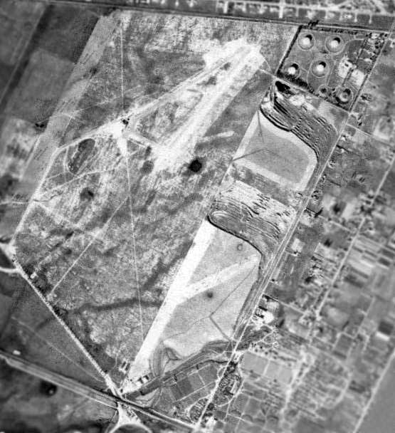
A circa 1940s aerial view (courtesy of Dan MacPherson) of Vail Airport (top of picture),
along with Montebello Airport (bottom of picture, across Yates Avenue to the south).
The 1945 AAF Airfield Directory (courtesy of Scott Murdock) described Vail Field
as a 417 acre irregularly-shaped field within which was a single 2,650' oiled NNE/SSW runway.
The field was said to have 2 hangars: 104' x 96' metal, and 50' square metal & wood.
The airport was described as being privately owned & operated.
Gary Priebe recalled, “From 1946-56, I lived near Vail Field in a small pie-shaped single-family development
bordered by Washington Boulevard & Anaheim/Telegraph Road, known as Rosewood Park & now the City of Commerce.
As kids we ran the fields chasing pheasant with our bows & arrows (with little luck)
and floating rafts on the large, deep gullies around Vail Field - Jim, Larry & myself.”
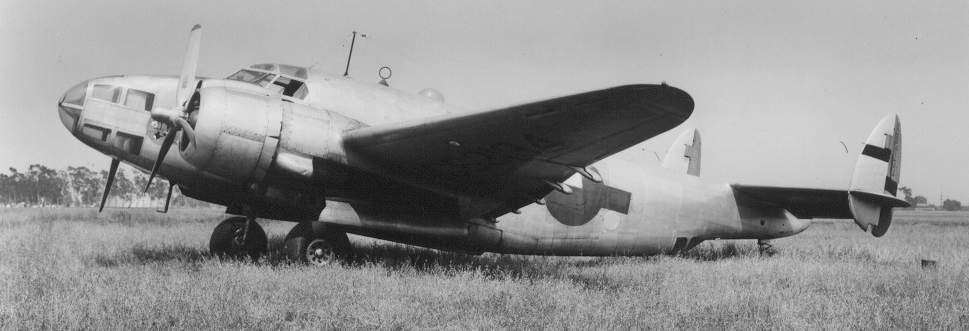
A Lockheed RB-34 Ventura patrol bomber, NC 63134, AF 41-38071, parked at Vail in 1946.
In the background is the Chevron tank farm (surrounded by eucalyptus trees), which is still present at the site.
Photo is courtesy of William Larkins (aviation historian & photographer for over 50 years), via Dan MacPherson.
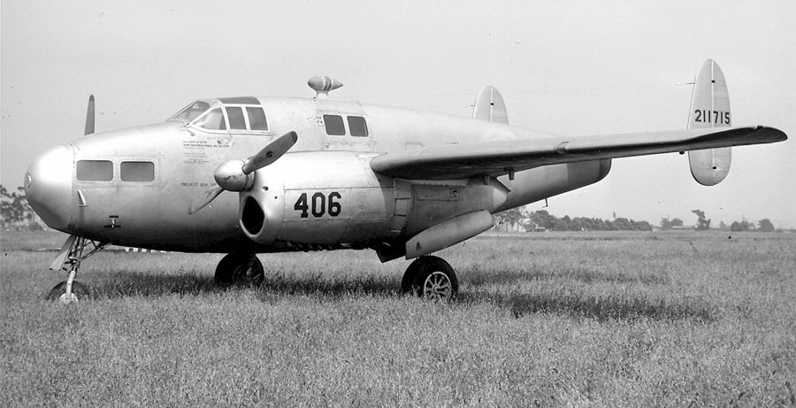
A photo captioned "A Fairchild AT-21 surplussed at Vail Field 5/17/46” (courtesy of Marc Kenton).
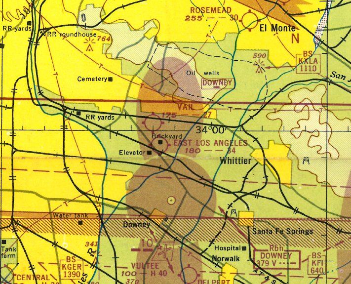
The 1947 LA Local Aeronautical Chart depicted Vail as having a 2,700' unpaved runway.
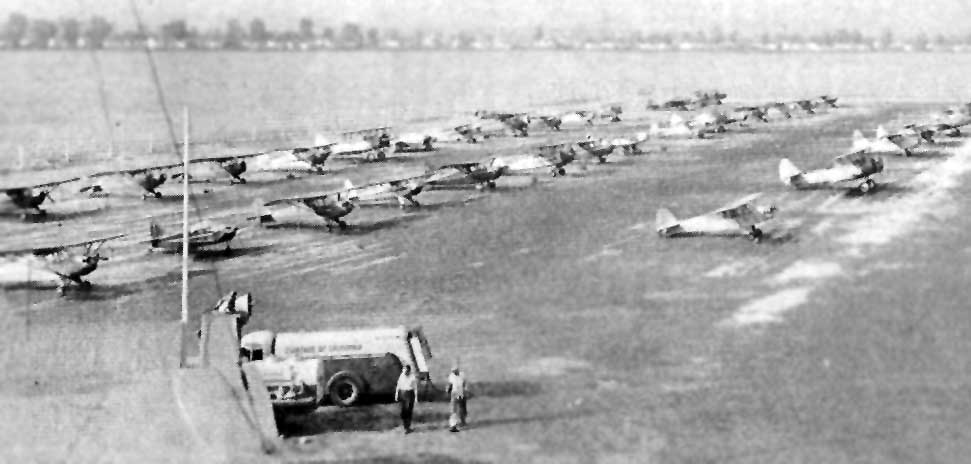
This photo appeared with the caption "W.H. Coffin Air Service, Vail Field Airport, Los Angeles, CA",
in the 1947 book "Airport Operation & Management", by Charles Zweng, courtesy of Steve Cruse.
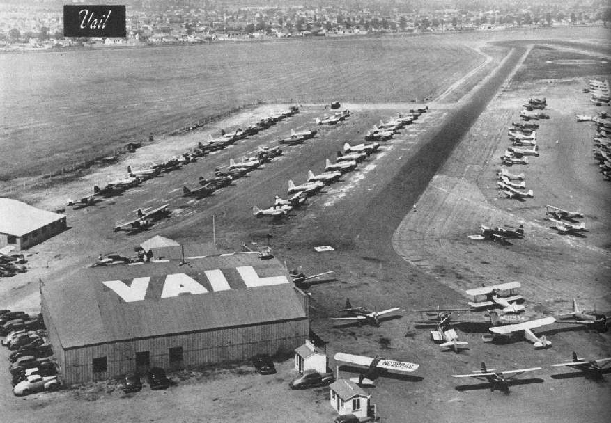
A 1947 photo of Vail by Don Downie, courtesy of Dan MacPherson.
The original caption reads, "Twenty-one A&E mechanics service the 220 planes based on this busiest airport is LA County.
Seven miles east of the city, the port has a single 3,200' oiled runway no tower - and an air traffic problem.
Tie-down is $15 monthly. Nearest transportation is 1/2 mile."
John Shelton reported in 2004 that he believes the hangar pictured in the above 1947 photo
still exists in 2004, after having been relocated to Whiteman Airport.
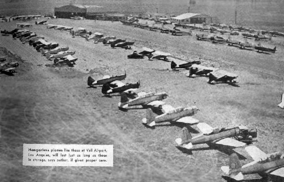
Another 1947 photo of Vail by Don Downie (courtesy of Dan MacPherson).
Note the large number of surplus former military aircraft - a collection which would be worth millions of dollars today!
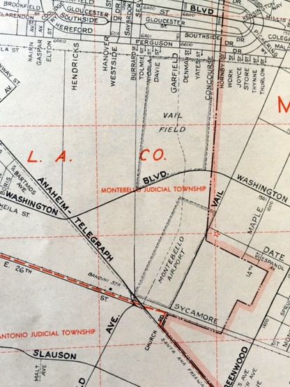
A 1947 street map (courtesy of Kevin Walsh) depicted Vail Field along with the nearby Montebello Airport.
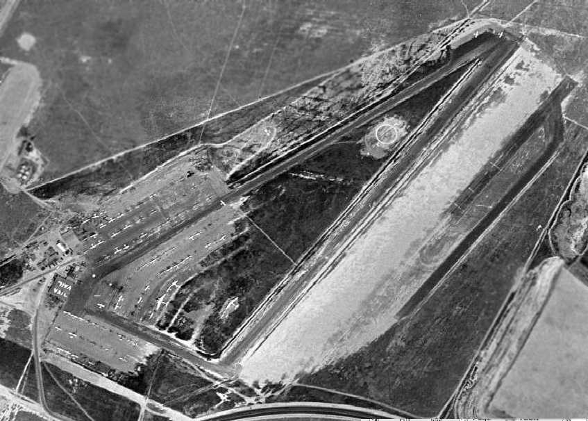
A 1948 aerial view depicted Vail Field as having 2 paved runways,
along with what appears to be an abandoned paved runway on the east side, along with its own parallel taxiway.
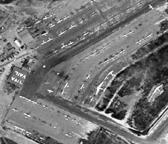
A closeup from the 1948 aerial photo,
showing an amazing number & variety of aircraft based at Vail Field, including 2 DC-3s.
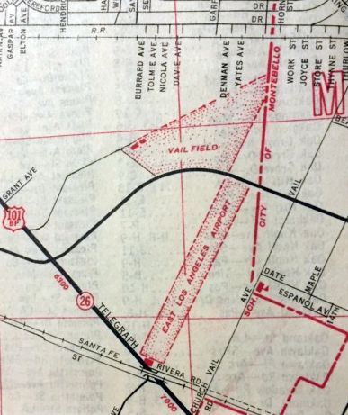
Vail Field (& nearby East Los Angeles Airport), as depicted on a 1950 street map (courtesy of Kevin Walsh).
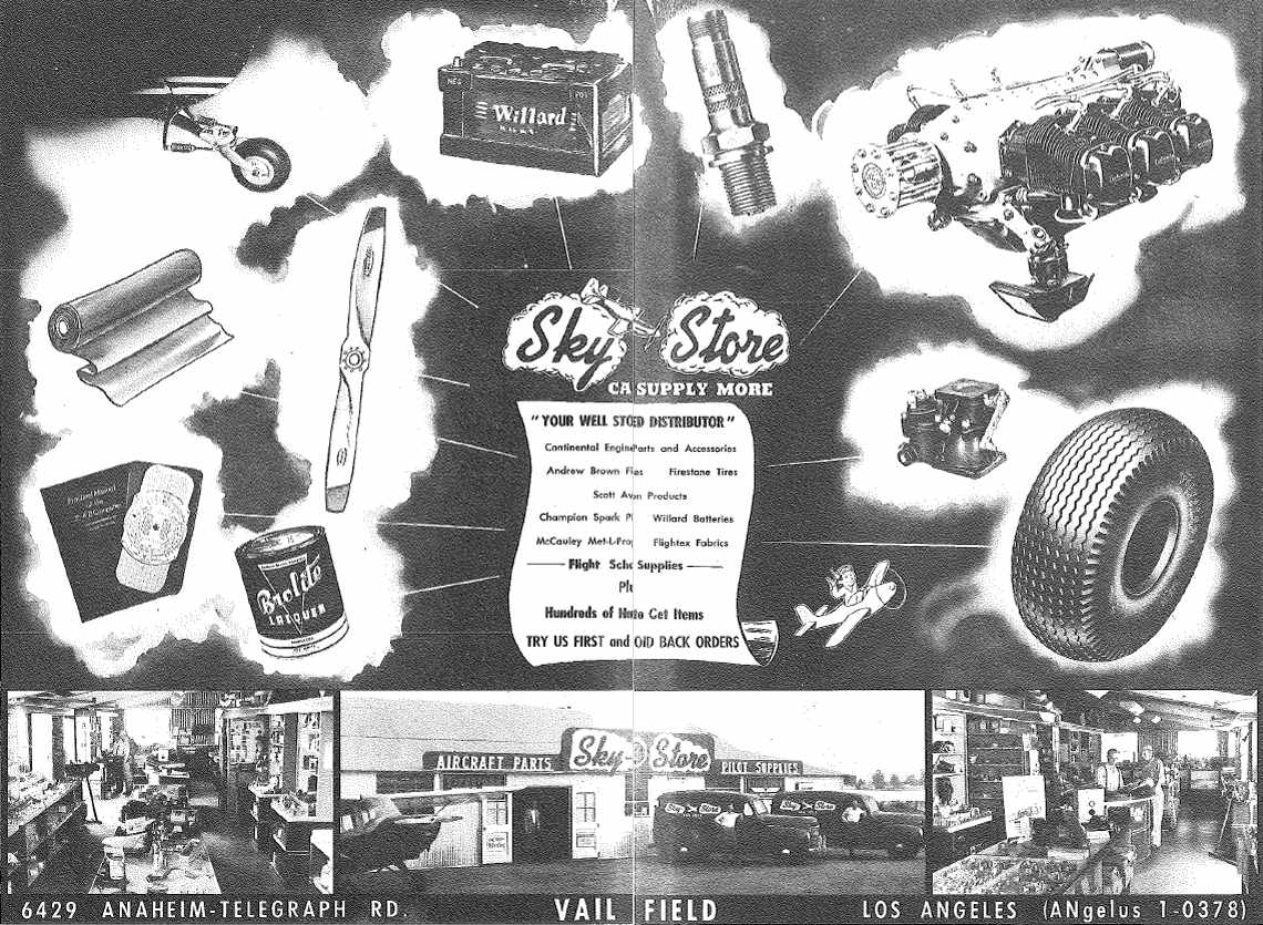
An advertisement for Vail Field's Sky Store from the 1950 Air Photo Guide (courtesy of Jonathan Westerling).
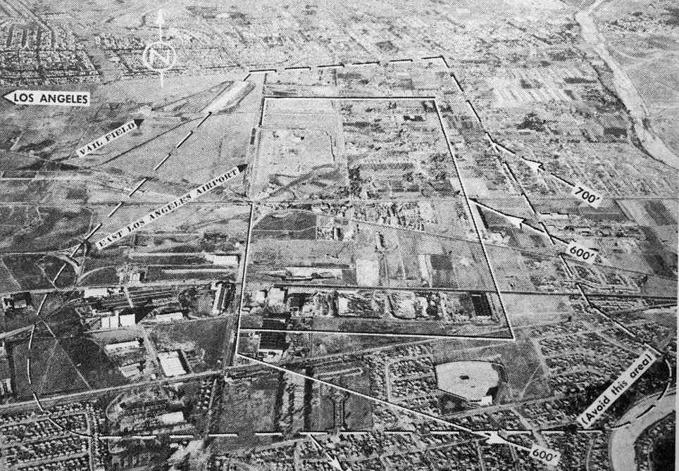
The last photo which has been located of Vail Field was an undated aerial view looking north from the 1950 Air Photo Guide (courtesy of Kevin Walsh).
The guide described Vail Field as having a 2,600' paved north/south runway, and listed the manager as W.H. Coffin.
In 1950, pilots from the 11th Coast Guard Auxiliary District were described as operating out of Vail Field,
flying search & rescue patrols over the mountains & deserts of southern California.
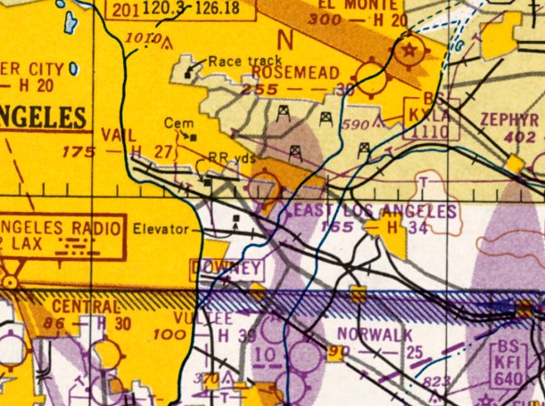
The last aeronautical chart depiction which has been located of Vail Field was on the September 1950 LA Sectional Chart,
which depicted it as having a 2,700' unpaved runway.
Bob Cannon recalled of the 1950s, "I rode my bike to Vail one day, all the way from Alhambra.
I stood on my toes to talk to a lady at a trailer-like office to see about getting flying lessons.
I'll never forget the name of the FBO: Coffin Flying Service!"
Gary Priebe recalled, “In the summer of 1952 while playing on the outer Vail Field, we noticed a 2-engined (radial) plane
over near the hangars so decided to go over & take a closer look.
It was not a sleek-type of plane but the fuselage was more of a square-cornered type, maybe like a Cessna AT-17 or Beech 18;
it was grey or olive drab in color & not plush at all inside so maybe military or a derivative?
There weren't many planes around & as we watched the mechanic working on the plane he was very friendly & spoke to us about his work.
He stated that he would soon be testing the plane & asked if we would like to go for a ride!
He stated that if we could get a signed permission slip from each parent, he would take us up.
Well, needless to say we ran back to Rosewood Park ASAP & did get these slips - this looked like our lucky day!”
Gary continued, “As we returned the mechanic was testing the engines & after a period he made some additional checks
after which time he said 'We are ready to go up' so we loaded up.
As we entered the plane, he asked who was the oldest & it was Jim (12) so he got to sit in the copilot's seat & Larry & I sat in 2 seats behind.
He ran the engines a while & then taxied out & we quickly took off - flying high over Montebello & East L.A.
I just couldn't believe we were flying & will never forget the experience of my 1st flight.
We landed after an all-too-short flight, got off & went back to our rafting.”
Gary continued, “Vail Field closed down in the mid-1950s & soon was graded.”
Vail Field was closed by 1953, as a 1953 aerial photo showed that Garfield Avenue had been extended through the property,
with the runway & hangars having been cleared & replaced by new streets.
Vail Field was no longer depicted at all on the September 1954 USAF LA Sectional Chart (courtesy of Chris Kennedy).
According to Dan MacPherson, Vail Field was "long gone by 1955."
A 1956 street map depicted streets having covered the site of Vail Field.
Gary Priebe recalled, “About 1957, a large & very long building was erected on the Vail site, fronting on Yates Street.
This was to be the Western Electric Company, the supply arm for the Bell T&T company.
This was a huge operation & employed thousands manufacturing & performing services on all of the Bell System’s Southern CA phones,
oak phone booths & instrumentation used in the testing of Bell’s circuits, a department in which I worked one summer in 1959 before college.”
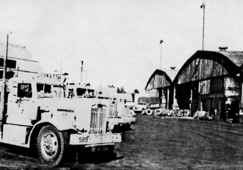
The former Western Air Express hangars from Vail Field were later reused
by the Belyea Trucking Company on Alameda Boulevard, as seen in a 1964 photo (courtesy of Dan MacPherson).
Gary Priebe recalled that the large Western Electric Company building constructed over the site of Vail Field was eventually replaced by smaller industrial buildings.
A 1974 aerial photo showed that the site of Vail Field had been covered with buildings.
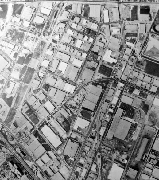
A circa 1983 aerial photo (courtesy of Kevin Walsh) showed no trace of Vail Field.
Dan MacPherson reported in 2003, "The address for Belyea Trucking was 21732 South Santa Fe.
I did not find any hangars on that site.
I cruised Alameda looking for them. Lots of possibilities but I could not locate them."
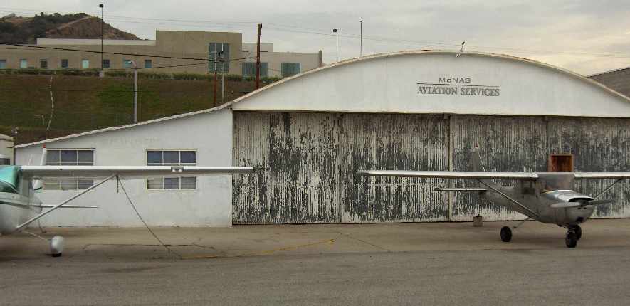
A 2007 photo by Dan MacPherson of one of 2 hangars at Whiteman Airport
which were relocated from Vail Airport to Whiteman (the same hangars are visible in the 1947 photo).
Marc Herman owns this hangar, but “the sad part is that he has several months to demolish the historic hangar.
Mark commented that he should have had the hangar declared a historic monument.
Hank Coffin did business in this hangar while at Whiteman, as did Probert-Devine aviation.
Marc thinks the 'Spirit of St. Louis' was kept in it at one time at Vail.”
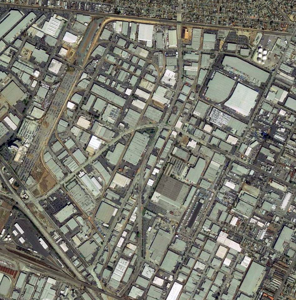
A 2016 aerial photo shows no trace of Vail Field remains at the site of the airport.
Several other airfields were located in close proximity to Vail.
Montebello was located directly across Yates Avenue, Eastside Airport was to the south, and Telegraph Airport was to the west.
See also:
http://www.commercemarketplace.com/home/CollectAir/Prints.html
http://www.ucar.edu/communications/staffnotes/0010/here.html
____________________________________________________
Montebello Airport / East Los Angeles Airport, Montebello, CA
33.99, -118.134 (Southeast of Downtown Los Angeles, CA)
Montebello Airport (along with nearby Telegraph-Atlantic & Vail Airports),
as depicted on the 1941 LA Sectional Chart (courtesy of Chris Kennedy).
Montebello Airport sat directly across Yates Avenue from Vail Airport.
The property was by Yates Avenue on the west, and Vail Avenue on the east, Washington Boulevard on the north, and Telegraph Road on the south.
Montebello Airport was opened by Don Reese in 1940.
A circa 1940s aerial view (courtesy of Dan MacPherson) of Montebello Airport (bottom of picture),
along with Vail Airport (top of picture, across Yates Avenue to the north).
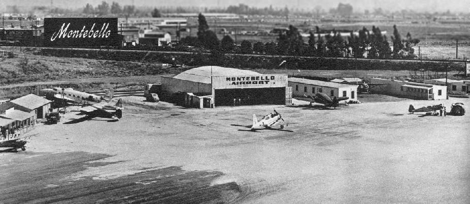
A 1947 photo of Montebello by Don Downie, courtesy of Dan MacPherson.
Note the Lockheed Ventura on the left.
By 1947, the airport had changed hands, and was owned by ventriloquist Edgar Bergen.
In a 1947 Flying Magazine article on LA airports,
Montebello was described as having a 3,400' oiled runway, with tie-down space for 80 aircraft.
As can be seen in the above 1947 photo,
Montebello had at least one hangar, as well as several smaller buildings.
The 1947 LA Local Aeronautical Chart depicted East Los Angeles Airport as having a 3,400' unpaved runway.
A 1947 street map (courtesy of Kevin Walsh) depicted Montebello Airport along with the nearby Vail Field.
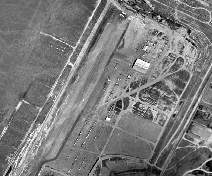
By the time of a 1948 aerial photo, Montebello Airport had been renamed East Los Angeles Airport,
as a 1948 aerial view showed the hangar painted with “East Los Angeles”.
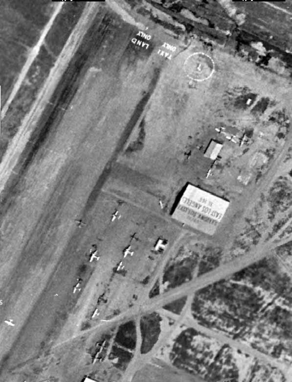
A closeup from the 1948 aerial view showed the hangar, the painted legends saying “Land Only” & “Taxi Only”,
and a large number of aircraft.
East Los Angeles Airport (& nearby Vail Field), as depicted on a 1950 street map (courtesy of Kevin Walsh).
The last photo which has been located of East Los Angeles Airport was an undated aerial view looking north from the 1950 Air Photo Guide (courtesy of Kevin Walsh).
The guide described East Los Angeles Airport as having a 3,400' blacktop north/south runway, and listed the manager as Clarence Bergren.
The last aeronautical chart depiction which has been located of East Los Angeles Airport was on the September 1950 LA Sectional Chart,
which depicted it as having a 3,400' paved runway.
Montebello / East Los Angeles Airport was reportedly still open in 1952.
However, it was apparently closed at some point between 1952-53,
as a 1953 aerial photo shows a row of new buildings along the west side of the site,
which was devoid of any aircraft.
Montebello was no longer depicted at all on the September 1954 USAF LA Sectional Chart (courtesy of Chris Kennedy).
According to Dan MacPherson, "Vail & Montebello airports were both long gone by 1955.
Montebello, I believe was the first to go."
A 1974 aerial photo showed that the site of Montebello Airport had been covered with buildings.
A circa 1983 aerial photo (courtesy of Kevin Walsh) showed no trace of Montebello Airport.
A 2016 aerial photo shows no trace of Montebello Airport remains at the site of the airport.
Dan MacPherson observed, "You can still stand on Vail Avenue
and look at the huge flat pad that was cut into the hilly terrain to build the airport."
Otherwise, not a trace of the airfield appears to remain at the site today - the site is very heavily developed.
Thanks to Dan MacPherson for pointing out this field.
____________________________________________________
Compton Central Airport, Compton, CA
33.91, -118.25 (North of Compton Airport, CA)
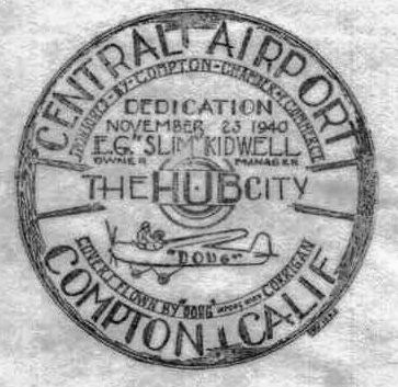
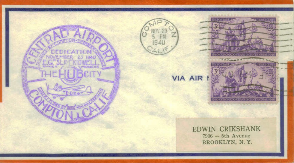
A postmark commemorated the 11/23/40 Dedication of Central Airport.
Compton Central Airport is yet another of the vanished former airports which once were spread all throughout the Los Angeles metropolitan area.
It was located only one mile north of Compton Airport.
There must be a certain amount of confusion about this airport, given the similarly-named "Grand Central" Airport in nearby Glendale.
The date of construction of Central Airport is unknown.
According to K.O. Eckland, in 1939 Central Airport consisted of a 2,000' x 1,800' landing area.
Central Airport was not yet depicted on a 1940 Shell street map (courtesy of Gary Alexander) or the August 1940 San Diego Sectional Chart.
A postmark commemorated the 11/23/40 Dedication of Central Airport.
According to John Underwood, “Central Airport in Compton: it was built & owned by E.G. (Slim) Kidwell, a real oldtimer, in 1940 in collaboration with Doug 'Wrong Way' Corrigan.
Doug was not an easy guy to get along with & the partnership didn’t last.”
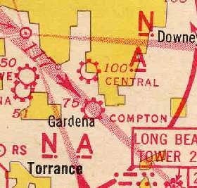
The earliest depiction of Central Airport which has been located was on the 1941 LA Sectional Aeronautical Chart (courtesy of Chris Kennedy).
According to Marissa Abruzzini, “Sometime between 1943-45, a plane was set on fire in a hangar at Compton Airport.
The news dubbed whoever was responsible the 5 'Laughing Vandals'. It was big news at the time.”
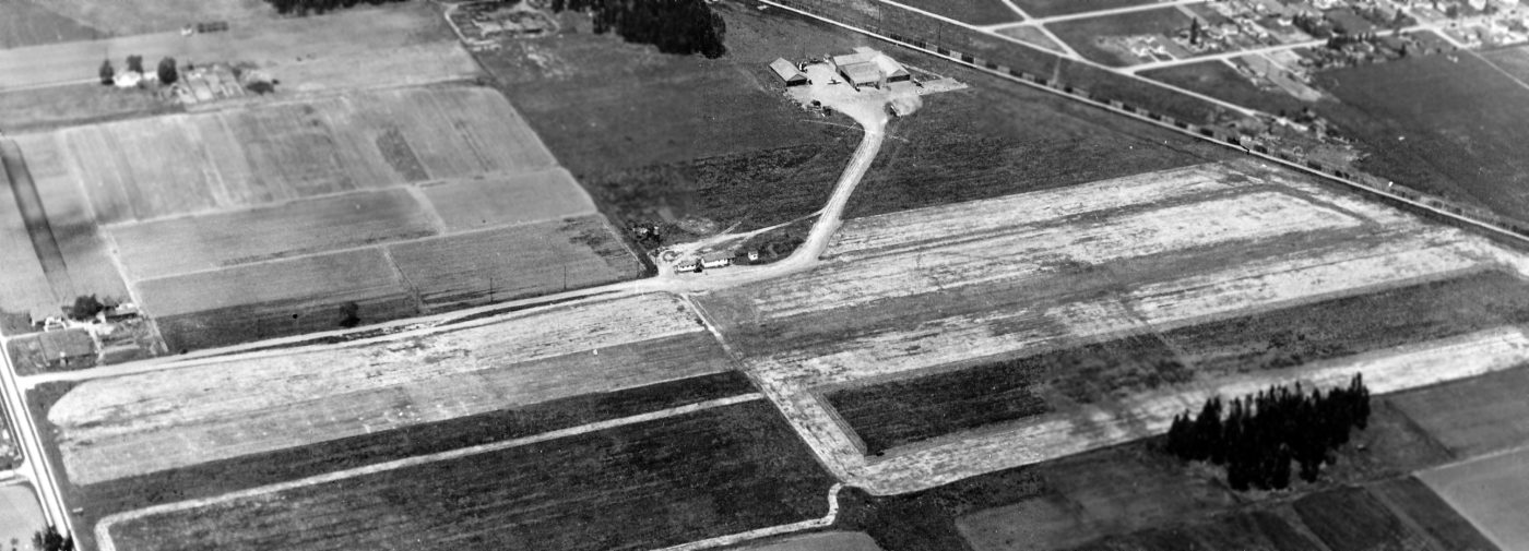
The earliest photo which has been located of Compton Central Airport was a 4/13/44 U.S. Navy aerial view looking northeast (from the National Archives, courtesy of Brian Rehwinkel).
Brian Rehwinkel observed, “This area was still being used for farming.
This airport had a somewhat unusual arrangement in that the hangars were north of the runway & a fairly long taxiway was used to access the runways.”
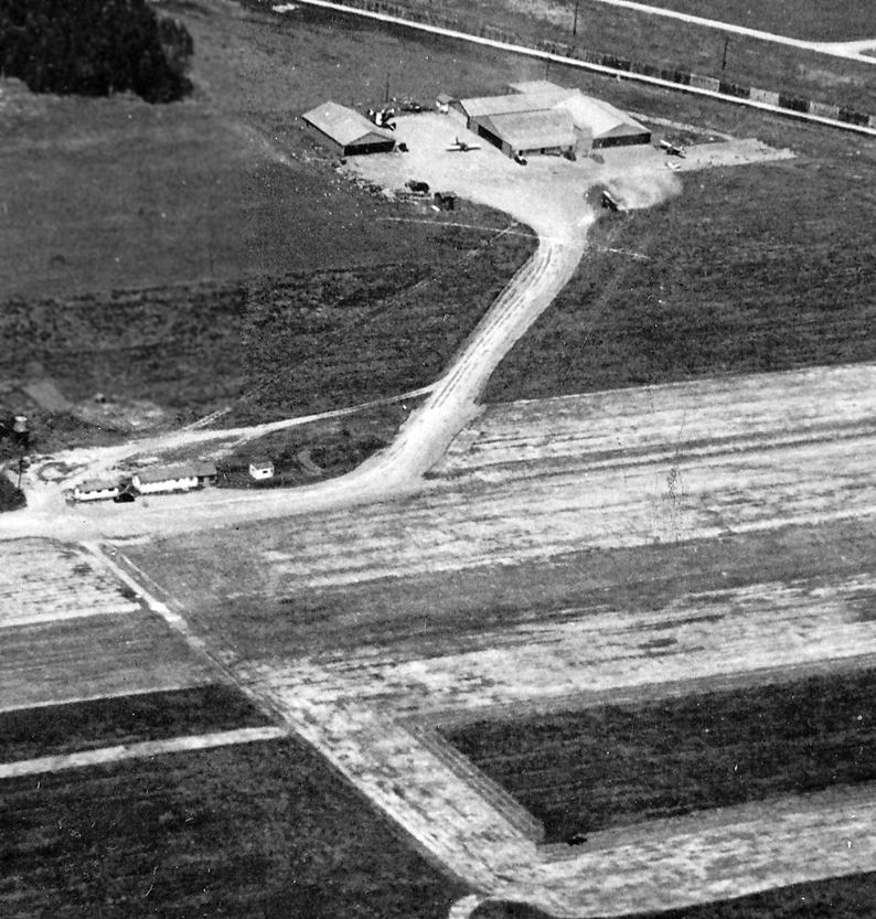
A closeup from the 4/13/44 U.S. Navy aerial view looking northeast at Compton Central Airport (from the National Archives, courtesy of Brian Rehwinkel).
Brian Rehwinkel observed, “There were only a couple of planes [2 or 3] evident in the photo, but I am sure the wartime restrictions of commercial aviation was the reason for this.”
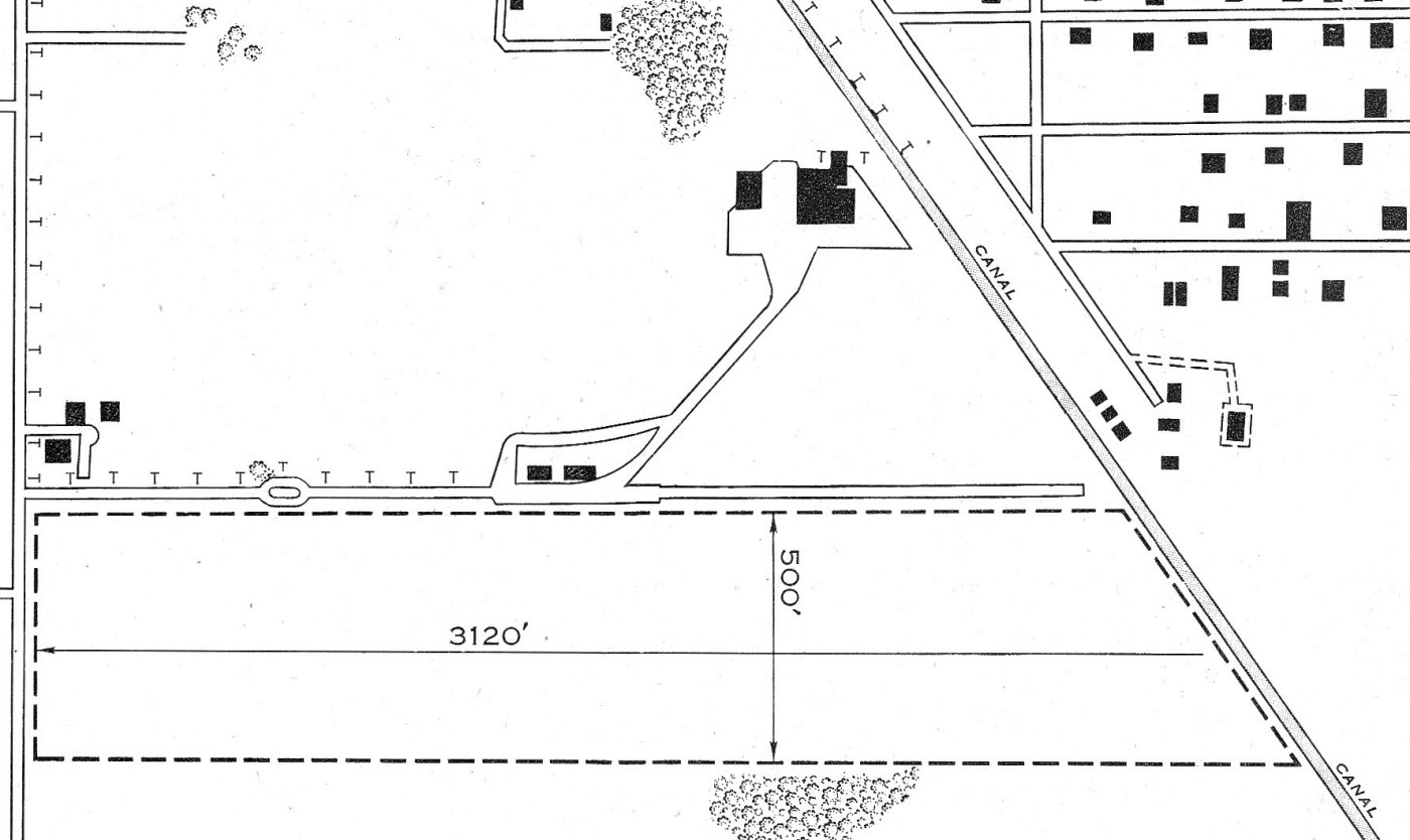
The layout of Compton Central Airport as depicted in the January 1945 USAAF Airport Directory (courtesy of Brian Rehwinkel).
According to Brian Rehwinkel, “The information in the airport directory says the runway was 3,120’ x 500’ & was sod.
Owned & operated by private interests. It also describes 4 hangars at the airport, on the north/northeast side of the field.”
According to John Underwood, Central Airport owner “E.G. (Slim) Kidwell was a test pilot of note
and distributed the Culver Dart in the immediate postwar period & later Bellanca Cruisairs & Cruisemasters.”
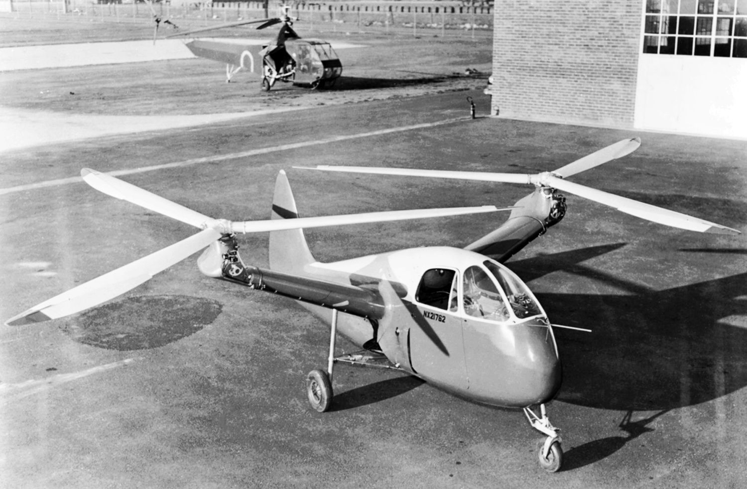
Some test flights of the H-2 took place at Compton Central Airport in 1946.
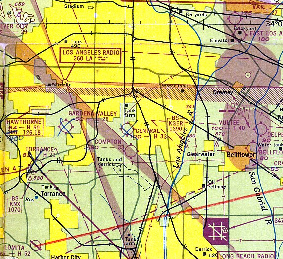
The 1947 LA Local Aeronautical Sectional Chart depicted Central Airport as having a 3,300' paved runway.
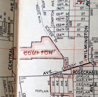
A 1947 street map (courtesy of Kevin Walsh) depicted Central Airport as an irregularly-shaped property outline.
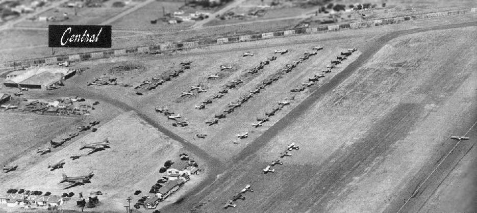
A 1947 aerial view looking northeast at Central Airport by Don Downie (courtesy of Dan MacPherson).
The Compton creek (wash) lines the airport perimeter in the background of the photo, with eucalyptus trees lining the wash. Note the 2 DC-3s at lower left.
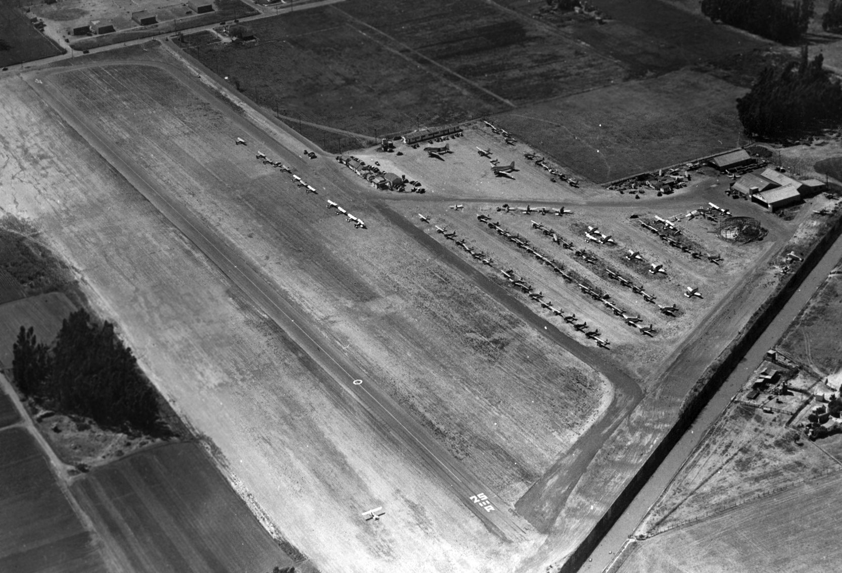
A 1947 aerial view looking northwest at Central Airport (courtesy of Norm Cowl). Note the aircraft on the grass runway, parallel to the paved runway.
A large number & variety of the aircaft were parked on the northeast side, including 2 DC-3 airliners.
According to a 1947 Flying Magazine article on LA Airports, Central Airport had a 3,250' oiled runway & 4 hangars, with 160 resident aircraft.
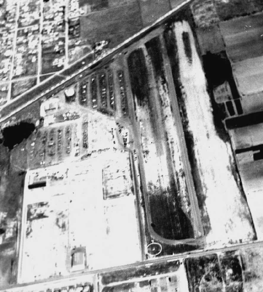
A circa 1947-48 aerial view of Central Airport (courtesy of Harry Gordon),
showing what appeared to be a paved runway with a parallel paved taxiway & a parallel unpaved runway.
Several rows of parked light planes were visible at the far end.
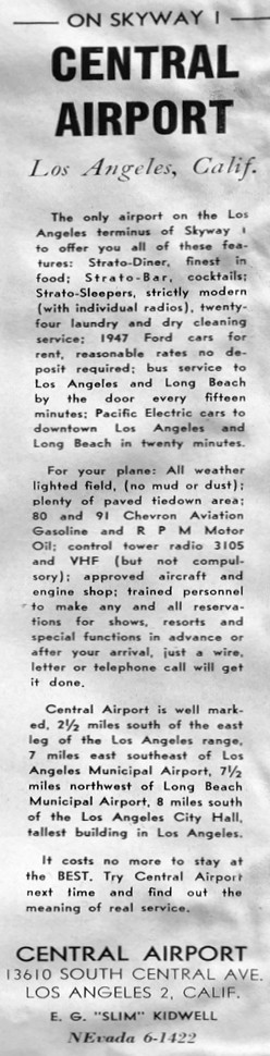
A 1948 advertisement for Central Airport (courtesy of Kevin Walsh).
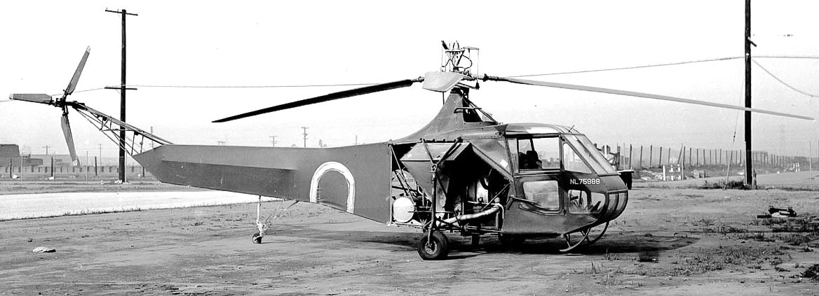
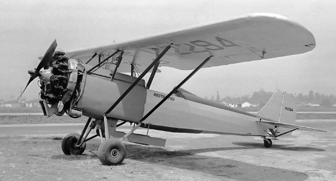
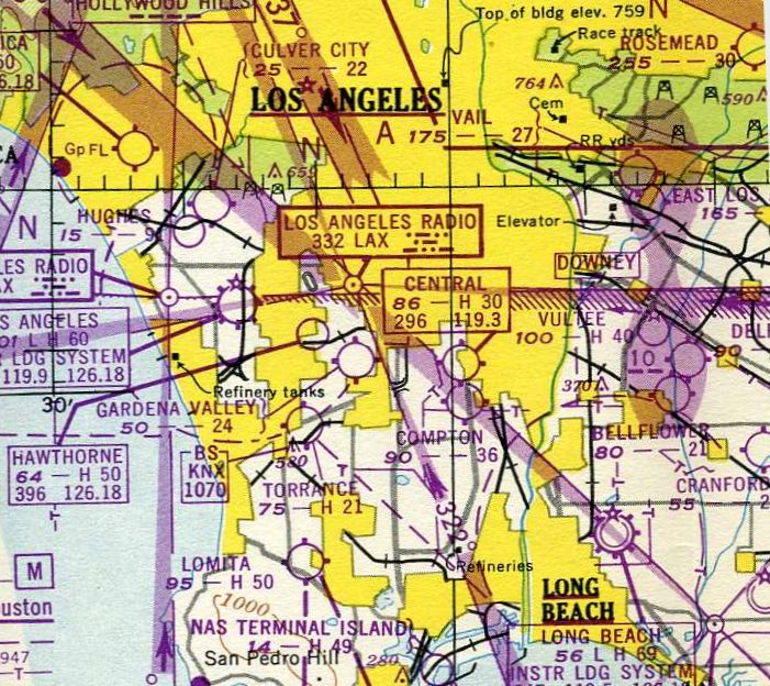
The last aeronautical chart depiction which is available of Central Airport was on the February 1949 LA Sectional Chart,
which depicted Central Airport as having a 3,000' paved runway.
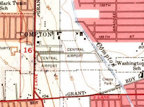
The 1949 USGS topo map depicted Central Airport as having an east/west runway bracketed by parallel taxiways.
According to Harry Gordon, “The airport manager was 'Slim' Kidwell.
They had a control tower of sorts at some point, and the tower operator was Stuart Nelson, the brother of my best friend.”
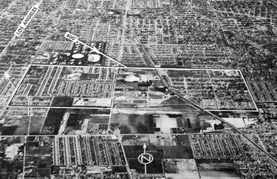
The last depiction which has been located of Central Airport was an undated aerial view looking north from the 1950 Air Photo Guide (courtesy of Kevin Walsh).
The guide described Central Airport as having a 3,000' paved Runway 7/25, and listed the manager as Slim Kidwell.
Central Airport was still depicted as an active airfield on the 1950 LAX Chart, according to Bob Cannon.
A 5/12/51 LA Daily News article (courtesy of Dick Morris) reported the sad news of the end for Central Airport:
“Biltmore Homes has purchased the 80-acre Central Airport & had started construction on 458 homes.”
A 1952 aerial photo showed houses covering the majority of the Central Airport property,
except what appeared to be a section of paved east/west runway & a former hangar.
The street adjacent to the airport (what eventually became the present-day 134th or 135th Street)
was still depicted as "Airport Way" on a 1954 street map & a 1956 street map (courtesy of Kevin Walsh).
Central Airport was no longer depicted at all on the September 1954 USAF LA Sectional Chart (courtesy of Chris Kennedy).
By the time of a 1972 aerial photo, dense housing covered the site of Central Airport.
A 1980 aerial view showed the only only remaining trace of Central Airport:
a sheetmetal hangar on the east side of Water Avenue.
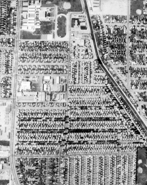
A circa 1983 aerial view (courtesy of Kevin Walsh) of the site of Compton Central Airport.
A 2003 aerial view showed that the former hangar had evidently been removed
and replaced with another row of houses at some point between 1980-2003,
erasing the last trace of Central Airport.
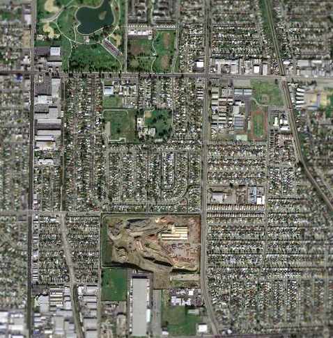
A March 2004 USGS aerial photo showed the site of Compton Central Airport has become a densely developed area.
The site of Central Airport is located at the intersection of North Central Avenue & 135th Street.
____________________________________________________
____________________________________________________
This site covers airfields in all 50 states.