
Abandoned & Little-Known Airfields:
California: San Mateo County
© 2002, © 2023 by Paul Freeman. Revised 8/2/23.
This site covers airfields in all 50 states: Click here for the site's main menu.
____________________________________________________
Please consider a financial contribution to support the continued growth & operation of this site.
For a 10th year, the CA pages of this website are sponsored by the California Pilots Association:
Belmont Airport (revised 7/20/23) - (Original) San Carlos Airport (revised 8/3/23) - San Mateo Airport (revised 8/27/22)
San Mateo Highlands Airfield (revised 7/19/23) - Varney Field / Johnson Field / Curtiss-Wright Airport / Bay Meadows Airport (revised 1/12/23)
____________________________________________________
(Original) San Carlos Airport, San Carlos, CA
37.503, -122.246 (South of San Francisco, CA)
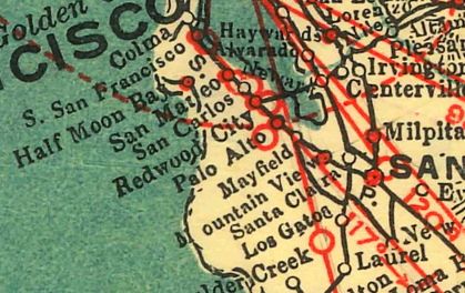
San Carlos Airport, as depicted on the 1929 Landing Fields of the Pacific West (courtesy of Jonathan Westerling).
The original location of San Carlos Airport was located south of Route 101.
The date of establishment of San Carlos Airport has not been determined.
The earliest depiction which has been located of San Carlos Airport was on the 1929 Landing Fields of the Pacific West (courtesy of Jonathan Westerling).
It described San Carlos as a commercial airport, operated by Coaley Aircraft.
It was said to have 2 runways, measuring 3,700' east/west & 2,700' north/south, with a hangar & repair shop.
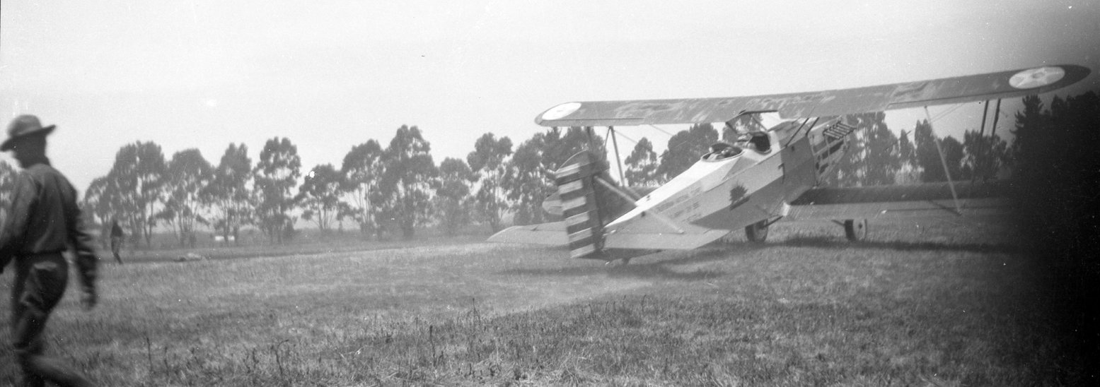
The earliest photo which has been located of San Carlos Airport was a circa 1920s photo (courtesy of Kevin Walsh) of an Army biplane (model unidentified) at San Carlos Airport.
San Carlos Airport may have been closed at some point between 1929-33, as it was not depicted on the May 1933 San Francisco Sectional Chart.
There was no recognizable sign of San Carlos Airport on a March 1941 aerial photo (courtesy of Kevin Walsh).
San Carlos Airport still was not depicted on San Francisco Sectional Charts thru 1944.
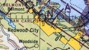
San Carlos Airport was evidently reopened at some point between 1944-45,
as it was once again depicted on the September 1945 San Francisco Sectional Chart (courtesy of Jonathan Westerling).
It depicted San Carlos as a commercial/municipal airport.
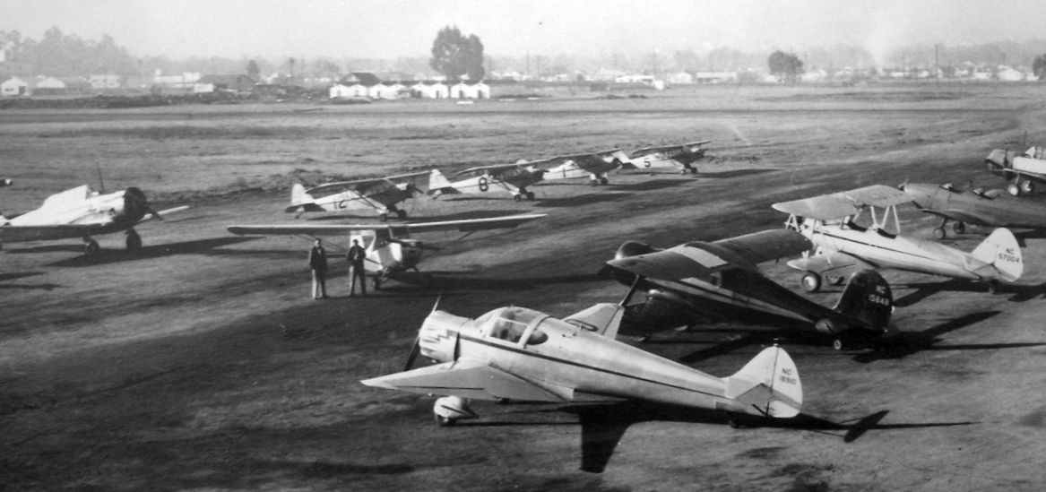
A circa late 1940s photo (courtesy of Jonathan Hull) depicted an AT-6 Texan & a variety of other light single-engine general aviation aircraft at San Carlos Airport.
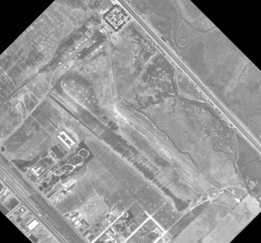
A 1947 aerial photo (courtesy of Jonathan Westerling) depicted over 20 light aircraft parked at Carlos Airport.
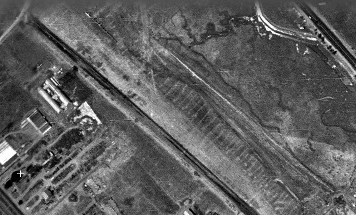
A 1948 aerial photo showed at least 8 light aircraft parked at Carlos Airport.
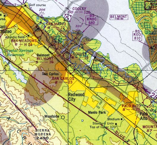
The February 1948 San Francisco Local Aeronautical Chart depicted San Carlos Airport as having a 2,300' unpaved runway.
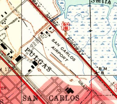
The earliest topo map depiction which has been located of San Carlos Airport was on the 1948 USGS topo map (courtesy of Jonathan Westerling).
It depicted San Carlos Airport as a northwest/southeast clearing on the south side of Route 101, with a few small buildings along the northwest side.
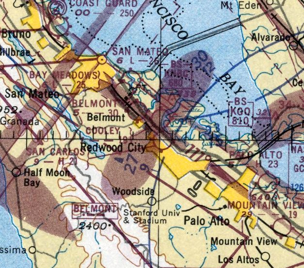
The last aeronautical chart depiction which has been located of San Carlos Airport was on the March 1951 San Francisco Sectional Chart.
It depicted San Carlos as having a 2,100' paved runway.
The original San Carlos Airport was evidently closed at some point in 1951,
as it was no longer depicted on the September 1951 San Francisco Sectional Chart.
It was eventually replaced by a larger San Carlos Airport located on the opposite (north) side of Route 101.
A 1956 aerial view showed all traces of the original San Carlos Airport had been removed between 1948-56.
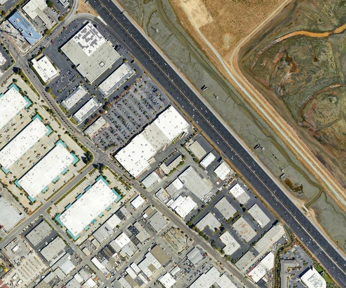
A 2022 aerial view showed no trace remaining of the original San Carlos Airport.
Thanks to Jonathan Westerling for pointing out this airfield.
____________________________________________________
San Mateo Highlands Airfield, San Mateo, CA
37.513, -122.337 (South of San Francisco, CA)
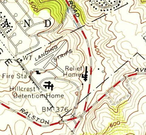
The 1956 USGS topo map (courtesy of Bruce Moore) depicted 3 short runways, labeled generically as “Landing Strips”.
This little airfield was evidently established at some point between 1949-56,
as it was not yet depicted on a 1946 aerial photo, the 1948 San Francisco Local Aeronautical Chart, or on the 1949 USGS topo map.
The earliest depiction which has been located of this airfield was on the 1956 USGS topo map (courtesy of Bruce Moore).
It depicted 3 short runways (the longest being the 1,000' northeast/southwest strip), labeled generically as “Landing Strips”,
with the Hillcrest Detention Home to the south, and a “Relief Home” to the southeast.
Bruce Moore reported, “Just down the hill (southeast of this airstrip) was San Mateo County Fire Station #17.
The fire chief at this station was a pilot & he flew a small high-wing plane, taking off & landing on an airstrip (shown on the topographic map).
He used the plane to help direct wildfire actions, being in contact with ground crews via radio.
An interesting thing about this strip, is that it is on the top of a hill (about 520’ elevation) that quickly drops into a canyon (about 370’ elevation).”
An article entitled “History Buffs on the track of antique airports” by George Golding in the 5/3/86 San Mateo Times (courtesy of Jonathan Westerling) reported,
“Other San Mateo County spots used as landing fields, including the front yard of the Department of Forestry County Fire station at Hillcrest, between Belmont & San Mateo Highlands,
which used to be used with regularity by the firefighting chief.”
According to the book "Two Hours By Crow" by Howard & Judith Campbell (courtesy of Wings of History),
“In 1952, the California Department of Forestry Division Chief Ernest Werder used to fly his personal Taylorcraft J-2 Cub from this field to the Pescadero CDF Strip & several impromptu fields within the County.”
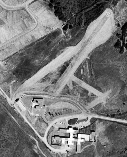
A 9/1/56 aerial photo (courtesy of Bruce Moore) depicted the San Mateo Highlands airfield as having 3 short runways (the longest being the 1,000' northeast/southwest strip),
with a white “X” inside a circle on the northeast end of the longest runway.
What may have been a hangar was located on the southwest side.
Bruce Moore reported, “At some point, the state of California took over all wildfire suppression, forming California Division of Forestry.
The air support was moved to San Carlos Airport & the airstrip was abandoned.”
No airfield was depicted at this location on the April 1959 San Francisco Local Aeronautical Chart.
According to Bruce Moore, “In an 8/15/60 aerial photo, it looks as if the strip has been little-used or even abandoned, though still intact.”
A 1968 aerial photo shows the runways had been removed, but traces were still recognizable.
Bruce Moore reported, “The hangar became a storage building, and it was still in use (fire trucks & equipment) when I was last there.
The runway is now gone, as one of the buildings of the Juvenile Detention Center has expanded & built a structure across it.”
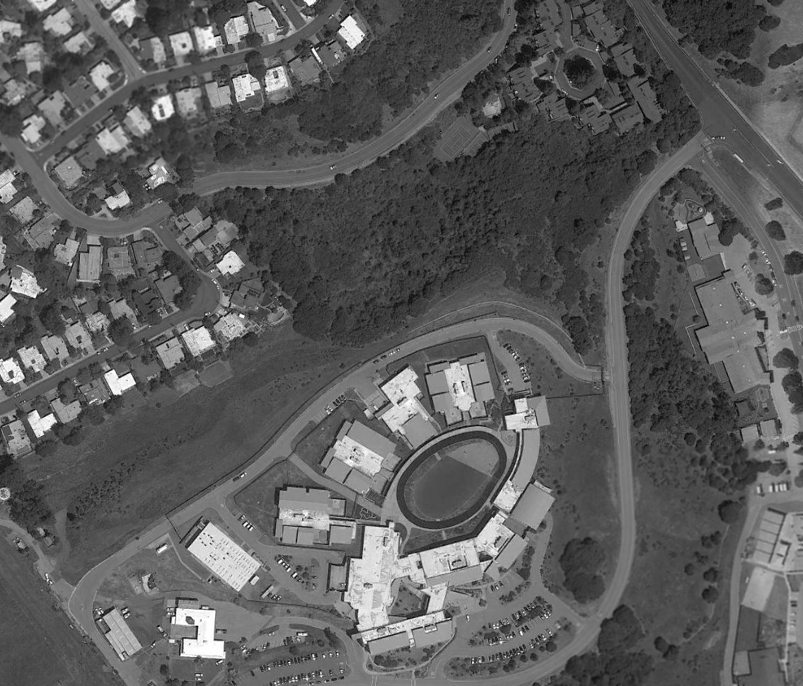
A 2018 aerial view shows the Hillcrest Juvenile Hall has been built over the site of the San Mateo Highlands Airfield.
What may have original been a hangar still remains standing – the building at bottom-left, possibly reused by a fire station.
The site of the San Mateo Highlands Airfield is located north of the western terminus of Tower Road.
Thanks to Bruce Moore for pointing out this airfield.
____________________________________________________
San Mateo Airport, San Mateo, CA
37.558, -122.298 (South of San Francisco, CA)
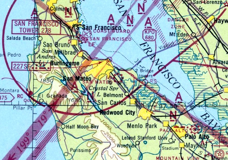
San Mateo Airport, as depicted on the December 1941 San Francisco Sectional Chart.
San Mateo Airport was evidently established at some point in 1941,
as it was not yet depicted on the April 1941 San Francisco Sectional Chart.
The earliest depiction which has been located of San Mateo Airport was on the December 1941 San Francisco Sectional Chart.
According to the book "Two Hours By Crow" by Howard & Judith Campbell (courtesy of Wings of History),
“The first mention we have of this field is an 8/5/23 government photo that depicts the sod runways.
A group of 6 people formed the San Mateo Airport Corporation, built the field, and ran it during its existence.
Joseph Lorenze, Cecil Smith, Jack Reilly; Ed & Elsie Watson; and Harry Cranston were the partners with the Watsons acting as the Fixed Base Operators.
As all private flight training had to move 150 miles or more inland during the War, we assume the site was dormant until 1945.
In these early years the main runway running parallel to the Bayshore Highway was paved with crushed redrock
and was stable enough to accommodate a Douglas DC-3 using the field to fly bettors in to Bay Meadows Horse races.
Prior to paving, the owners tried to stabilize the soft, gummy, adobe clay surfaces with a layer of crushed rock.
They spread the stones across the shaded runways & were going to roll the surface down to embed the matrix into a firm composite that would allow aircraft to roll out during landing.
Unfortunately, before they could get to the last stage of this idea, a Cessna T-50 Bobcat spotted the beautiful, smooth light gray runway below & came in.
Well-known aircraft photographer William Larkins was able to record the end result, [with] both blades of both props bent back & the wheels sunk down to the hubs in the gravel.”
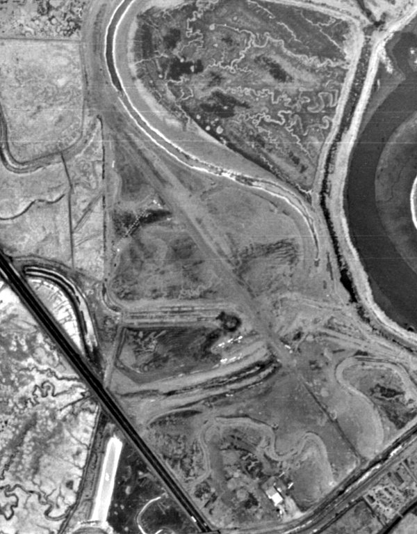
The earliest photo which has been located of San Mateo Airport was on a 1946 aerial photo (from the UCSB Library, courtesy of Jonathan Westerling).
It depicted the airfield as having a single unpaved northwest/southeast runway, with a small hangar & 8 small single-engine aircraft at the southeast corner.
The 1947 Decker's Guide (courtesy of Jonathan Westerling) described San Mateo Airport as having “Runways under construction.”
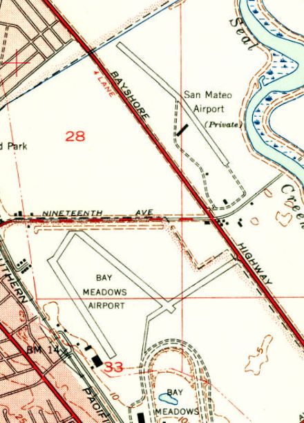
The 1947 USGS topo map depicted San Mateo Airport as a private field having a single northwest/southeast runway, with a slight bend in the middle.
Three small buildings were depicted on the south side of the airfield.
Note it also depicted Bay Meadows Airport across Bayshore Highway to the south.
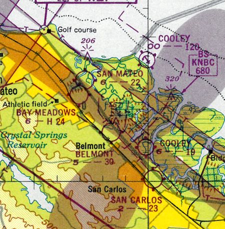
The 1948 San Francisco Local Aeronautical Chart (courtesy of Tim Zukas) depicted San Mateo Airport as having a 2,200' unpaved runway.
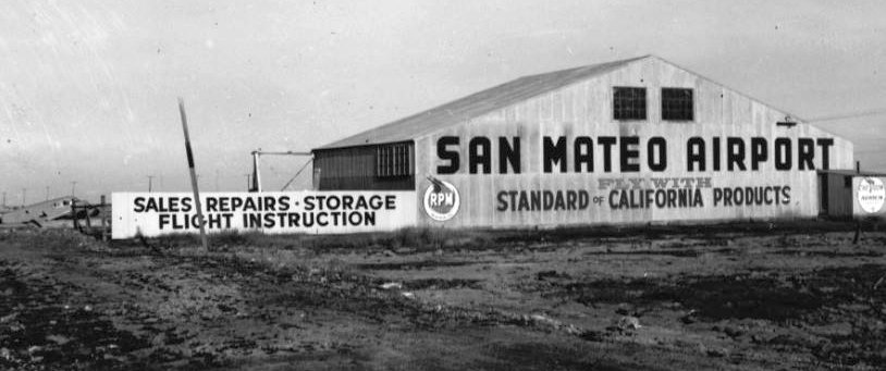
The only ground-level photo which has been located of San Mateo Airport was an undated photo (courtesy of Kevin Walsh)
of the hangar labeled “San Mateo Airport”, advertising sales, repairs, storage, and flight instruction.
A Cessna T-50 twin was visible in the background.
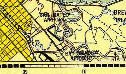
The 1948 USAF Urban Area Chart depicted San Mateo Airport as having a northwest/southeast runway & 2 taxiways.
The 1949 USGS topo map depicted San Mateo Airport in the same fashion as the 1947 USGS topo map.
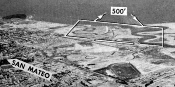
The last photo which has been located of San Mateo Airport was an undated aerial view looking north from the 1950 Air Photo Guide (courtesy of Kevin Walsh).
It described San Mateo Airport as having a 2,600' gravel Runway 13/31 & a 2,000' dirt Runway 6/24, and listed the manager as Edward Watson.
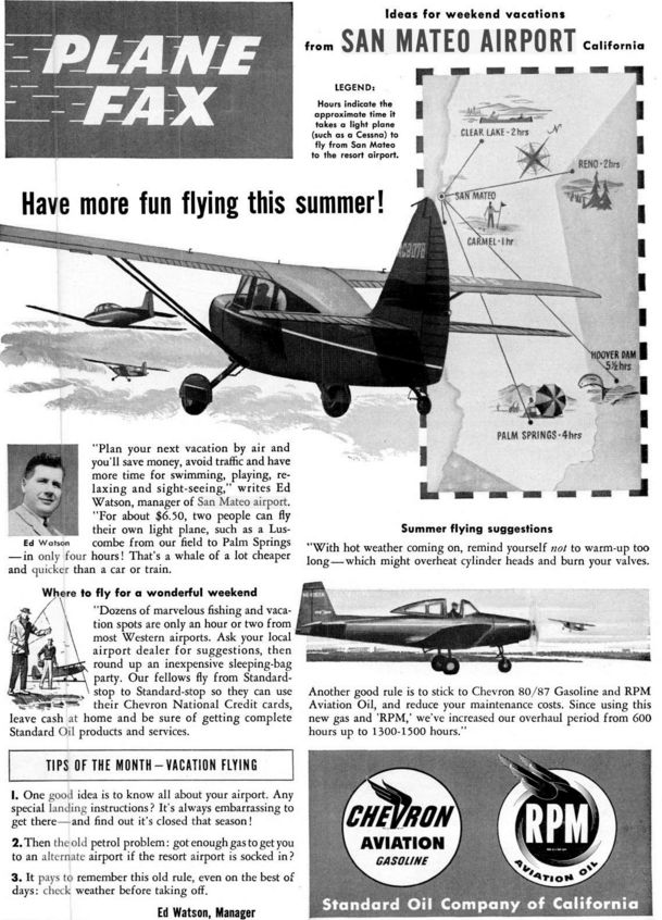
A June 1951 magazine advertisement for San Mateo airport (courtesy of Jonathan Westerling).
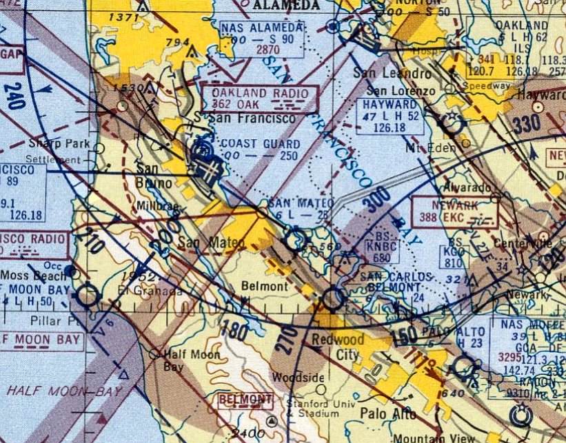
The last aeronautical chart depiction which has been located of San Mateo Airport was on the March 1953 San Francisco Sectional Chart.
It depicted San Mateo Airport as having a 2,600' unpaved runway.
San Mateo Airport was evidently closed at some point between 1953-54,
as it was no longer depicted on the September 1954 San Francisco Sectional Chart.
According to the book "Two Hours By Crow" by Howard & Judith Campbell (courtesy of Wings of History),
“By 1955 the Parkside Shopping Center was selling products to their customers & most of the roads were in, with homes sprouting up everywhere.
The San Mateo Airport was gone, an all-too-familiar story.”
A 1956 aerial photo showed streets & houses covering the site of San Mateo Airport.
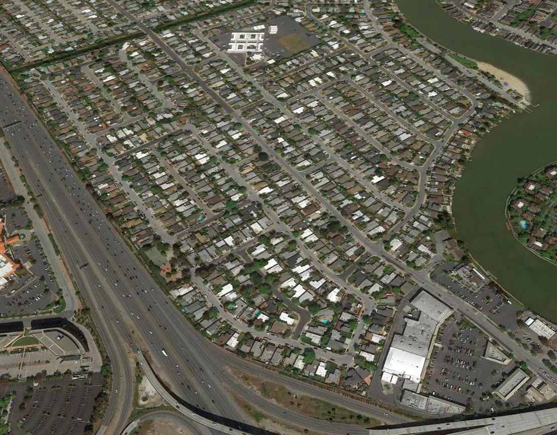
A 2015 aerial view looking north shows no trace remaining of San Mateo Airport.
The site of San Mateo Airport is located north of the intersection of the 101 Freeway & Route 92.
____________________________________________________
37.53, -122.28 (Southeast of San Francisco, CA)
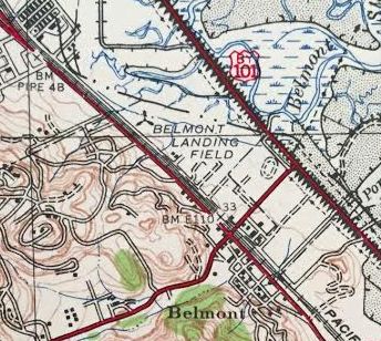
“Belmont Landing Field”, as depicted on the 1942 USGS topo map (courtesy of Kevin Walsh).
According to the book "Two Hours By Crow" by Howard & Judith Campbell (courtesy of Wings of History),
“In 1939 two pilots set up this airport in Belmont right against the San Mateo City line.
While Highway 101 is at about sea level & flat; El Camino Real, Highway 82, has a distinct hump as it leaves San Mateo & enters Belmont glancing off the bay side of Notre Dame Hill.
El Camino Real rises to about 33' above sea level here. The airport property lies in the flat just below this hill.”
The earliest depiction which has been located of Belmont Airport was on the 1942 USGS topo map (courtesy of Kevin Walsh).
It labeled the site as “Belmont Landing Field”, but did not depict any details.
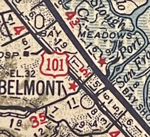
A 1942 ACSC map (courtesy of Kevin Walsh) depicted the Belmont Airport as a rectangular property outline with the “T” airport symbol.
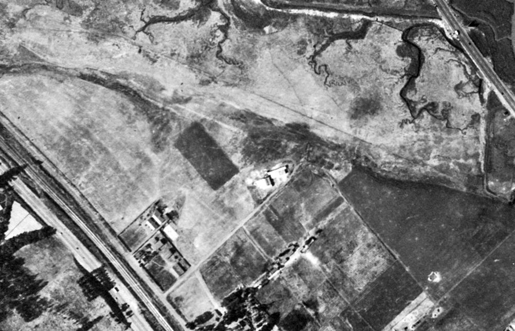
The earliest photo which is available of Belmont Airport was a 1943 aerial view (from the UCB Library, courtesy of Jonathan Westerling).
It depicted Belmont Airport as having an unpaved northwest/southeast runway, with 2 hangars on the south side. No planes were visible on the field.
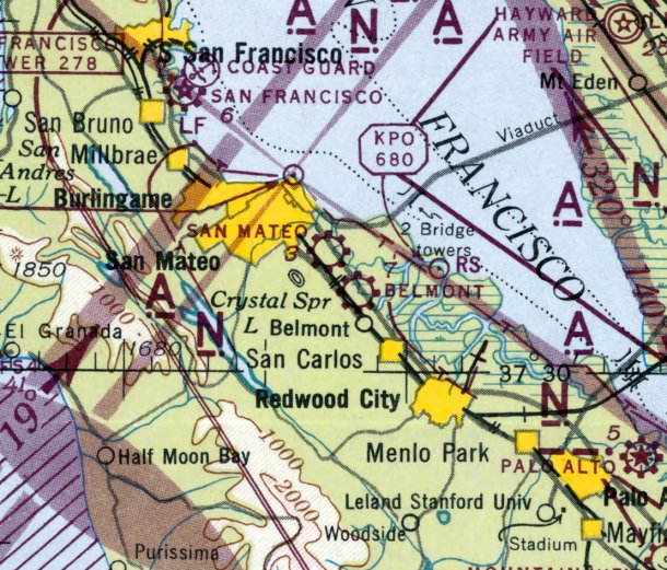
The earliest aeronautical chart depiction which has been located of Belmont Airport was on the August 1943 San Francisco Sectional Chart.
The 1943 Directory of Airfields (courtesy of Jonathan Westerling) included Belmont Airport.
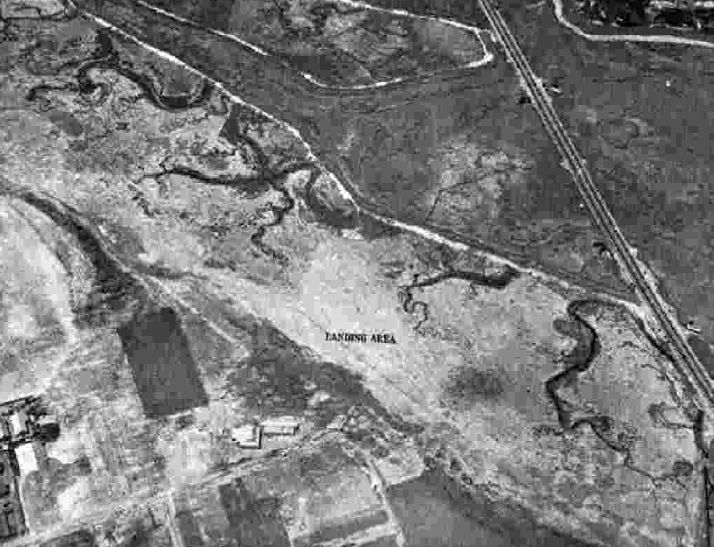
A 8/5/43 aerial view looking north from the 1945 AAF Airfield Directory (courtesy of Scott Murdock) depicted Belmont Airport as an unpaved landing area.
The 1945 AAF Airfield Directory (courtesy of Scott Murdock) described Belmont Airport
as a 114 acre irregularly-shaped property having 2 sod runways, measuring 3,200' east/west & 3,000' northwest/southeast.
The field was said to have 2 wood & metal hangars, the largest being 100' x 50', and to be owned & operated by private interests.
According to the book "Two Hours By Crow" by Howard & Judith Campbell (courtesy of Wings of History),
“Of the two pilots, 'Tex' Harris & Marvin Franklin, it seems that 'Tex' left the partnership after a couple of years as his name is not listed when the field reopened after World War II in 1945.
There were all the usual services; fuel, repairs, sales, training, and hangars.
From 1945-51 the field hosted a very large variety of surplus military planes: PT-13, -15, & -17s, BT-13s, AT-6s, and any number of the lighter L-series [liaison] of smaller aircraft.
Flight instruction was given in these smaller machines as they were cheaper to fly.
Then more advanced ratings were trained in the more expensive units such as a Cessna T-50 (UC- 78).
Three flying clubs were on the field & quite a social atmosphere was present during the weekends; featuring picnics, flight games, flying over-nighters and tours.”
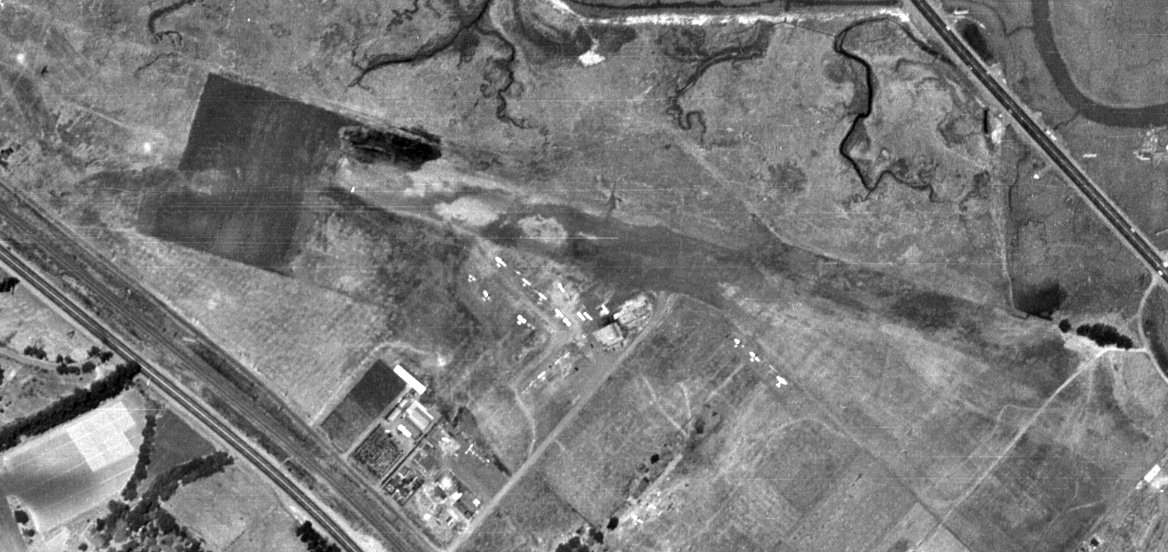
A 1946 aerial view (from the UCB Library, courtesy of Scott Murdock) depicted Belmont Airport as having an unpaved northwest/southeast runway,
with more than a dozen light single-engine aircraft parked near some small buildings on the south side.
A typical healthy little airport in the post-WW2 general aviation boom.
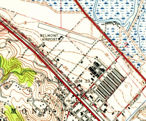
The 1947 USGS topo map depicted Belmont Airport as having a single northwest/southeast runway, with 2 small buildings on the south side.
George Harper observed that his logbook shows “on 6/25/47 I continued my flight training at the Belmont Airport on the San Francisco Peninsula.”
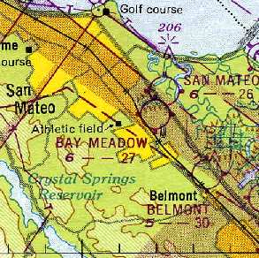
The 1949 San Francisco Local Aeronautical Chart (courtesy of Chris Kennedy) depicted Belmont Airport as having a 3,000' unpaved runway.
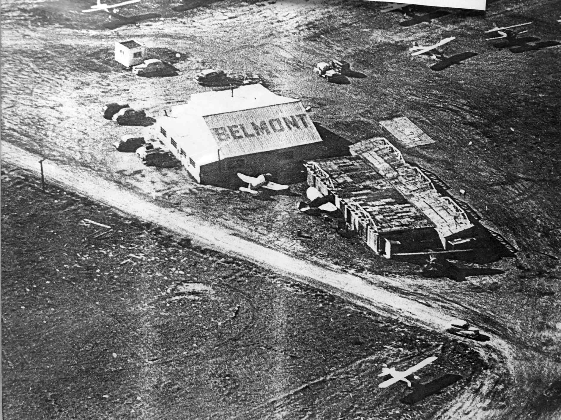
A circa 1940s aerial view of 2 Belmont Airport hangars (courtesy of Jonathan Hull), one of which had the airport name painted on its roof.
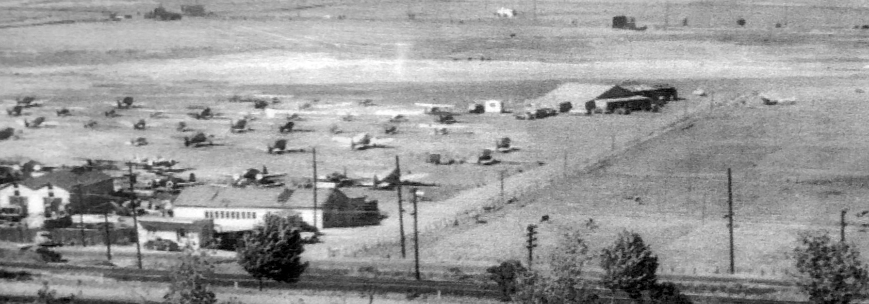
A circa 1940s aerial view looking north at Belmont Airport (courtesy of Jonathan Hull), showing a large number of light planes parked near the hangars.
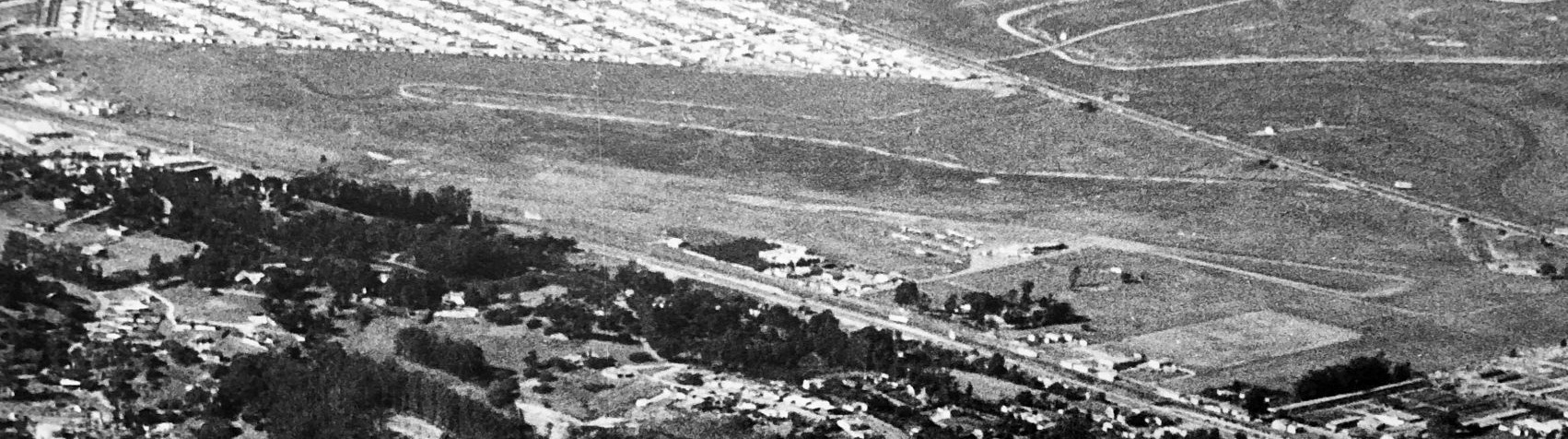
A circa 1940s aerial view looking north at Belmont Airport (courtesy of Jonathan Hull).
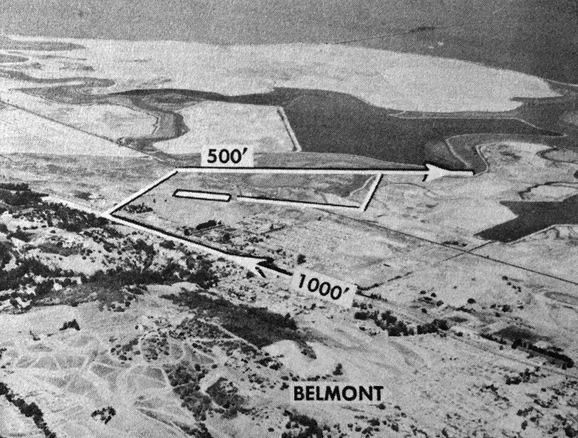
The last photo which is available of Belmont Airport was an undated aerial view looking north from the 1950 CA Air Photo Guide (courtesy of Jonathan Westerling).
It described Belmont Airport as having a 3,000' sod Runway 10/28.
The manager was listed as Victor Voit, and there was said to be “Dining, dancing, and cocktails adjacent to airport.”
According to the book "Two Hours By Crow" by Howard & Judith Campbell (courtesy of Wings of History),
“Nothing remains of the field as it was taken over by the Sterling Downs Tract of homes in 1951.”
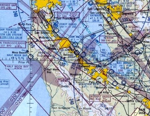
The last aeronautical chart depiction which has been located of Belmont Airport was on the 1952 San Francisco Sectional Chart (courtesy of Jonathan Westerling).
It depicted Belmont Airport as having a 3,000' unpaved runway.
The May 1952 Airman's Guide (courtesy of Jonathan Westerling) described Belmont Airport as “Reported abandoned”.
A 1956 aerial photo showed new streets & dense houses covering the site of Belmont Airport.
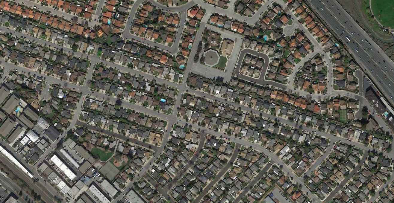
A 2014 aerial view showed no trace of Belmont Airport.
The site of Belmont Airport is located at the intersection of Marine View & Hiller Street.
Thanks to George Harper for pointing out this airfield.
____________________________________________________
Varney Field / Johnson Field / Curtiss-Wright Airport / Bay Meadows Airport, San Mateo, CA
37.54, -122.3 (South of San Francisco, CA)
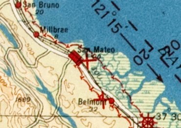
Varney Field, as depicted on the 1924 San Francisco – LA Strip Chart (courtesy of Jonathan Westerling).
A series of small airports on this property have gone through a succession of at least 4 names.
This property may have had aeronautical roots going back to 1911.
Jim Douglass recalled, “My dad used to tell me that the property was the site of Northern California's first powered airplane flight in 1911.”
According to “MSS Wings Over San Francisco Bay” by R.T. Reuther (courtesy of Jim Douglass),
“In 1921 Walter Varney moved his flying school [from Redwood City Airport] to San Mateo.”
According to the book "Two Hours By Crow" by Howard & Judith Campbell (courtesy of Wings of History),
“Between 1921-25, this was known as Varney Field, named by Walter Varney (co-founder of United Air Lines) when he started with just a hangar on the site.”
The 1922 Aviation Yearbook (courtesy of Jonathan Westerling) said Walter Varney's “base shelters 15 machines.”
The earliest aeronautical chart depiction which has been located of Varney Field was on the 1924 San Francisco – LA Strip Chart (courtesy of Jonathan Westerling).
According to the book "Two Hours By Crow" by Howard & Judith Campbell (courtesy of Wings of History),
“In 1925-29, Victor 'Speed' Johnson came up from Mountain View Airport to run the field.”
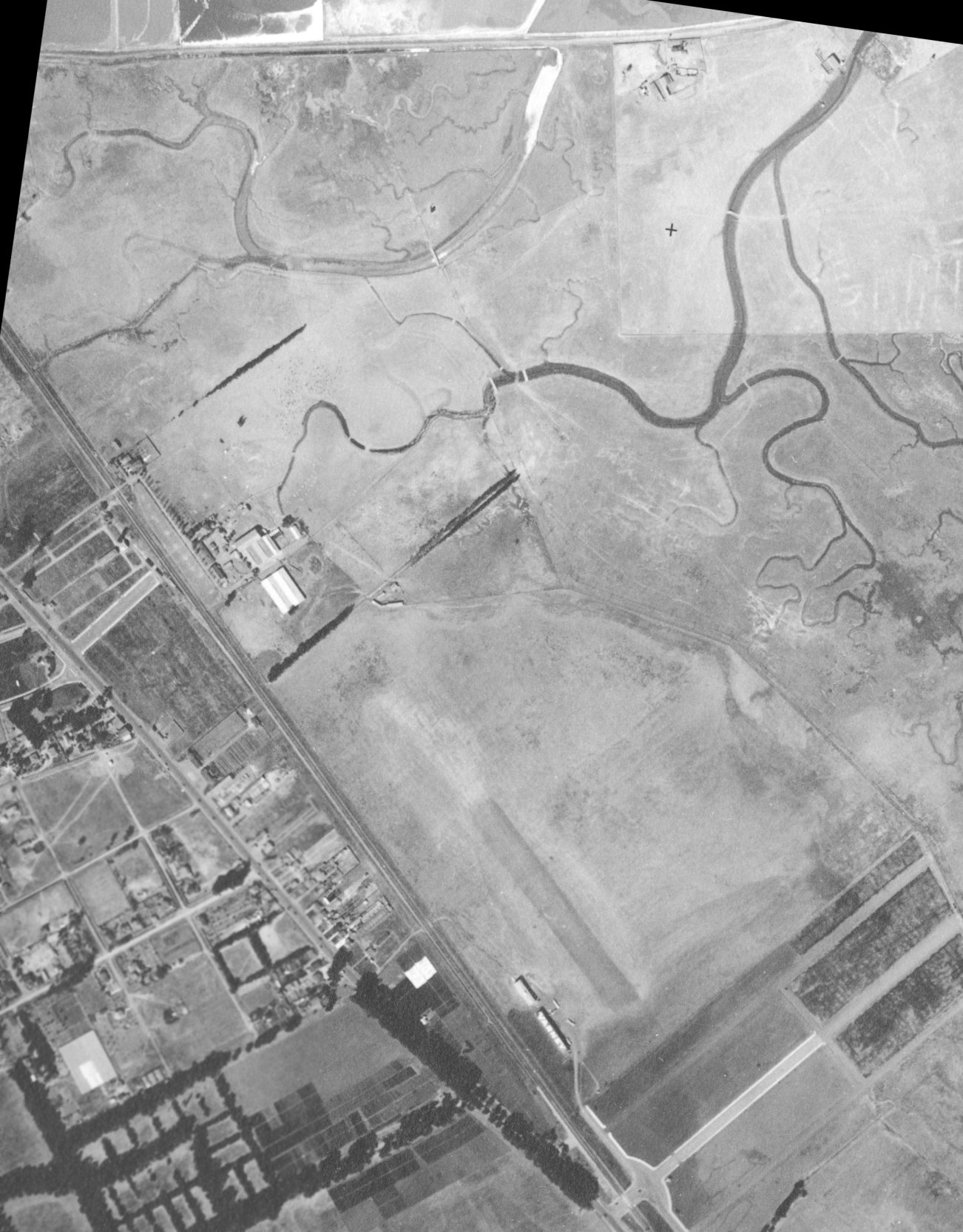
The earliest photo which has been located of Varney Field was a 1928 aerial view (from the UCSB photo archive, courtesy of Jonathan Westerling).
It depicted Varney Field as an irregularly-shaped unpaved field having a single unpaved northwest/southeast runway.
Two small hangars were on the southwest corner, with the southern hangar having “Varney” painted on its roof, and 4 light single-engine planes were parked near the hangars.
Note that a row of trees or bushes at the northwest corner separated the airfield from a cluster of buildings, presumably used for farming.
These buildings would go on in subsequent years to be reused as hangars.
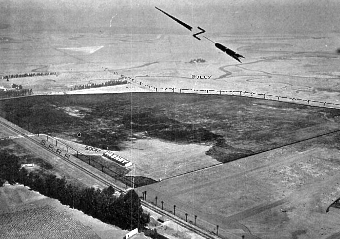
An undated aerial view looking northeast at Varney Field from the 1929 Richfield Airport Directory (courtesy of Jonathan Westerling)
depicted Varney Field as an irregularly-shaped unpaved field measuring 2,600' north/south by 1,500' east/west, with a hangar with “Varney” painted on its roof on the southwest corner.
The field was said to comprise 92 acres.
According to Jonathan Westerling, “Varney Field existed until the late 1920s when Walter Varney left for Idaho to start Varney Air Lines, which went on to become United Airlines.”
According to the book "Two Hours By Crow" by Howard & Judith Campbell (courtesy of Wings of History),
“When Varney moved on from this field, he left 'Speed' Johnson & the Flying School as the operator.”
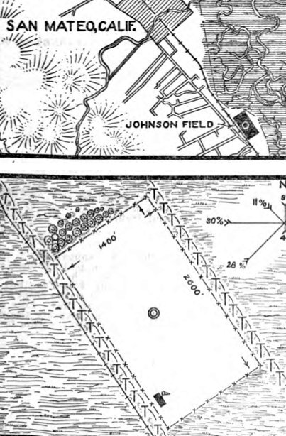
The 11/10/28 Commerce Department Airway Bulletin #231 (courtesy of Jonathan Westerling) depicted Johnson Field
as having a rectangular sandy loam field measuring 2,600' northwest/southeast, with a hangar on the south corner, which was said to have “Johnson” painted on one side of its roof & “Varney” on the other side.
The field was said to comprise 92 acres, and was owned & operated by Victor Johnson.
The 1929 Landing Fields of the Pacific West (courtesy of Jonathan Westerling) described “Speed Johnson Flying School” as a commercial airfield 2 miles south of San Mateo.
The field was said to have 2 sandy loam runways, measuring 2,600' north/south & 1,500' east/west.
It was said to have 2 hangars on the southwest corner, one of which had “Varney” pained on its west side & “Johnson” pained on its east side.
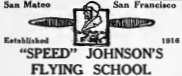
An advertisement in the May 1929 Aero Digest Magazine (courtesy of Jonathan Westerling) for Speed Johnson's Flying School of San Mateo.
An article in the 1/2/30 San Mateo Times (courtesy of Jonathan Westerling) reported:
"Until recently Johnson conducted the 'Speed' Johnson flying school, the oldest established student school on the Peninsula.
Several months ago he sold the land on which his flying school stood to the Curtiss-Wright service, which is now building a new airport on the site."
The article gave Johnson's age as 29.
According to the book "Two Hours By Crow" by Howard & Judith Campbell (courtesy of Wings of History),
“The Curtiss-Wright Corporation (owners of 45 airports throughout the U.S.) bought 400 acres ofl and for $5000,000 at this site in the Beresford District of San Mateo in 1929.
It included the land used by Victor G 'Speed' Johnson & his Flying School.
Curtiss-Wright Field would open for business on 7/4/30.”
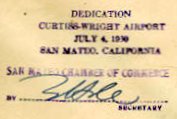
A postmark commemorating the 7/4/30 Dedication of Curtiss Wright Airport, San Mateo (courtesy of Fred Kelso).
According to a biography of noted stunt pilot Paul Mantz (courtesy of Jonathan Westerling),
“In an effort to gain notoriety, on 7/6/30 Mantz set a record in flying 46 consecutive outside loops as a part of the dedication ceremonies of the San Mateo Airport.”
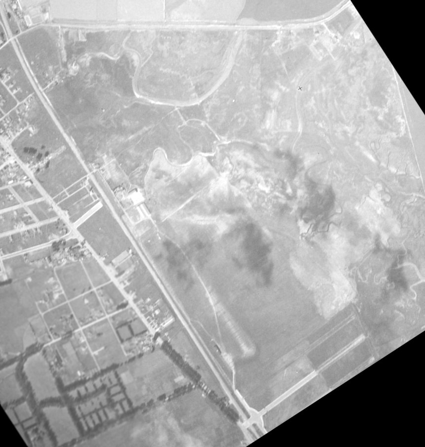
The earliest photo which has been located of Curtiss-Wright Airport was a 1930 aerial view (courtesy of Jonathan Westerling).
One of the hangars of Varney Field had been removed, but one remained standing, to the southwest of the unpaved northwest/southeast runway.
Also note that the row of trees or bushes at the northwest corner had been removed at some point between 1928-30,
which would eventually allow the buildings to the northwest to eventually be reused as hangars.
According to the book "Two Hours By Crow" by Howard & Judith Campbell (courtesy of Wings of History),
“In 1930 Curtiss-Wright picked up the management for 6 more years.
“In 1931 the list of runways was, '500 feet in all directions, surface smooth & grassy. East side of field, muddy in extreme wet weather.'"
Jim Douglass recalled, “My dad used to tell me that in 1931 they had a dedication airshow there
at which the German ace Ernst Udet set a record for the number of successive loops performed at one time.”
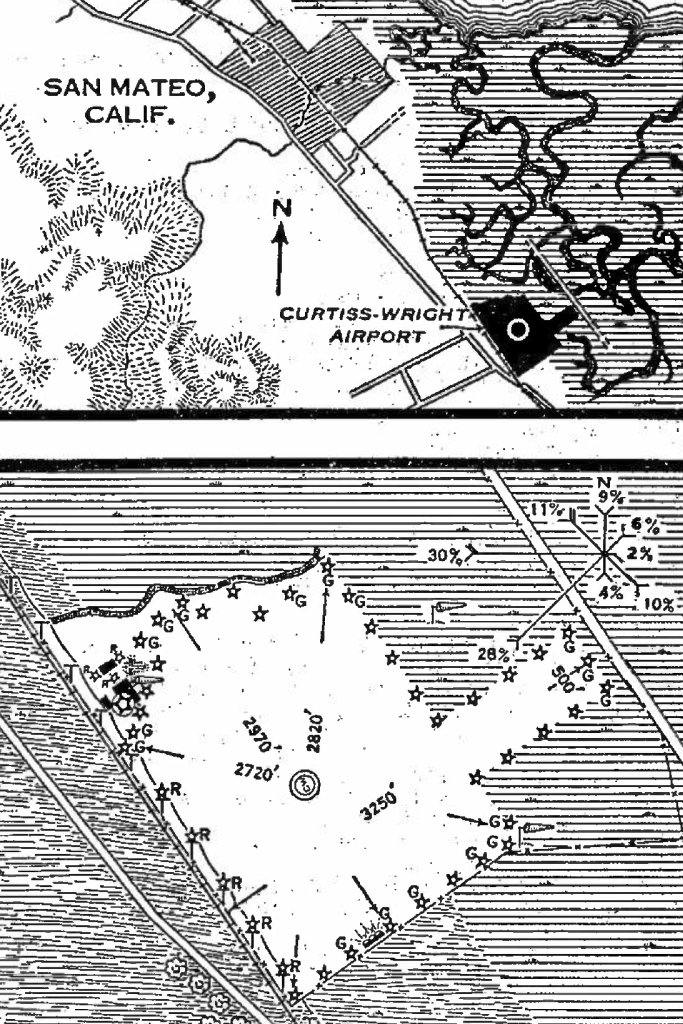
The 2/17/31 Commerce Department Airway Bulletin (courtesy of Jonathan Westerling) described Curtiss-Wright Airport
as a commercial airport owned by California Air Terminals Inc., operated by Curtiss-Wright Flying Service.
It was said to consist of a 141 acre irregularly-shaped sandy loam field, with the longest distance being 3,250' northeast/southwest.
Three small buildings were depicted on the northwest corner, of which one was described as a 180' x 120' hangar.
The 2 original Varney Field hangars at the southwest end had been removed.
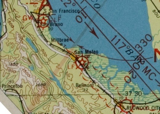
The earliest aeronautical chart depiction which has been located of Curtiss Wright Airport was on the 1932 strip chart (courtesy of Jonathan Westerling).
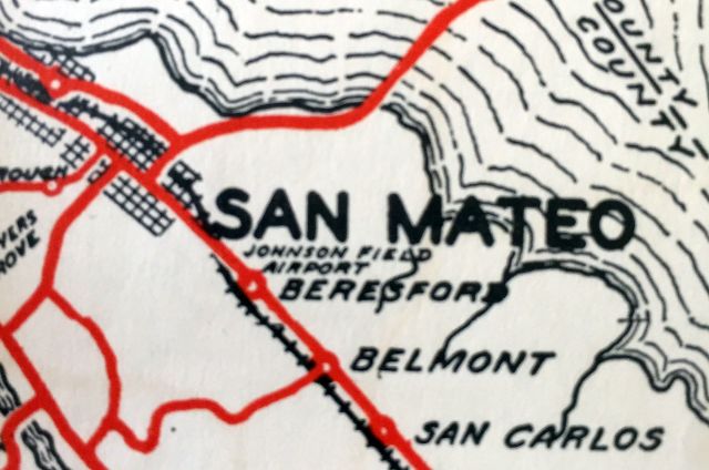
A 1932 road map (courtesy of Kevin Walsh) labeled the airport to the southeast of San Mateo as “Johnson Field Airport”.
This being a non-aviation map, the labeling of the airport as “Johnson Field” was evidently outdated,
as it had become Curtiss-Wright Airport 2 years earlier.
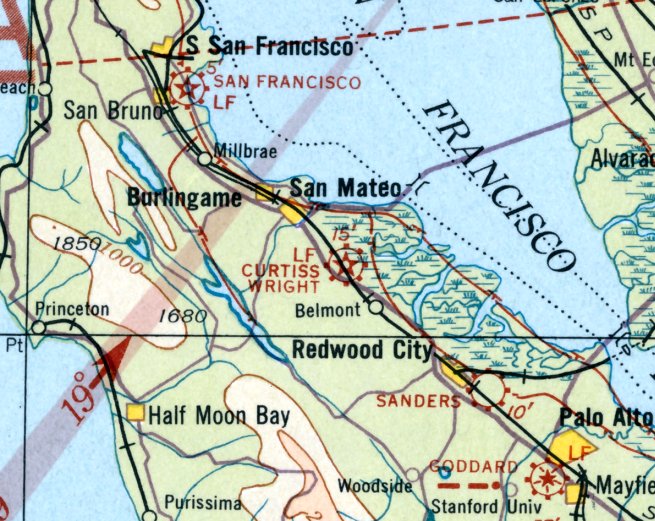
The earliest Sectional Chart depiction which has been located of Curtiss Wright Airport was on the May 1933 San Francisco Sectional Chart.
Curtiss Wright Airport evidently operate for very long, and was evidently closed at some point between 1933-34 (presumably a victim of the Depression),
as it was no longer listed in the 1934 Commerce Department Airway Bulletin (according to Jonathan Westerling).
According to the book "Two Hours By Crow" by Howard & Judith Campbell (courtesy of Wings of History),
“In 1934, the California Jockey Club opened the Bay Meadows Race Track here.
They offered all forms of horse racing until Thoroughbred Racing proved to be the most profitable type.”
The Bay Meadows horse racing track was built over the southeastern portion of the airport site.
The property evidently had no aviation use for a few years, as no airfield was listed at this location in the 1936 Commerce Department Airway Bulletin (according to Jonathan Westerling)
or depicted on the October 1937 or April 1941 San Francisco Sectional Charts.
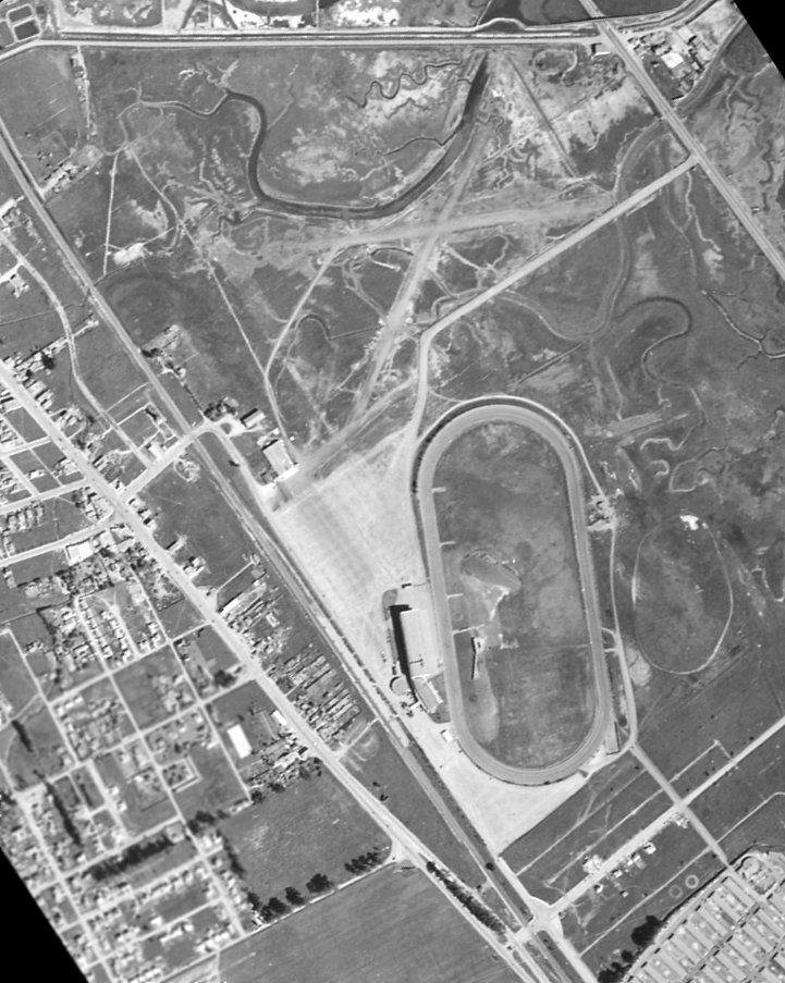
A 1941 aerial view (from the Alexandria Digital Library @ UC Santa Barbara, courtesy of Jonathan Westerling)
showed that a new Bay Meadows Airfield (with 2 unpaved runways in an “X” shape) had been constructed at some point between 1934-41 on the north side of this property.
Taxiways connected these new runways to the buildings to the west (originally presumably farm buildings), which were presumably reused as hangars.
The Bay Meadows horse racetrack was immediately adjacent to the southeast side of the airfield.
Amazingly only 2 years later, a 1943 aerial view (from the Alexandria Digital Library @ UC Santa Barbara, courtesy of Jonathan Westerling)
showed that the runways had been completely removed, perhaps due to wartime security concerns along the west coast.
The hangar remained, but the site was no longer recognizable as an airfield.

An October 1943 photo looking north (courtesy of Kevin Walsh) depicted the 2 hangars at the southwest corner of Bay Meadows Airfield evidently during the period they were not being used for aviation.
The Bay Meadows runways were evidently reconstructed at some point between 1943-45.
According to the book "Two Hours By Crow" by Howard & Judith Campbell (courtesy of Wings of History),
“At the War's end in 1945, the Bay Meadows Aviation Corporation started flying race horses & their entourage into the track.
One of the carriers was National Skyway Freight Corporation flying their Budd RB- I Conestoga twin-engine freighters in that service.
The first race horse to be air transported into Bay Meadows, was El Lobo (the Wolf).
On 10/26/45 El Lobo landed on this field, and next day, he won the Burlingame Handicap Race.”
A history of the race track mentions that "the first horse transported by air landed at Bay Meadows.
That took place in 1945 when El Lobo was flown from Los Angeles by his owner,
country & western entertainer Stuart Hamblem, to contest the Burlingame Handicap.
After landing safely on an airstrip adjacent to Bay Meadows, El Lobo completed the history-making journey by winning the race."
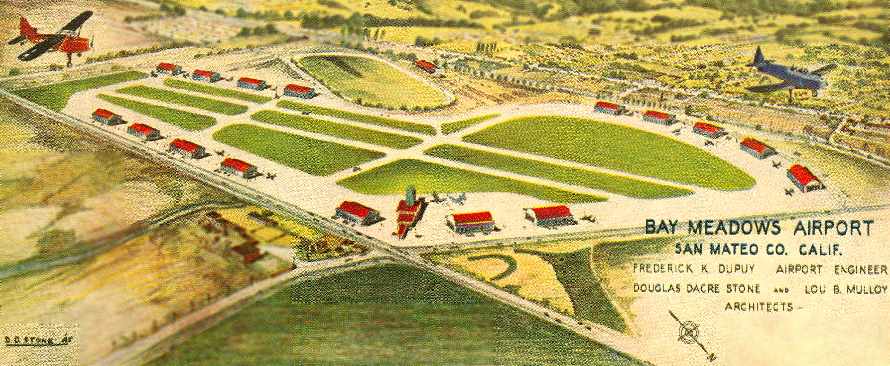
An artist's concept looking southwest at plans for a much-expanded Bay Meadows Airport from the cover of a July 1945 brochure (courtesy of Aaron Becker).
It depicted the field as having 2 parallel runways, oriented northwest/southeast, with a total of 16 (!) hangars lining ramps on the north & south sides of the runways.
This extensive layout of runways & hangars was a grandiose plan which was never completely realized.
The airport engineer was listed as Frederick Dupuy, and the field's architects were listed as Douglas Stone & Lou Mulloy.
Bay Meadows Airport was not yet depicted on the February 1946 San Francisco Sectional Chart.
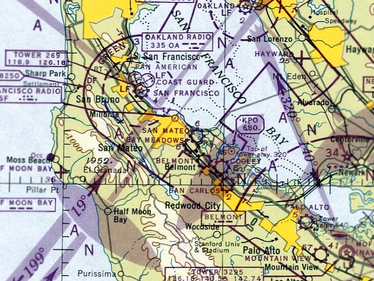
The earliest aeronautical chart depiction which has been located of Bay Meadows Airport was on the August 1946 San Francisco Sectional Chart.
It depicted Bay Meadows Airport as a commercial/municipal airport.
An obituary in the San Francisco Examiner mentioned Bay Meadows Airport as the departure point of a 1946 flight which ended in a fatal crash.
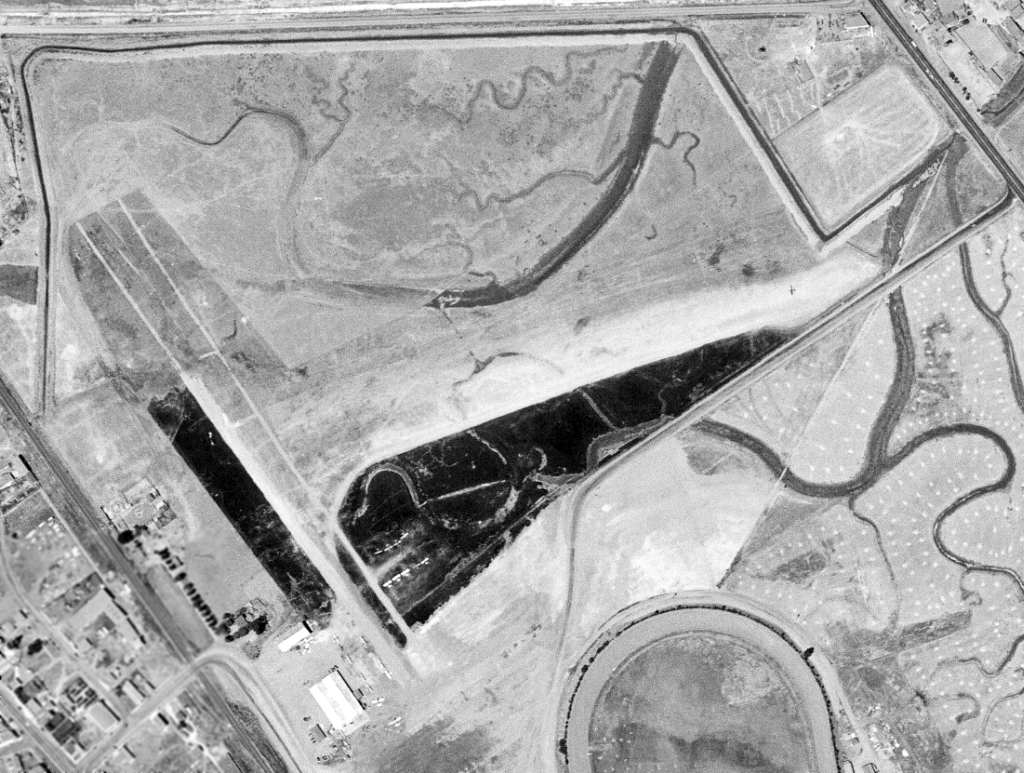
A 7/29/46 aerial view of the Bay Meadows Airport depicted the field as having 2 unpaved runways, with 2 hangars on the southwest side of the field.
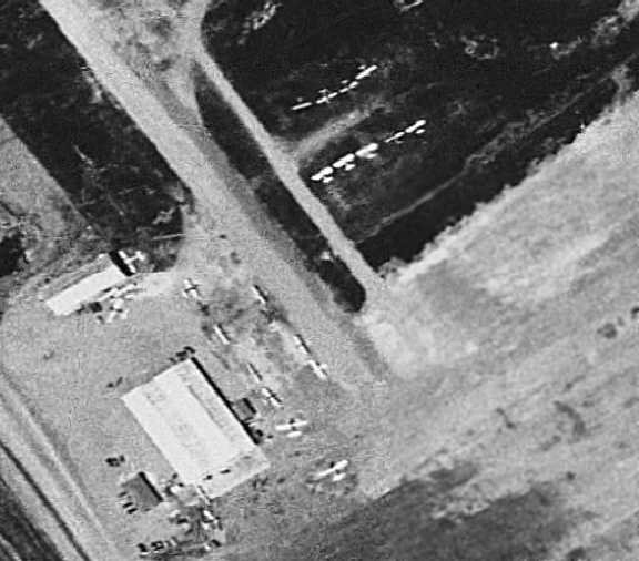
A closeup from the 1946 aerial view showed 19 single-engine aircraft parked around a hangar on the southwest side of the Bay Meadows Airport.
The earliest topo map depiction which has been located of Bay Meadows Airport was on the 1947 USGS topo map.
It depicted Bay Meadows Airport as having a total of three 2,300' runways or taxiways adjacent to the northwest side of the race track.
Two buildings or hangars were depicted on the southwest side of the airfield.
Note it also depicted San Mateo Airport across Bayshore Highway to the north.
The 1948 USAF Urban Area Chart depicted Bay Meadows Airport as having a northwest/southeast runway.
The 1948 San Francisco Local Aeronautical Chart (courtesy of Tim Zukas) depicted Bay Meadows Airport as having a 2,400' paved runway.
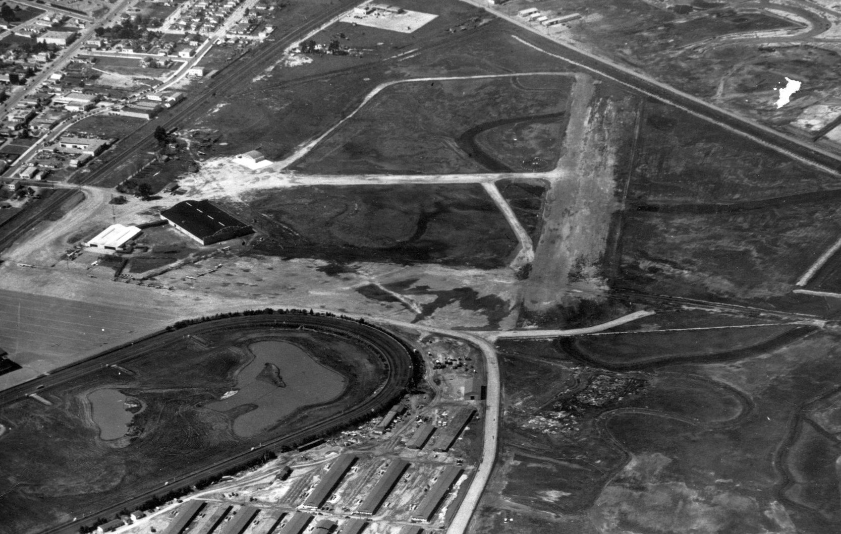
A circa 1940s aerial view (courtesy of Jack O'Leary) looking northwest at Bay Meadows Airport showed the field as having 2 unpaved runways,
with 2 hangars on the southwest side of the field, around which were parked a dozen light aircraft.
The Bay Meadows racetrack was visible in the foreground.
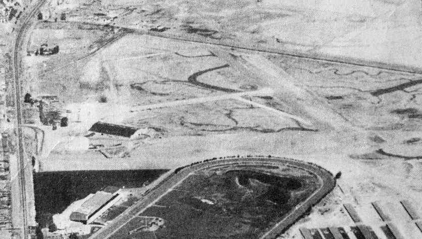
A circa 1940s aerial view looking north at Bay Meadows Airport (courtesy of Kevin Walsh), with the racetrack visible in the foreground.
The 1949 San Francisco Local Aeronautical Chart (courtesy of Chris Kennedy)
depicted "Bay Meadow" Airport as having a 2,700' unpaved runway.
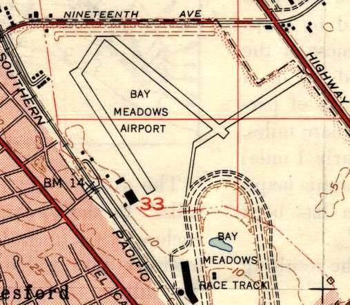
The 1949 USGS topo map depicted "Bay Meadows Airport"
as having a total of three 2,300' runways or taxiways adjacent to the northwest side of the race track.
Two buildings or hangars were depicted on the southwest side of the airfield.
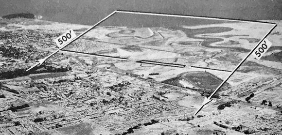
The last photo which has been located showing Bay Meadows Airport was an undated aerial view looking north from the 1950 Air Photo Guide (courtesy of Kevin Walsh).
It described Bay Meadowns as having a 2,750' oil surface Runway 13/31.
The field was said to feature a hangar, and the manager was listed as Robert Gunderson.
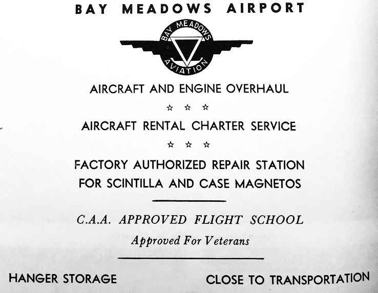
An advertisement for Bay Meadows Airport from the 1950 Air Photo Guide (courtesy of Kevin Walsh).
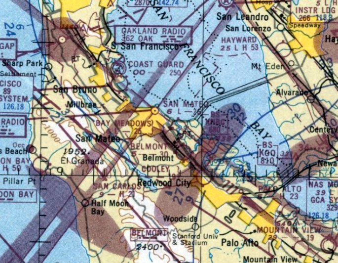
The last aeronautical chart depiction which has been located of Bay Meadows Airport was on the March 1951 San Francisco Sectional Chart.
It depicted "Bay Meadow" Airport as having a 2,500' unpaved runway.
Bay Meadows Airport evidently closed at some point in 1951,
as it was no longer depicted on the September 1951 San Francisco Sectional Chart.
Jim Douglass recalled, “I lived about 3/4 of a mile from the Bay Meadows airport from 1958-72.
My father had kept a Cessna 140 there until it closed.
According to him, the field had been privately owned.
When the city first began talking about closing it,
the owner did a study which showed that the airport brought in several million dollars a year to the city coffers
and offered not only to give it to the city if they'd keep it open
but to expand the facilities to where it would support scheduled DC-3 service.
This was, of course, in the days of regulated air carriers & 'feeder' lines which landed every 30 or 40 miles.
Needless to say, the city declined & the field was closed.”
Jim continued, “When we lived there, the property housed the county fairgrounds.
As a kid, I attended several county fairs there,
and at least 4 (maybe as many as 6) large hangars still existed & were used as display halls.
From El Camino Real & 25th Avenue you could still make out the name of the airport
in faded paint on the roof of one of the hangars (I only think it said 'Bay Meadows Airport').”
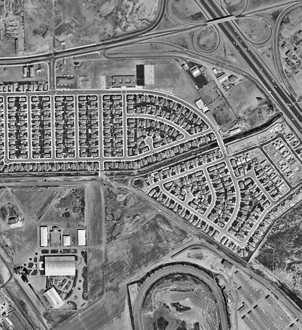
A 1956 aerial view (from the UCSB Library, courtesy of Jonathan Westerling) showed that houses had been built over the northern portion of the site of Bay Meadows Airport.
The hangar at the southwest corner remained standing.
The 1956 USGS topo map depicted the southern portion of the former airport
as being the location of the Fiesta Gardens School & the Fiesta Grounds (County Fairgrounds).
A 1968 aerial view showed the former hangar at the southwest corner remained standing.
A 1980 aerial view showed the former hangar at the southwest corner had been removed at some point between 1968-80,
erasing the last trace of Bay Meadows Airport.
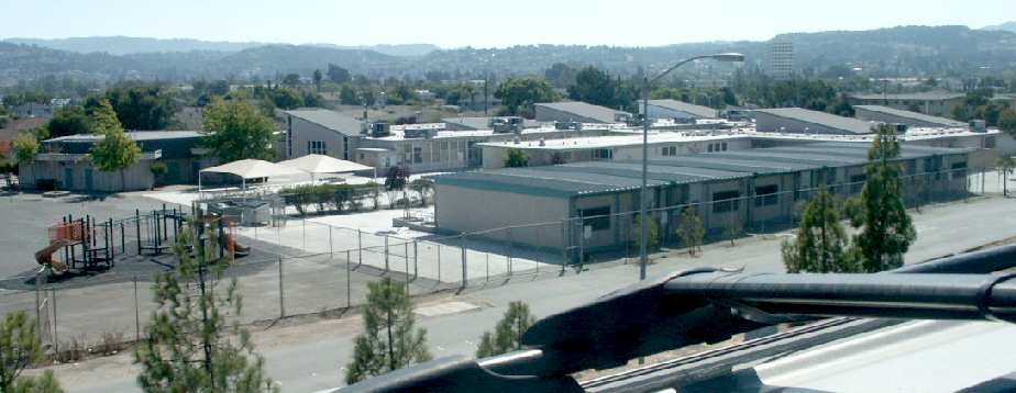
A 2003 photo by Tim Tyler, looking south-southwest at the Fiesta Gardens Elementary School,
which occupies the northeast corner of the site of the Bay Meadows Airfield.
Tim Tyler visited the site of the former Bay Meadows Airfield in 2003,
and reported that "The area is now mostly residential, with a few stores,
some small factory/warehouse type buildings, and a San Mateo - Foster City School District center."
According to the book "Two Hours By Crow" by Howard & Judith Campbell (courtesy of Wings of History),
“The entire complex [the Bay Meadows track] was closed on 8/17/08 & an industrial/housing development replaced it.”
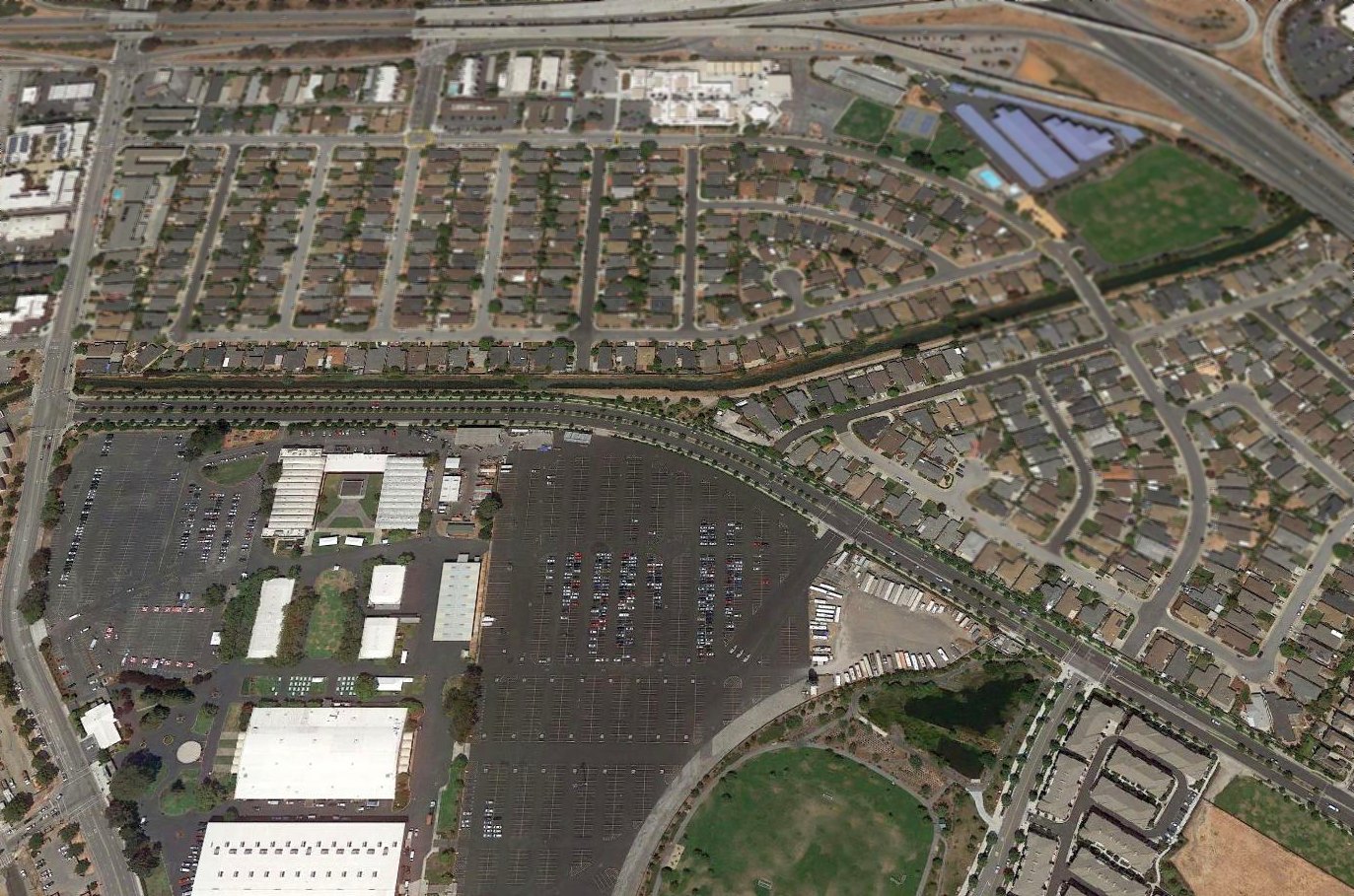
A 2018 aerial view looking north at the site of Bay Meadows Airport.
The site of Bay Meadows Airport is located southwest of the intersection of the 101 Freeway & Route 92.
Thanks to Chris Kennedy for pointing out this airfield.
____________________________________________________
____________________________________________________
This site covers airfields in all 50 states.