Abandoned & Little-Known Airfields:
Indiana: Northwestern Indianapolis area
© 2002, © 2026 by Paul Freeman. Revised 8/15/26.
This site covers airfields in all 50 states: Click here for the site's main menu.
____________________________________________________
Please consider a financial contribution to support the continued growth & operation of this site.
Brownsburg Airport (revised 11/21/25) - Capital Airways Airport / Capitol Airways Airdrome / Aircraft Owners Airfield / Tarkington Airport (revised 7/27/19)
Hoosier Airport (revised 7/27/19) - Indianapolis Motor Speedway Aerodrome / Indianapolis Motor Speedway Aviation Repair Depot (revised 11/3/24)
Ropkey Field (revised 8/15/26) - Shank Airport (revised 7/20/19)
____________________________________________________
Ropkey Field (IN63), Indianapolis, IN
39.899, -86.272 (Northwest of Downtown Indianapolis, IN)
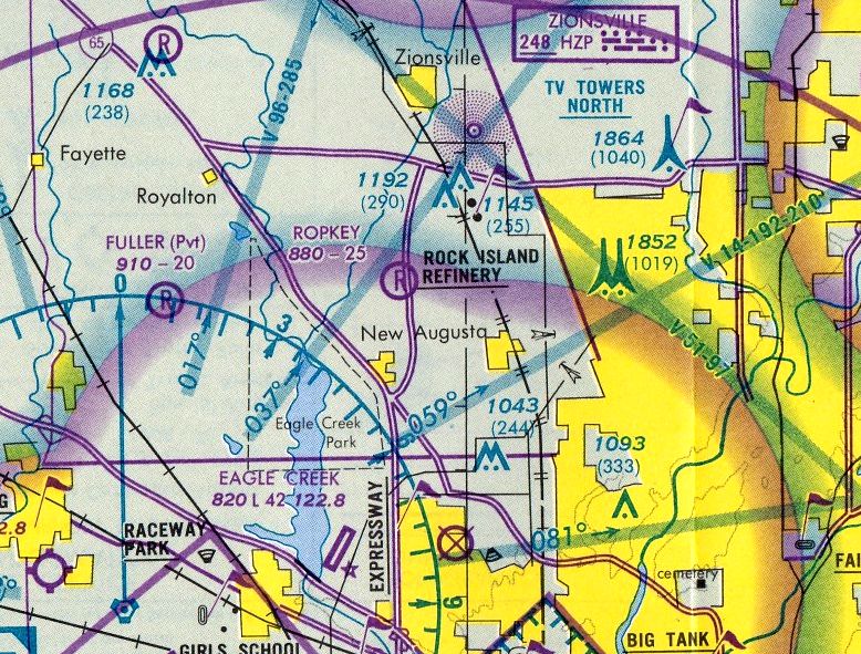
Ropkey Field, as depicted on the 1984 St. Louis Sectional Chart.
This small airfield supported the Ropkey Armor & Aviation Museum, a small collection owned by former Marine Fred Ropkey.
Ropkey Field was evidently established at some point between 1971-84, as it was not yet depicted on a 1971 aerial photo.
The earliest depiction which has been located of Ropkey Field was on the 1984 St. Louis Sectional Chart.
It depicted Ropkey as a private airfield having a 2,500' unpaved runway.
The earliest photo which has been located of Ropkey Field was a 1984 aerial photo.
It depicted a single grass northeast/southwest runway, with several buildings at the southwest end.
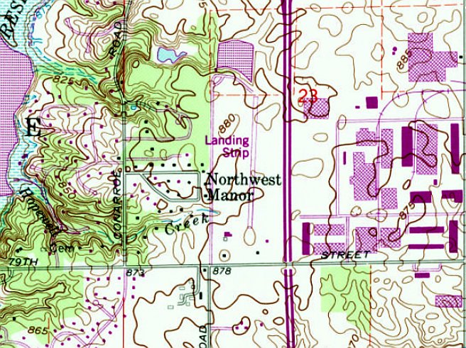
Ropkey Field, as depicted on the 1988 USGS topo map.
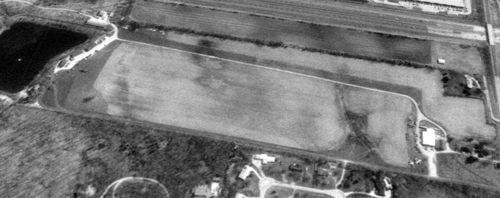
The earliest photo which is available of Ropkey Field was a 1992 aerial view looking northeast.
It depicted a single grass northeast/southwest runway, with several buildings having been added at some point between 1984-92 at the north end.
Two aircraft were visible on the south end, and at least one aircraft at the north end.
Ropkey Field was no longer depicted on the 1995 St. Louis Sectional Chart.
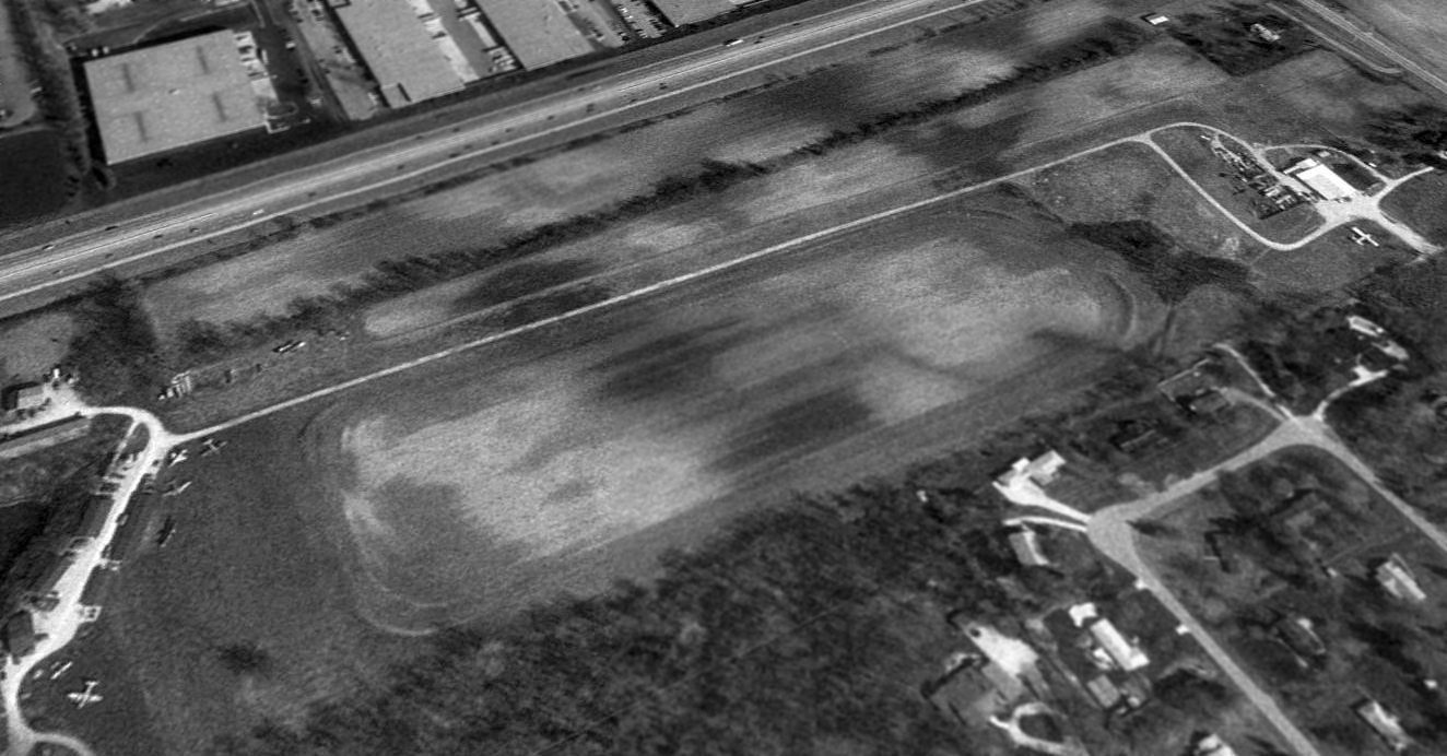
A 1998 aerial view looking southeast showed Ropkey Field perhaps at its zenith, with a total of 7 aircraft visible on the field.
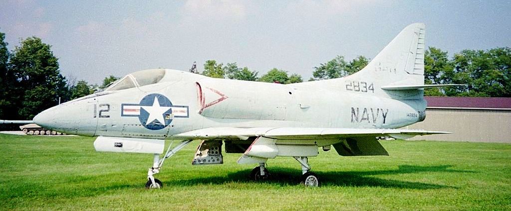
A September 2003 photo by Stewart Lanham of Navy Douglas A-4B Skyhawk 142834, and a tank in the left background & the museum building in the right background, just south of the lake.
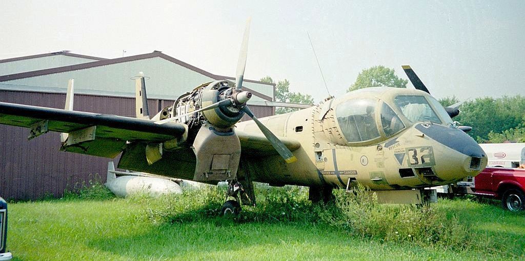
A September 2003 photo by Stewart Lanham of Army Grumman OV-1B Mohawk 63-13119, “taken at the back of the workshop which contained a couple of unrestored aircraft & outside was a compound with aircraft parts.”

A 9/11/03 photo by Stewart Lanham at Ropkey Field of an Antonov An-2 “about to depart to the Indianapolis Air Show. Just visible on the right is the wing of the Mohawk with the hangar behind it.”

A 2003 photo by Stewart Lanham at Ropkey Field of “the frames of a Fleet 1 & a Stearman as well as a radio-controlled drone in the rafters of the hangar.”
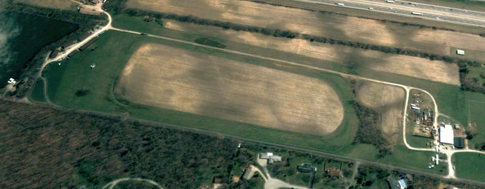
The last photo which has been located showing aircraft at Ropkey Field was a 2004 aerial view looking northeast.
A 2005 aerial view showed no aircraft remaining outside at Ropkey Field.
Ropkey Armor & Aviation Museum owner Fred Ropkey passed away in 2013.
The Ropkey Armor & Aviation Museum moved to Crawfordsville, and then closed in 2019.
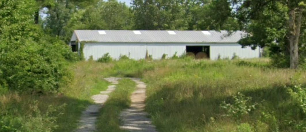
A 2024 photo looking north at the former Ropkey Armor & Aviation Museum hangar/workshop, reused for agricultural storage.
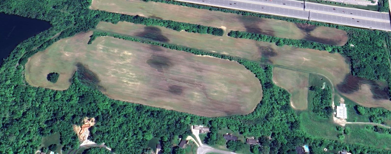
A 2025 photo looking northeast at the Ropkey Field site. The alignment of the former runway is still recognizable,
and the museum hangar/workshop remains at the south end, but the museum buildings at the north end have been removed.
Thanks to Stewart Lanham for pointing out this airfield.
____________________________________________________
Indianapolis Motor Speedway Aerodrome / Indianapolis Motor Speedway Aviation Repair Depot, Indianapolis, IN
39.8, -86.23 (Northwest of Downtown Indianapolis, IN)
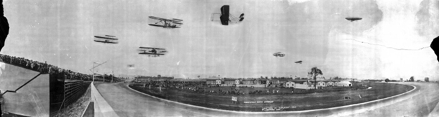
A 6/14/10 photo of the National Aviation Meet held at the Indianapolis Motor Speedway (courtesy of Eric Lawrence).
Eric Lawrence reported, “The world-famous Indianapolis Motor Speedway was originally built in 1909
and the first event held there was a helium gas-filled balloon competition on 6/5/1909, which drew an estimated 40,000 people to the track.
Nine balloons lifted off with the winner, a balloon called Universal City, covering 382 miles in a little more than a day, landing in Alabama.
The track held the National Aviation Meet on 6/14/1910, featuring the Wright Brothers.
Walter Brookins set a world record by attaining a height of 4,938' in a Wright Brothers aircraft.”
The earliest depiction that has been located showing aircraft at the Indianapolis Motor Speedway was a photo of the 6/14/1910 National Aviation Meet (courtesy of Eric Lawrence).
Eric Lawrence observed, “Visible in the photo is the original layout of the airfield portion on the Indianapolis Motor Speedway.
Visible are 11 hangars individually numbered (Hangar #7 is hidden behind #8) inside what is Turn 1 of the oval track.
The large hangar in the background was built to store balloons for the 1909 balloon race & is on the inside of Turn 2 of the oval track.
Also visible in the background near the balloon hangar is a pedestrian & vehicle bridge allowing access to the inside of the oval track.”
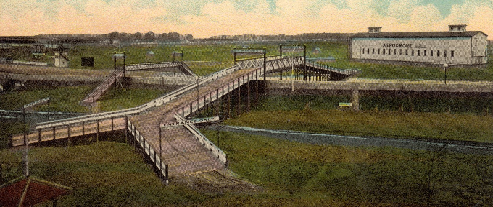
A 1912 postcard colorized photo of the Indianapolis Motor Speedway Aerodrome (courtesy of David Parker) was captioned "Overhead Auto Bridge & Aviation Field - Indianapolis Motor Speedway".
Eric Lawrence observed, “This photo from the outside of Turn 2 shows the vehicle & pedestrian bridge over Turn 2, the balloon hangar, and the aircraft hangar complex to the extreme left of the picture.”
Eric Lawrence reported, “On 5/30/1911 the track held the first Indianapolis 500, a race which would make it world famous.
It is likely that the track owners focus on one 500-mile car racing event a year at the track indicates that it held no other aviation events after 1910
and there is no record of aviation-related events taking place until the close of the facility to racing with the 3/23/1917 announcement that the 1917 Indy 500 was canceled.”
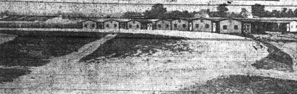
The last image showing the former numbered hangars inside Indianapolis Motor Speedway's Turn 1 was a circa 1910-17 photo (courtesy of Eric Lawrence).
Eric Lawrence observed, “They are labeled as private garages, likely for manufacturers conducting private tests & racing teams.”
Eric Lawrence reported, “There is no record after 1912 of the large balloon hangar inside Turn 2 after the 1912 postcard.”
Eric Lawrence reported, “The second phase of Indianapolis Motor Speedway’s use as an airfield began when the 810th Aero Squadron arrived on 2/4/1918 from Kelly Field, San Antonio, TX.
Soon arriving were the 809th, 811th, and 821st Aero Squadrons.
The Speedway Repair Depot would be the first repair depot in the United States established to repair & put back in service all manner of U.S Air Service aircraft.
The existence of the Allison Experimental Company at the south end of Main Street in Speedway, which made Liberty engines,
its central geographical location as a suburb of Indianapolis, and abundant amount of automobile & race car mechanics looking for work made the race track an ideal location for a repair depot.
Two new hangars were built on the east side of the back straight along with a small control tower structure.”
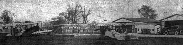
A circa 1918 photo of unidentified biplanes in front of Indianapolis Motor Speedway hangars (courtesy of Eric Lawrence).
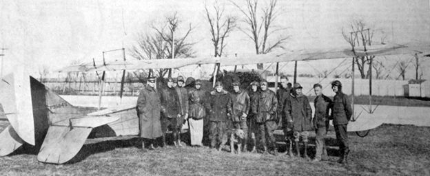
A circa 1918 photo of a group in front of a JN-4 Jenny at the Indianapolis Motor Speedway (courtesy of Eric Lawrence).
Eric Lawrence reported, “We must assume, since the large balloon hangar & smaller numbered hangars were never pictured being utilized for WWI despite the large numbers of WWI aviation squadron pictures available,
these hangars were torn down between 1912-18, likely for additional infield parking during the Indianapolis 500.
In the above pictures it is noted that in front of the hangars is the race track itself & a fence runs behind the hangars separating the Indianapolis Motor Speedway property from the farm to the east of the track, placing these on the back stretch of the oval track.
Amazingly though, the Speedway Repair Depot, where the aircraft were repaired, was not located on the Indianapolis Motor Speedway grounds, but along Main Street in Speedway, IN.
The aircraft were partially-disassembled with the wings being removed & the tail elevated & attached to a truck which towed the aircraft one mile from the inside of Turn 2 to the repair depot,
bounded by Main Street, 14th Street, Polco Street, and the Baltimore & Ohio Railroad track.”
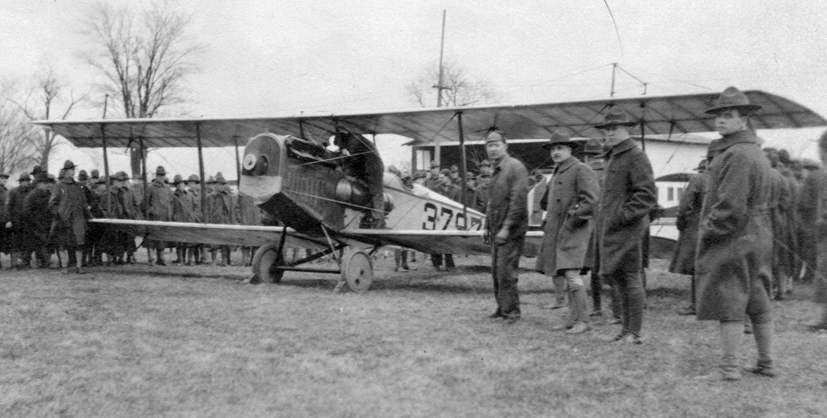
A 1918 photo of a JN-4 Jenny at the Indianapolis Motor Speedway Aviation Repair Depot (courtesy of David Parker).
According to a historical marker at the Indianapolis Motor Speedway, “U.S. entry in WWI spurred rapid aviation expansion in the country.
Due to city's strategic location to military airfields, railroads, and industry, U.S. Army opened an Aviation Repair Depot here in early 1918.
The 809th, 810th, 811th, and 821st Aero Squadrons repaired, modified, and tested training aircraft & engines.
The Speedway provided hangars & a flight test field. The Speedway area became an innovative aviation hub during WWI.
Work at the depot increased pilot safety & aircraft structural integrity.
Italian Pomilio Brothers Corporation developed aircraft here for the Liberty engine produced by Nordyke & Marmon with parts by Allison Experimental Company.
The depot repaired 313 planes & 350 engines in 1918.”
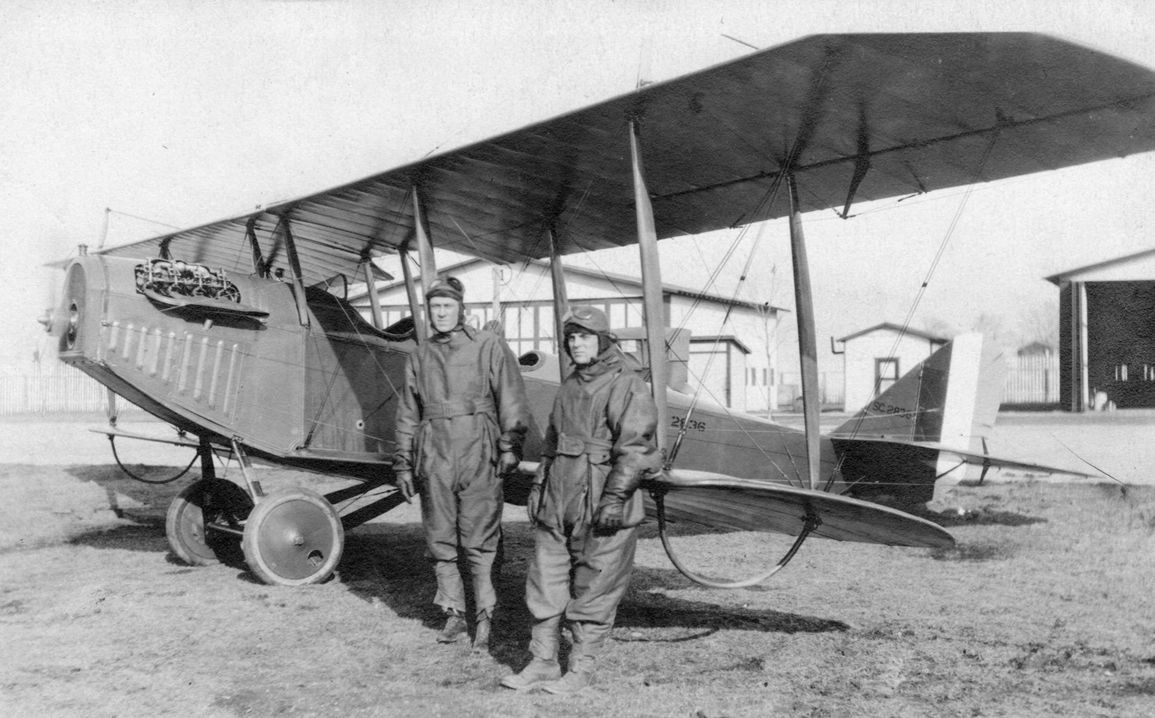
A 1918 photo of a JN-4 Jenny at the Indianapolis Motor Speedway Aviation Repair Depot (courtesy of David Parker).
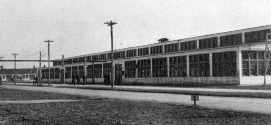
A
1918 photo of the Indianapolis Motor Speedway Aviation Repair Depot
aircraft engine repair shop (courtesy of David Parker).
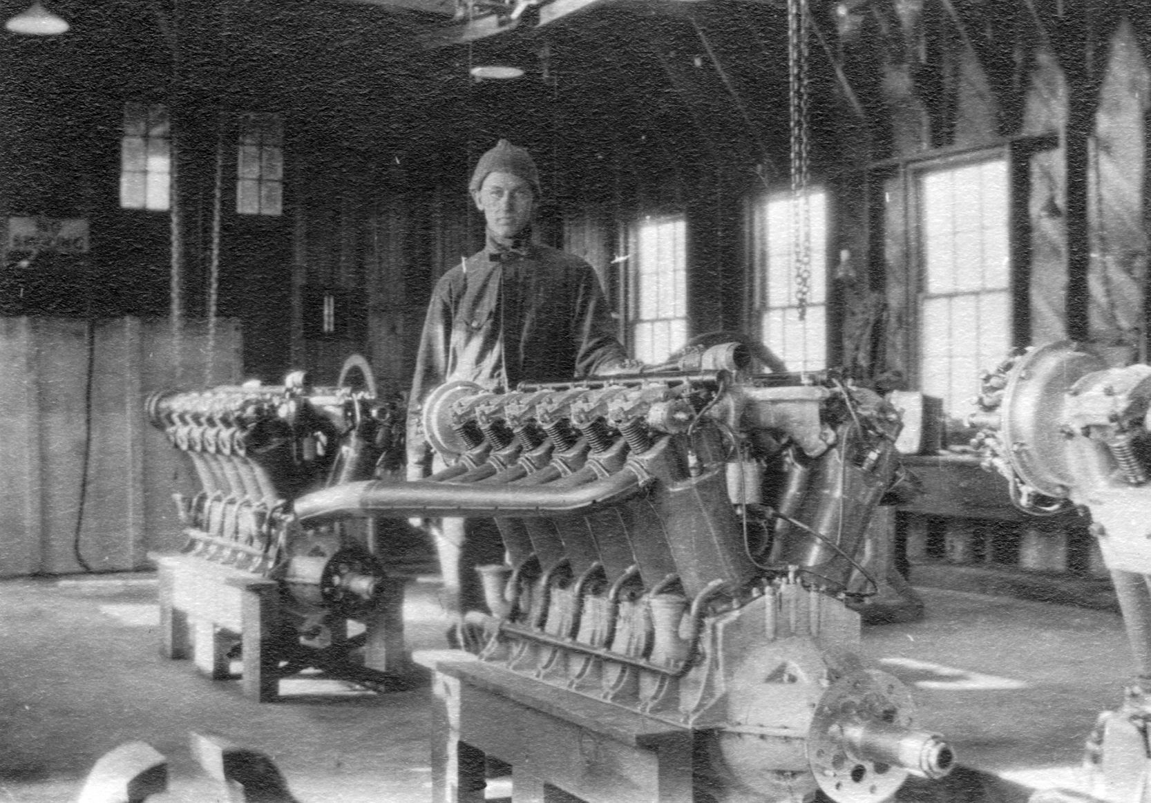
A 1918 photo of Liberty aircraft engines inside the Indianapolis Motor Speedway Aviation Repair Depot engine repair shop (courtesy of David Parker).
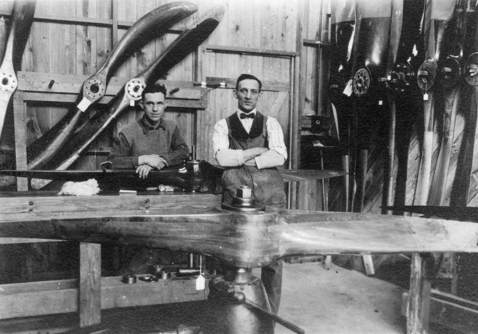
A 1918 photo of the Indianapolis Motor Speedway Aviation Repair Depot propeller repair shop (courtesy of David Parker).
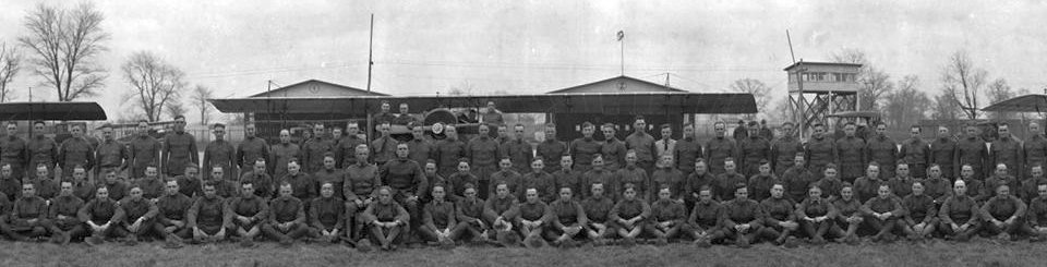
A December 1918 photo of the 821st Aero Squadron at the Indianapolis Motor Speedway Aviation Repair Depot (courtesy of David Parker).
The “Speedway Dope”, the repair depot's newspaper, reported in January 1919 that “313 airplanes were repaired at the depot during 1918, representing a total value of $1,195,550 & 350 airplane motors valued at $638,699.
In addition to these figures, the report noted repairs of wings, ailerons, elevators, rudders, and other miscellaneous parts valued at approximately $300,000. Added together, repairs at the depot well exceeded $2,000,000.”
Eric Lawrence reported, “When WWI ended on 11/11/1918, and the announcement was made that the Indianapolis 500 would resume in May 1919, the fate of the Speedway Repair Depot was sealed.
Abandonment of the repair depot on Main Street was ordered in September 1920.
The buildings of the repair depot were at first purchased by the Allison Engineering Company & used for James Allison's race teams & growing engineering firm.
The office building on Main Street & some of the large workshops remained.
The hangars, however, saw extensive use as a storage facility for the equipment needed to maintain the racetrack.”
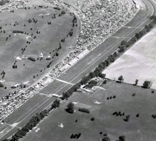
A 1936 aerial photo of the Indianapolis Motor Speedway taken during the 1936 race (courtesy of Eric Lawrence) showed the 2 hangars at the midpoint of the backstretch on the east side of the racetrack.
Eric Lawrence observed, “You can even make out the fence behind them separating them from the newly-built golf course. They were used to store the large machinery needed to maintain the track surface.”
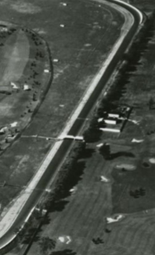
A 1946 aerial photo of the Indianapolis Motor Speedway (courtesy of Eric Lawrence) showed the 2 remaining hangars.
Eric Lawrence reported, “By 1952 much of the [depot] facility had been bulldozed & used as parking lots. The land was still owned by Allison Engine Company.”
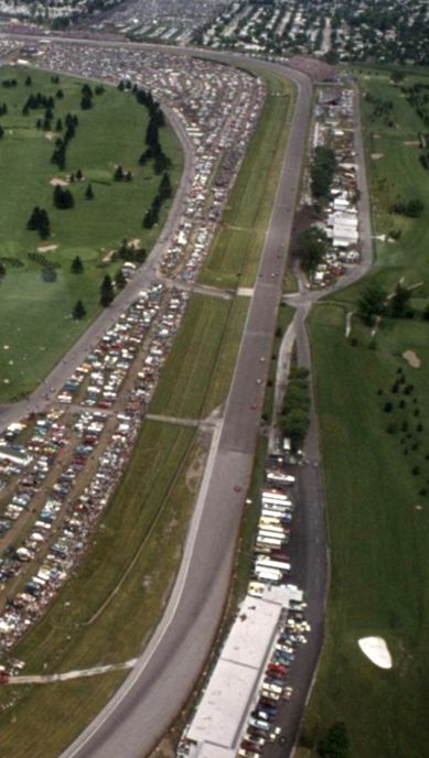
A 1974 aerial photo of the Indianapolis Motor Speedway taken fron a Goodyear Blimp (courtesy of Eric Lawrence) showed the 2 remaining hangars, with their hinged doors open on race day.
Eric Lawrence reported, “The hangars were finally torn down between 1992-98 when the Gold course layout was redesigned & replaced with a new building in the same location.
No trace of the hangars exist today.
The workshops were demolished by 2005 & the office building was demolished in 2010.
The site of the Speedway Repair Depot lies East of Main Street with the Dallara Racing Factory now occupying the northwest corner of the facility.
The train tracks to the south can still be identified & are now a walking/biking trail. No trace of the deport remains.”
Eric Lawrence reported, “Phase 3 of Indianapolis Motor Speedway’s use as an airfield brought us full circle to the beginning of the track’s existence with the Red Bull Air Race being held at the track from 2016-18.
Hulman Boulevard, the main north/south traffic street running through the middle of the Indianapolis Motor Speedway, which also forms a part of the backstretch of the road course, served as the runway for the competitors.
An adjacent parking lot served as a ramp area for the hangars.
I attended all three years. It was a great experience. I believe it was one of the very few races that began from a full-stop on the runway since most of their events took place at a stadium or overwater location not located at the airport they utilized.”
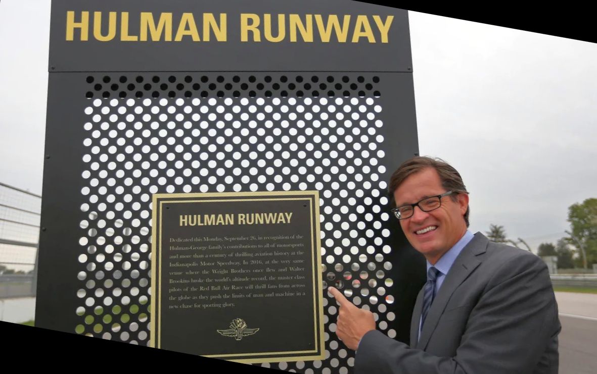
A photo of Indianapolis Motor Speedway President Doug Boles with the “Hulman Runway” marker from a 10/6/17 Indystar article (courtesy of Eric Lawrence).
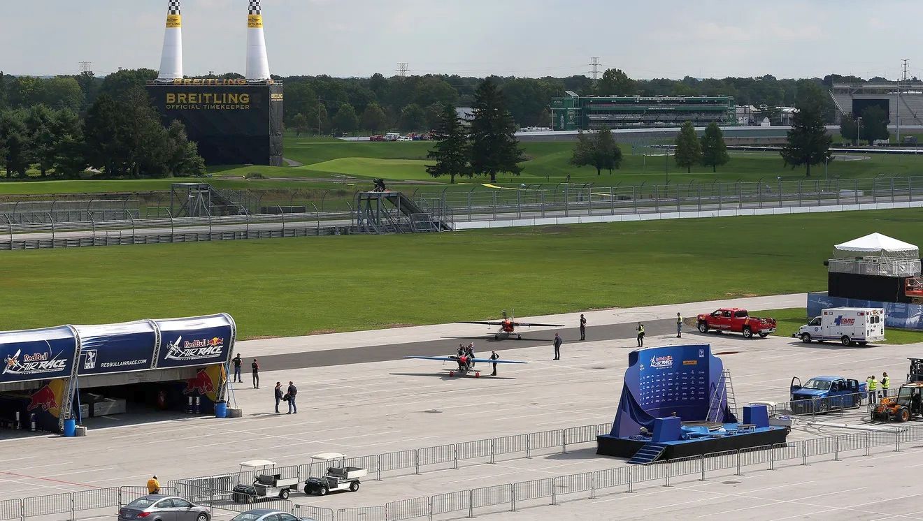
A 2016-18 photo of 2 Red Bull Air Race aircraft on the Indianapolis Motor Speedway.
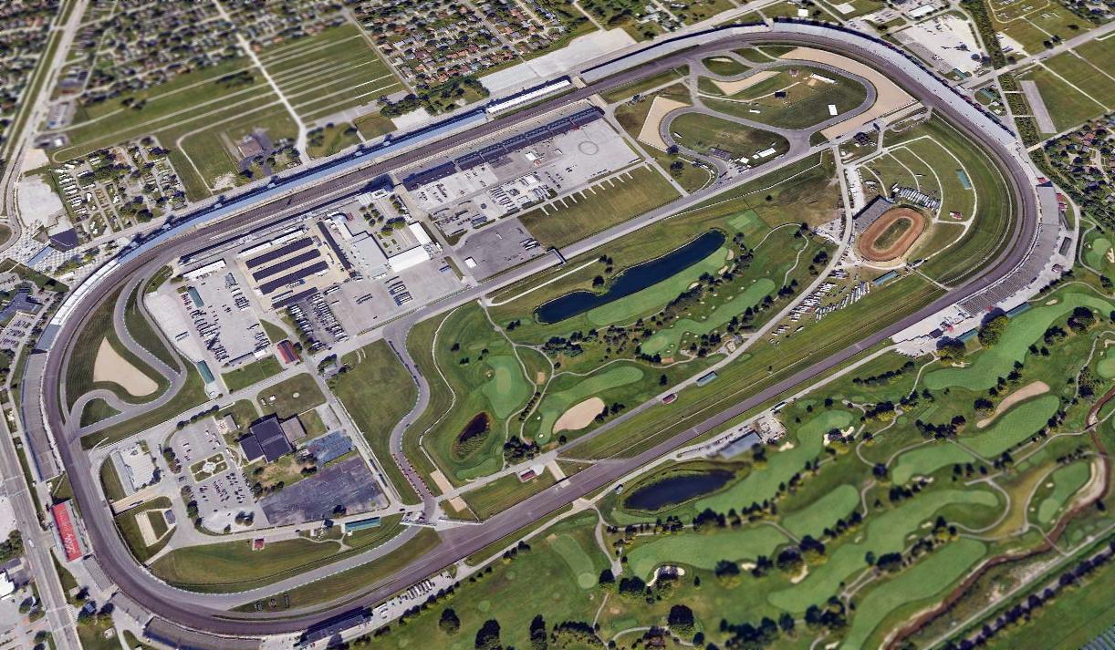
A 2018 aerial view looking northwest at the Indianapolis Motor Speedway showed no trace remaining of its aviation facilities.
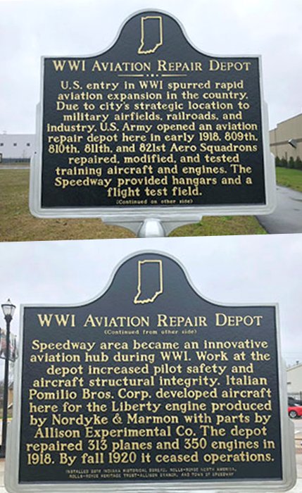
A pre-2019 photo of the historical marker standing at the site of the Indianapolis Motor Speedway Aviation Repair Depot.
Thanks to David Parker for pointing out this airfield.
____________________________________________________
Capital Airways Airport / Capitol Airways Airdrome / Aircraft Owners Airfield / Tarkington Airport, Indianapolis, IN
39.818, -86.231 (Northwest of Downtown Indianapolis, IN)
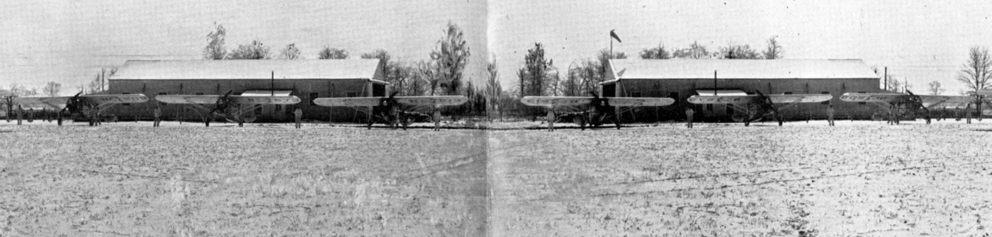
An undated photo from a circa 1928 advertisement for Capitol Airways Inc, showing “Winter activities at Capitol Airways Airdrome” (courtesy of Tom Heitzman).
This small airport was located less than a mile north of the Indianapolis Motor Speedway.
The date of establishment of Capitol Airways Airdrome has not been determined.
The earliest photo which has been located of this airfield was an undated photo from a circa 1928 advertisement for Capitol Airways Inc (courtesy of Tom Heitzman),
captioned “Winter activities at Capitol Airways Airdrome”.
It depicted a total of 13 monoplanes & biplanes in front of 2 hangars.
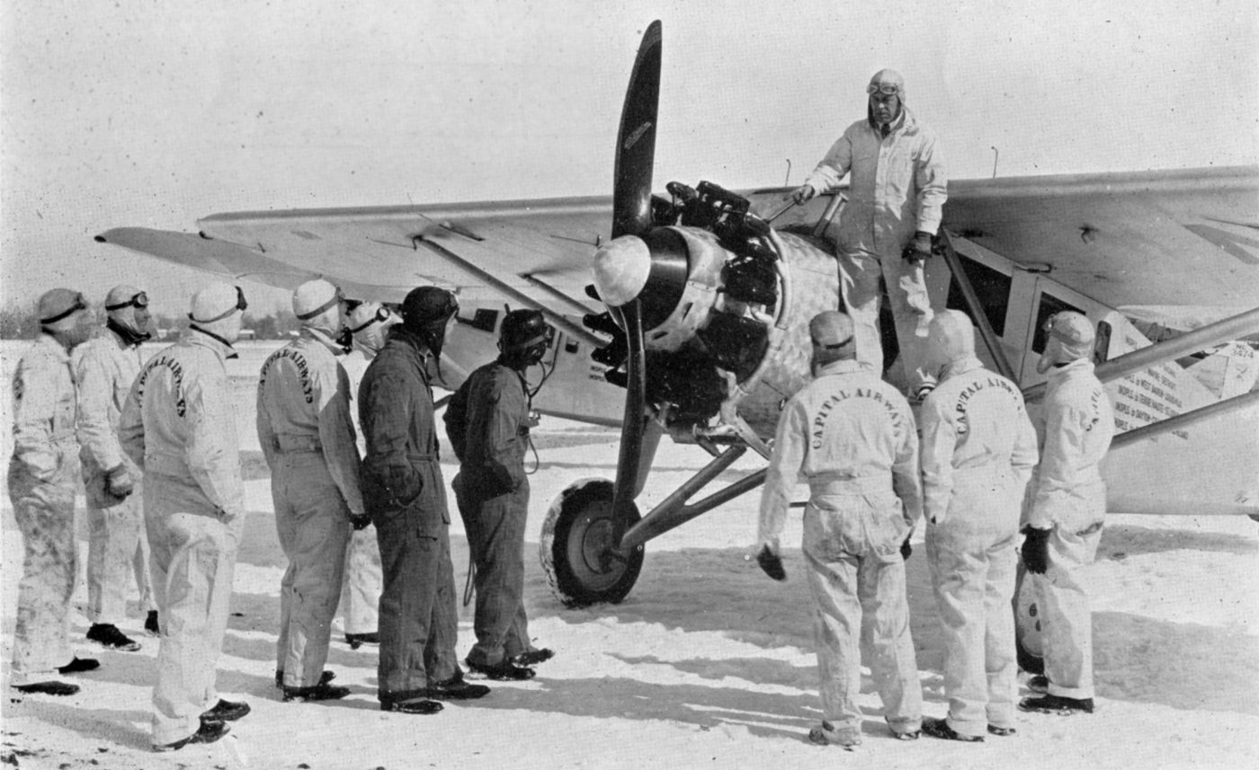
An undated photo from a circa 1928 advertisement for Capitol Airways Inc, showing “Instructing students on Wright Whirlwind engine” (courtesy of Tom Heitzman).
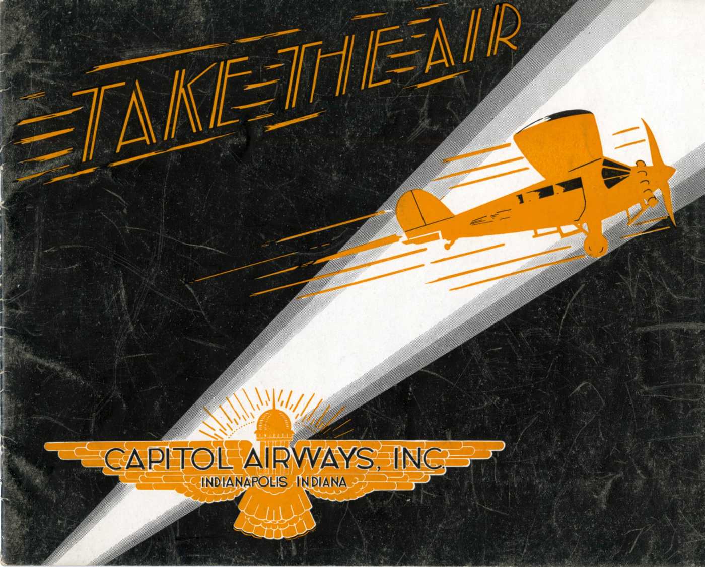
A circa 1928 advertisement for Capitol Airways Inc (courtesy of Tom Heitzman).
According to the book “The Encyclopedia of Indianapolis”, “The second airline to serve the city was Capitol Airways,
which on 10/22/28 began a passenger & express service from Capitol Airport.
By the spring of 1929 however all services were temporarily discontinued.”
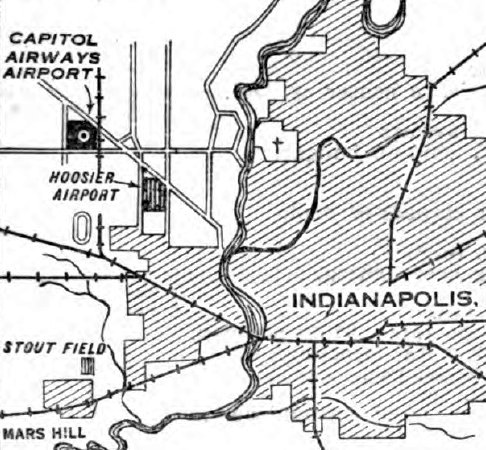
The location of Capitol Airways Airport, as depicted on the 3/18/29 Commerce Department Airway Bulletin #585 (courtesy of Lee Corbin).
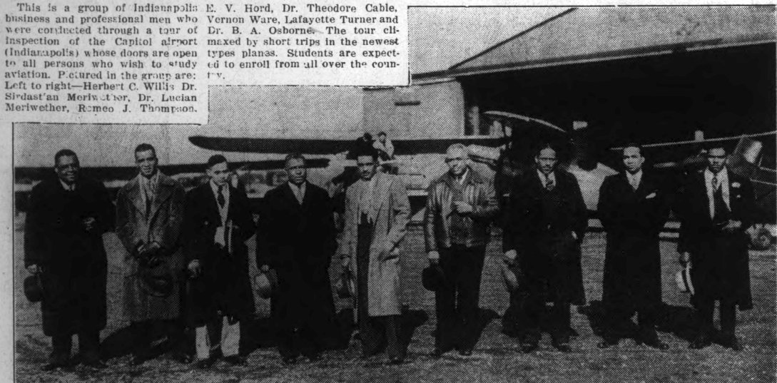
The last photo which has been located of Capitol Airport was an undated photo from the 3/18/33 Indianapolis Recorder (courtesy of Mark Hess)
showing a group of African Americans who toured Capitol Airport, standing in front of several aircraft & a hangar.
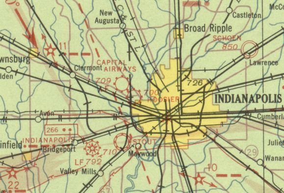
The earliest aeronautical chart depiction which has been located of Capitol Airways Airfield was on the November 1933 Cincinnati Sectional Chart.
It labeled the field as “Capital [sic] Airways”.
It was still depicted as Capitol Airways Airfield on the June 1934 Cincinnati Sectional Chart.
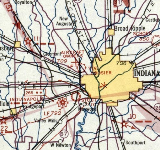
It was evidently renamed “Aircraft Owners” Airfield at some point between 1934-35, as that is how it was labeled on the April 1935 Cincinnati Sectional Chart.
It was depicted as an auxiliary airfield.
It was still depicted as Aircraft Owners Airfield on the November 1935 Cincinnati Sectional Chart.
Aircraft Owners Airfield was evidently abandoned at some point between 1935-36,
as it was no longer depicted on the March 1936 Cincinnati Sectional Chart.
No airfield was depicted at this location on the February 1937 Cincinnati Sectional Chart.
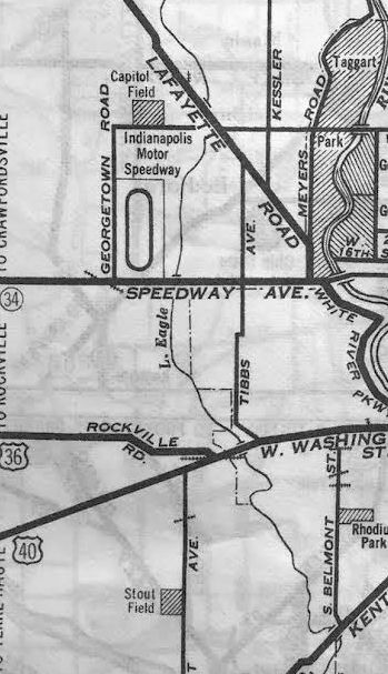
The last depiction which has been located of Capitol Field was on a 1938 street map (courtesy of Kevin Walsh).
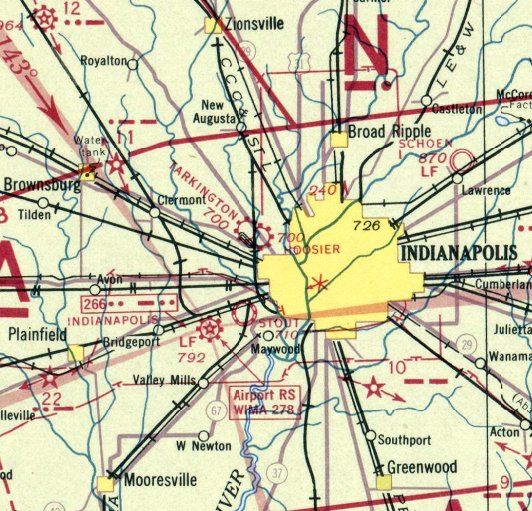
This airfield was evidently reopened under the name of “Tarkington” at some point between 1937-38, as that is how it was labeled on the September 1938 Cincinnati Sectional Chart.
Tarkington was depicted as a commercial/municipal airfield.
It was still depicted as Tarkington Airport on the May 1939 Cincinnati Sectional Chart.
Tarkington Airport was evidently abandoned in 1939, as it was no longer depicted on the September 1939 Cincinnati Sectional Chart.
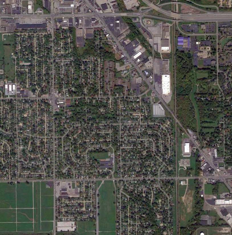
A 2014 aerial view showed no trace remaining of Capitol Airways Airport.
The site of Capitol Airways Airport is located south of the intersection of Lafayette Road & West 38th Street.
Thanks to Tom Heitzman for pointing out this airfield.
____________________________________________________
Brownsburg Airport, Brownsburg, IN
39.825, -86.394 (West of Indianapolis, IN)
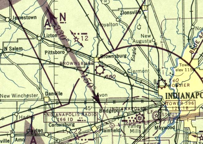
Brownsburg Airport, as depicted on the November 1945 Cincinnati Sectional Chart.
Brownsburg Airport was apparently established immediately after WW2
(like hundreds of other airports in the American post-WW2 aviation boom),
as it was not yet depicted on the May 1944 Cincinnati Sectional Chart.
The earliest depiction of Brownsburg Airport which has been located was on the November 1945 Cincinnati Sectional Chart.
It depicted Brownsburg as having a commercial/municipal airport.
The June 1950 Cincinnati Sectional Chart depicted Brownsburg as having a 2,600' unpaved runway.
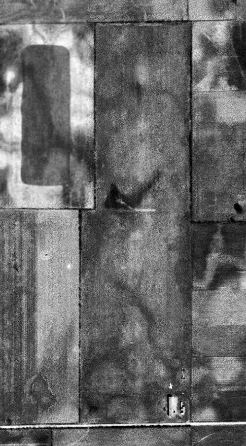
The earliest photo which has been located of Brownsburg Airfield was a 11/1/52 USGS aerial view.
It depicted Brownsburg as having a single north/south grass runway, with 3 light planes & a few small buildings on the southeast side.
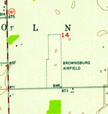
The earliest topo map depiction of Brownsburg Airport which has been located was on the 1953 USGS topo map.
It depicted “Brownsburg Airfield” as a north/south rectangular outline with 1 small building in the southeast corner.
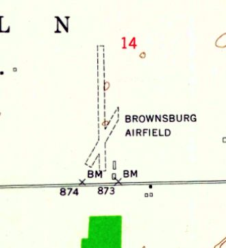
The 1959 USGS topo map depicted Brownsburg Airfield as having 2 unpaved runways, with 2 small buildings on the southeast side.
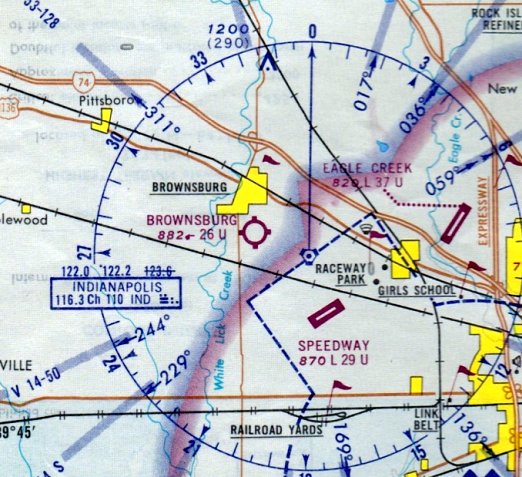
The September 1969 St Louis Sectional Chart depicted Brownsburg as having a 2,600' unpaved runway.
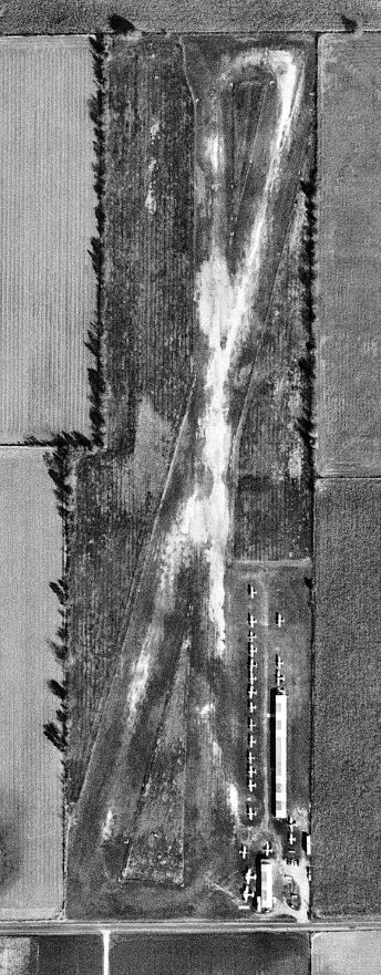
A 10/23/69 USGS aerial photo depicted Brownsburg Airport at perhaps the zenith of its popularity, with a total of 24 single-engine aircraft visible on the field.
The December 1971 Sectional Chart (courtesy of Charles Germaine) depicted Brownsburg as having a 2,600' unpaved runway.
Phil Brooks observed, “I visited & had the privilege of meeting legendary operator 'Shorty' Graves. He was someone special.”
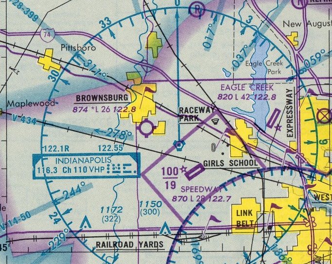
The last aeronautical chart depiction which has been located of Brownsburg Airport was on the 1984 St Louis Sectional Chart.
It depicted Brownsburg as having a 2,600' unpaved runway.
Charles Germaine recalled, “I made one landing & takeoff from Brownsburg during my time flying;
the FBO at Eagle Creek really didn’t like their rental planes going in & out of grass strips.
The runway was ruff & rutted. I got my license in 1987 & it was still open but it closed soon after, sometime in the late 1980s.”
Brownsburg Airport was no longer depicted on the May 1995 St Louis Sectional Chart (courtesy of Stu Sibitzky).
A 1998 aerial photo showed the site was covered with houses, with no trace remaining of Brownsburg Airport.
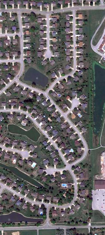
An 8/29/12 aerial photo showed the site of Brownsburg Airport was covered with houses, with no trace remaining of the little airport.
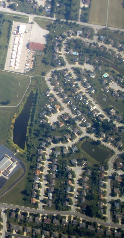
A 7/13/14 aerial view by Phil Brooks looking south at the site of Brownsburg Airport.
The site of Brownsburg Airport is located north of the intersection of Devin Drive & Airport Road, appropriately enough.
Phil Brooks observed, “I live in Brownsburg, and people relatively new to the area assume that Airport Road refers to Speedway Airport, rather than Brownsburg!”
Thanks to Charles Germaine for pointing out this airfield.
____________________________________________________
Hoosier Airport, Indianapolis, IN
39.8, -86.215 (Northwest of Downtown Indianapolis, IN)
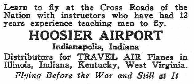
An advertisement for Hoosier Airport from the 8/18/28 issue of Aviation Magazine (courtesy of Chris Kennedy).
This small airport was located less than a mile east of the Indianapolis Motor Speedway.
Hoosier Airport was established in 1927 by Harold Brooks & Bob Shank (who would later establish nearby Shank Airport).
It was the first privately owned airfield in Marion County (according to the 7/18/76 issue of the Indianapolis Star).
According to a 2/6/48 Indianapolis News article (courtesy of Chuck Stuart),
Hoosier Airport was established by Bob Shank in 1928.
According to Mark DeVecchio, “I believe Richard Taylor & Captain Fowler owned the Hoosier Airport from possibly the mid/late-1920s until about 1940.”
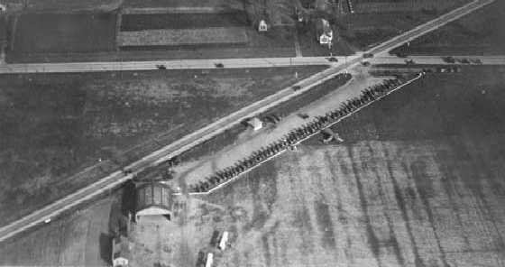
The earliest photo which has been located of Hosier Airport was a circa 1928-30 aerial view looking east,
showing a hangar along the north side of a grass field, on which were visible 3 aircraft.
The location of Hosier Airport, as depicted on the 3/18/29 Commerce Department Airway Bulletin #585 (courtesy of Lee Corbin).
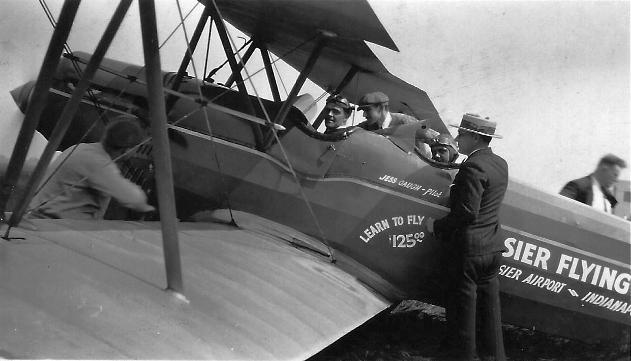
A circa 1929 photo of an unidentified biplane marked “Jess Gaugh – Pilot, Learn to fly $125, Hoosier Airport” (courtesy of Fred Kelso).
The Airport Directory Company's 1933 Airports Directory (courtesy of Chris Kennedy)
described Hoosier as a commercial airport consisting of a 3,000' x 1,320' rectangular sod field.
The field was said to have hangars, one of which had "Hoosier" painted on the roof.
The earliest aeronautical chart depiction which has been located of Hoosier Airport was on the November 1933 Cincinnati Sectional Chart.
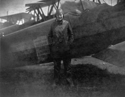
A circa 1930s photo of pioneering young aviatrix Martha Belle Jacobson in front of a biplane marked “Hoosier Airport” (courtesy of David Parker).
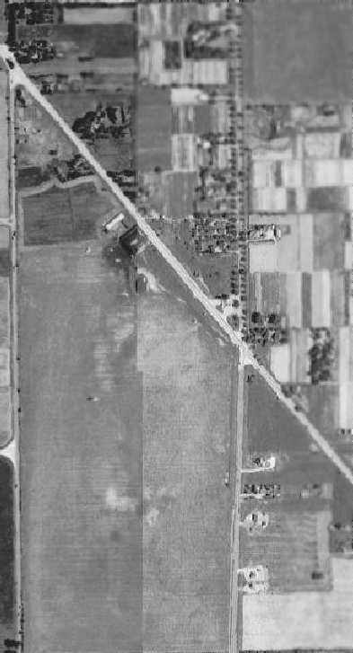
A 1941 aerial view from the IN Historical Aerial Archive (courtesy of Chris Kennedy)
depicted an airplane taking off or landing (just left of the center of the photo) at Hoosier Airport,
as well as airplanes parked near the hangar at the north end.
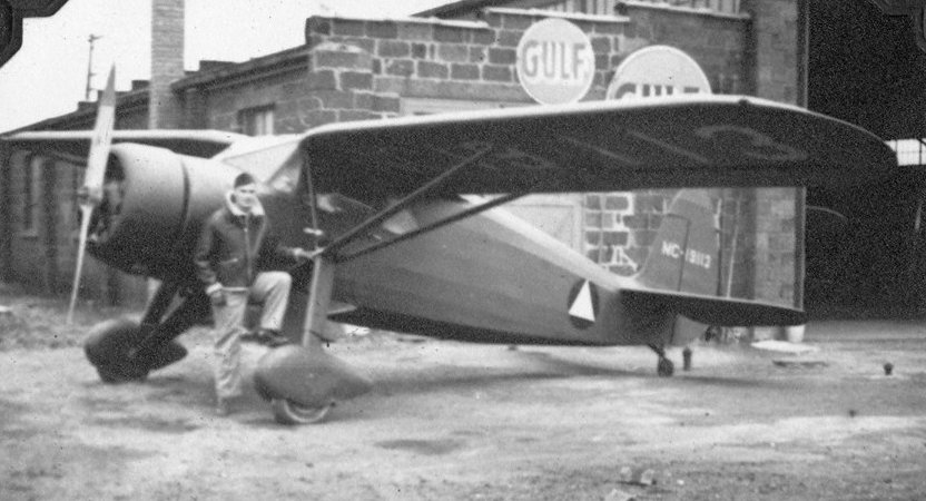
A 2/6/44 photo of an unidentified pilot & a Fairchild in front of a Hoosier Airport hangar (courtesy of David Parker).
According to David Parker, “The airplane was owned by the Civil Aeronautics Administration, but was on loan to the Civil Air Patrol.”
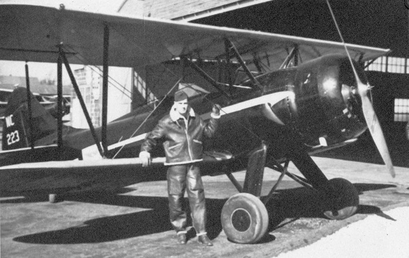
A 2/6/44 photo of an unidentified pilot & a Waco biplane in front of a Hoosier Airport hangar (courtesy of David Parker).
According to David Parker, “The airplane was owned by Butler University.”
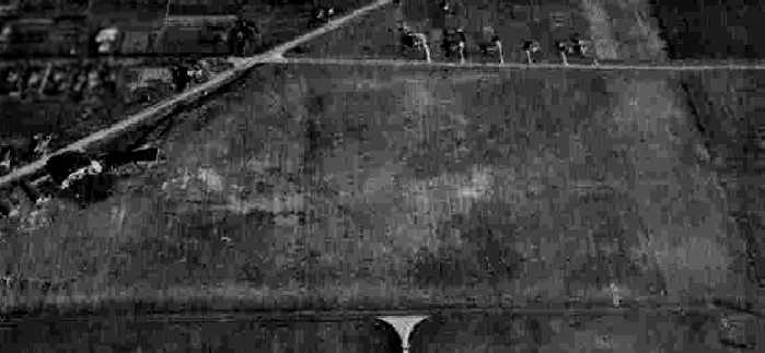
A 11/17/43 aerial view looking east from the 1945 AAF Airfield Directory (courtesy of Scott Murdock)
depicted Hoosier Airport as an irregularly-shaped grass area with a hangar along the north side.
It was still depicted as "Hoosier" Airport on the May 1944 Cincinnati Sectional Chart (courtesy of Chris Kennedy).
The 1945 AAF Airfield Directory (courtesy of Scott Murdock) described Hoosier Airport
as an 81 acre rectangular property containing an all-way sod field measuring 2,640' north/south by 1,320' east/west.
The field was said to have a total of 7 hangars, the largest being a 124' x 86' cinder block structure.
Hoosier Airport was described as being owned & operated by private interests.
According to a 2/6/48 Indianapolis News article (courtesy of Chuck Stuart),
“The 82 acre field, oldest privately operated airport in Indianapolis, has been subleased by Charlie Stuart & John Ramp, Indianapolis automobile dealers.
The Parks name will be dropped, so that the field will again be called Hoosier Airport.
The new occupants will take over February 15, and a part of their sizable automobile sales operations
will be transferred to the office & hangar which has served as an airport repair shop.
Both Mr. Ramp & Mr. Stuart are aviation enthusiasts.
Mr. Stuart & Mr. Ramp will maintain the hangar storage & gasoline & oil phases of the airport business.
Other airport activities, the flying school, sales agencies, and repair shop will be leased to private operators.”
Richard Slagle reported, “I have lived near the old Hoosier Airport most of my life.
In about 1948 I took great delight in the Hoosier Airport as it was used for the landing site for the Goodyear Blimp
which came for the Indy 500 race & it was easy to access as a kid.
in those days you could walk right up to it... the field wasn't busy & people would come & look at the blimp.”
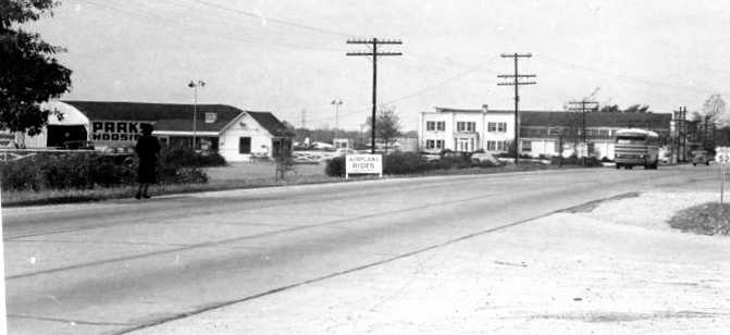
A circa 1940s photo by B.L Weddle (courtesy of Chuck Stuart) looking at the Parks Hoosier hangar.
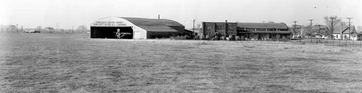
A circa 1940s photo by Robert Young (courtesy of Chuck Stuart) of a Hoosier Airport hangar.
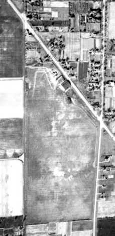
A circa 1940s aerial view (courtesy of Chuck Stuart) depicted Hoosier Airport as having a hangar & a few smaller buildings along the north side.
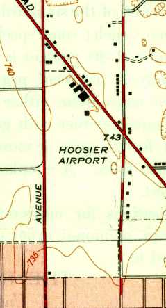
The 1948 USGS topo map depicted Hoosier Airport as an open area with several buildings along the north side.
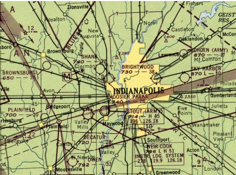
The field was evidently renamed "Hoosier Parks" at some point within the next 4 years,
as that is how it was depicted on the September 1948 Cincinnati Sectional Chart (courtesy of Chris Kennedy).
Hoosier Airport was evidently closed (for reasons unknown) at some point between 1948-49,
as it was no longer depicted on the September 1949 Cincinnati Sectional Chart.
Dave Slosson recalled, “I grew up in this area, from 1954.
Hoosier was gone before I knew about it, becoming Eagledale shopping center & housing area.”
A 1956 aerial photo showed the airfield area of the site of the Hoosier Airport had been densely redeveloped with housing,
but several hangars appeared to remain intact along the northern part of the property.
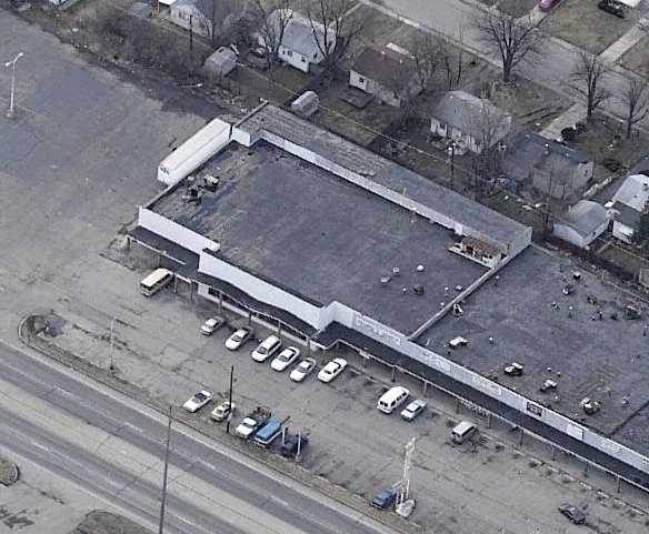
A circa 2006 aerial view looking south at a building (west of the intersection of Lafayette & Groff)
which was the former Hoosier hangar, according to Richard Slagle.
Richard reported that the former hangar “later became Walt's Super market and a addition was added to the north of the building,
also gone is the large concave arched roof of the hangar,
the small metal sheds were there for many years after the airport closed, but everything is gone now.”
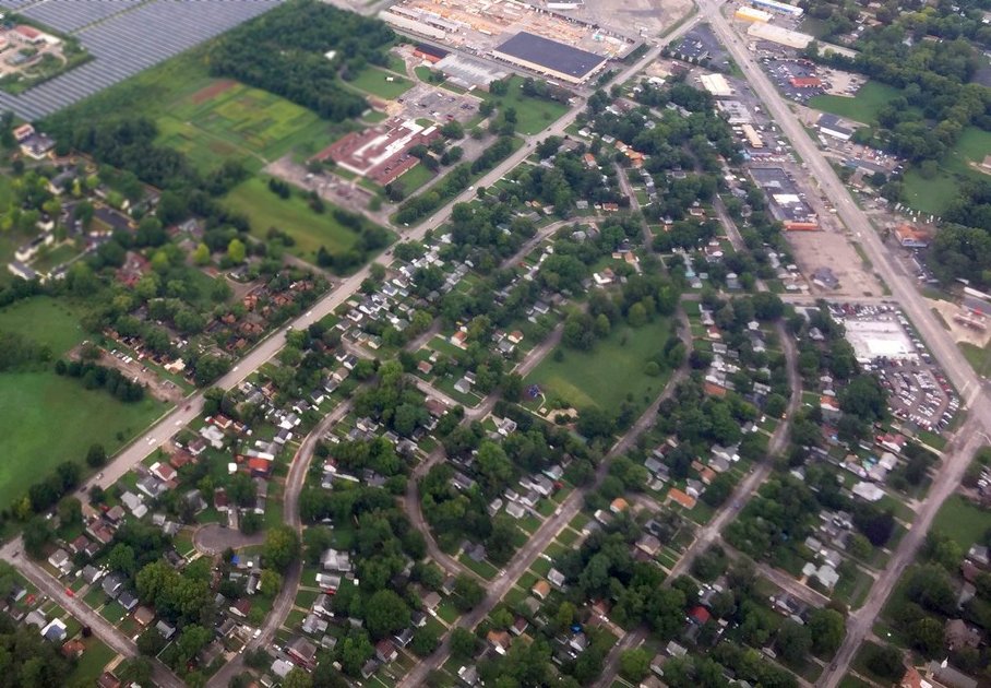
As seen in an 8/17/18 aerial view looking northwest by Phil Brooks, not a trace appears to remain of Hoosier Airport.
The site of Hoosier Airport is located west of the intersection of Lafayette Road & Kessler Boulevard.
____________________________________________________
Shank Airport, Indianapolis, IN
39.83, -86.25 (Northwest of Downtown Indianapolis, IN)
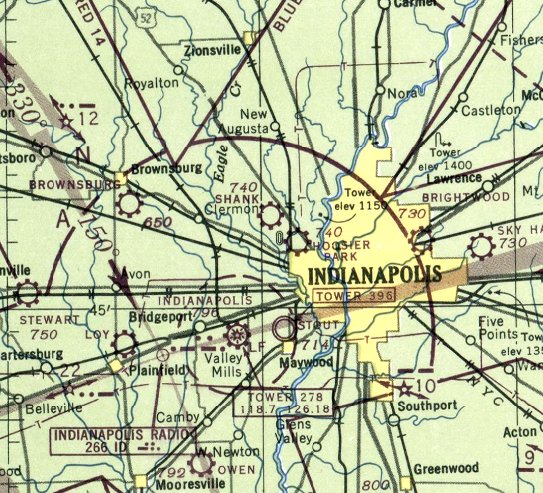
Shank Airport as depicted on the April 1947 Cincinnati Sectional Chart.
No airfield was yet depicted at this location on a 1941 aerial photo.
Robert Shank was a pioneer air mail pilot & a flight instructor during both World Wars,
who was also one of the founders of nearby Hoosier Airport.
In 1944, he founded the Bob Shank Airport, less than 2 miles northwest of the Indianapolis Motor Speedway.
Bob Shank Airport was described as "Now under construction" in an advertisement in the 1945 Haire Publishing Airport Directory (courtesy of Chris Kennedy).
Bob Shank Airport was not yet listed among active airfields in the 1945 AAF Airfield Directory (courtesy of Scott Murdock),
nor depicted on the October 1946 Cincinnati Sectional Chart.
Robert Shank was awarded the Haire Publishing Company Trophy for the most outstanding airport development in 1946.
The earliest depiction of Shank Airport which has been located was on the April 1947 Cincinnati Sectional Chart.
The September 1948 Cincinnati Sectional Chart (courtesy of Chris Kennedy) depicted Shank as having a 3,200' unpaved runway.
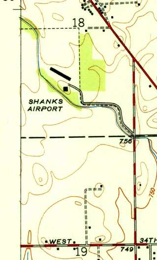
The 1948 USGS topo map depicted “Shanks Airport” as having 2 buildings on the northeast side of an open airfield area.
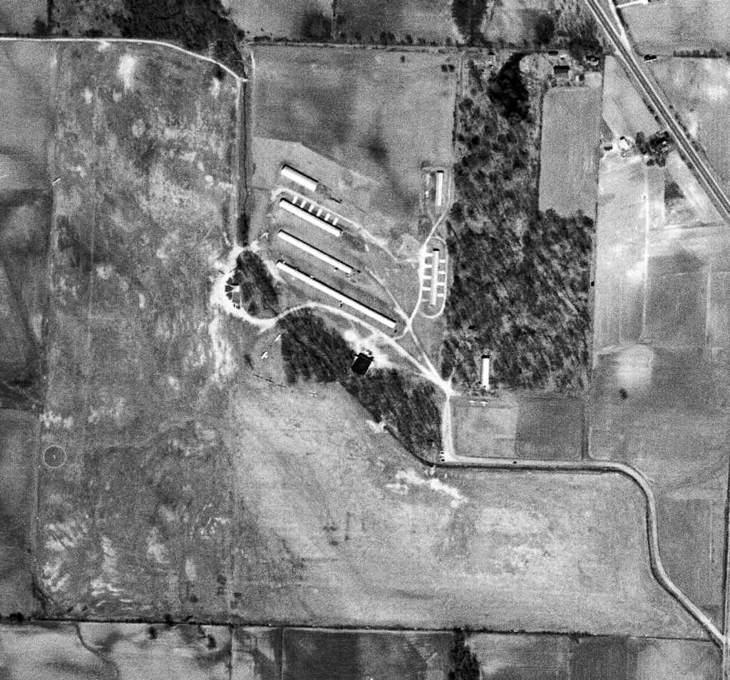
The earliest photo which has been located of Shank Airport was an 11/1/52 USGS aerial view.
It depicted Shank as having a large grass airfield area, with runways oriented north/south & east/west.
Six long narrow hangars were depicted on the northeast side of the airfield, and at least 10 single-engine aircraft were visible.
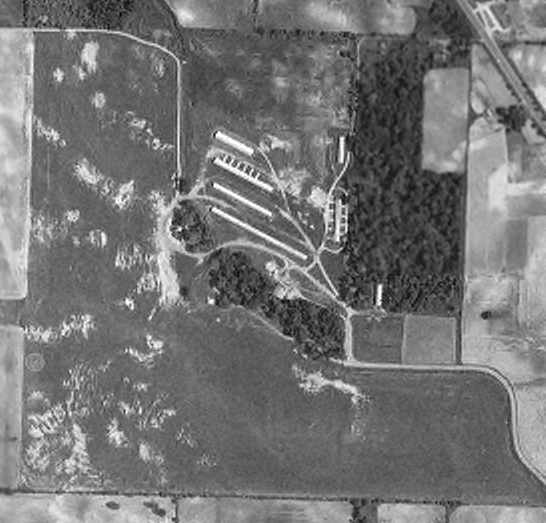
A 1956 aerial view (from the IN University Electronic Atlas of Central IN Historical Aerial Archive, courtesy of Chris Kennedy)
depicted Shank as having a large grass airfield area, with runways oriented north/south & east/west.
Six long narrow hangars were depicted on the northeast side of the airfield.
Robert Shank continued to operate the airport until his retirement in 1957.
Gordon Lamb recalled, “My first home field, Shank Airport, was the closest airport to the Indianapolis Motor Speedway.
Every Memorial day, about 5,000 light (& bigger) aircraft would arrive for the Indianapolis 500.
I worked the entire day, parking, tie-downs, fueling, and fondling the aircraft.
There were several P-51s, never fewer than 3 Ford Trimotors, a few A-26s & B-25s converted to executive jobs, and other exotica too numerous to mention.”
Gordon added “a request for pictures taken on Memorial Day?”
The 1961 Cincinnati Sectional Chart (courtesy of Chris Kennedy) still depicted Shank as having a 3,200' unpaved runway.
Dave Slosson recalled, “Shank was fun to watch, and I remember Cubs landing on an east/west short sod strip parallel to 38th Street in the mid-1960s,
years before they added the northeast/southwest paved strip.
My dad was a WWII Navy pilot, so we paid attention to such things.”
John Teipen recalled of Bob Shank Airport, “Where I first took some flying lessons during the Summer of 1966.
My first lessons were in a J3 Cub ($12.50 per hour CFI included)
and at that time I remember 'Shank Field' as being a grass strip.
My logbook was kept at the airport & I have often wondered what became of that logbook.”
The runway at Shank was evidently paved at some point between 1966-68,
as the 1968 Cincinnati Sectional Chart (courtesy of Chris Kennedy)
depicted Shank as having a single 3,200' paved runway, oriented northeast/southwest.
Phil Brooks recalled, “Shank is close to my heart because I took my first small plane ride there, I believe in the summer of 1968 (when I was 6 years old).
The pilot was my neighbor Harry Eakin. He flew a Navion.”
Randy Wade recalled, "I started flying at Shank Airport in 1970-71.
Ned Bottoms & Charlie Lamb were 2 old gentlemen that ran the airport at that time."
Bob Leyner recalled, “Shank Field... My mother took instruction in a Franklin engine powered Cub.
My first flight instruction was in the Cub under her ‘block time’ at Bottoms & Lamb in the Cub for $10/hour.
My brother & I both got our certificates. Bottoms & Lamb operated from a trailer.”
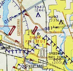
The May 1971 St. Louis Local Aeronautical Chart (courtesy of Robert Brown) still depicted Shank as having a 3,200' paved northeast/southwest runway.
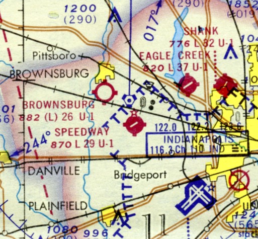
The last aeronautical chart depiction which has been located of Shank Airport was on the December 1971 Sectional Chart (courtesy of Charles Germaine).
It depicted Shank as having a 3,200' northeast/southwest paved runway.
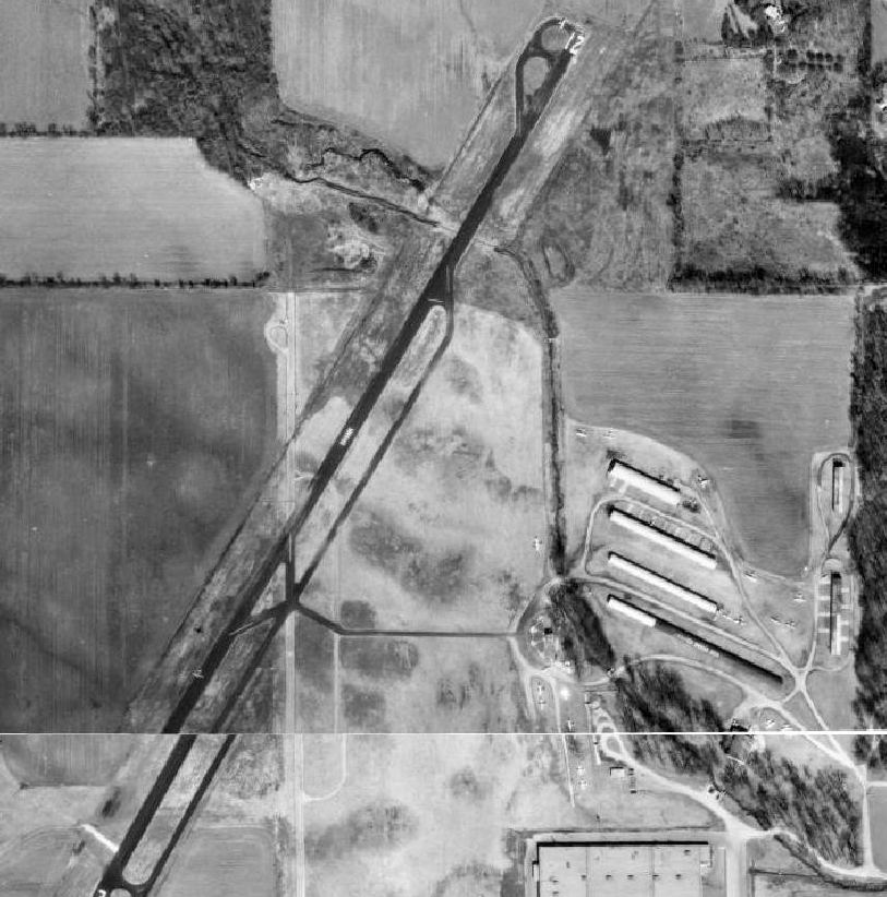
The last photo which has been located of Shank Airport was a 1972 aerial view (from http://maps.indy.gov/MapIndy, courtesy of Matthew Payne).
It depicted Shank as having a paved Runway 3/21, with one aircraft entering the runway, and another dozen parked around the hangars.
Phil Brooks recalled, “Around 1973 I recall a Ford Trimotor giving rides out of Shank. My mother expressly forbid my purchasing a ride, dang it!”
The 1974 USGS topo map still depicted Shank Airport, but that doesn't necessarily prove the field was still open at that point.
According to the City of Indianapolis web site, "Shank Airport at 38th & Moller Road survived until the 1970s - a victim to the building boom in Pike Township."
Phil Brooks recalled, “My first job was in summer, 1978, bussing tables at the Laughner's Cafeteria at the southeast corner of the field.
I don't recall it being open, or at least active, at that time.”
A 1978 aerial photo (from http://maps.indy.gov/MapIndy/, courtesy of Matthew Payne) showed that the end had come for Shank Airport,
with roads having been built across the northern, central, and southern portions of the runway.
Shank Airport was depicted as an abandoned airfield on the 1980 St. Louis Sectional Chart.
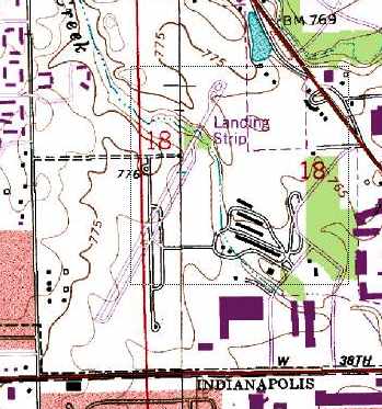
The 1984 USGS topo map still depicted the airfield layout of Shank Airport, even though it was already closed at that point.
It depicted 2 paved runways, oriented north/south & northeast/southwest.
Several long narrow hangars were depicted to the east of the runway. The field was labeled simply "Landing Strip".
The 1998 USGS aerial photo showed that the site of the Shank Airport had been thoroughly covered by redevelopment,
with large buildings & parking lots obliterating any trace of the former airport.
A new road, West Pike Plaza Road, had also been built through the center of the airport site.
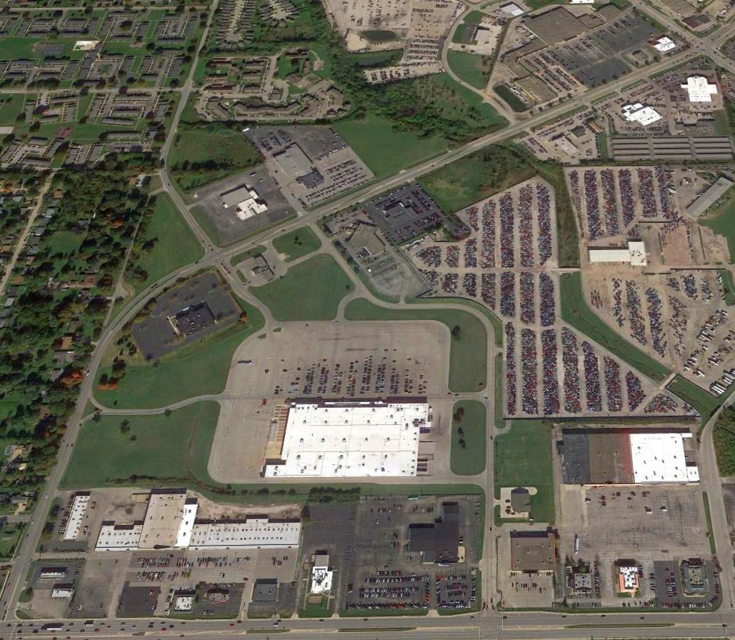
A 2016 aerial view looking north showed no trace remained of Shank Airport.
The site of Shank Airport is located southwest of the intersection of West Pike Plaza Road & Lafayette Road.
____________________________________________________
Or if you prefer to contact me directly concerning a contribution (for a mailing address to send a check),
please contact me at: paulandterryfreeman@gmail.com
If you enjoy this web site, please support it with a financial contribution.
____________________________________________________
This site covers airfields in all 50 states.