Abandoned & Little-Known Airfields:
Indiana: Southwestern Indianapolis area
© 2002, © 2026 by Paul Freeman. Revised 5/24/26.
This site covers airfields in all 50 states: Click here for the site's main menu.
____________________________________________________
Please consider a financial contribution to support the continued growth & operation of this site.
Clinton Airport (revised 11/21/25) - Kelly Airfield / Lowry Air-Field (revised 5/24/26)
Speedway Airport (revised 1/29/23) - Stout Field / Stout AAF (revised 1/4/26)
____________________________________________________
Kelly Airfield / Lowry Air-Field, Mooresville, IN
39.577, -86.378 (Southwest of Indianapolis, IN)
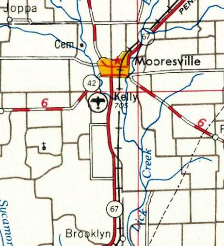
Kelly Airfield, as depicted on the 1953 USGS topo map.
The date of establishment of this rural general aviation airport has not been determined.
The depiction which has been located of Kelly Airfield was on the 1953 USGS topo map.
It depicted the airport a mile north of its eventual location – was this a prior location, or an error by the mapmakers?
Kelly Poe established Poe's Cafeteria adjacent to the airfield in 1954.
Kelly Airfield was not yet depicted on a 1958 aerial photo or the 1959 Cincinnati Sectional Chart.
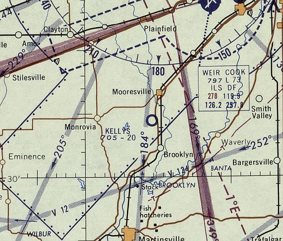
The earliest aeronautical chart depiction which has been located of Kelly Airfield was on the December 1960 Cincinnati Sectional Chart.
It depicted Kelly as having a mere 2,000' unpaved runway.
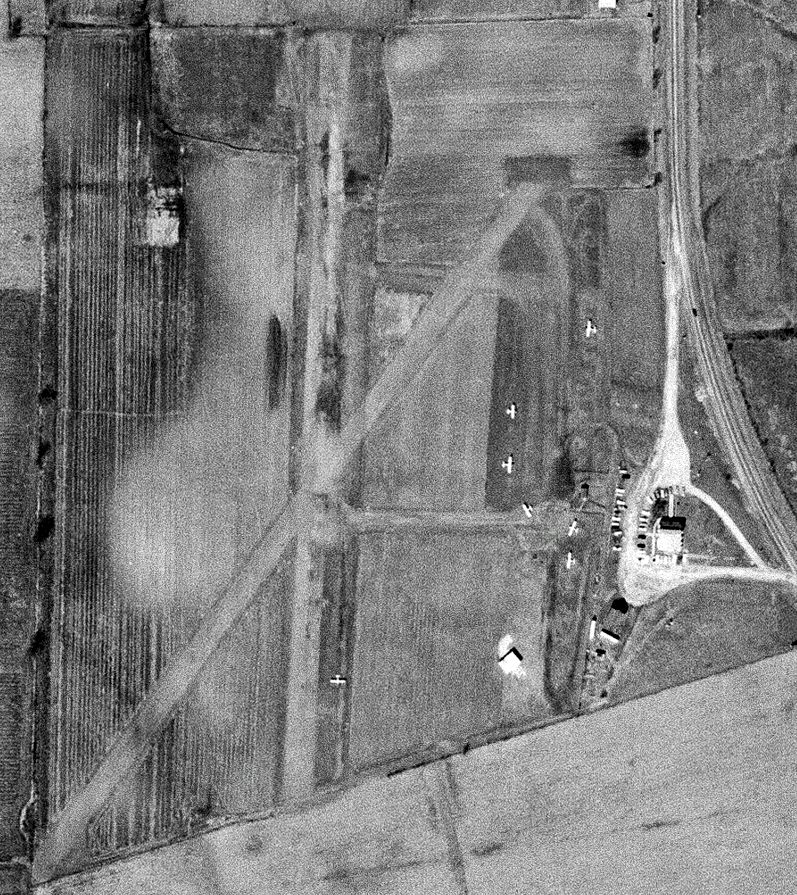
The earliest photo which has been located of Kelly Airfield was a 3/21/64 USGS aerial view.
It depicted Kelly as having 2 unpaved runways & several small buildings & 7 light single-engine aircraft on the east side.
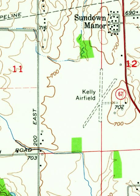
The earliest topo map depiction which has been located of Kelly Airfield in its eventual location was on the 1966 USGS topo map.
It depicted Kelly as having 2 unpaved runways & 3 small buildings on the east side.
A 1966 aerial view showed Kelly Airfield had gained 2 hangars on the southeast side at some point between 1964-66.
Four light aircraft were visible on the field.
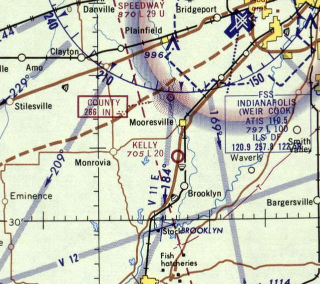
The last aeronautical chart depiction which has been located of Kelly Airfield was on the August 1969 Cincinnati Sectional Chart.
It depicted Kelly as having a mere 2,000' unpaved runway.
Phil Brooks recalled, “Parachutes & Associates ran a jump school there in the 1970s.”
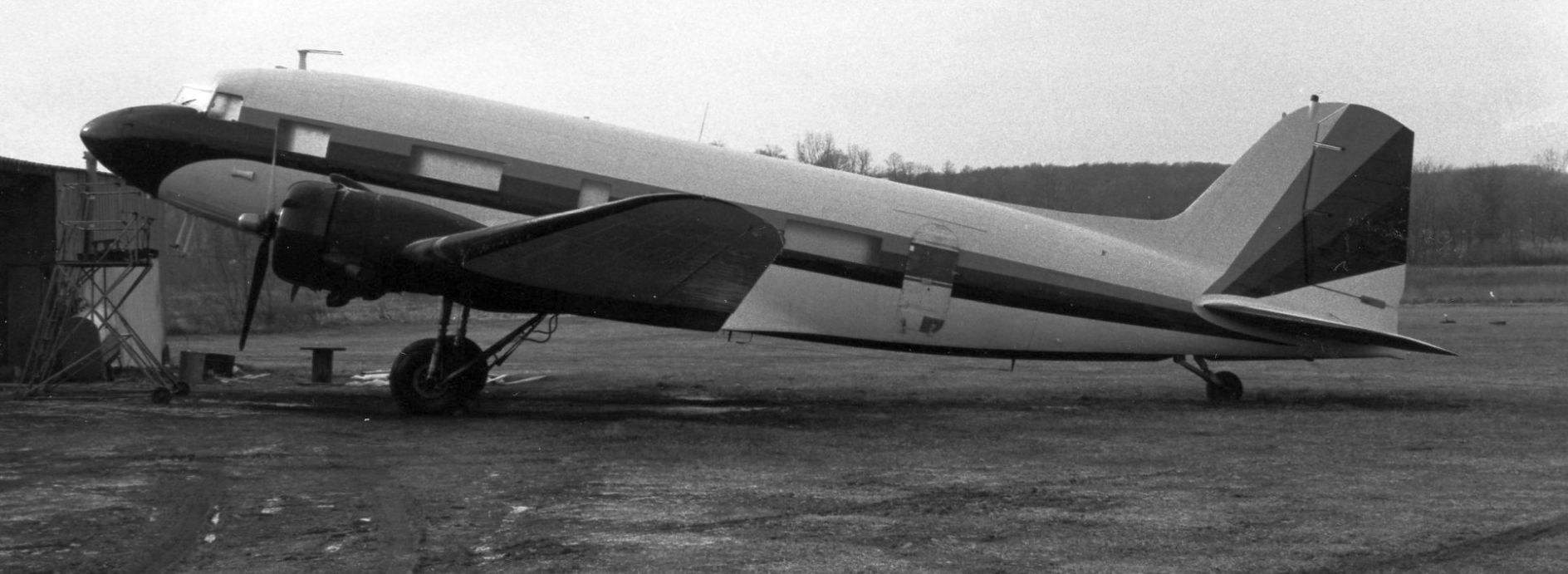
A 12/9/78 photo (courtesy of Phil Brooks) of Douglas DC-3 N300MR at Kelly Field.
An article in the 11/22/80 Banner Graphic (courtesy of Phil Brooks) entitled “Air chase ends in drug arrests at Mooresville airport” reported,
“Three men are under arrest after a DC-3 with marijuana residue was seized here, authorities say.
They believe the plane was one chased by two U.S. Customs Service airplanes. The chase began near Vero Beach FL before dawn Thursday.”
A 1987 aerial view showed the runways & buildings of Kelly Field appeared to remain intact,
but there were no aircraft on the field or any other sign of recent aviation use.
Phil Brooks recalled, “The parachute operation had moved to Frankfort IN by 1990.”
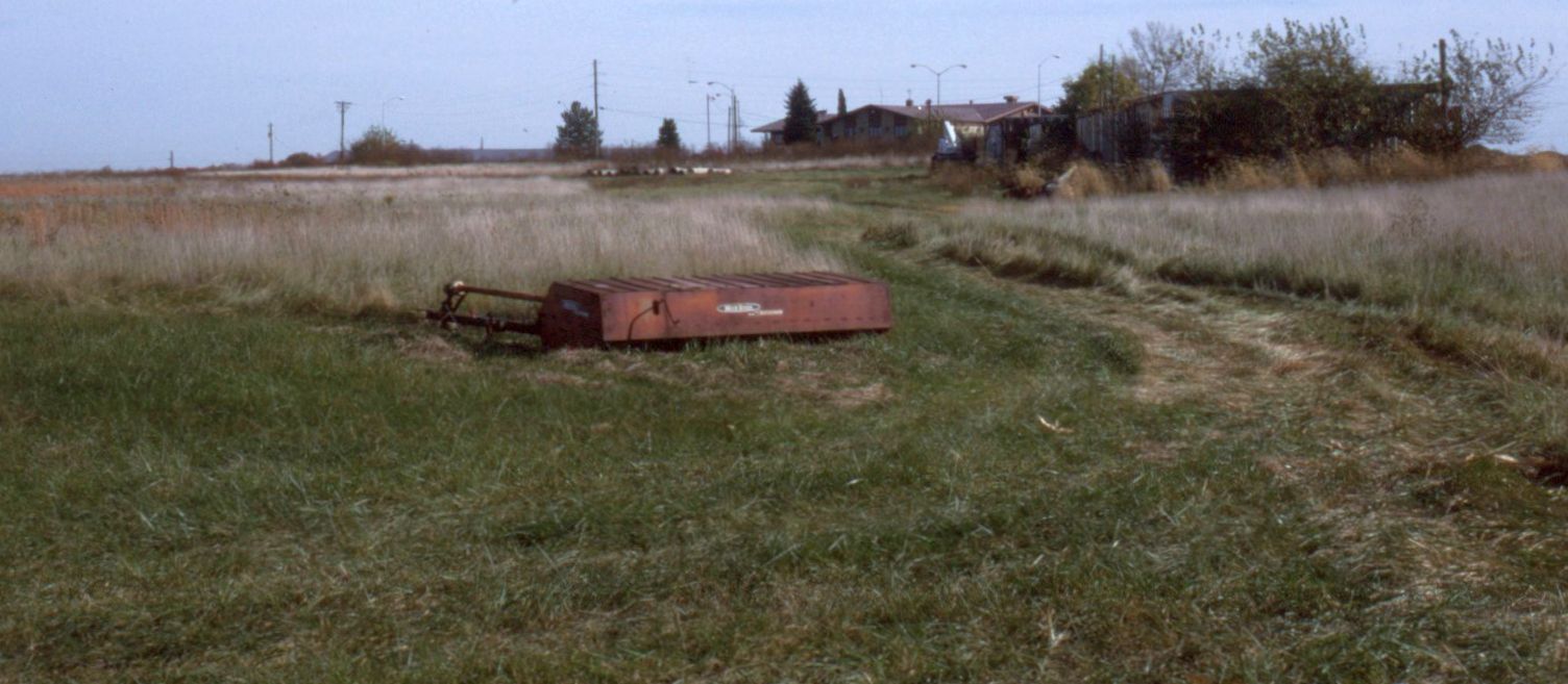
A 1995 photo by Phil Brooks of the former Poe's Cafeteria next to Kelly Airfield.
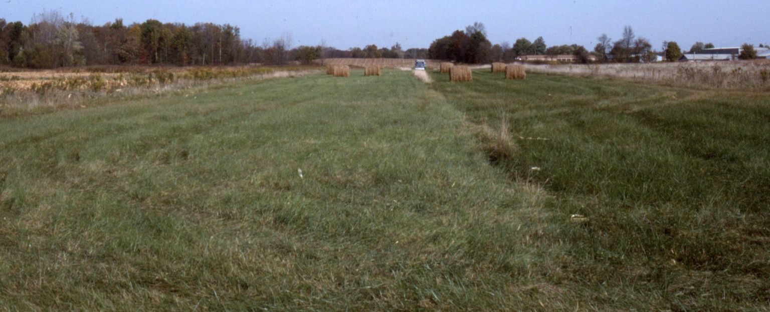
A 1995 photo by Phil Brooks of the former Kelly Airfield runway.
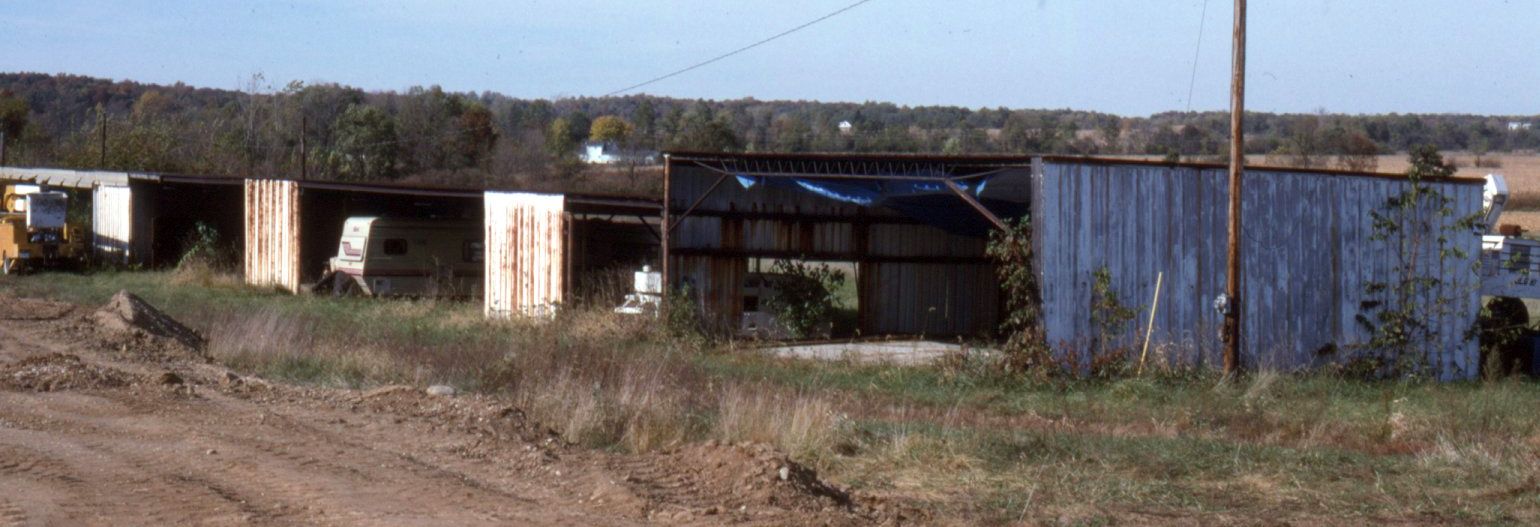
A 1995 photo by Phil Brooks of the former Kelly Airfield hangars.
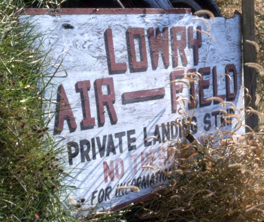
A 1995 photo by Phil Brooks of a sign at the Kelly Airfield site, of a different name, “Lowry Air-Field, Private Landing Strip”.
No other references have been found of this name.
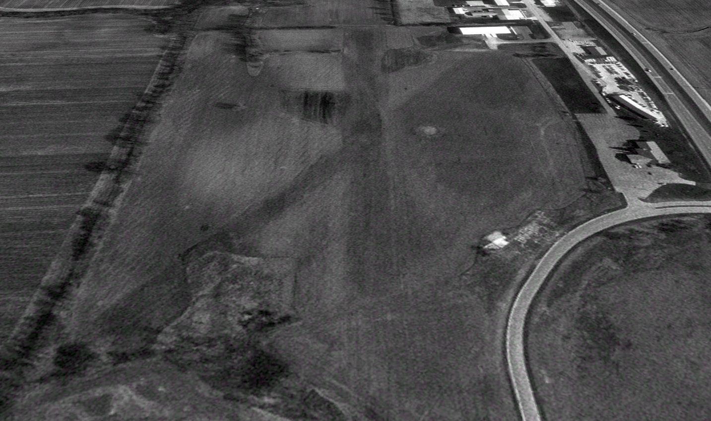
A 1998 aerial view looking north showed the Kelly Airfield hangars had been removed.
Kelly Poe closed the adjacent Poe's Cafeteria in 2019.
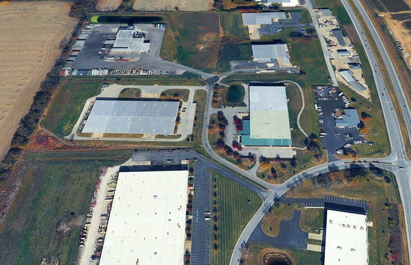
A 2024 aerial view looking north showed no trace remaining of Kelly Airfield.
Ironically, a 2026 street map labels one of the large industrial buildings on the property as “Kellys Airfield”.
The site of Kelly Airport is located west of the intersection of Route 67 & Hancel Parkway.
Thanks to Phil Brooks for pointing out this airfield.
____________________________________________________
Clinton Airport (1I7), Clinton, IN
39.71, -87.4 (West of Indianapolis, IN)
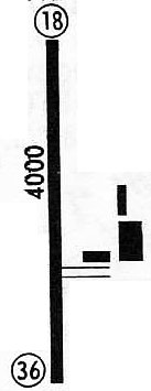
Clinton Airport, as depicted on a 1971 airport diagram.
This rural general aviation airport was evidently established at some point between 1969-71, as it was not yet depicted on a 1962 aerial photo
or the August 1962 Cincinnati Sectional Chart.
The depiction which has been located of Clinton Airport was a 1971 airport diagram.
It depicted a single 4,000' paved Runway 18/36, with a taxiway leading to 3 buildings on the east side.
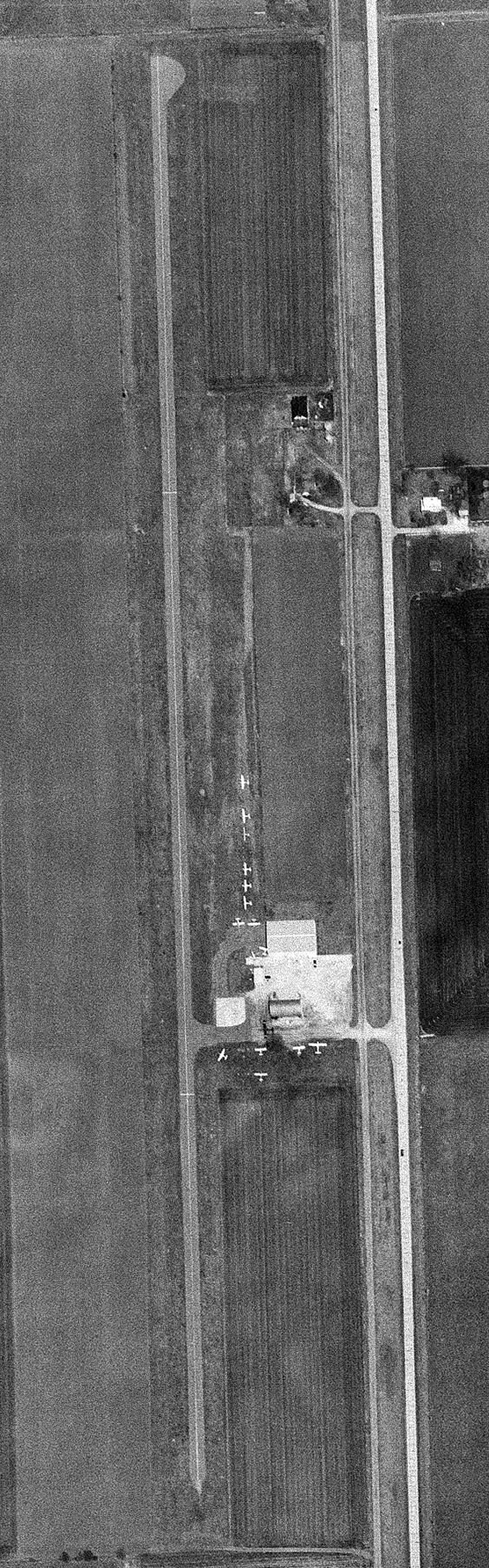
The earliest photo of Clinton Airport which has been located was a 4/22/75 USGS aerial view.
It depicted a single north/south paved runway, on the east side of which was a single hangar, a few smaller buildings, and 15 light single-engine aircraft.
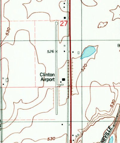
The earliest topo map depiction which has been located of Clinton Airport was the 1978 USGS topo map.
It depicted a single paved north/south runway, with a taxiway leading to 3 buildings on the east side.
Dave Tourtelot recalled, “Back in the early to mid-1980s I used to fly into Clinton Airport. At first in a Piper Senica, then later in a Cessna 402.
At that time, very little traffic in or out. There was a small line shack I could wait in with a TV that only got the Weather Channel.
The strip was somewhat narrow for a 402.”
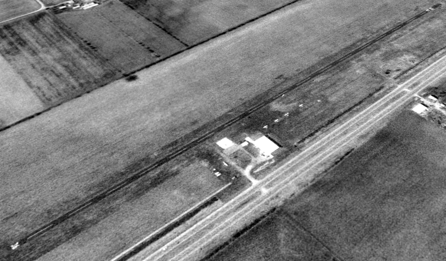
A 1992 aerial view looking northwest depicted Clinton Airport as having a single asphalt Runway 18/36, on the east side of which was a single hangar, a few smaller buildings, and 5 light single-engine aircraft.
According to its FAA Airport/Facility Directory data, Clinton Airport consisted of a 120 acre property, having a single 3,750' asphalt Runway 18/36.
For the year of 2004, Clinton Airport conducted an average 16 takeoffs or landings per day, and it had 11 single-engine based aircraft.

A 2009 photo looking northwest showed a single-engine Cessna & a single-engine cropduster parked to the south of the Clinton Airport hangar.
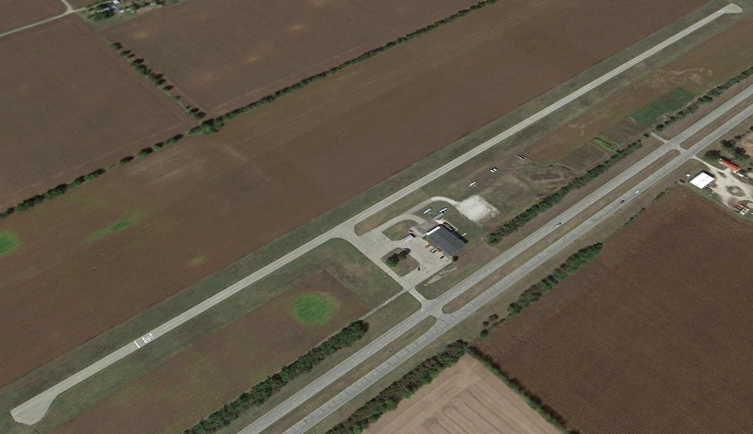
The last photo which has been located showing aircraft at Clinton Airport was a 2013 aerial view looking northwest.
Although the airport remained intact, the number of aircraft had dwindled to only 3.
A 5/1/17 FAA NOTAM indicated that Clinton Airport was permanently closed (for reasons unknown).
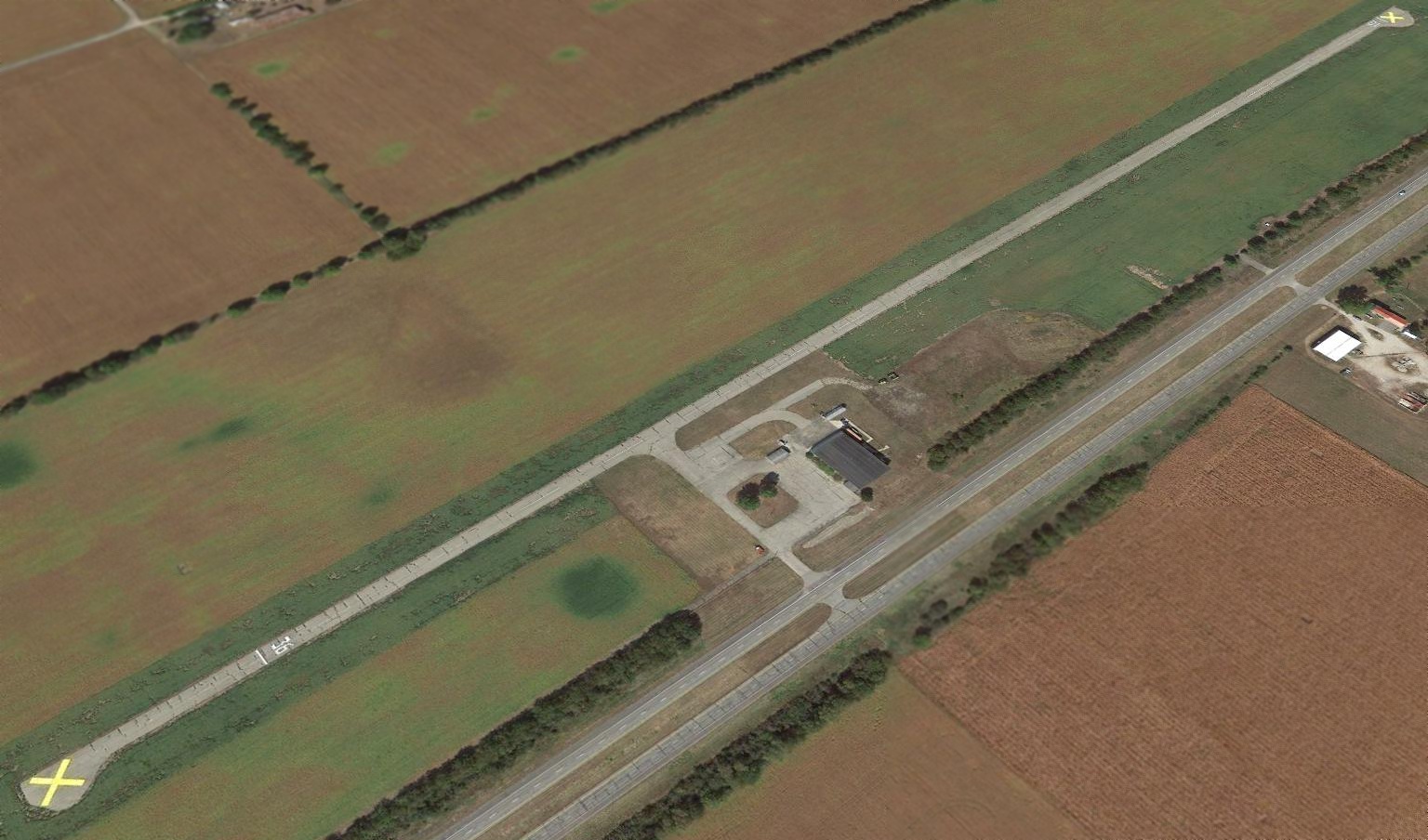
A 2017 aerial view looking northwest showed Clinton Airport remained intact, but devoid of aircraft, and a yellow closed-runway “X” had been painted on each end of the runway.

A 2023 photo looking northwest showed the Clinton Airport runway & hangar remained intact, reused by several businesses.
As of 2024, street maps labeled the former Clinton Airport hangar as being used by D&B Self Storage.
Thanks to Dave Tourtelot for pointing out this airfield.
____________________________________________________
Speedway Airport (3SY), Indianapolis, IN
39.8, -86.36 (West of Downtown Indianapolis, IN)
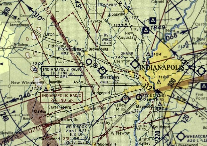
Speedway Airport, as depicted on the December 1957 Cincinnati Sectional Chart.
Speedway Airport was apparently established at some point in 1957,
as it was not yet depicted on the 1953 USGS topo map or the June 1957 Cincinnati Sectional Chart.
The earliest depiction of Speedway Airport which has been located was on the December 1957 Cincinnati Sectional Chart.
It depicted Speedway Airport as having a 2,700' unpaved runway.
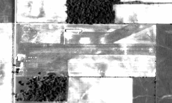
The earliest photo which has been located of Speedway Airport was a 1958 aerial view
from the IN University Electronic Atlas of Central IN Historical Aerial Archive (courtesy of Chris Kennedy).
It depicted Speedway Airport as having 2 grass runways, oriented east/west & northeast/southwest.
Two hangars were located on the north & west sides of the field, and there was a total of 6 light aircraft visible on the field.
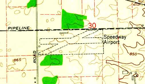
The 1959 USGS topo map depicted Speedway Airport as having 2 unpaved runways, with small buildings on the west & north sides.
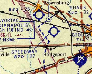
The 1961 Cincinnati Sectional Chart (courtesy of Chris Kennedy) depicted Speedway Airport as having a 2,700' unpaved runway.
Joe Chadwick recalled, “Speedway Airport... I flew my 1941 Ercoupe from there in the early 1960s.
The main Runway was 9/27, grass; [Runway] 6-24 was shorter & narrow. We just called it 'The Diagonal'.
The field was operated by Bert Gerts & his 2 teenage sons. Bert worked elsewhere during the day.
The airport was wide open & on the honor system.
If you needed gas, 80/86 only, you pulled up to the pump, went inside, turned it on, pumped it, turned it off and put money or IOU in the cigar box.
Tie-down was $12 a month.”
Charles Miles recalled, “Speedway Airport... I was a flight instructor & manager of the airport from April 1963 to September 1963.
The airport was recently owned by William McGinty & I flew with William & his son John many times in 1963.
We had a Piper PA-22 (N8894C), a Cessna 172A (N7497T), and in July 1963 I flew a 1946 J3 from Shank's Airport to Speedway.
I have many hours instructing in that J3 (N6200H) at Speedway Airport.
We had only the grass runway. When I first came to the airport the new lounge & office was built on the east side of the main hangar.”
Jon McVeyme recalled, “Speedway Airport... Between 1964-66 I took flight instructions from Bill Lewis; in 1966 I received my license.”
Richard Pearsall recalled, "I was there many years ago before it was paved.
It was the race day. It was a real zoo. Everyone wanted to get landed & get to the track… I never saw anything like it."
Donna McCallum recalled, “Speedway Airport... I lived there from 1967-78 as my father was the FBO - George Stubbs.
The runway was paved by the time we moved there in 1967.”
The 1968 Cincinnati Sectional Chart (courtesy of Chris Kennedy) depicted Speedway as having a 2,800' paved runway.
A 1970 aerial photo from the IN University Electronic Atlas of Central IN Historical Aerial Archive (courtesy of Chris Kennedy)
depicted Speedway as having a paved northeast/southwest runway & a grass east/west runway.
The single row of T-hangars along the north side of the field had been expanded to 3 longer rows of T-hangars.
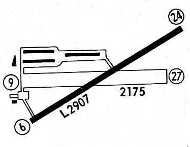
A 1971 airport directory (courtesy of Chris Kennedy)
depicted Speedway Airport as having 3 long rows of hangars along the northwest side of the runway.
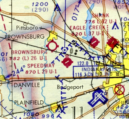
The December 1971 Sectional Chart (courtesy of Charles Germaine) depicted Speedway as having a 2,900' northeast/southwest paved runway.
Dave Slosson recalled, “In the summer of 1976 I flew into Speedway airport in a helicopter,
doing auto-rotations after maintenance with the Indianapolis Police Department's Hughes 269.
The mechanic I worked for had a Taylorcraft in the hangar at the far end, in the open area of the T's.
One of the female observers was taking flying lessons from Officer Jim Stanley, who later took over the FBO, in a Piper Colt at Speedway.
My father was also on the board of the Indianapolis Airport Authority from 1972-82.
I remember discussions about Speedway being in a poor spot as far as future plans for Indianapolis International,
not because the pattern was in the way, but because any approaches to either end of the main runway would conflict with the flow at IND.
It was just too close. It was also real close to the site of the Indianapolis VORTAC, as the sectionals show.”
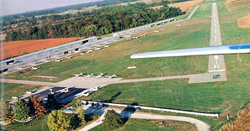
An aerial view by Roger Rozelle looking northeast after having departed from Speedway's Runway 24 from the 1979 AOPA Airports USA directory (courtesy of Jonathan Westerling).
Over 24 light aircraft were visible on the field.
The 1982 AOPA Airport Directory (courtesy of Ed Drury) described Speedway as having a 2,820' asphalt Runway 6/24 & a 2,345' turf Runway 9/27.
The operator was listed as Stanley Aviation Service.
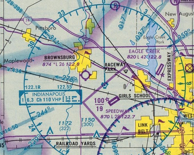
The 1984 St Louis Sectional Chart depicted Speedway as having a 2,800' northeast/southwest paved runway.
A 1987 airport directory (courtesy of Chris Kennedy) listed the operator as Speedway Aviation.
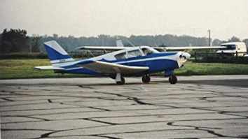
An August 1990 photo by Bob Fitzpatrick of the Comanche in which he flew into Speedway.
In Bob's words, “While I only flew out of there once, I often flew over it.
It was an airport that really didn't have to die, and I am sorry to see it gone.”
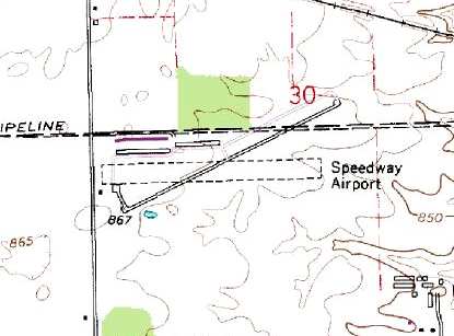
The 1992 USGS topo map depicted Speedway Airport
as having one paved runway & one unpaved runway,
along with 3 hangars on the northwest side of the field.
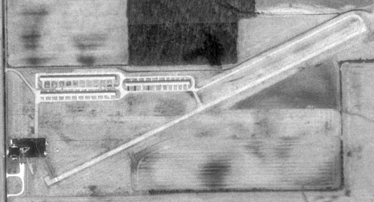
A 1993 USGS aerial photo depicted Speedway Airport as having a paved runway,
3 long hangars on the northwest side, and 3 light single-engine planes parked near a small hangar on the southwest side.
According to Indianapolis resident Phil Brooks, the northern-most of the 3 hangars (depicted in the 1993 photo)
was removed by "a tornado [which] blew through in the early 1990s, destroying several aircraft contained within.
A United mechanic had JUST moved his 2 or 3 aircraft in from San Francisco before the tornado hit."
According to Nick Newcomb, “I visited the library, and found some information about this airport.
The tornado went through on 4/27/94. The tornado destroyed '22 vintage airplanes & their hangars.'
They decided not to rebuild the hangar because there were already plans for a new airport.
The airport lasted in service longer than expected, it was supposed to be closed in the early 1990s, but lasted a few more years.”
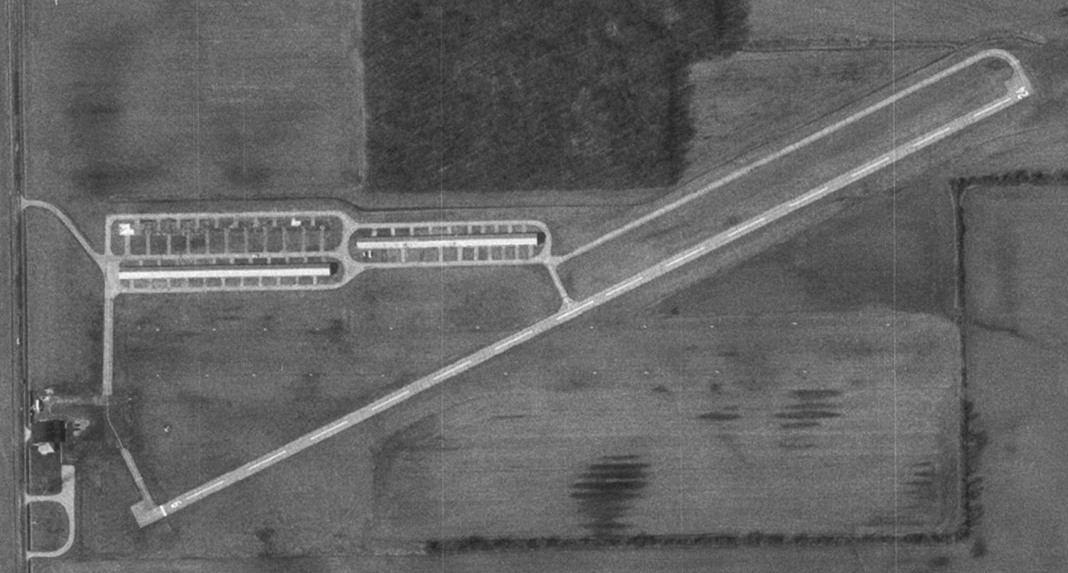
A 1998 USGS aerial view showed that Speedway Airport was not doing very well, as not a single plane was visible on the field.
It appeared as if it was already closed, yet it was still open.
Also note that the northern-most of the 3 hangars was missing, having been leveled a few years before by the tornado.
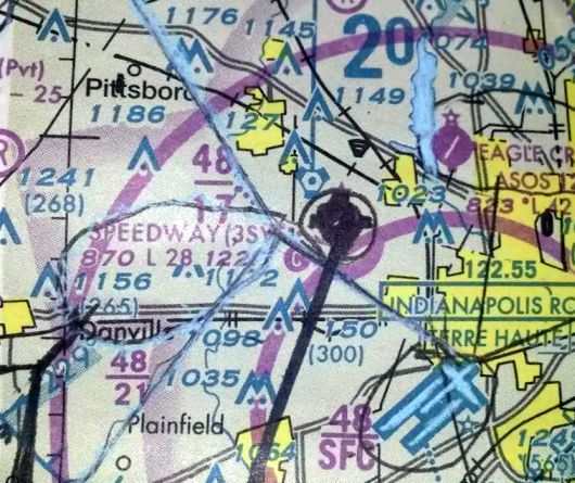
The last aeronautical chart depiction which has been located of Speedway Airport was on the 2000 Sectional Chart (courtesy of Ruth Wells).
It depicted Speedway as having a 2,800' paved runway.
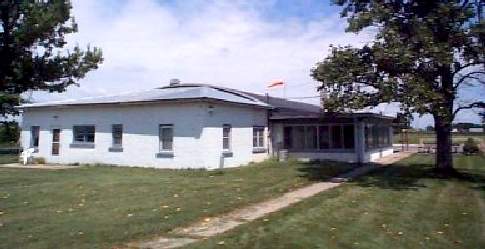
A 2000 photo of the office at Speedway Airport.
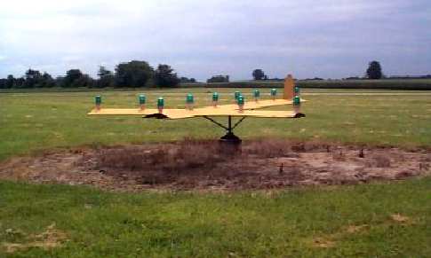
A 2000 photo of the wind indicator at Speedway Airport.
Speedway was still listed as an active airfield in the 2000 AOPA Airport Directory with a 2,820' asphalt Runway 6/24 & a 2,185' turf Runway 9/27.
The operator was listed as B & J Aviation.
In its latter days, Speedway Airport was owned by the Indianapolis Airport Authority.
According to Indianapolis resident Phil Brooks, "Speedway Airport was closed on New Year's Eve, 2001."
It was replaced by the new Hendricks County Airport (2R2), which opened in 2001 on Indianapolis' west side.
Dennis Fabbrini reported in 2003, "While on approach from the west today into Indianapolis, I noticed an X'ed off strip just northwest of Indianapolis International.
After checking a map, I determined it to be Speedway Airport.
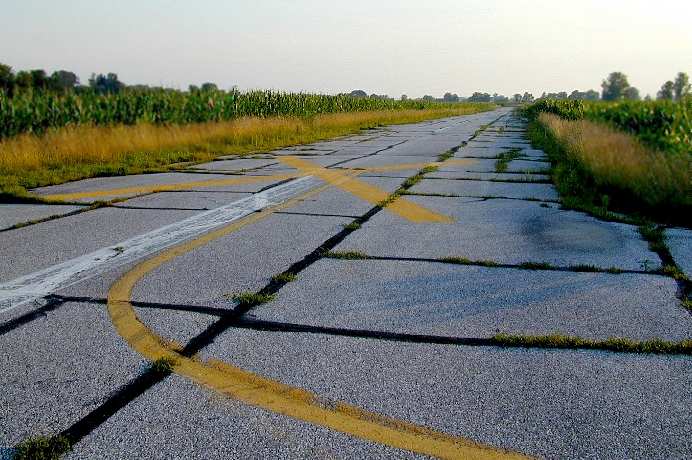
A 2003 photo by Dennis Fabbrini of Speedway Airport's abandoned Runway 3.
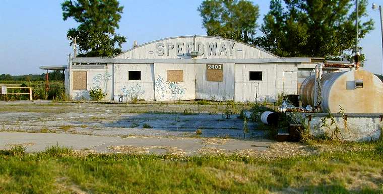
A 2003 photo by Dennis Fabbrini of Speedway Airport's abandoned main hangar.
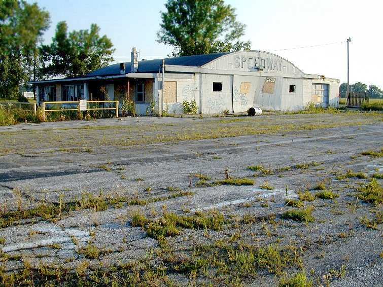
A 2003 photo by Dennis Fabbrini of Speedway Airport's abandoned main hangar & office.
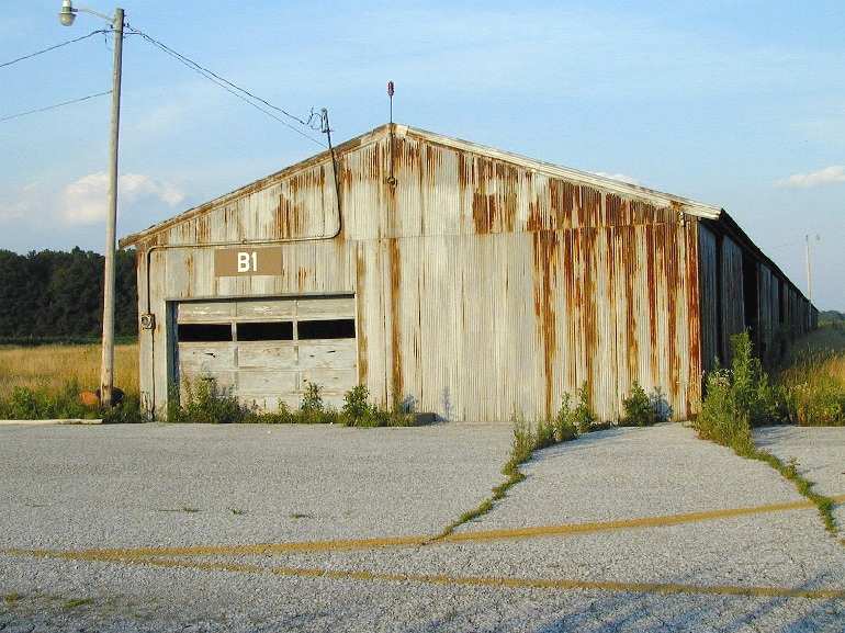
A 2003 photo by Dennis Fabbrini of Speedway Airport's abandoned B1 hangar.
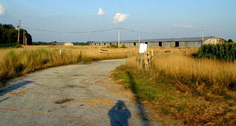
A 2003 photo by Dennis Fabbrini of other abandoned hangars at the former Speedway Airport.
Dennis Fabbrini continued, "The closure must have been recent, because the pavement is in pretty good shape.
Relatively fresh graffiti on the main hanger says 'goodbye old friend.'
Two long hangars sit on the north side of the field, with abundant tie-down area nearby.
The runway is oriented northeast/southwest.
New housing developments surround the field, and fresh fence posts around the perimeter of the property indicate new chain link is on the way."
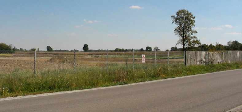
Phil Brooks visited the site of Speedway Airport on 10/4/04, to find "Nothing left - very sad."
This photo is of the "site of the main hangar, looking Southeast."
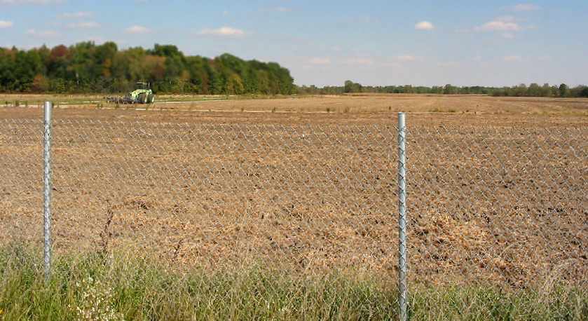
A 2004 photo by Phil Brooks, "looking East-Northeast, along what used to be the grass Runway 9/27, also showing the former hangar area on the left."
Speedway Airport was depicted as being closed on the December 2004 St Louis Sectional Chart (courtesy of Stu Sibitzky).
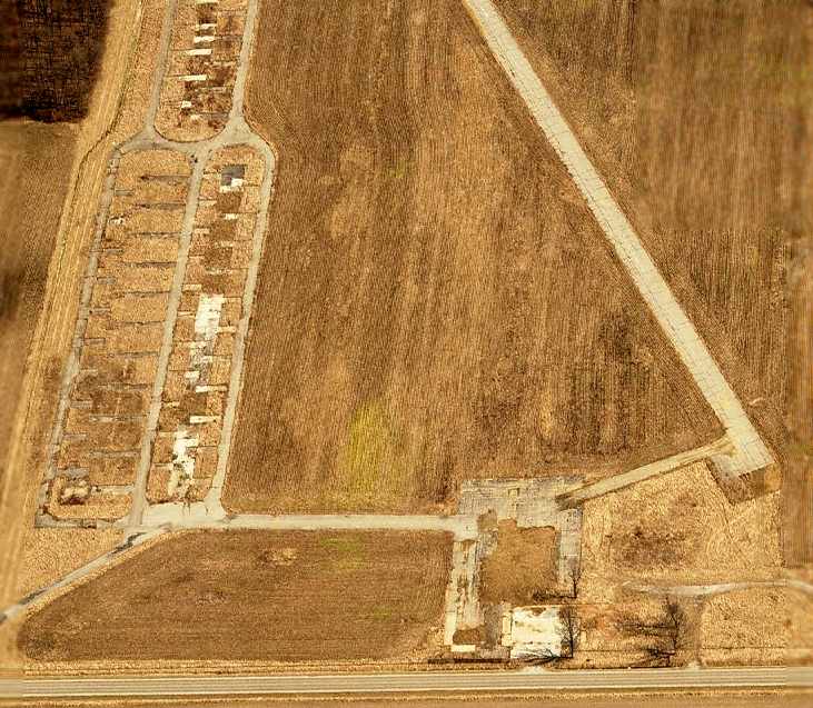
A sad sight – a circa 2006 aerial view looking east at the site of Speedway Airport,
showing all of the hangars to have been removed, but the runway & taxiway pavement still intact.
Jonathan Katz reported in 2008, “The site is still owned by the Indianapolis Airport Authority. It's 'For Sale' but there is no buyer.
They want $4M or so for all the property & were trying to sell it to the village of Avon, which is the incorporated town in the area.
I'd love to redevelop it as an airpark (it's in an area of booming home development & good schools) but I don't have the cash & the economy is the pits.
There was some talk about the land over the past year or two in the Indianapolis Star.
One of the reasons for the airport closure was listed as 'it interfered with traffic for IND.'
I find that hard to believe given that pattern traffic at 3SY would be below any approach or take-off from Indianapolis' Runway 14/32.”
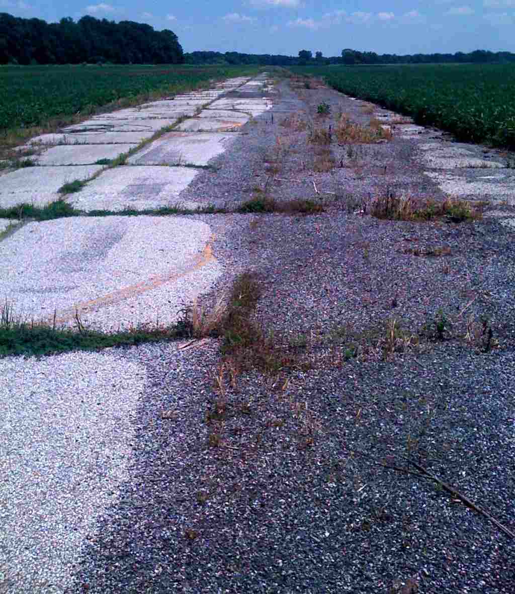
A 2010 photo by Jonathan Katz looking along the remains of the Speedway paved runway.
Jonathan reported, “The Indianapolis Airport Authority is still trying to sell the land that made up the Speedway Airport.
They're still farming the greenspace & letting the tarmac decay.”
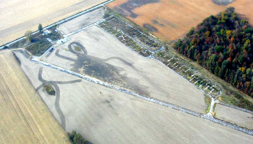
A 10/11/10 aerial view by Phil Brooks looking northwest at the abandoned Speedway Airport.
Phil Brooks noted in 2010 an unusual aspect of the Indianapolis Airport Authority's advertisement for selling the Speedway Airport land:
“Either they've forgotten why the airport was closed, or are engaging in revisionist history. This is the first time I'd heard the tornado excuse!”
Tom Townsend reported on 3/5/11, “I visited the Speedway airfield & it is the same as listed [above].
It is surrounded by new housing developments & probably will go under the bulldozer soon.”
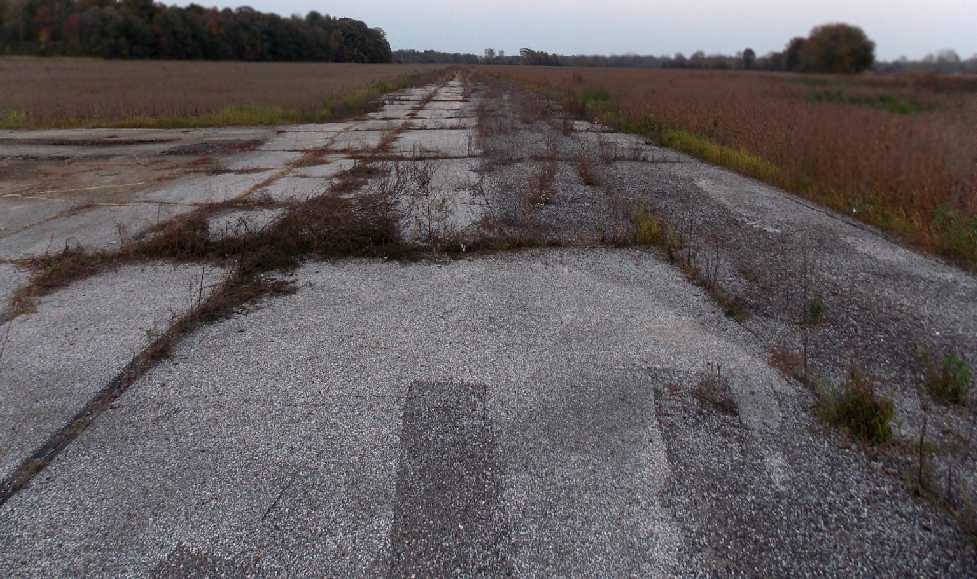
A 10/4/12 photo by Nick Newcomb looking northeast along Runway 6, with the main taxiway to the left.
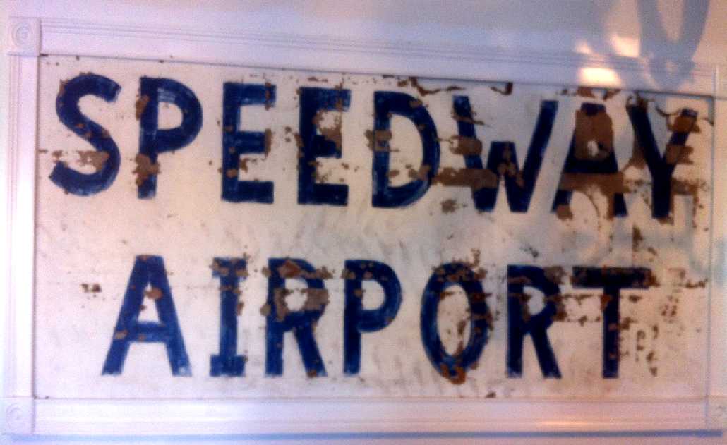
A 2013 photo by Dave Smith of a Speedway Airport sign.
Dave Smith recalled, “When they were tearing it down I noticed a 'Speedway Airport' sign sitting on top of a trash pile,
so I took it, hung it in my garage & nicely framed it. It's a cool conversation piece now.”
Phil Brooks reported in 2014, “The area is STILL undeveloped. What a waste of a nice airport.
Just to the southeast is the Outer Marker for IND Runway 14, but it's been years since that runway was used on a regular basis for landings, so there wasn't really a conflict.
Interestingly, the 'cutout' in the Class C airspace to accommodate a left downwind to Runway 21 at Speedway still exists on the latest St. Louis Sectional,
despite the airport being gone for 12 years!”
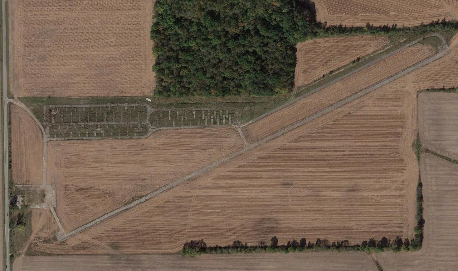
A 2015 aerial view shows the site of Speedway Airport to remain mostly intact, without redevelopment.
What a shame that this nice little airport had to be closed, with the property to remain completely unused 14 years later.
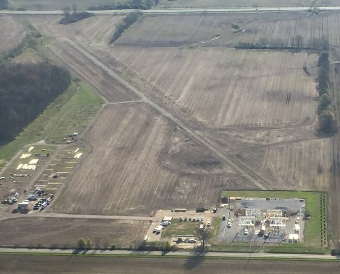
A 4/20/20 aerial view by Phil Brooks looking east at the remains of Speedway Airport.
Phil reported, “There has finally been something built on the property, an electrical substation”, over the southwest end of the former Runway 6.
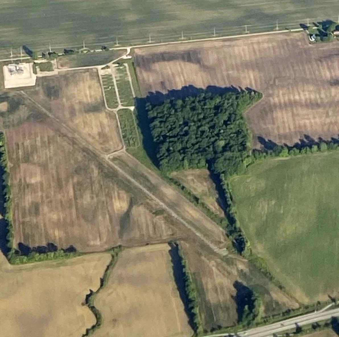
A 6/14/21 aerial view by Phil Brooks looking northwest at the remains of Speedway Airport.
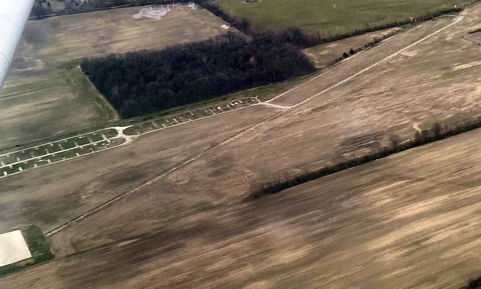
A 4/20/22 aerial view by Phil Brooks looking northeast at the remains of Speedway Airport.
Phil observed, “The only thing that’s been built is the substation on the west end.
There appears to be a concrete pad on the left side of the photo; that may have something to do with the substation.”
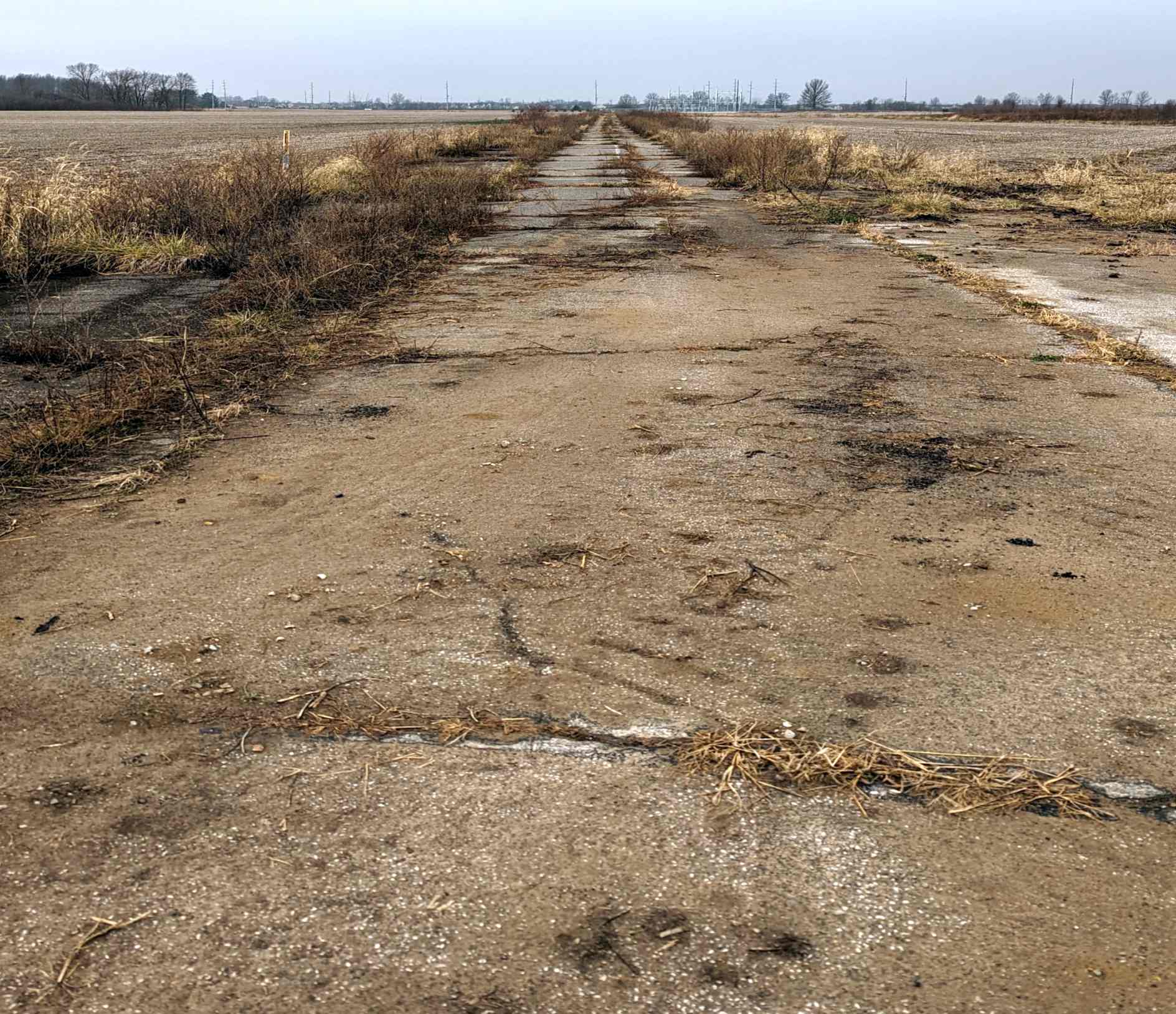
A 12/10/22 photo by Brandon Jett looking along the remains of the Speedway Airport runway.
Brandon observed, “There's a warehouse that's been built on the northeast end & I think their drainage pond may have resulted in the removal of a small portion of the runway,
but it generally still seems intact, though clearly overgrown.”
The site of Speedway Airport is located northeast of the intersection of West 21st Street & Griswold Road South.
Thanks to Dennis Fabbrini for pointing out this airfield.
____________________________________________________
Stout Field / Stout Army Airfield, Indianapolis, IN
39.74, -86.23 (East of Indianapolis International Airport, IN)
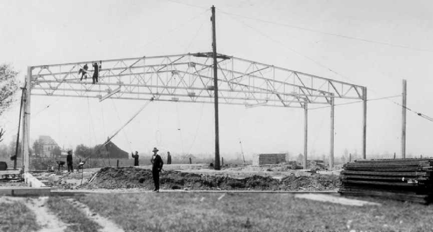
A photo captioned “1st hangar at Staut [sic] Field 1927” (courtesy of Becky Strosnider).
This former airfield is located only 2 miles east of the present-day Indianapolis International Airport.
Stout Field was built in the 1920s by the city of Indianapolis as a municipal airport & a home for the Indiana National Guard.
According to the City of Indianapolis web site, it was also initially known as the Mars Hill Airport,
and it was the first airport to provide Indianapolis with passenger & mail service.
The earliest depiction of Stout Field which has been located was a photo captioned “1st hangar at Staut [sic] Field 1927” (courtesy of Becky Strosnider).
It depicted the construction of the frame of a hangar.
In 1928, with expansion possibilities at Stout already limited, the city realized it needed a larger airport,
and it purchased 1,000 acres 2 miles west to build what would eventually become Indianapolis International Airport.
Stout Field was then turned over to the state to be used primarily by the National Guard & as a secondary commercial airport.
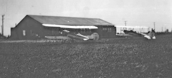
The earliest photo which has been located of aircraft at Stout Field was a circa 1928-30 photo of 2 unidentified biplanes in front of a hangar.
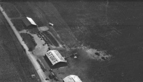
A circa 1928-30 aerial view looking southwest at Stout Field showed several hangars (one of which was painted “Stout” on its roof)
along the east side of a grass field, with 4 aircraft visible on the field.
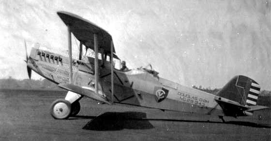
A circa 1929 photo of a Douglas O-2H biplane at Stout Field.
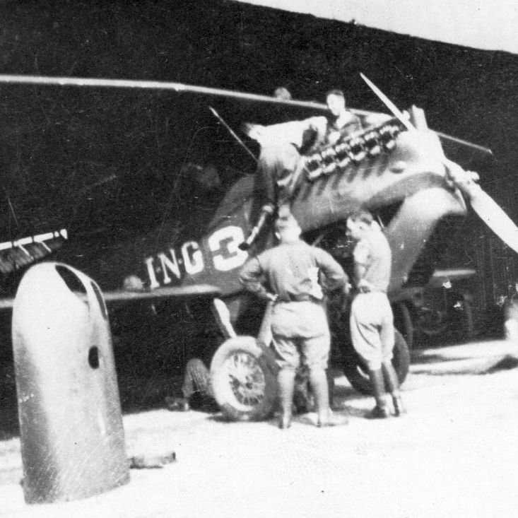
A 1929 Indiana Army National Guard Air Corps photo by Sgt. Fred Mangold of 2 Indiana soldiers inspecting an unidentified biplane at Stout Field.
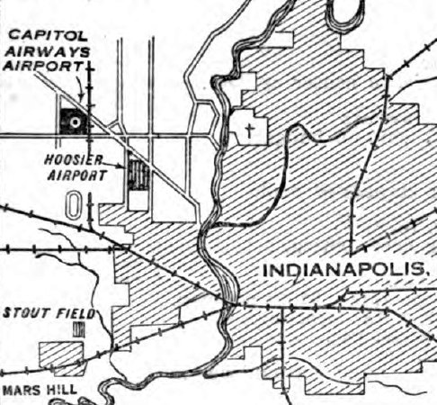
The location of Stout Field, as depicted on the 3/18/29 Commerce Department Airway Bulletin #585 (courtesy of Lee Corbin).
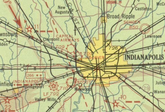
The earliest aeronautical chart depiction which has been located of Stout Field was on the November 1933 Cincinnati Sectional Chart.
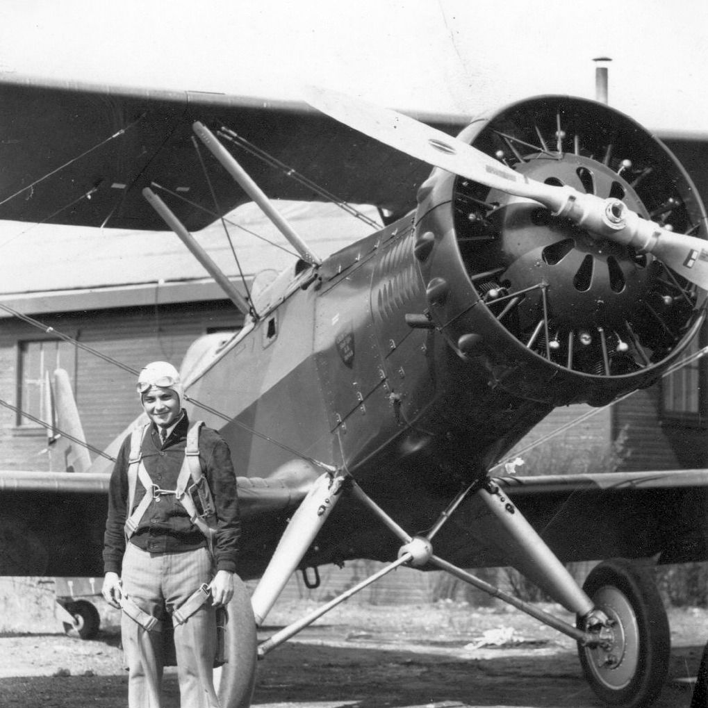
A 1935 Indiana Army National Guard Air Corps photo of Sgt. Fred Mangold of the 113th Observation Photo Section & an unidentified biplane at Stout Field.
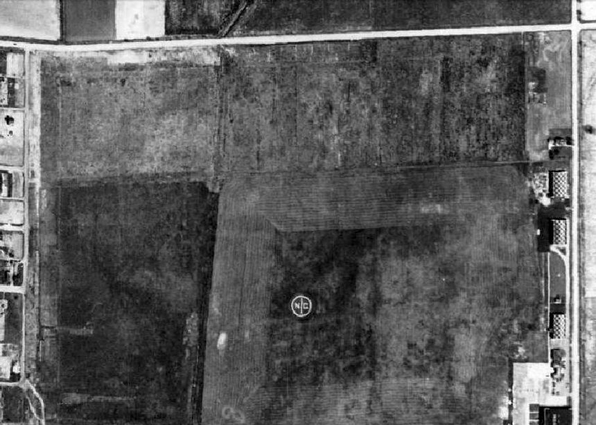
A 1937 aerial photo (from http://maps.indy.gov/MapIndy/) depicted Stout Field as a square grass field
with an “NG” (National Guard) marking in the center & several checkerboard-roofed hangars along the east side.
The Airport Directory Company's 1937 Airports Directory (courtesy of Bob Rambo)
described Stout Field as being operated by the National Guard, and consisting of a 2,800' square sod field.
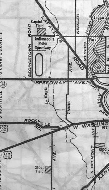
A 1938 street map of Stout Field (courtesy of Kevin Walsh).
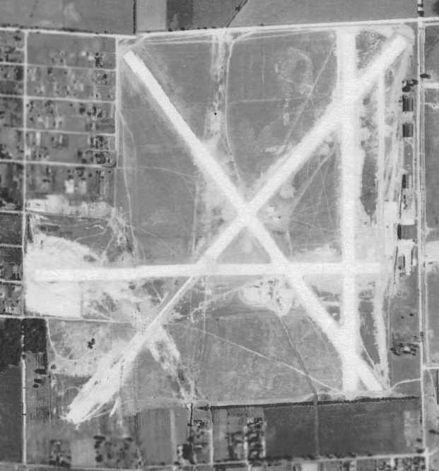
A 1941 aerial view of Stout Field from the IN University Electronic Atlas of Central IN Historical Aerial Archive (courtesy of Chris Kennedy)
depicted Stout's 4 runways in the process of being paved, and 4 hangars along the east side.
In early 1942 the Army Air Forces leased the nearly empty airport from the state
& converted it into a training field & headquarters for the newly created I Troop Carrier Command.
It operated C-47, C53 & C-46 transports.
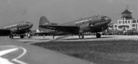
A WW2-era photo of 2 Curtiss C-46 Commando transports in front of Stout's control tower.
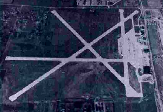
A 11/17/43 aerial view looking north from the 1945 AAF Airfield Directory (courtesy of Scott Murdock)
showed that Stout Field had gained paved runways, a large paved ramp, and another hangar between 1941-43.
In 1944 Stout acquired a glider pick-up school as well.
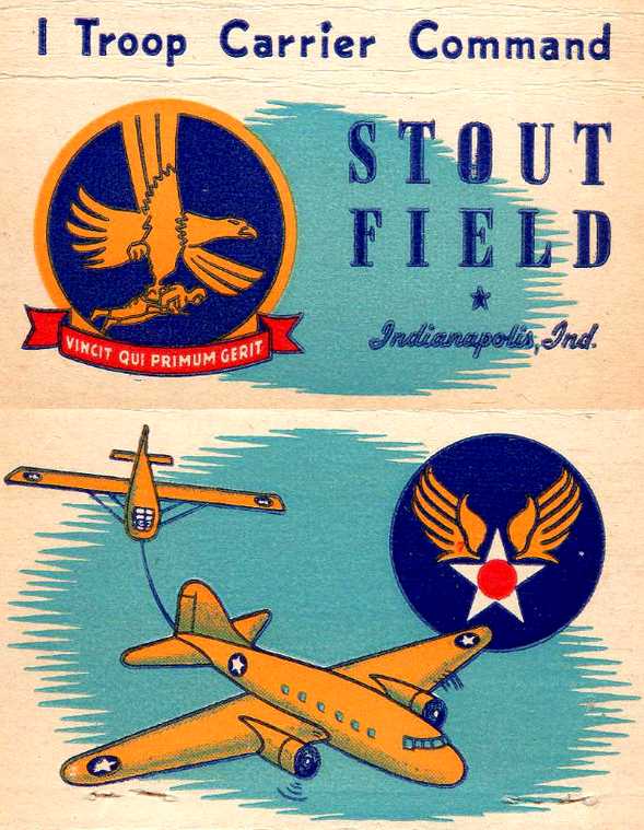
A WW2-era matchbook cover for Stout Field, showing a C-47 towing a glider.
The airfield at Stout Field was significantly expanded during WW2,
as the 1944 US Army/Navy Directory of Airfields (courtesy of Ken Mercer)
described the field as having a 4,500' hard-surface runway.
Ralph Miller recalled, “Stout Field... In the summer of 1944, I attended a 2-week camp there for Civil Air Patrol Cadets. I was 16.
They were training Waco CG-4A glider pilots & snatching them with C-47s.
Ground school was very good, well organized & thorough.
Most glider snatching was on the grass beside Runway 4.
The high point for the Cadets was a ride in a glider snatched by a C-47.
There was a roar as the tow plane passed overhead just above us.
Then the jerk as he caught the tow line loop between 2 upright poles.
The nose dipped as we gained speed sliding on the skids & then rolling on the wheels.
We climbed rapidly, but it was quiet. We could see the C-47 ahead of us.
He banked left for a 180 degree turn to parallel the runway. Then another to fly overhead the landing point.
The glider pilot cut us loose there & started a 360 left to glide back to land near the starting point.
The landing was smooth & he lifted the tail to lower the nose to drag the skids to stop. A great flight!”
Ralph continued, “One day as we rode a bus from the classrooms at the south end of the field to the quarters area at the north end for lunch,
we passed by a very large 4-engine very shiny new bomber parked on the ramp.
We were instructed to forget we had seen it. It was the first I knew of the B-29s. It was gone when we passed by again.”
According to the book "Forgotten Fields of America, Volume III" by Lou Thole,
during WW2 Stout Field was comprised of a total of 357 acres, and had approximately 150 buildings.
The 1945 AAF Airfield Directory (courtesy of Scott Murdock) described Stout Field
as a 357 acre irregularly-shaped property containing 3 concrete runways, the largest being the 4,495' northeast/southwest strip.
The field was said to have 2 hangars, the largest being a 247' x 209' concrete & steel structure.
Stout Field was described as being owned by the State of IN & operated by the Army Air Forces.
After the war, the I Troop Carrier Command headquarters was transferred to Greenville, SC, and Stout stood vacant for a while.
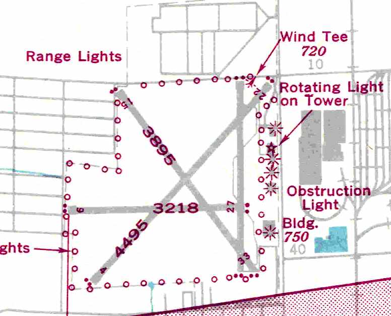
A 1946 USAAF KS-NY Pilot's Handbook (courtesy of Chris Kennedy)
depicted Stout as having 3 paved runways, with the longest being the 4,495' Runway 4/22.
In 1947 the field was returned to the state & again became the home of the Indiana National Guard.
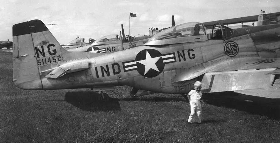
A circa 1947 photo of several Indiana National Guard P-51 Mustang at Stout Field.
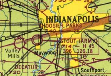
"Stout (Army)" was described as having a 4,500' paved runway on the 1948 Cincinnati Sectional Chart (courtesy of Chris Kennedy).
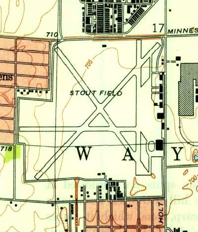
The 1948 USGS topo map depicted Stout Field as having 4 paved runways, and a ramp & buildings along the east side.
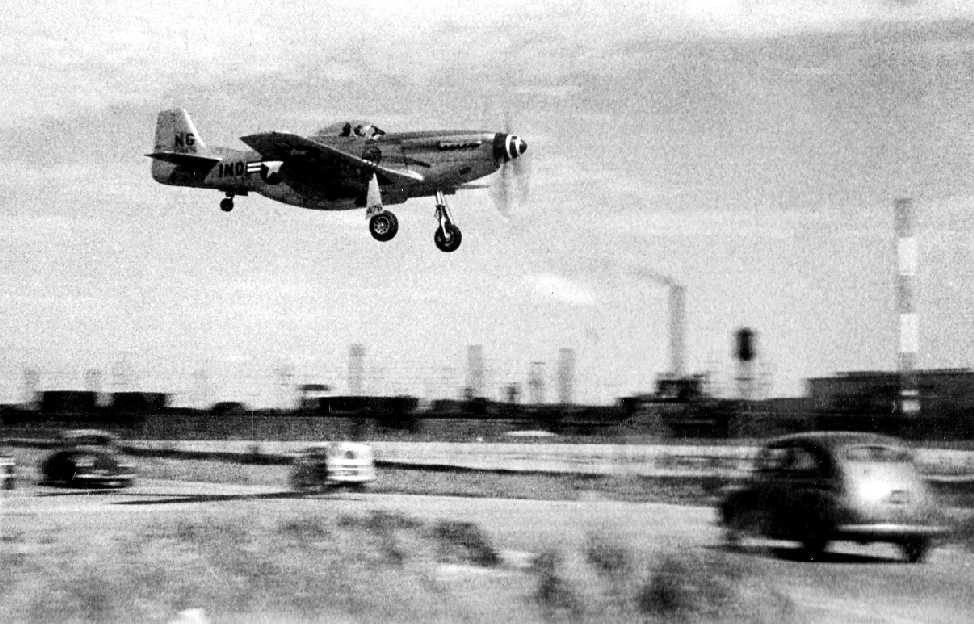
A circa late 1940s photo by Harry Cole of a National Guard “P-51 Mustang about 20-30' above Minnesota Street, gear down heading to a landing” at Stout Field.
Harry recalled, “I grew up in Indy about 3 miles from Stout Field.
I remember riding in my dad's car & the aircraft flying so low my brother and I thought it was going to land on us.
I know these photos are of Stout Field because of the buildings of what I knew was Bridgeport Brass in the background.”
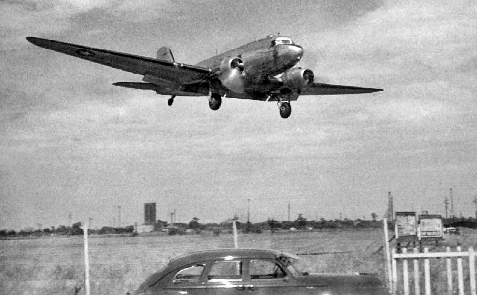
A circa late 1940s photo by Harry Cole “of a C-47 on final approach with gear down about 20-30' above the ground & north of Minnesota Street”, landing at Stout Field.
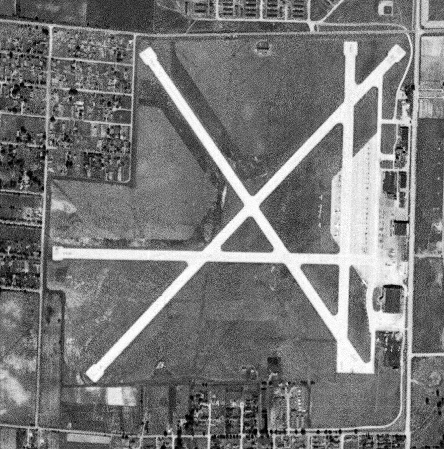
The last photo which has been located showing aircraft at Stout Field was a 9/1/48 USGS aerial view.
Dozens of aircraft were parked on the east side, both on the ramp & on the grass.
Stout Field was described as having a 4,500' paved runway on a 1953 Flight Chart (courtesy of Scott O'Donnell).
Jim Slater recalled, “I've lived in Indianapolis since late 1955,
and as luck would have it, I lived about 1 & ½ blocks west of Runway 9.
Living in between 2 airports in the 1950s was exciting sometimes.
There was always something going over the house... day & night!
I remember, on weekend, 'adults' would bring their model airplanes to the west end of Runway 9 & fly them.
They were using 60 foot wires to do this, so as a youngster, it was fun to watch.
Sometime in about 1956, they used part of Stout Field for sports car racing.
Now and then, an old National Guard Otter would come out, do an engine check & then taxi back to a hangar.
The Indiana State Police had some very beautiful aircraft parked at Stout... V-tailed Bonanzas.
These aircraft had a wonderful turquoise & white color scheme.
These would takeoff & land now & then, but not on Runway 9,
(too many houses at the west end of the runway).”
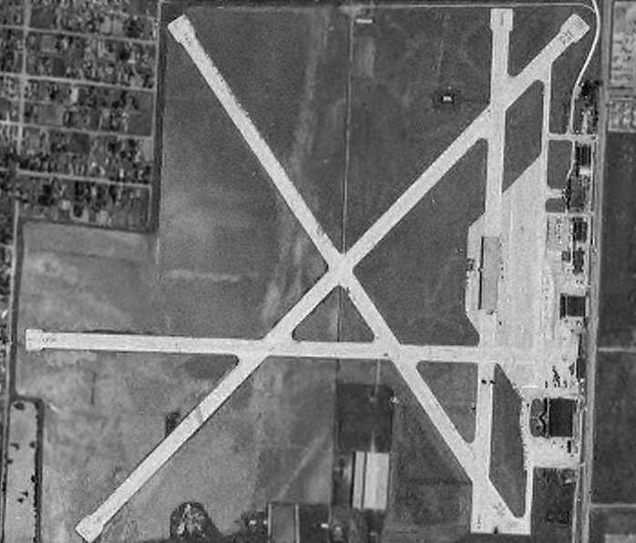
In the 1956 aerial photo of Stout AAF from the Electronic Atlas of Central IN (courtesy of Chris Kennedy),
the airfield looked for all intents abandoned, as not a single aircraft was visible on the entire field.
But all 4 runways remained intact.
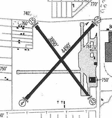
Stout was still depicted in the 1960 Jeppesen Airway Manual (courtesy of Chris Kennedy),
but the field was described as being "available to IN National Guard, State Police, and Highway Department aircraft only."
The field was depicted as having only 2 active runways (4,490' Runway 4/22 & 3,890' Runway 15/33).
The north/south & east/west runways were still depicted, but they had apparently been closed.
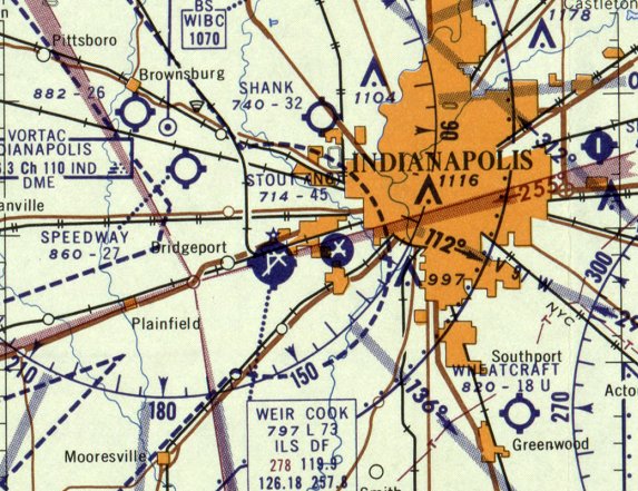
The last aeronautical chart depiction which has been located of Stout Field )" was on the January 1960 Cincinnati Sectional Chart.
It depicted “Stout (ANG)” as having 3 paved runways, with the longest being 4,500'.
Stout AAF was closed at some point between 1960-61,
as it was labeled "Stout (NG) (Closed)" on the 1961 Cincinnati Sectional Chart (courtesy of Chris Kennedy).
Jim Slater recalled, “By 1961, buildings were popping up on some of the runways. After that, it stopped looking like an old airport.
It took on the appearance of an industrial park combined with a parking lot for National Guard trucks.”
Stout Field appeared to remain largely intact in a 1962 aerial photo, but several buildings had been constructed over Runway 15.
Stout Field was depicted as an abandoned airfield on the September 1969 St. Louis Sectional Chart (courtesy of Ron Plante).
Jim Slater recalled, “By the mid-1970s, there were 2 F-80s mounted on pylons at the southeast & northeast end of the field.”
By 1977, portions of the land not used by the National Guard were sold off to become an industrial park.
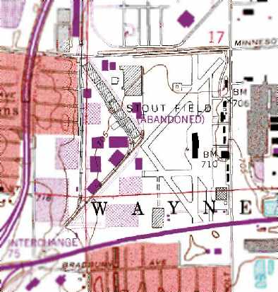
The 1986 USGS topo map still depicted several remaining runways at “Stout Field (Abandoned)”.
According to Jim Slater, “There were plans to make an outdoor museum so a collection of different aircraft started coming together,
but something changed by the mid 1980s & most of it was gone.”
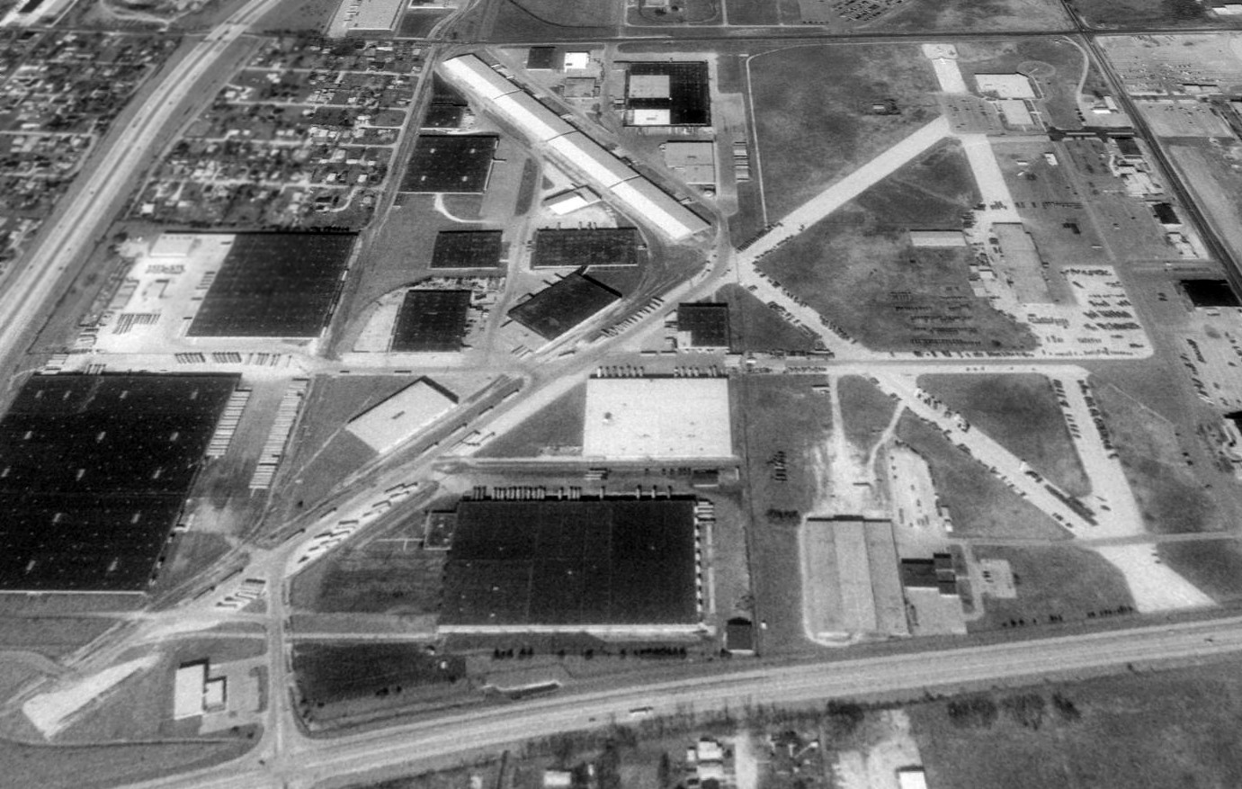
A 1992 USGS aerial view looking north showed warehouses had been built over significant portions of the Stout Field runways,
and other portions of the runways were used for vehicle parking.
According to Jim Slater, “In the mid-1990s, there was still 1 aircraft parked at the field.
It was a static display the public hardly noticed it. An old F-101 Voodoo was all that was left.
Needless to say, I took my young daughter to Stout Field 1 day,
got permission from the National Guard to walk out to the F-101 & I took her picture standing next to it.
She was more interested in the birds that were flying in & out of the air intakes.”
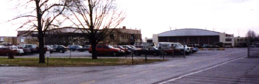
A 1994 photo by Lou Thole (author of the book "Forgotten Fields of America") of former hangars at Stout Field.
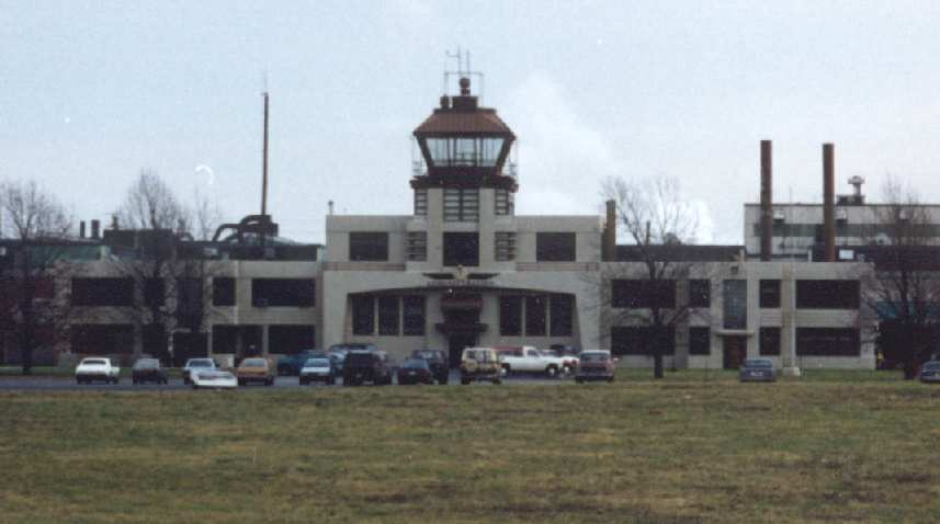
A 1994 photo by Lou Thole (author of the book "Forgotten Fields of America")
of Stout Field's former headquarters building (with control tower on top).
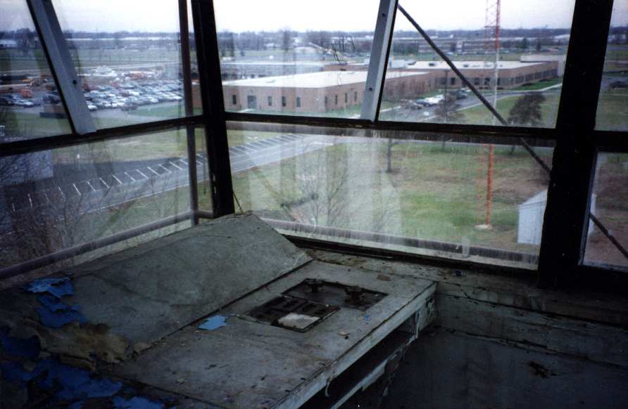
A 1994 photo by Lou Thole showing the view from inside Stout Field's former control tower.
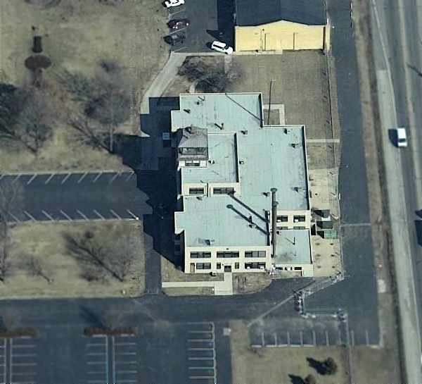
A circa 2005 aerial photo looking north at Stout's remaining control tower building.
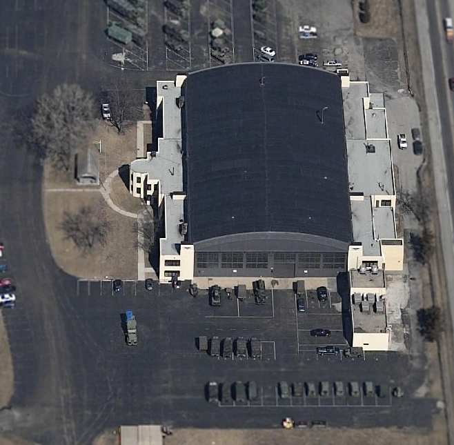
A circa 2005 aerial photo looking north at 1 of 2 remaining hangars at Stout Field, on the southeast corner of the base.
Jim Slater reported that by 2005, the static display F-101 formerly at Stout Field “was long gone.”
Jim Slater reported in 2006, “The old control tower & a couple of the old hangars are still at Stout Field.
Old, crumbling runways can still be found, along with yellow painted lines, but you have to look for them.
They're all reminders of how this airport, at 1 time, was an active place, pointing to the future.
Funny how when we sometimes look so hard for the future, we forget & bury our past.”
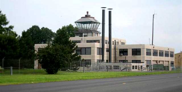
A 2008 photo by Dick Merrill of Stout's control tower.
Dick reported, “The guard said I couldn't get on the field to take photos of the old terminal.”
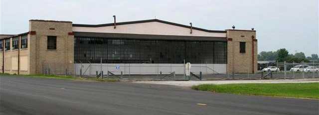
A 2008 photo by Dick Merrill of a former hangar at Stout Field.
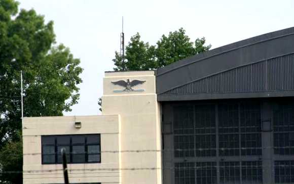
A 2008 photo by Dick Merrill of a military emblem on a former hangar at Stout Field.
Brian Harrier of Tippmann Properties reported in 2008, “The history of Stout Field is not completely forgotten.
I manage many of the industrial buildings in the park.
We still refer to the buildings that were built on Runway 15 as the 'Runway Buildings'.
Grass does not easily grow on the north end, possibly where the runway lights used to be.
We also use some of the original brick drainage system that dates back well before 1961.”
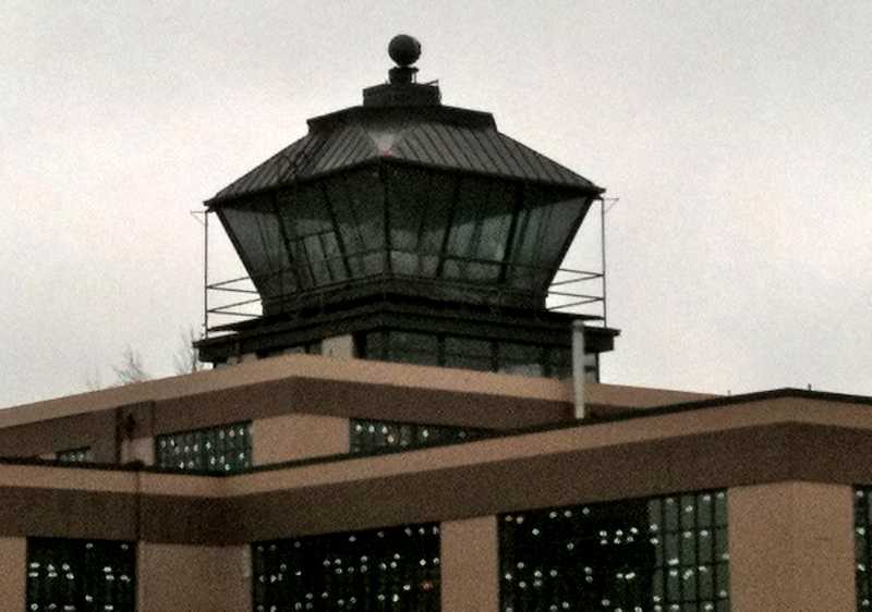
A 3/5/11 photo of the Stout control tower by Tom Townsend.
Tom reported, “I could not get through the gate, but the guard said that the Indiana Historical Society is rehabbing the tower & visits can be arranged by calling them in advance.”
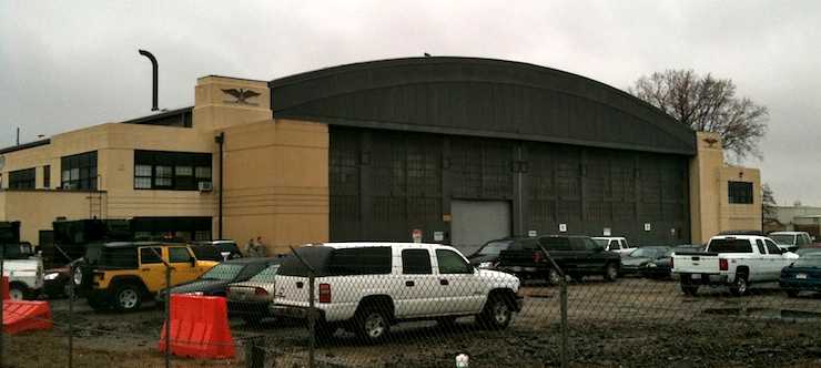
A 3/5/11 photo of a Stout hangar by Tom Townsend.
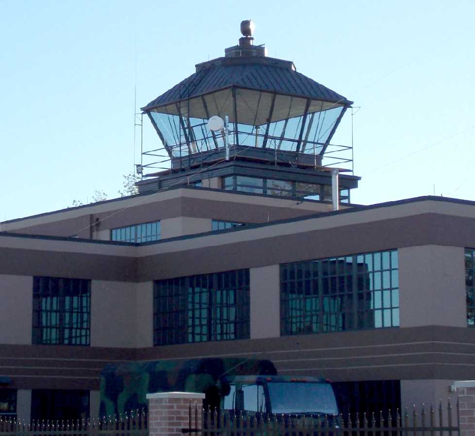
A 9/22/12 photo of the Stout control tower by Nick Newcomb.
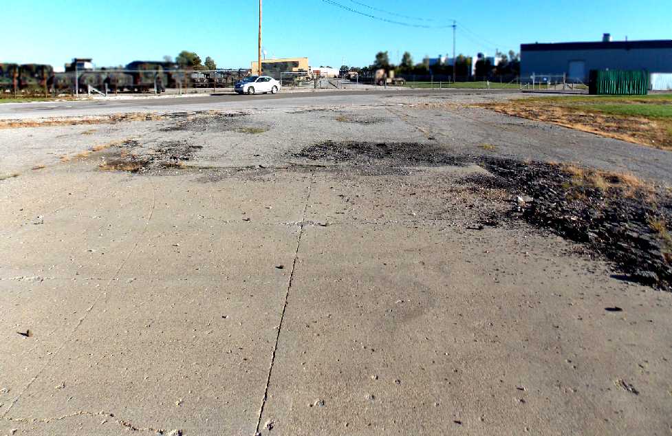
A 9/22/12 photo by Nick Newcomb of Stout's “original runway pavement, you can get a good idea of the condition from this picture.
There is a road that runs right through the center of the field, and the National Guard is stationed there now. Barbed wire fences surround much of the field.
Parts of the former runways are now degraded, and covered with gravel from the runways, but there are some patches of runway that are visible.
The concrete itself seems to be in pretty good condition in some places.”
H. Bennis reported in 2013, “The tower building has been renovated & is used for National Guard office space.
The hangar immediately south was used to refurbish the bronze top from the monument on the circle last year.
It is now office space for the Employer Support of the Guard & Reserve.
The hanger (Building 9) on the southeast corner was headquarters for the Indiana Guard Reserve & a National Guard military police company.
Both have moved to Tyndall Armory downtown & the hangar is being extensively refurbished.
Last year it was used for the American Legion convention & a job fair.
The National Guard Joint Forces Headquarters is also undergoing some major additions.
The 38th Infantry Division vehicle maintenance depot has doubled in size on the southwest corner.”
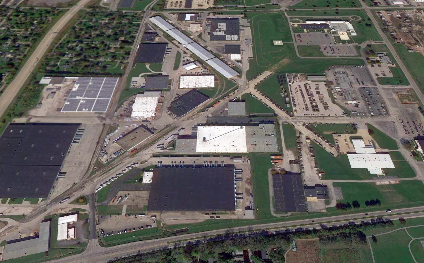
A 2016 aerial view looking north showed the alignment of Stout Field's runways was still recognizable.
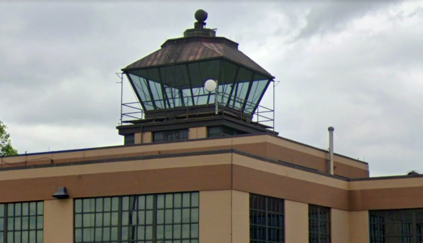
A May 2019 photo looking southwest at the former Stout control tower.

A May 2019 photo looking northwest at a former Stout Field hangar which remains on the southeast corner of the site.
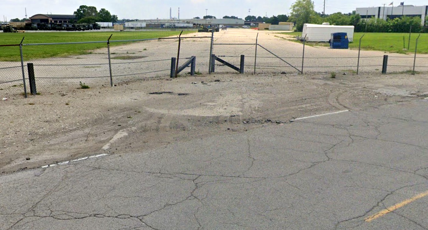
A May 2019 photo looking south along the former Stout Field Runway 15, with the former hangar visible at top-left.
As of 2023, street maps label for the former Stout control tower building as “Joint Force Headquarters”.
____________________________________________________
Or if you prefer to contact me directly concerning a contribution (for a mailing address to send a check),
please contact me at: paulandterryfreeman@gmail.com
If you enjoy this web site, please support it with a financial contribution.
____________________________________________________
This site covers airfields in all 50 states.