
Abandoned & Little-Known Airfields:
North-Central Massachusetts
© 2002, © 2026 by Paul Freeman. Revised 2/5/26.
This site covers airfields in all 50 states: Click here for the site's main menu.
____________________________________________________
Please consider a financial contribution to support the continued growth & operation of this site.
Clinton Airport / Balboni Airport / Bolton Airport (revised 6/26/20) - Fort Devens AAF / Ayer NAAS / Moore AAF (revised 10/20/23) - Marlboro Airport (revised 3/24/21)
Pine Hill Airport (revised 8/23/05) - Shirley Airport (revised 7/18/21) - Turnpike Airport / Westboro Airport (revised 2/5/26)
____________________________________________________
Marlboro Airport (9B1), Marlborough, MA
42.343, -71.509 (West of Boston, MA)
Marlboro Airport, as depicted on the March 1933 Boston Sectional Chart.
According to the Marlboro Airport website, “Marlboro Airport was founded in 1922, the era when barnstormers flew by the seat of their pants.”
According to the Marlboro Airport website, Jack McManus served as Marlboro Airport manager from 1934–37,
and Charles Spaulding starting in 1937.
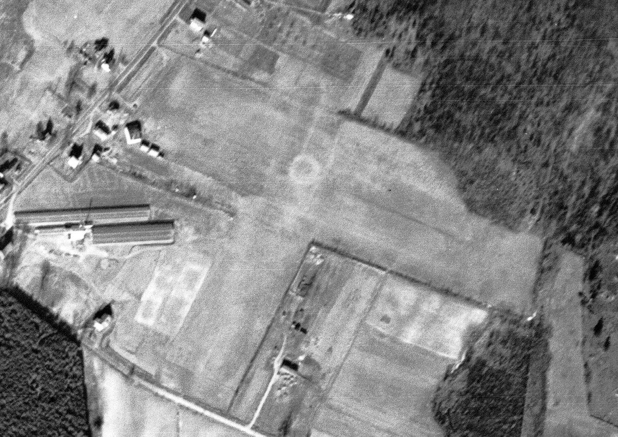
The earliest photo which has been located of Marlboro Airport was a 12/15/38 USGS aerial view.
It depicted the field as having 2 perpendicular grass runways, with an airport circle marking at the center, with some small hangars on the west side.
According to the Marlboro Airport website, Charles Spaulding served as Marlboro Airport manager until 1939, at which point Norman Sims took over.
Strangely, Marlboro Airport's FAA Airport/Facility Directory data listed an Activation Date of April 1940.
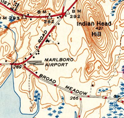
The 1943 USGS topo map depicted Marlboro Airport as an open area with a few small buildings on the west side.
According to the Marlboro Airport website, Norman Sims served as Marlboro Airport manager until 1946, and Don LaCouture starting in 1946.

A late 1940s photo of Donald Lacouture Sr. & his wife after he became Manager of Don's Flying Service at Marlboro Airport (courtesy of Ralph Bennett).

The 1949 Boston Local Aeronautical Chart (courtesy of Tim Zukas) depicted Marlboro Airport as having a 1,700' runway.
The 1953 USGS topo map still depicted Marlboro Airport as an open area with a few small buildings on the west side.

A mid- to late-1950s aerial view looking southeast at Marlboro Airport during final approach to Runway 14 (courtesy of Ralph Bennett),
showing 2 grass runways, a few small hangars, and 2 light single-engine planes on the west side.
Dick Bicknell recalled, “My most favorite base was 9B1 Marlboro (R.I.P.).”

A late 1950s – early 1960s aerial view looking west at Marlboro Airport during an antique airplane fly-in (courtesy of Ralph Bennett).
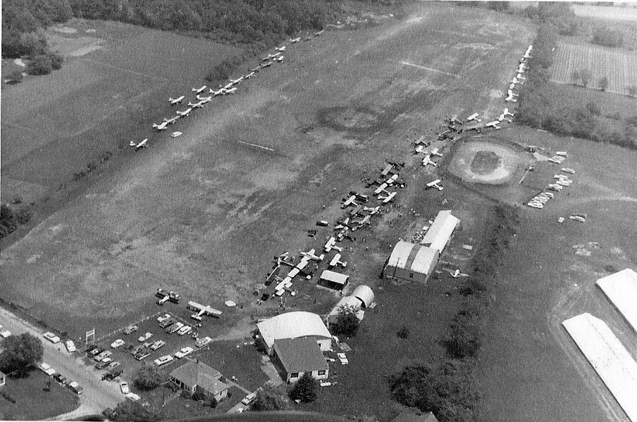
A late 1950s – early 1960s aerial view looking east at Marlboro Airport during an antique airplane fly-in (courtesy of Ralph Bennett).
An undated aerial view from the 1965 MA Airport Directory (courtesy of Jonathan Westerling) depicted Marlborough as having a single northwest/southeast runway, with a several small buildings & 16 light aircraft on the west side.
The Manager was listed as Don LaCouture & the Fixed Base Operators as Don's Flying Service & Dorr's Aviation.

The 1969 USGS topo map showed Marlboro Airport had gained a paved northwest/southeast runway at some point between 1953-69.
David Fogarty recalled, “My Uncle Steve Fogarty was one of my original flight instructors out of Marlboro; Don's Flying Service flying C-150s.”

An 11/17/80 USGS aerial view depicted Marlboro Airport at perhaps the zenith of its popularity, with at least 48 light aircraft visible parked around the airport.
Eric Meltzer recalled, “I did my first 10 hours [of flight instruction] at Marlboro Airport as well as ground school in late 1991/92
when Don Sr. was running the Fixed Base Operation & later checked out in their Cess172 with Don Jr.”
Malcolm Dickinson recalled, “I landed at Marlboro once in 1994, shortly after getting my private certificate.
It was (and remains) the shortest airport I've ever landed at! Runway 14/32 was paved & only 1,659' long!”

A 1995 USGS aerial view looking northeast at Marlboro Airport depicted 2-dozen light single-engine aircraft parked around the airport.
According to the Marlboro Airport website, Don LaCouture served as Marlboro Airport manager until 1998,
and then Robert Stetson starting in 1999.
David Gray recalled, “During my Private Pilot training, my CFI Thomas Neal had me takeoff & land at Marlboro once.
I never dared attempt it solo though… The landing 'picture' was as if you were attempting to land in someones backyard, not at an airport.”
Eric Meltzer recalled, “I knew Bob Stetson briefly before & after he bought the airport around 2000.”

According to Jonathan Westerling, “The airport got some attention back in 2010 when Obama's helicopters & entourage landed there.”
News articles confirm that the airport's owner filed a lawsuit against the federal government for damages sustained by heavy vehicles, and the federal government made an undisclosed financial settlement.
The airport's owner, Robert Stetson, said no one cleared the use of the ground vehicles on the airport or checked on the facility’s limitations.
According to the Marlboro Airport website, Robert Stetson served as Marlboro Airport manager until 2012, Bruce Prentiss from 2012-2014, and Sandy Stetson starting in 2014.
As of 4/27/16, Marlboro Airport's FAA Airport/Facility Directory data described it as conducting an average of 48 takeoffs or landings per day.
As of 2017, Marlboro Airport's FAA Airport/Facility Directory data described it as having a single 1,659' asphalt Runway 14/32, “in fair condition”.
The owner & manager was listed as Sandy Stetson,
and the field was said to have a total of 25 based aircraft: 24 single-engine aircraft & 1 helicopter.

A 2017 aerial view looking northeast at Marlboro Airport showed the number of aircraft visible on the field had decreased to 9.
According to the Marlboro Airport website, as of 2017, “It is the oldest continuously operating commercial [air]field in the state of MA.
Currently it hosts one Fixed Base Operator, Don's Flying Service, named for former airport manager Don LaCouture Sr.
Don's Flying Service offers flight instruction, tie-downs & hangar space, and major & minor aircraft repairs.
Chapter 673 of the Experimental Aircraft Association is based at Marlboro Airport.
Also known as The Marlboro Antiquers (since many of the founding members owned antique airplanes), the chapter has about 40 members.”

The 2017 Boston Terminal Chart depicted Marlboro Airport as having a 1,600' paved northwest/southeast runway.
Graeme Smith reported in 2017, “The owner died last year. The wife & kids were not interested [in running an airport]. More money in developing the land.
There is outline approval for redevelopment [which] passed the local planning board. All the planes are moving out.
My Airframe & Powerplant mechanic was based there & has moved. The flight school moved to Southbridge.
The local EAA chapter is having a 'Last Cookout' there on Labor Day.”

An 8/27/17 aerial view by Graeme Smith on final approach for Marlboro Airport's Runway 32.
The Last Cookout announcement (courtesy of Graeme Smith) read: “With the pending sale of Marlboro Airport & the closing of the airport at the end of September,
Labor Day presents the last opportunity that EAA Chapter 673 will be able to host an impromptu cookout & gathering of all the friends of Marlboro Airport.
Monday 9/4/17 EAA Chapter 673 encourages all Chapter members & families, former members & families,
and friends & families of the airport to attend & enjoy the camaraderie, renew old friendships & tell tales of the aviators.”

A 4/1/18 photo by John Mockus of the Don's Flying Service Inc. hangar at Marlboro Airport.
John reported in 2018, “Marlboro Airport... it was probably officially closed, but the owner Mrs. Stetson told me there are still 10 planes in the hangars awaiting removal by the owners.
Her husband died last year, and this was his baby - he told her after he dies, take the money & run.”
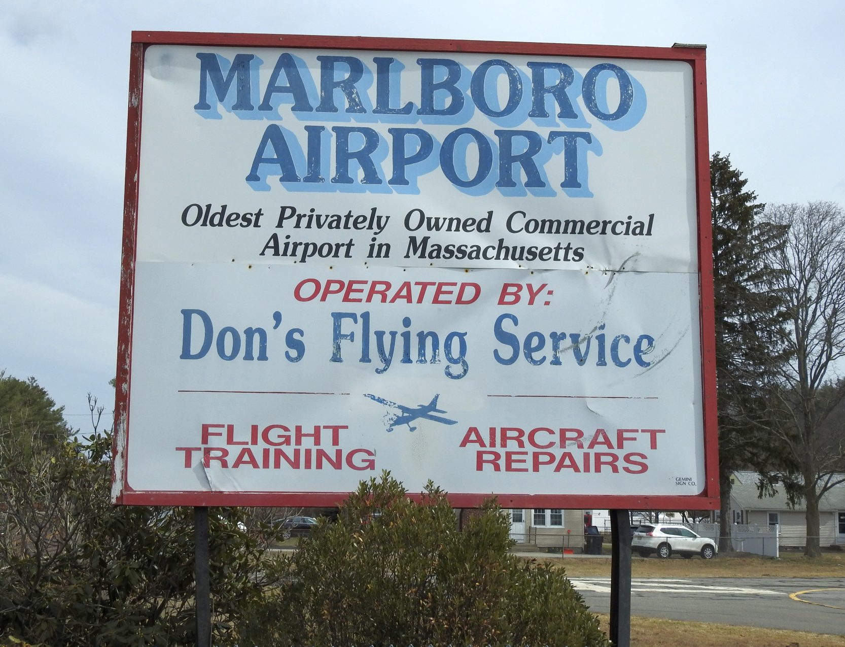
A 4/1/18 photo by John Mockus of the Marlboro Airport sign.

A 4/1/18 photo by John Mockus of a propeller adorning a Marlboro Airport hangar.

A 4/1/18 photo by John Mockus looking northwest along Marlboro Airport's Runway 32.

A 4/1/18 photo by John Mockus of a 1959 Cessna 182B in front of the Dorr Aviation hangar at Marlboro Airport.

A 4/1/18 photo by John Mockus of a partially-disassembled 1964 Cessna 150E inside an open-air shelter at Marlboro Airport.
The end for Marlboro Airport unfortunately finally came on 12/20/18, when NOTAM 12/074 (courtesy of Graeme Smith) announced the airport to be permanently closed.

A 3/9/19 aerial view by Graeme Smith looking north at a snow-covered Marlboro Airport, still intact but sadly devoid of any planes.

A sad sight for any aviator: a 3/16/19 photo by Eric Meltzer of the “Airport Closed” sign at Marlboro Airport.
Eric reported, “Such a shame to watch another great, small field go down but it was probably inevitable considering real estate prices & encroachment anywhere in the greater Boston area, as well as other factors affecting GA.”

A 3/16/19 photo by Eric Meltzer of a Marlboro Airport hangar.

A 3/16/19 photo by Eric Meltzer of the Marlboro Airport runway, ramp, and fuel pump.
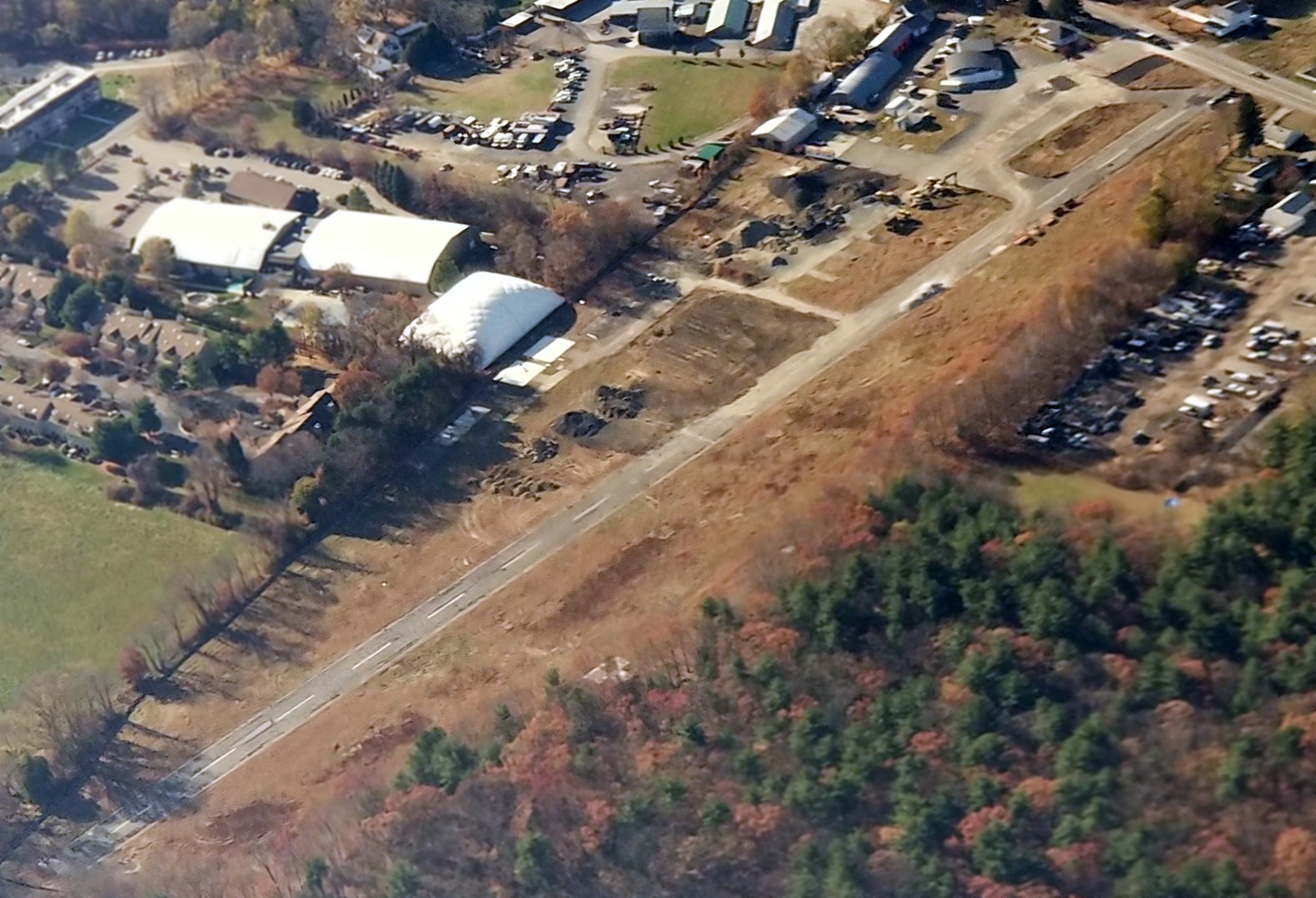
An 11/9/19 aerial view by Graeme Smith looking southwest at Marlboro Airport, showing that many buildings/hangars had been razed,
but the main arch-roof hangar & airport office still remained (at top-right).

A circa 2019 aerial view looking southeast along Marlboro Airport's Runway 14.

A sad 6/23/20 aerial view by Doug Stone (courtesy of Richard Bicknell) looking west at the site of Marlboro Airport, showing a road having been constructed over the former runway.
Marlboro Airport is located northeast of the intersection of Farm Road & Broadmeadow Street.
Thanks to Graeme Smith for pointing out the closure of this airport.
____________________________________________________
Pine Hill Airport, Lancaster, MA
42.47, -71.65 (Northwest of Boston, MA)

The Pine Hill Airport, as depicted on the 1950 USGS topo map.
Photo of the airport has not been located.
Jonathan Westerling reported, "According to pilot John Zimmer,
the Pine Hill Airport was actually never opened as an airfield,
though the land there was cleared in 1950 to serve as a replacement for the then-closing Bolton Airport."
The earliest depiction which has been located of Pine Hill Airport was on the 1950 USGS topo map.
It depicted Pine Hill Airport as having 2 runways (a 1,700' north/south strip & a 1,200' east/west strip),
along with what may have been a single small building on the south side of the field.
Pine Hill Airport not depicted on the January 1950 Boston Sectional Chart (or later Sectionals)
or the 1960 Boston Local Aeronautical Chart (courtesy of Mike Keefe).
The earliest photo which has been located of the Pine Hill Airport site was a 1963 aerial view.
It depicted the faint outline of 2 unpaved runways.
Jonathan Westerling recalled, "I visited the site of the Pine Hill Airport back in 1991.
By that time the runways had grown up so much that they were virtually impassable.
The gravel company which owned the land was slowly eating up the runways from the south.
There were also no buildings at the site."
The 1992 USGS topo map labeled the site as a gravel pit.

In the 1995 USGS aerial photo,
the outline of a portion of the former Pine Hill Airport north/south runway was still apparent.

In a circa 2001-2005 USGS aerial photo,
the faintest trace of the outline of a portion of the former north/south runway was still apparent.
The site of Pine Hill Airport is located at the eastern terminus of Pine Hill Road.
...............................................................................................................
Jonathan Westerling reported, "At one point in the early 1990s a reliever airport for Logan was planned just north of Pine Hill,
but neighborhood resistance kept it from getting past the planning stage.
It's a great place for an airport, though."
____________________________________________________
Turnpike Airport / Westboro Airport (3B6), Westboro, MA
42.275, -71.65 (West of Boston, MA)

Turnpike Airport, as depicted on the March 1933 Boston Sectional Chart.
This small general aviation airport was located along the north shore of Hocomonco Pond.
The date of construction of Turnpike Airport has not been determined.
The earliest depiction which has been located of Turnpike Airport was on the March 1933 Boston Sectional Chart.
It depicted Turnpike as a commercial/municipal airport.
The Airport Directory Company's 1937 Airport Directory (courtesy of Bob Rambo)
described the Westboro "Turnpike" Airport as being located 2 miles northwest of Westboro,
and the field was said to consist of a 1,300' x 1,200' irregularly-shaped sod landing area.

The 1937 “Progress Report of the Committee For Aeronautics of the Commonwealth of MA” (courtesy of Jonathan Westerling) depicted Turnpike Airport as an irregularly-shaped 42 acre sod field,
within which the longest landing distance was 1,300' northeast/southwest.
It was described as a commercial airport, owned by Mrs. Robert Robinson & operated by Desjardin Flying Service Inc.
A 40'x40' metal hangar was depicted on the northeast side of the field, along with a 22'x14' wooden office building.

The earliest photo which has been located of Turnpike Airport in operation was a 12/15/38 USGS aerial view.
It depicted an open grass airfiedl area, with 1 light single-engine aircraft & a small building on the east side.

A undated flight ticket book from Turnpike Airport (courtesy of Dave Edstrom).
Pauline Douglas recalled of Westboro Airport, “Lucien Desjardin was my dad who, with my mother Grace, and my uncles Frederick, Larry, Alfred, and Albert, did a lot of flying and instructing in the 1930s.
They used to charge $2 a lesson. Rides were 50 cents to go around the pattern, $1 for half an hour, and $1.50 for an hour. The phone number only had 3 numbers.”

A 10/30/42 aerial view from the 1945 AAF Airfield Directory (courtesy of Scott Murdock) depicted Turnpike Airport as an open grass field.
Nothing at the site of Westboro Airport was depicted on the 1943 USGS topo map.
The airport may have been temporarily closed during the war
(as was the case with many other small civil airfields along the coasts),
or it may have simply been overlooked due to its relatively small size.
The April 1944 US Army/Navy Directory of Airfields (courtesy of Ken Mercer)
described Westboro Turnpike Airport as having a 1,500' unpaved runway.
The 1945 Boston Sectional Chart (courtesy of John Voss) depicted Westboro as a commercial/municipal airport.
The 1945 AAF Airfield Directory (courtesy of Scott Murdock) described the Turnpike Airport
as a 42 acre irregularly-shaped field with a sod all-way landing area, with the longest dimension being 1,300' northeast/southwest.
The field was said to have a single 100' x 60' metal hangar, and to be privately owned & operated.

Westboro Airport was depicted on the 1953 USGS topo map as an open field,
with several buildings (hangars?) around the periphery.
Leo Page recalled, "Right after the Korean War ended I flew out of Westboro for quite a while.
A man named Ken Lynde was either the owner or operator of the field.
He had 3 J-3 Piper Cubs, a Taylorcraft plus an A-model Bonanza.
The Cubs & Taylorcraft he rented out, the Bonanza he used for charter."
Warren Wilbur recalled, “I went to Babson College in 1954-57.
I was a member of the Babson Flying Club that owned a red & yellow Aeronca Champ.
I was a student pilot under training by the Club’s CFI – a wonderful guy named Frank O’Hara.
I soloed there & went on to a lifetime of flying.
I paid for Mr. Lynde to take a friend up for his first flight in his Bonanza.
I noticed that he did not check the magnetos prior to takeoff;
upon landing I (being a student) questioned him on the subject.
He just shrugged & said that one of the mags was inoperative.
Quite a feat flying in & out of that 1,500' grass strip, landing over telephone wires
and getting stopped prior to rolling down hill the last 300' of the strip.
I have many fond memories of getting up early on cold winter days,
driving out to the strip, hand propping the Champ & going flying by myself. I thought I was Lindbergh
However, my first solo trip after Frank cut me loose to do touch & go's was not so fond
as I took off, flew around for a while & then landed not noticing that the wind had sprung up and I was landing downwind.
I finally stopped at the down hill end of the runway. A shaken but wiser pilot.”

Westboro Airport was depicted on the 1960 Boston Local Aeronautical Chart (courtesy of Mike Keefe) as having an 1,800' unpaved runway.

Westborough Airport apparently gained a somewhat longer paved runway at some point between 1960-65,
as an undated aerial view from the 1965 MA Airport Directory (courtesy of Jonathan Westerling) depicted Westborough Airport as having 2 unpaved runways on the west side of the road
and a longer paved runway on the opposite (east) side of the road, along with several small buildings & about 6 light aircraft.
The Manager was listed as Kenneth Lynde, and the Fixed Base Operator as Lynde Flying Service.

The 1968 Flight Guide (courtesy of Robert Levittan) depicted Westboro as having 4 unpaved runways on the southwest, and a single 2,300' paved Runway 7/25 to the northeast.

The 1968 Boston Local Aeronautical Chart (courtesy of Mike Keefe) depicted Westboro as having a single 2,300' paved runway.

A circa 1960s photo of a Cessnas in a Westboro Airport hangar.

A circa 1960s photo of several Cessnas & Pipers in & around a few small hangars at Westboro Airport.

A circa 1960s photo of a snowy scene of Cessnas & Pipers at Westboro Airport.
Ed Romero recalled, “My first solo was as Westboro Airport in a J-3 Cub.
There was a paved runway there in 1969. But it was on the other side of the street [to the northeast]. An unusual situation for sure.
The 80 octane pump was on the grass strip while the 100 octane pump was with the 2,300' paved strip across the street.
This made fueling Ken Lynde’s Tri-Pacer a bit of a chore as the grass strip was where all the aircraft were stored.
Ken was quite a character.”
Bob Berlyn recalled, "I learned how to fly at Westboro Airport in the late 1960s & early 1970s.
It was run by Kenneth Lynde (Lynde's Flying Service) until the early to mid 1970s
when David Kubly, a Westboro resident, the B-29 Pilot, and then professor at, I think Clark,
and another man, Dick Stone, who worked at Bay State Abrasives in Westboro took it over.
I was a flight instructor there for a while & the place has many fond memories for me."

The last photo which has been located showing Westboro Airport in operation was a 1971 aerial view.
It depicted Westboro as having several unpaved runways, with a hangar & several buildings on the east & north sides of the field, along with 10 light aircraft.
David Fogarty recalled, “My Uncle Steve Fogarty was one of my original flight instructors out of Westboro (J-3 Cub). He introduced me to the local flying tribe.
Steve Fogarty upon returning from his 2nd tour in Vietnam (Army 1st Cav) became a very well-known & highly-regarded flight instructor in Central MA.
Steve's older brother Jack, my Uncle,was also a pilot flying from Westboro Airport.
Harvey Tamasian was also flying from Westboro in those days.”

The last aeronautical chart depiction which has been located of Westboro Airport was on the January 1973 Boston Sectional Chart.
It depicted Westboro Airport as having a mere 1,700' unpaved runway.
Ed Wickham recalled of Westboro Airport, "I flew in there a few times in the early 1970s from my home field in Marlboro.
I know that a gentleman (who was a B-29 pilot) was the last known operator of the airport."
Westboro was still listed in the 1976 Airport/Facility Directory (according to Timothy Aanerud),
and described as having a single 2,300' paved Runway 17/35.
Doug stone reported, “According to my log book, I flew one of my Dad’s flight school Cessna 150s out of Westborough to Worcester on 9/2/77.
This was one of the last flights (if not the last) from Westborough as my dad operated the flight school out of Worcester for a short time.
My dad’s partner was the B-29 pilot, Dave Kubly, a college professor, who operated the ground school of which I was a student.
My instructors included Chris Cobb (who soloed me there)
and Louis Pope, who used to fly his Cub over from Oxford Airport to give lessons in Westborough on weekends.
The sod field - I always remember it as 1,700’ long.
My dad was the last operator of the Westborough, Massachusetts airport which closed in 1977.
My dad & I moved 2 of the T-hangars (that were right next to Otis Street) to Marlborough Airport
where I still keep his Piper PA-11 Cub Special and fly it regularly.”

An undated flyer entitled “Save Westboro Airport”.
Westboro Airport was evidently closed at some point between 1973-79,
as it was no longer depicted on the December 1979 NY Sectional Chart (courtesy of Ron Plante).
Stephen Baker reported, “The Westboro field was used up until the summer of 1980
when Astra Pharmaceutical Products broke ground on the plant in the photo.
There was an auto race track across from it and I used to watch the planes do touch & go's while in the stands.”

Although Westboro Airport was still depicted as having 2 runways on the 1989 USGS topo map,
the field was labeled simply as "Landing Strip", which typically means that the airport was no longer open by that point.
The 1992 USGS topo map no longer depicted the Westboro Airport runways,
as the Astra Pharmaceutical Products building had been built over the airport site.
The 1995 USGS aerial photo showed the majority of the Westboro Airport site to be occupied by the Astra Pharmaceutical Products buildings & parking lots.

A 2019 aerial view showed no trace of Westboro Airport to remain, with the site occupied by the Astra Pharmaceutical Products buildings & parking lots.
The site of Westboro Airport is located northwest of the intersection of Otis Street & Smith Parkway.
Thanks to Ed Wickham for pointing out this airfield.
____________________________________________________
Shirley Airport (9B4, 61MA), Shirley, MA
42.527, -71.666 (Northwest of Boston, MA)
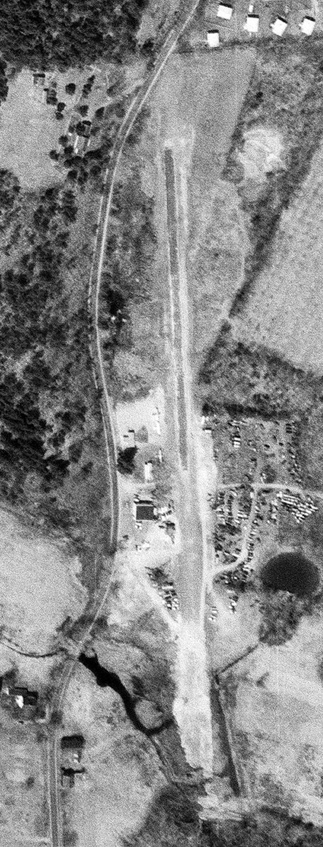
Shirley Airport, as depicted on a 4/29/63 USGS aerial view.
This little general aviation airport was evidently established at some point between 1960-63,
as it was not yet depicted on the 1951 USGS topo map
or the November 1960 Boston Sectional Chart.
The earliest photo which has been located of the Shirley Airport was a 4/29/63 USGS aerial view.
It depicted Shirley as having a single north/south runway, with a few small hangars & 3 light single-engine planes on the west side.
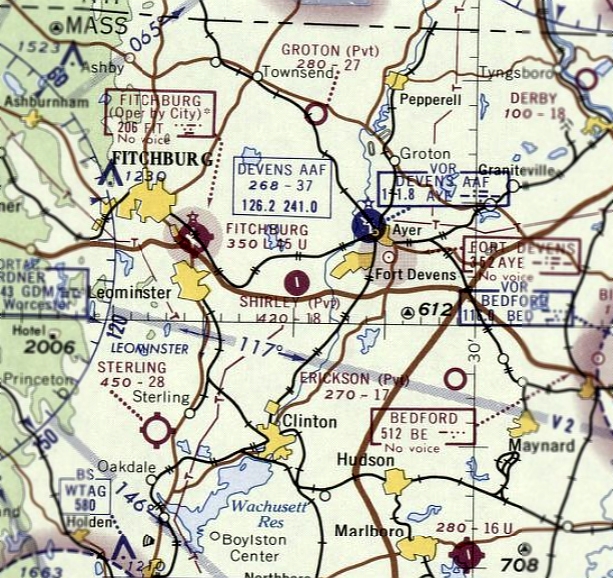
The earliest aeronautical chart depiction which has been located of the Shirley Airport was on the September 1965 Boston Sectional Chart.
It depicted Shirley as a private airfield having a single 1,800' paved north/south runway.
Neil Johnson recalled, “There was a small field just outside the western edge of Fort Devens, between Shirley & Shirley Center.
I only used it once when I had my private exam checkride. The examiner pilot was a lady about 70 years old.”
A 1971 aerial photo depicted a total of 10 single-engine aircraft parked along the northwest side of Shirley Airport,
which had a single paved north/south runway, and a few small hangars along the northwest side.
Dave Pando recalled, “I took my first flight there with Don Baker in 1972.”

The earliest photo which is available of the Shirley Airport was a circa 1981 aerial view by Dave Pando on final approach to Runway 1.
Dave recalled, “I took the photo from the right seat of Cessna 172 225JS which was owned by my student & John Skrzypczak.
We would fly there for lunch because we both thought the waitress at the diner looked just like Wonder Woman.”
Raymond Lallo recalled, “I was a Green Beret with 10th Special Forces Group (Airborne) stationed at Ft. Devens MA, from 1987-96.
In the later years we used Shirley Airport for training for counter-drug, Airfield recon & take-down & CSAR training.”
A 1992 aerial photo depicted a total of only 4 aircraft, on the east side of the Shirley runway.

The last aeronautical chart depiction which has been located of Shirley Airport
was on the December 1992 Boston Terminal Aeronautical Chart (courtesy of Gwen Shafer).
It depicted Shirley as having a 3,200' paved runway.

A 1995 USGS aerial view looking southwest did not depict any aircraft at Shirley Airport.

The last photo which has been located showing aircraft at Shirley Airport was a 2000 aerial view looking southwest,
which depicted 2 single-engine aircraft on the northwest side of the runway.
Shirley Airport was evidently closed (for reasons unknown) at some point between 2001-2005,
as a 4/1/05 aerial view depicted the northern end of the runway having been cut by a new road,
and 2 closed-runway “X” symbols visible along the runway.
Brendan Hurley reported in 2005, “The Shirley Airport has been abandoned & a few things have been built on the old dirt strip.
It was closed sometime within the last year or two. I'm not sure why, but I imagine it was a decline in use over the last few years.”
Perry Dickau reported, “Shirley Airport... In 2005, the owner of the airport sold off part of the property, which was the east end of the airport,
where a new commercial building was erected, and a new road was put in that bisected what used to be the runway.
At that time, the official designation of the airport was changed from 9B4 to 61MA, and it was for the 1,700' turf strip [oriented] 16/34 (versus the old [Runway] 1/19 asphalt strip).
Shirley Airport was my exclusive training location through 2010 (I am a CFI for Light Sport Aircraft, specifically powered parachutes).
The property was also home of the Shirley Crowhoppers Ultralight Club, which has since moved to Crow Island Airpark in Stow, MA.
For the last 6 or 7 years of the life of that airport, I seemed to be the exclusive user of the facility.
The owner was always super accommodating, but the writing was on the wall that the property would have a limited life as an airport.”
Peter Ward reported in 2006, “I drove past Shirley Airstrip not long ago and it looked like some business paved right across the runway.
I was aghast! I thought that strip was still used, for planes as well as ultra-light activities. Oh well.”

A 1/28/07 photo looking along Shirley's closed runway, with the “X” symbol in the foreground.
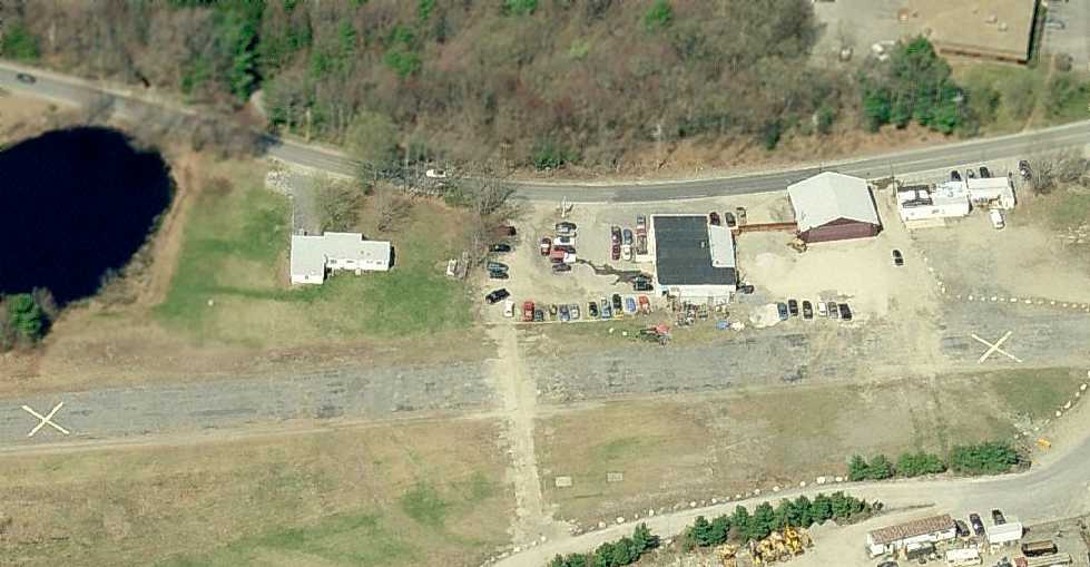
A circa 2008 aerial view looking west at the hangars & runway which remain at Shirley Airport.
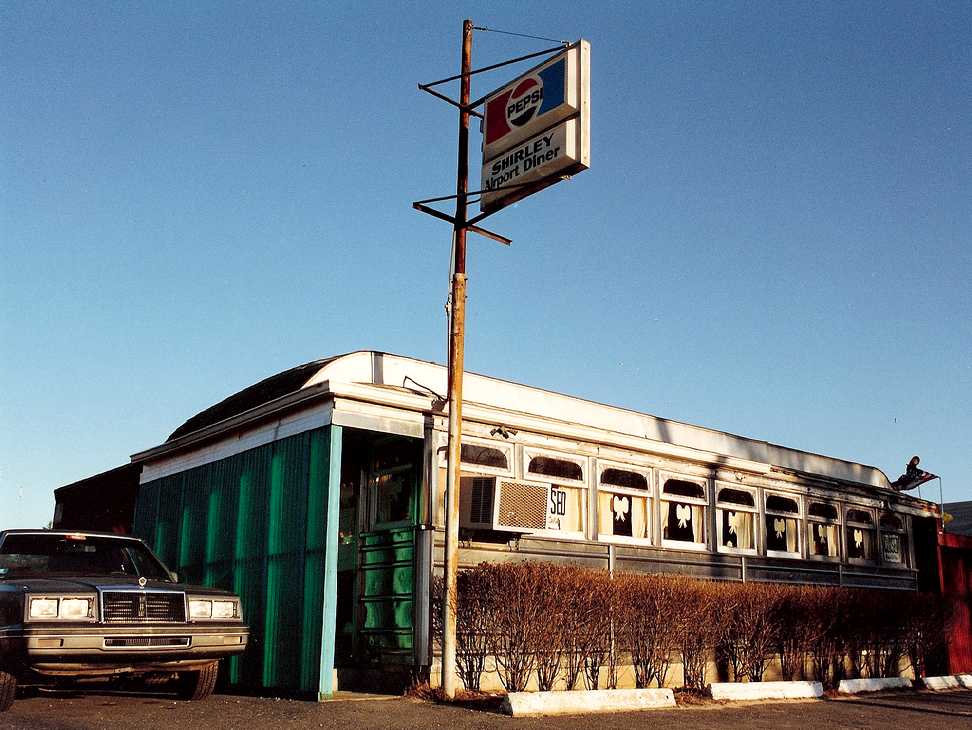
A 2/22/09 photo of the Shirley Airport Diner, which sits along the northwest corner of the site.
A 2009 aerial view showed the Shirley Airport remained intact though deteriorated.
Longtime Shirley resident Glenn Gould reported in 2014, “This spring the Shirley Airport was turned into a solar electric generating farm.
It is not finished yet, but the uprights for the solar panels are up. At least it is not more houses.”

A 2016 aerial view looking southwest showed solar panels covering the majority of the site of Shirley Airport,
but portions of the northern end of the runway pavement remained intact, along with several hangars.
The site of Shirley Airport is located southeast of the intersection of Shirley Road & Mt. Laurel Circle.
Thanks to Paul Zahornasky for pointing out this airfield.
____________________________________________________
Clinton Airport / Balboni Airport / Bolton Airport, Bolton, MA
42.436, -71.651 (Northwest of Boston, MA)

Bolton Airport, as depicted on the Boston Chamber of Commerce's
1931 "Airports & Landing Fields of New England" (courtesy of Chris Kennedy).
According to an article by Graham Entwistle in the 10/30/98 issue of The Bolton Common (courtesy of Kevin LeCompte),
a parcel of land on the south side of Wilder Road was acquired by the Balboni family in 1929.
Zelmira Balboni started to use the land as an airstrip for his plane,
and a deed recording the transfer of some of the land to him in April 1930
was the earliest reference which has been located which mentioned the Balboni Airport.
In the following years, a shack for minor aircraft repairs was built at Balboni.
The Boston Chamber of Commerce's 1931 "Airports & Landing Fields of New England" (courtesy of Chris Kennedy)
described the "Clinton-Lancaster-Bolton Airport" as being located 2 miles north of Clinton.
The field was said to have two 1,400' grass runways, and the operator was listed as Amilio Balboni.
Cathy Balboni reported, “Amilio Balboni that was mentioned was her son my Grandfather, Emilio.”
The Airport Directory Company's 1933 Airport Directory (according to Chris Kennedy) listed a "Clinton" Airport, 2 miles north of the town of Clinton.
It was described as having two 1,500' sod runways, oriented north/south & east/west.

The earliest aeronautical chart depiction which has been located of Clinton Airport was on the March 1933 Boston Sectional Chart.
It depicted Clinton as an auxiliary airfield.
The last aeronautical chart depiction which has been located of Clinton Airport was on the August 1935 Boston Sectional Chart.
Clinton Airport was evidently closed (for reasons unknown) at some point between 1935-36,
as it was no longer depicted on the January 1936 Boston Sectional Chart.
This may have been due to the economic effect of the Depression.
“Bolton (Clinton)” was listed as recently closed
in the 1937 “Progress Report of the Committee For Aeronautics of the Commonwealth of MA” (courtesy of Jonathan Westerling).
The Airport Directory Company's 1938 Airport Directory (according to Chris Kennedy)
did not list any airfields in either Clinton or Bolton.

The earliest photo which has been located of Clinton Airport was a 4/10/39 aerial view.
It depicted the field as having 3 grass runways, with a one small buildings on the west side.
There were no aircraft visible on the field though, so it may still have been closed at that point.

A 10/30/42 aerial view looking west at Clinton Airport from the 1945 AAF Airfield Directory (courtesy of Scott Murdock)
depicted the field as having 3 grass runways, with a few small buildings on the west side.
Clinton Airport was still not on the November 1942 Boston Sectional Chart.

Although the shape of the Clinton Airport runways were depicted on the 1943 USGS topo map,
the airport itself was not labeled (the "Mountain View Golf Course" was adjacent to the east side of the airport).

The former Clinton Airport was evidently reopened as Bolton Airport at some point between 1942-43,
as that it now it was depicted on the November 1943 Boston Sectional Chart.
It depicted Bolton as a commercial/municipal airport.
The April 1944 US Army/Navy Directory of Airfields (courtesy of Ken Mercer)
confusingly listed a "Balboni" Airport in Bolton & a "Bolton" Airport in Clinton.
Both were described as having a 1,400' unpaved runway, so were these actually the same field?
The "Bolton" Airport was described as being "Restricted to CAP [Civil Air Patrol] only."
The 1945 AAF Airfield Directory (courtesy of Scott Murdock) described Clinton Airport
as a 79 acre irregularly-shaped field within which were 2 sod 1,600 runways, oriented ENE/WSW & NNW/SSE.
The field was said to have a single 60' square wood hangar,
and to be owned & operated by private interests.
After the end of WW2, activity at the field began to pick up, when Worcester industrialist Harry Kumpe formed Airports Inc. & rented the airfield.
He hired Loran "Pappy" Malone to manage the field, who quickly became a father figure to the young student pilots at Bolton.
The Haire Publishing Company's 1945 Airport Directory (courtesy of Chris Kennedy)
listed the Bolton Airport as being located 2.3 miles northeast of Clinton,
and described the field as having two 1,900' sod runways, oriented north/south & east/west.
On New Year's Day in 1946, there were only 3 private aircraft based at the Bolton Airport: a Piper Cub, another Piper, and a Fleet.
Within a year, Airports Inc. had brought in 6 Aeronca Champs, an Aeronca Chief, 2 Taylorcrafts, a Waco, and a Cessna.
In addition, a total of 8 private aircraft were hangared there.

A 1946 photo of a Kitty Hawk biplane at Bolton Airport (courtesy of Jonathan Westerling).
The Kitty Hawk was purchased by Jerry Mears from Harry Kumpe.

A circa 1946-47 photo of a variety of planes in front of the hangar & office at Bolton Airport (courtesy of Jonathan Westerling).
At its peak (according to Jerry Mears, who flew at Bolton from 1946-49), approximately 25 aircraft called Bolton home.
During the airport's heyday its owners designed many expansion schemes.
According to Randy Wilson (who learned to fly at Bolton), "They were calling it the Country Club of the Air. They had big plans."

A still by Jonathan Westerling from a 1949 movie by Brigham Mayo of the Bolton Airport office, with spectators watching a flying display.

A still by Jonathan Westerling from a 1949 movie by Brigham Mayo, showing a beautiful red Cessna T-50 Bamboo Bomber in front of the Bolton Airport hangar.

A license plate attachment, advertising Bolton Airport (courtesy of Jonathan Westerling).
"The license plate attachments were very poplar during the 1940-50 period to advertise your local airport."

The 1950 USGS topo map depicted the outline of 3 runways at Bolton Airport, as well as what appeared to be a total of 3 buildings.
According to former Bolton Airport pilot Jerry Mears,
the primary runway was over 2,000' in length, while the shorter runway was approximately 1,000'.
"You had to be a pretty good pilot to come in on the short one", Mears said.
Unfortunately, by the early 1950s, the "GI Bill" funding which had previously enabled much of the flight training business at Bolton had started to decline,
and this resulted in a sharp decrease in flight training & aircraft sales.
These factors, coupled with competition from other airports,
caused the Bolton Airport to be officially closed in the Summer of 1951.
However, a few local pilots continued to use the closed airfield for a little while.
In a sad ending to the little airport, it had its only fatal accident after the field was closed:
in 11/1/52, Brigham Mayo crashed while attempting to land at the abandoned airport.
In 1953 the airport land was sold to Albert Surprennant & George Forsberg, along with the adjacent Runaway Brook Country Club.

A Summer 1954 aerial view looking north showed Bolton Airport's runways & buildings still remained intact (courtesy of Kevin LeCompte).
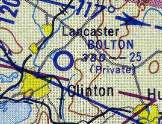
Bolton Airport was still depicted as a private field (with a 2,500' unpaved runway)
on the November 1954 Boston Sectional Chart (courtesy of Chris Kennedy),
but the Aerodromes table listed the field as "Closed".
Bolton Airport was evidently closed at some point between 1954-55,
as it was no longer depicted on the May 1955 Boston Sectional Chart.
Between 1955-58, the new owners of the property expanded the golf course onto the land formerly occupied by Bolton Airport.

By the Summer of 1958, the former Bolton Airport buildings still remained intact,
but the runways had been covered with golf course fairways
in this aerial view looking northwest (courtesy of Kevin LeCompte).
A 1971 aerial photo shows the airport office building was torn down at some point between 1958-71,
but the 2 former hangars were retained & reused.
After a few changes of ownership, the golf course became known as the International Golf Club.
As seen in the 1995 USGS aerial photo, 2 former hangars from Bolton Airport remained standing.
Not a trace remained of the runways - they were all covered by fairways.
Kevin LeCompte reported in 2004, "The hangar still serves as a maintenance Shop for the IGC golf club.
Lots of older local pilots have told me about it but none have pictures. I fly over regularly - you can almost make it out."

A circa 2010-2017 aerial view looking north at the remaining hangars from Bolton Airport.

A 2016 aerial view looking northwest showed the former hangars of Bolton Airport remained standing,
but not a trace remained of the runways - all covered by fairways.
The site of Bolton Airport is located southwest of the intersection of Wilder Road & Eastern Avenue.
Thanks to Jonathan Westerling for pointing out this airfield.
____________________________________________________
Fort Devens AAF / Ayer NAAS / Moore AAF, Leominster, MA
42.574, -71.606 (Northwest of Boston, MA)

The location & layout of the “Ayer (Camp Devens) Emergency Field”,
as depicted on the 6/21/26 Department of Commerce Aeronautical Bulletin (courtesy of Jonathan Westerling).
Fort Devens was built as a division-size training camp in 1917.
An airfield was evidently established at Fort Devens in 1926,
as the 6/21/26 Department of Commerce Aeronautical Bulletin (courtesy of Jonathan Westerling)
listed the “Ayer (Camp Devens) Emergency Field” as becoming “available 7/1/26.”
The airfield was described as a sod field measuring 2,300' northwest/southeast by 850' northeast/southwest,

The Fort Devens Airfield gained a 2nd runway within the following year,
as the 12/12/27 Department of Commerce Aeronautical Bulletin (courtesy of Jonathan Westerling)
described the “Camp Devens” Airfield as having 2 runways in an L-shape,
with the longest being the 2,325' northwest/southeast strip.
The field had no hangars or other facilities.
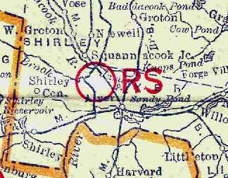
The 1929 Rand-McNally Air Trails Map of Massachusetts (courtesy of Chris Kennedy)
described the Camp Devens Airfield as an auxiliary airfield, operated by the Army.
The field was said to be 2,325' x 1,560' in size. The "RS" indicated that the field had a radio station.

The 1934 U.S. Navy Aviation Chart (courtesy of Chris Kennedy) depicted a "Marked Auxiliary Field" in this location,
but did not label the field with a name.
The 1939 USGS topo map depicted the outline of a single unpaved northwest/southeast runway,
but did not label the field.

The 1939 USGS topo map (courtesy of Rex Ricks) showed the “Fort Devens Airport” in its expanded configuration,
with 3 paved runways, taxiways, a paved ramp, and a large hangar.
Fort Devens was expanded in the pre-WW2 period, and it was at this point that the Fort reportedly "gained" its own airfield,
but this was apparently just an expansion of the already-extant airfield at this location.
This newly-expanded airfield was completed in 113 days, at a cost of $680,000
(according to the book "Images of Fort Devens" by William Graig, courtesy of Ron Titus).
The airfield became home to the 152nd Observation Squadron.

The earliest photo which has been located of Ft Devens Airfield was a May 1941 aerial view looking south (from the MA Aeronautics Commission).
It was evidently taken during construction of the field's paved runways, and the hangar was visible in the foreground.

A 1941 photo of Ft. Deven's main hangar being constructed by the John Bowen Company (courtesy of the Fort Devens Museum, via Ryan Keough).

A postmark (courtesy of Kevin Carruth) commemorated the 7/15/41 Dedication of “Fort Deven's Airport”.

An undated photo of 2 L-16s of the 152nd Observation Squadron at Fort Devens (courtesy of Ron Titus).
During 1942-1943, the Army based liaison & photo-reconnaissance squadrons at the field.
Fort Devens AAF was described by the 1944 US Army/Navy Directory of Airfields (courtesy of Ken Mercer)
as having a 5,200' hard-surface runway,
but the remarks said, "On standby status - no Army operations."
In 1944, the Army withdrew from the field & turned it over to the Navy.
They named the facility Ayer Naval Auxiliary Air Station.
It was used to support training operations at Squantum NAS.
Carrier Air Groups 4 & 83 were based at Ayer during 1944.
The Navy aircraft also used Beverly Airport as a bounce field.

"Ayer (Navy)", as depicted on the November 1944 Boston Sectional Chart (courtesy of Chris Kennedy).
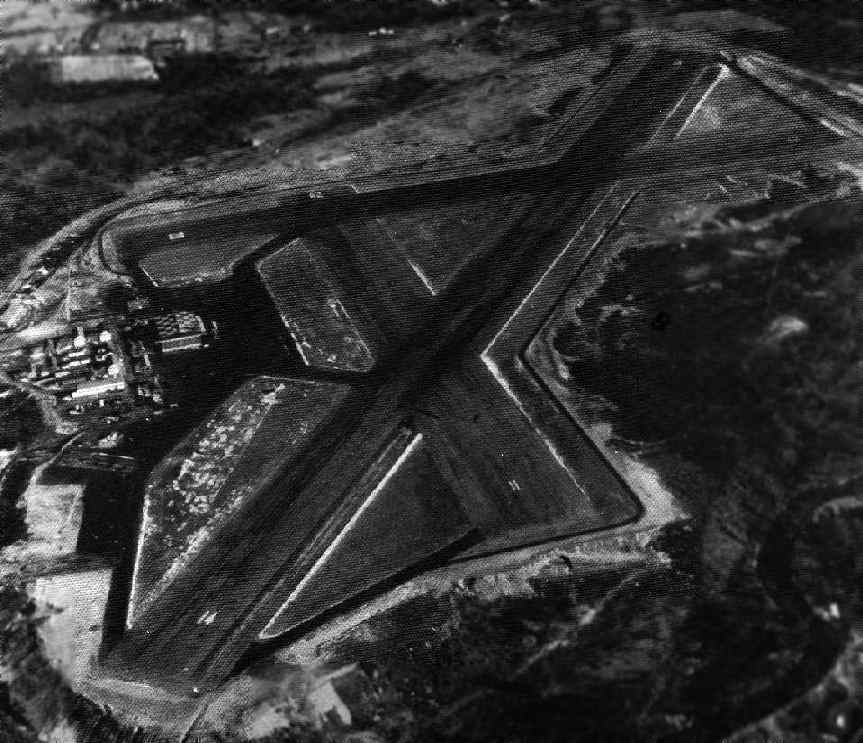
A WW2-era National Archives aerial view looking southeast at Ayer Naval Auxiliary Air Station.
Ayer was still depicted as an active Navy airfield
on the November 1944 Boston Sectional Chart (courtesy of Chris Kennedy).
The Navy discontinued their use of Ayer NAAS at some point between 1944-46.

A circa 1946 USAAF “plan of the Fort Devens Airfield (National Archives, courtesy of Ron Plante).
As part of the postwar demobilization, the Army deactivated Fort Devens in 1946,
but then reopened it again in 1948.
The November 1954 Boston Sectional Chart (courtesy of Chris Kennedy)
depicted "Ayer AAF" as having a 5,200' hard surface runway & a control tower.

The field was evidently renamed "Fort Devens AAF" at some point between 1954-59,
as that is how it was labeled on the 1959 Boston Local Aeronautical Chart (courtesy of Chris Kennedy).
The Aerodromes table described the field as having 3 paved runways, with the longest being 5,200'.
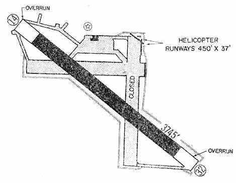
The 1960 Jeppesen Airway Manual (courtesy of Chris Kennedy
depicted Ft. Devens AAF as having a single 3,745' paved Runway 14/34,
along with 2 small 450' helicopter runways at the northeast corner of the field.
Two other former runways (oriented north/south & east/west) were still depicted, but were labeled as closed.
A single hangar was depicted on the ramp on the north side of the field.

Devens AAF, as depicted on the 1968 Boston Sectional Chart (courtesy of Mike Keefe).
Leigh Hettick recalled, "I was an air traffic controller at Moore Army Airfield during late 1970 to early 1971.
The airfield was upgraded in the early 1960s with a new tower & GCA approach.
When Vietnam started up, most of the aircraft based there were Piasecki HU-21s.
They went to Vietnam never to return.
When I arrived fresh from Vietnam, our base flying club had more aircraft there than the Army [did].
The Army had a couple of U-10 Helio Couriers, UH-1 Hueys, and Beech C-45s."
Leigh continued, "While I was there, to keep our controller skills sharp & prevent us from going nuts from boredom,
we worked up a deal with Hanscomb Field to allow their aircraft use of our field for training.
At that time, 10th Special Forces was based at Ft Devens,
so we regularly had C-130s come in for parachute jumps.
On several occasions the Air Force C-130s got confused & were talking with us
while they were wheels down for landing at the nearby Fitchburgh airport."

A 1971 aerial view showed that the only aircraft visible on Devens AAF were 3 single-engine light aircraft (presumably flying club planes).
Dean Charron recalled, “I was stationed from 1974-75 at Moore AAF.
At one end of the field was a vintage Aero Commander that was rumored to belong to President Eisenhower.
The airplane belonged to the Ft. Devens flying club but never flew because it had a bad engine.
It was also rumored that the airplane had belonged to the Civil Air Patrol & had also been used as a jump plane.
I used to look into the window of that plane back in the 1970s & wish I could fly it but the club never got it running.
A [Beech] Queen Air, also known as a U-8, was flying while I was there. There was CW-3 Raleigh who was the main pilot.
I was working one day when this plane lost an engine shortly after departing -
there's an old saying with the Queen Air: 'The second engine is there to get you to the crash site quicker!'
I would bet this airplane was left behind as obsolete & scrapped for fire practice.”
Bob Mitchell recalled, “I found myself stationed at Fort Devens in 1976.
I was assigned to the 10th Special Forces Group
and made many many trips in & out of there in C-130s -
mostly one-way trips for parachute drops over at Turner Drop Zone.”
Bob Mitchell continued, “In the aerial pictures, there is a white building that is to the northern most point on the airfield.
That building was the 'Rigger Shed'.
All parachute rigging was done there - also, prior to most jumps, pre-jump training was conducted there.
There was a 'Mock Door' area & parachute landing fall platform.
For the mock door - a group of parachutist would all go in to the little building – about the size of a bus -
sit down on the benches - await the commands to 'Stand Up', 'Hook Up', etc.
Then the command to 'Go'.
We would all come shuffling out the door, drop the 18 inches or so & count to 4,
then look up to see if our imaginary parachute had opened (what can I say - this was the Army).
Once the jump was completed, we would be trucked back to from Turner DZ to that same white building
where we would hoist up our parachutes in the tall tower connected to the building
(it must have been at least 60 feet tall)
and shake the debris out of the chutes (stick, rocks, leaves, rabbits, etc.).”
At some point after 1976, the airfield was renamed Moore AAF,
in honor of Ayer native Chief Warrant Officer 2 Douglas Moore.
Bob Mitchell recalled of Doug Moore, “I went through Basic Training with him in 1968.
I met his mother... she told me that the way Doug died was by small arms fire during a landing to a hot LZ -
he was piloting and had just touched down when a round hit him in the head.”
During its later years, Moore was used by the Hanscom AFB Aero Club.
Jeffrey Geibel recalled that "I got my Private license at the Ayer AAF at the Fort Devens Aero Club in 1976-77.
As an instructor at the Hanscom AFB Aero Club (1986-95),
we used to use Ayer AAF until it closed."
A 1978 aerial view showed a number of helipads had been laid out on the ramp at some point between 1971-78.
Mark Wilkinson recalled, "From the early 1980s through it's closure,
I flew a C-12 (military King Air) into Moore AAF a few times a year.
There was an oil painting of CW2 Moore in the operations building lobby.
To my knowledge, this is the only major AAF named after a Vietnam KIA (killed in action)."

An undated patch from the Moore AAF Crash, Fire, and Rescue Department.

A 1980 aerial view of Moore, from a government aerial survey (courtesy of Jonathan Westerling).
Note the 2 small helicopter runways which have been added at the northeast corner.
John Gamel reported in 2004, "I was an FBI Agent assigned to the Boston Office between 1979-2001.
We started Boston FBI Firearms training at Fort Devens in the Fall of 1985,
and the training continues there to this day.
From the point of view of the airfield, I recall that when the 10th Special Forces were still active,
C-130s would fly into the Fort Devens field, pick up parachutists,
then drop them in what was called the 'Turner Drop Zone' in the south post area of Fort Devens.
When the C-130s would fly toward the zone from the West,
Range Control would call the ranges & have us all cease firing for a period.
We would then watch the parachutists float to the ground, then resume firing.
In terms of timing, I think the parachute drops continued until maybe 1991, and then the 10th Group departed.
During this period, some UH-1 helicopters operated out of the airfield,
and we would see them over the south post flying perhaps ten feet above the utility lines
running along the range road in the South Post area.
Every once in a while, one of the UH-1 helos would take some of the parachutists pretty high up,
and they'd do what is called a HALO jump. Very interesting stuff."
The last aeronautical chart depiction which has been located of Moore AAF
was on the December 1992 Boston Terminal Aeronautical Chart (courtesy of Gwen Shafer).
It depicted Moore as having 3 paved runways, with the longest being 4,700'.
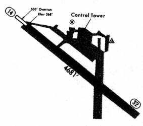
The 1994 Jeppesen Airport Directory depicted Moore AAF as having a single 4,681' paved Runway 14/32.
Fort Devens was eventually downgraded from an active base to the Devens Reserve Forces Training Area.
The airfield was apparently declared excess when the base was downgraded,
and was closed sometime between 1995-2000.
By the time of its closure, 2 of the original 3 runways had been abandoned,
and the longest runway was still maintained (14/32, approximately 4,700 ft long).
There were also 2 helicopter runways (2/20 & 15/33, each approximately 500 ft long)
located at the NE corner of the airfield.

A 2002 photo by Jonathan Westerling of the former Moore AAF gate, now a State Police driver training facility.

A 2002 photo by Jonathan Westerling of an abandoned hangar & tower at Moore AAF.
Jonathan Westerling visited the now-closed airfield in 2002,
and observed that it is now used by the MA State Police as a driver training facility.
"There is also a lot of army hardware behind fences.
The runways are still largely intact, and no buildings have been built on the airfield."
John Gamel reported in 2004, "As you may know, Fort Devens is now called 'Devens'
and is the home to an industrial park, as well as a Federal Prison hospital."

A circa 2006 aerial view looking north at the Moore AAF hangar, control tower, ramp, and runways.

A January 2007 photo by Dave Westerling (courtesy of Jonathan Westerling) looking south
at the fuselage of a military Beech U-8 Queen Air near the end of Runway 14.
According to Dave, “The fuselage is used by the state police for search & rescue training.”
Dean Charron believes this was the Queen Air which he witnessed having an engine failure after takeoff from Moore AAF.
According to Jonathan Westerling, “They are discussing how to put an industrial park over the runways at Moore AAF.”

A 6/12/11 photo of the Moore AAF control tower & hangars.

A 2016 aerial view looking north showed Moore AAF remained completely intact, including a hangar with “Moore AAF” still painted on its roof.
____________________________________________________
Or if you prefer to contact me directly concerning a contribution (for a mailing address to send a check),
please contact me at: paulandterryfreeman@gmail.com
If you enjoy this web site, please support it with a financial contribution.
____________________________________________________
This site covers airfields in all 50 states.