Abandoned & Little-Known Airfields:
New Jersey: Southern Trenton area
© 2003, © 2024 by Paul Freeman. Revised 3/10/24.
This site covers airfields in all 50 states: Click here for the site's main menu.
____________________________________________________
Please consider a financial contribution to support the continued growth & operation of this site.
Applegarth Airfield (revised 11/30/22) - Central Jersey Airport / Hightstown-Windsor Airport (revised 3/10/24) - Mahalchik Airfield (revised 3/18/18)
(Original) Mercer County Airport / Trenton-Mercer Airport (revised 3/10/24) - Norcross Airport / Hightstown Airport (revised 11/13/20)
____________________________________________________
Applegarth Airfield, Applegarth, NJ
40.28, -74.475 (Northeast of Philadelphia, PA)
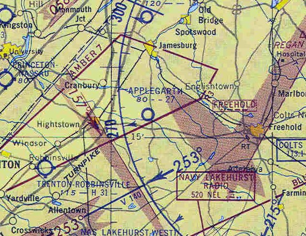
Applegarth Airfield, as depicted on the January 1955 NY Sectional Chart.
The Applegarth was a popular Italian restaurant, which boasted its own private airfield.
The Applegarth Airfield was evidently established at some point between 1953-55,
as it was not yet depicted on the 1953 NY Local Aeronautial Chart (courtesy of Tim Zukas).
Christina Alesi-Luis recalled, “Tony Lane aka Tony Alesi was my grandfather. He had a dirt runway behind his restaurant called the Applegarth Inn from the mid-1940s.
James Dean use to fly remote-control airplanes there with my grandfather.”
The earliest depiction which has been located of the Applegarth Airfield was on the January 1955 NY Sectional Chart,
which depicted it as having a 2,700' unpaved runway.
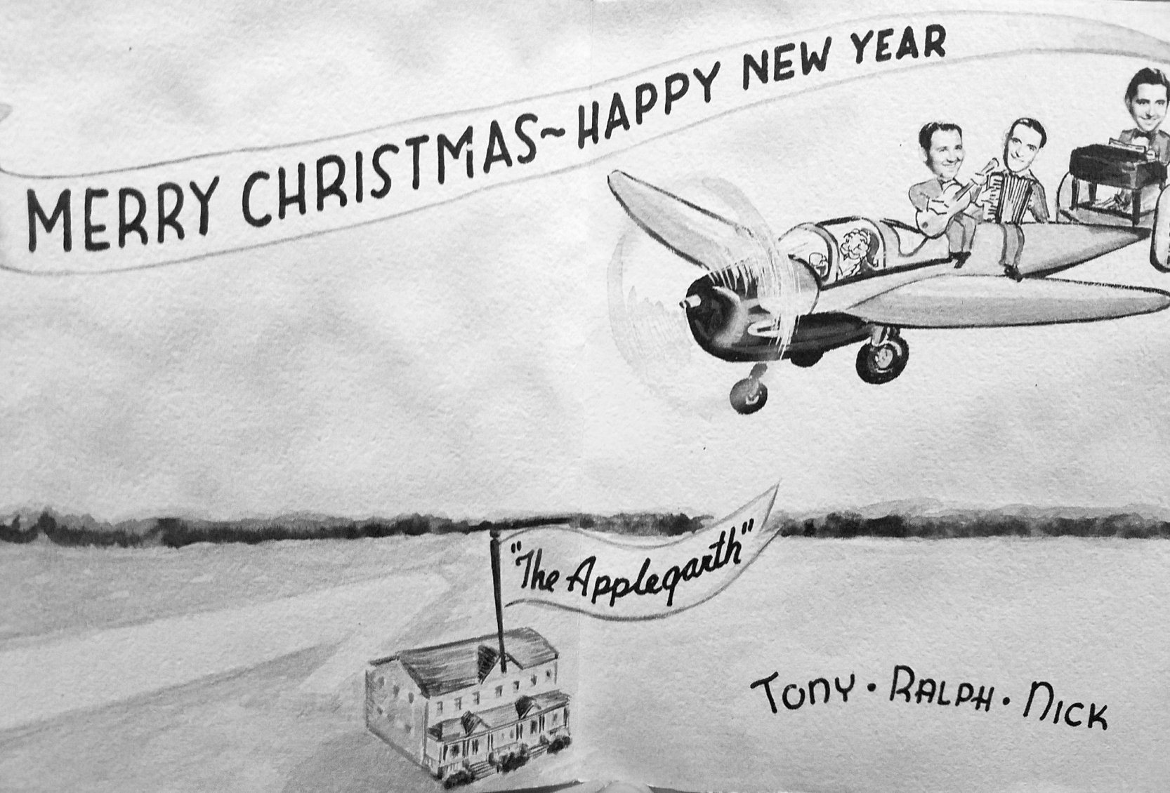
A circa 1950s advertisement for the Applegarth Airfield (courtesy of Christina Alesi-Luis), showing the runway behind the restaurant.
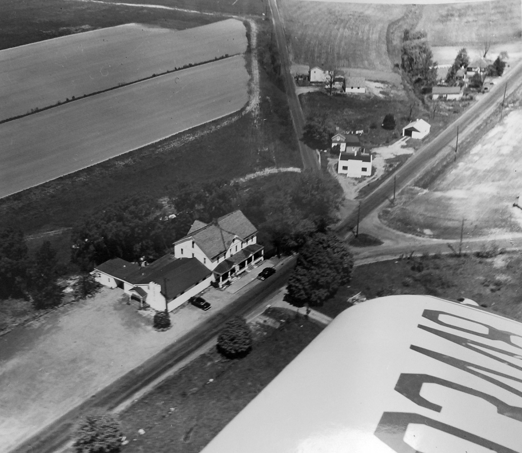
A circa 1950s aerial view looking northwest at the Applegarth restaurant (courtesy of Christina Alesi-Luis), showing the runway at the top-left.
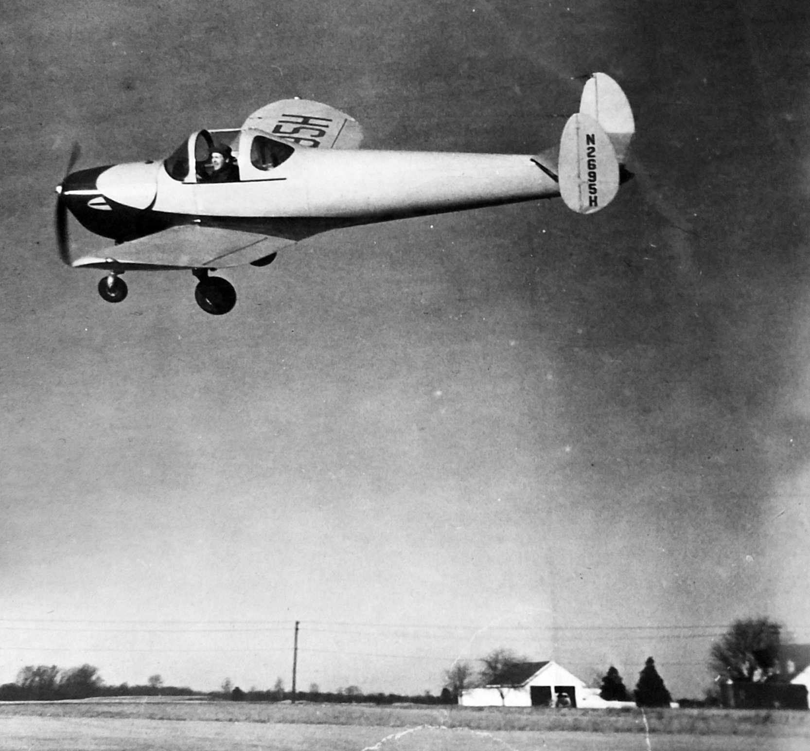
A circa 1950s photo of Tony Lane Alesi flying an Ercoupe over the Applegarth Airfield (courtesy of Christina Alesi-Luis).
Amazingly his hat remains on his head in spite of the open canopy!
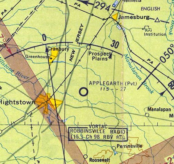
The 1961 NY Local Aeronautical Chart depicted Applegarth Airfield as having a 2,700' unpaved runway.
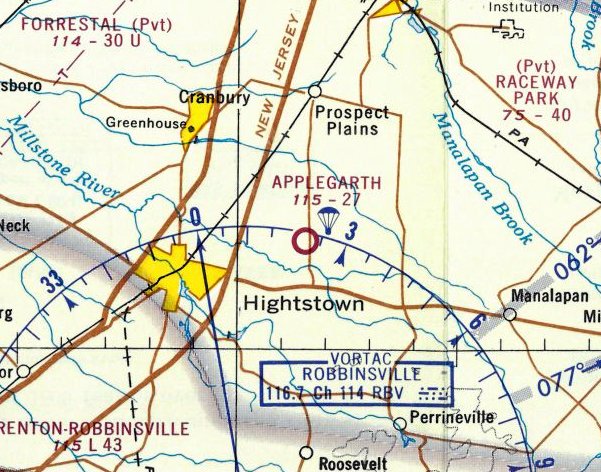
The 1968 NY Local Aeronautical Chart depicted Applegarth as having a 2,700' unpaved runway, and noted it as conducting parachute operations.
Christina Alesi-Luis recalled, “A parachuting team use to practice there & also the Olympic skydiving team. The main skydiver was named Bud.”
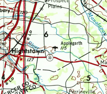
Applegarth Airfield, as depicted on the 1969 USGS topo map.
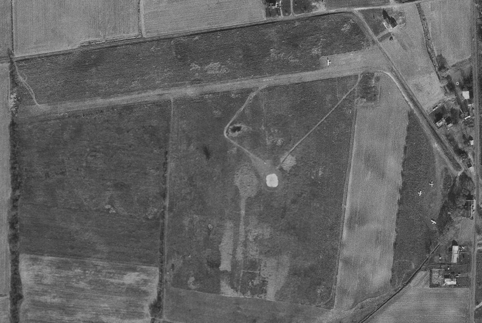
A 11/30/69 USGS aerial view depicted a total of 4 light single-engine planes on Applegarth Airfield, which had a single unpaved northeast/southwest runway.
According to Christina Alesi-Luis, her grandfather Tony Alesi owned the Applegarth until the late-1960s.
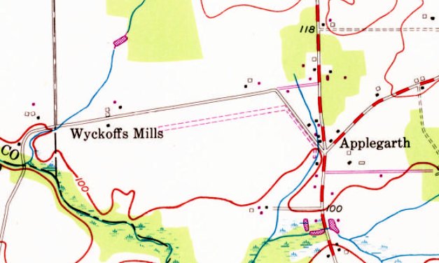
The 1970 USGS topo map still depicted Applegarth Airfield's unpaved northeast/southwest runway, but without any label.
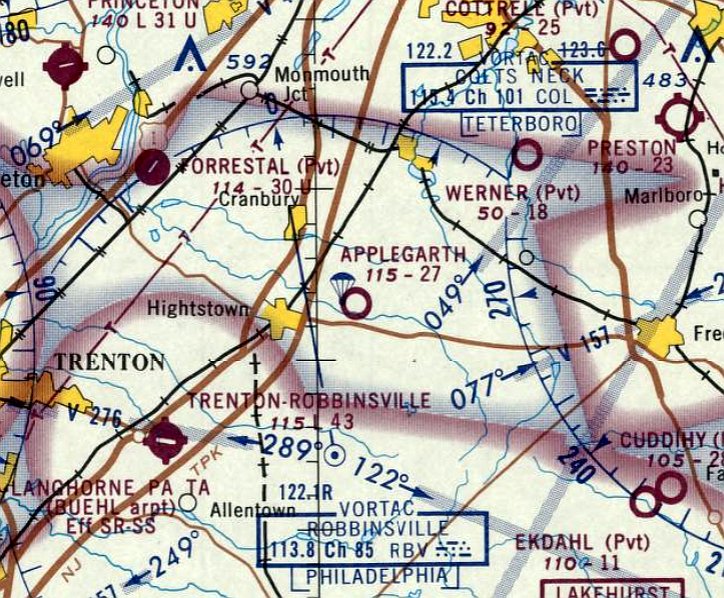
The last aeronautical chart depiction which has been located of the Applegarth Airfield was on the October 1970 NY Sectional Chart,
which depicted it as having a 2,700' unpaved runway, and noted it as conducting parachute operations.
The last photo which has been located showing planes at Applegarth Airfield was a 1972 aerial view,
which depicted 2 light single-engine planes next to the runway.
Applegarth Airfield was evidently closed (for reasons unknown) at some point in 1972,
as it was no longer depicted on the 1972 NY Local Aeronautical Chart.
A 1979 aerial view showed no trace remaining of the Applegarth runway, with the land having been taken over by farming.
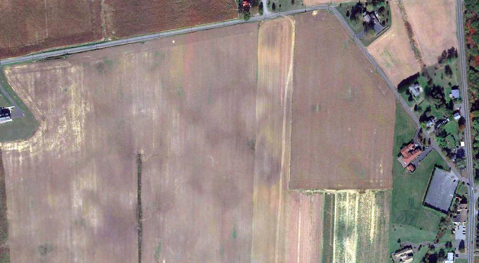
A 2017 aerial photo did not show any trace of Applegarth Airfield.
The site of Applegarth Airfield is located northwest of the intersection of Applegarth Road & Wyckoff Mills Applegarth Road.
Thanks to Christina Alesi-Luis for pointing out this airfield.
____________________________________________________
Norcross Airport / Hightstown Airport, Hightstown, NJ
40.256, -74.537 (Northeast of Philadelphia, PA)
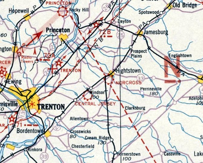
Norcross Airport, as depicted on the April 1933 NY Sectional Chart.
Photo of the airport is not available.
One of the huge number of New Jersey's general aviation airports lost to “progress”.
Norcross Airport was evidently established at some point between 1932-33,
as it was not yet depicted on the August 1932 NY Sectional Chart.
The earliest depiction which has been located of Norcross Airport was on the April 1933 NY Sectional Chart,
which depicted Norcross as a commercial/municipal airport.
It was listed as Hightstown Airport in the Airport Directory Company's 1933 Airport Directory (according to Jim Stanton).
It was still labeled Norcross Airport was on the May 1934 NY Sectional Chart,
At some point between 1933-34, it was evidently renamed Hightstown Airport, as that is how it was depicted on the July 1934 NY Sectional Chart,
Hightstown Airport was not listed among active airports in the Airport Directory Company's 1937 Airport Directory (according to Jim Stanton).
The earliest photo which has been located of Hightstown Airport was a 1940 aerial photo,
which depicted a grass field with a single hangar on the northwest corner.
Hightstown Airport was not depicted on the March 1946 NY Sectional Chart (according to Jim Stanton).
According to George Manser, the airport in Hightstown was also “known as Tony Lanes.
Tony Lane operated a bar & restaurant very close to the airport or on the airport.”
The only photo which has been located showing an aircraft at Hightstown Airport was a 1947 aerial view.
It depicted one single-engine light aircraft parked next to the hangar on the northwest corner, which had a checkerboard-painted roof.
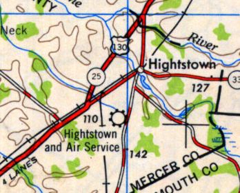
The 1949 USGS topo map depicted “Hightstown and Air Service” as a commercial/municipal airport.
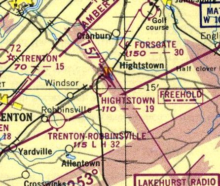
The last depiction which is available of Hightstown Airport was on the 1950 NY Sectional Chart.
It depicted Hightstown as having a mere 1,900' unpaved runway.
Hightstown Airport evidently closed at some point between 1950-53,
as a 1953 aerial photo depicted the oval racetrack of the East Windsor Speedway having been built over the eastern portion of the airport property.
But the hangar remained standing on the northwest corner.
According to Jim Stanton, Highstown Airport “was last depicted on the January 1954 NY Sectional Chart.”
Hightstown Airport was no longer depicted on the 1957 NY Sectional Chart (courtesy of Mike Keefe).
A 1957 aerial view continued to show the East Windsor Speedway on the east side, and the hangar remaining on the northwest corner of the former airport.
A 1963 aerial photo showed the hangar had been removed at some point between 1957-63.
A 1970 aerial photo showed the smaller East Windsor Speedway was replaced by a larger oval track on the southwest portion of the former airport property.
A 2008 aerial view showed the oval outline of the former East Windsor Speedway still remained on the property.
A 2010 aerial view showed housing construction covering the site of Hightstown Airport.
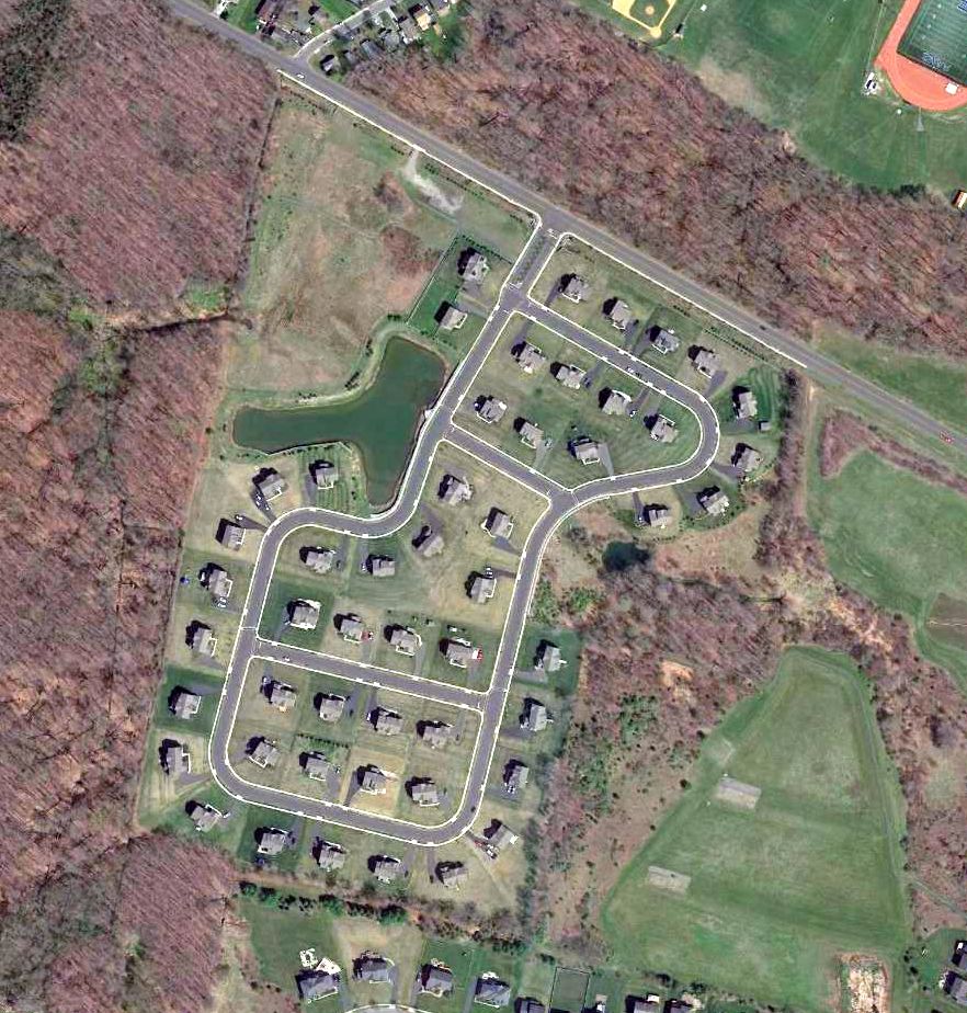
A 2016 aerial photo did not show any trace of Hightstown Airport.
The site of Hightstown Airport was located south of the intersection of Endeavor Boulevard & Airport Road, appropriately enough.
Thanks to George Manser for pointing out this airfield.
____________________________________________________
Central Jersey Airport / Hightstown-Windsor Airport, Windsor, NJ
40.233, -74.591 (Northeast of Philadelphia, PA)
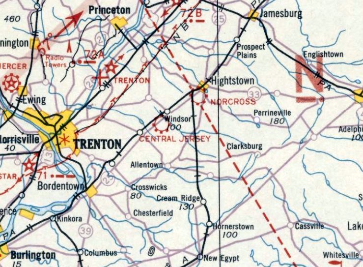
Central Jersey Airport, as depicted on the April 1933 NY Sectional Chart.
One of the huge number of New Jersey's general aviation airports lost to “progress”.
The date of establishment of Central Jersey Airport has not been determined.
A 1931 aerial view appeared to show the hangar on the north edge of the airfield, along with possibly 1 aircraft.
Central Jersey Airport was not yet depicted on the August 1932 NY Sectional Chart nor listed among active airports in the Airport Directory Company's 1933 Airport Directory (according to Jim Stanton).
The earliest depiction which has been located of Central Jersey Airport was on the April 1933 NY Sectional Chart,
which depicted Central Jersey as a commercial/municipal airport.
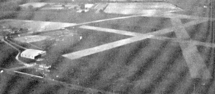
The earliest photo which is available of Central Jersey Airport was an undated aerial view from The Airport Directory Company's 1937 Airport Directory (courtesy of Bob Rambo).
The directory described Central Jersey / Hightstown-Windsor Airport as a commercial airport located 3.5 miles southwest of Hightstown.
It was said to consist of a 2,200' x 1,500' rectangular sod field, with “Windsor” painted on the hangar.
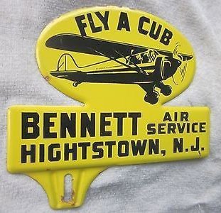
A circa 1930s sign promoting Bennett Air Service, Hightstown NJ (courtesy of Ed Drury).
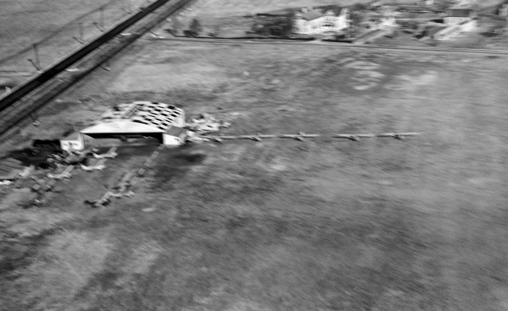
A circa late 1930s aerial view of Central Jersey Airport (courtesy of Al Bennett Jr.), showing at least a dozen light planes parked near the hangar.
Al Bennett Jr. reported, “My father Al Bennett Sr. operated Central Jersey Airport in the 1930s.”
According to Jim Stanton, “Al Bennett was known as the 'world's greatest airplane salesman' during that period.
He was selling a new airplane every 2 weeks as well as many used aircraft.”
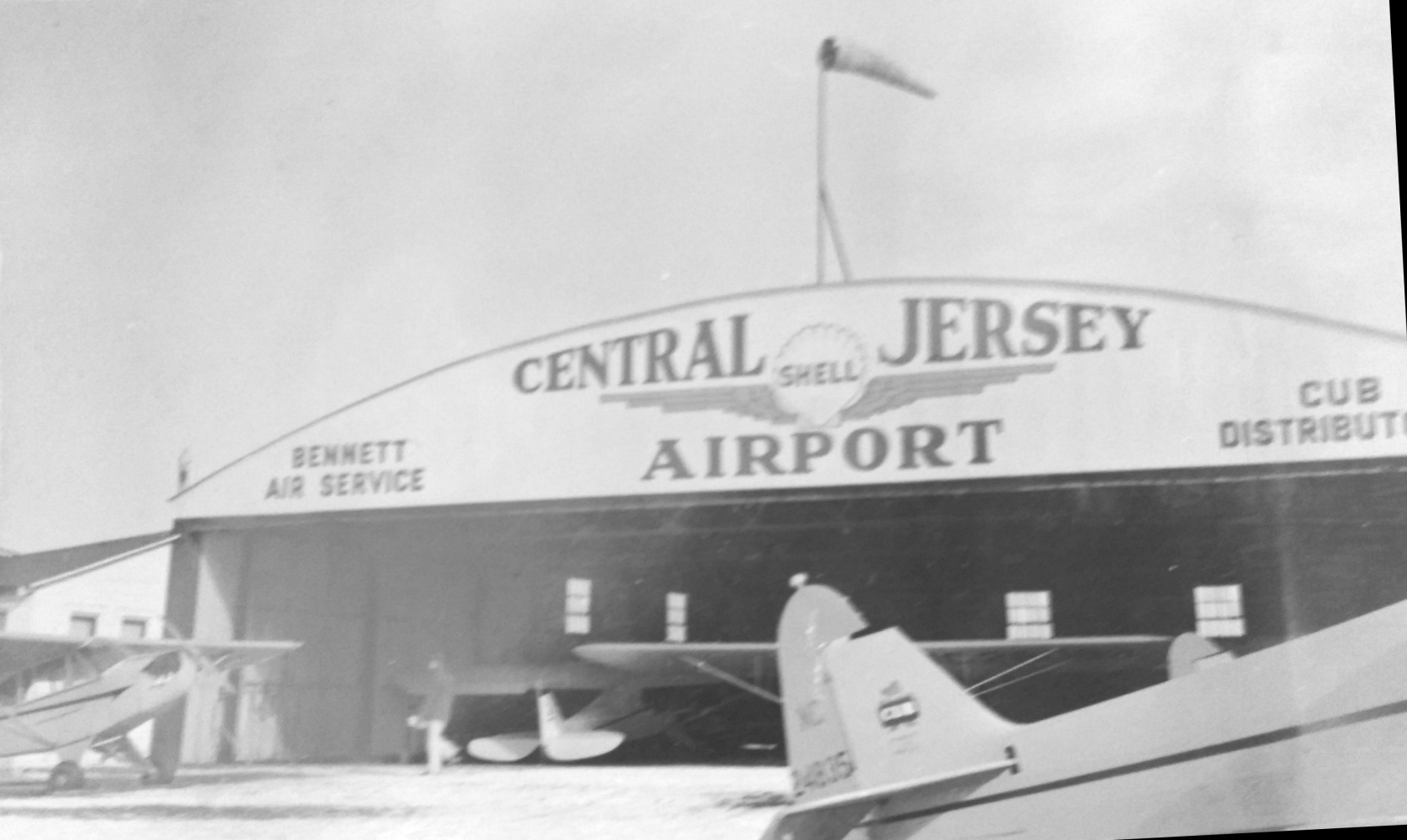
A circa late 1930s photo of 4 Piper Cubs & the Central Jersey Airport hangar (courtesy of Al Bennett Jr.).
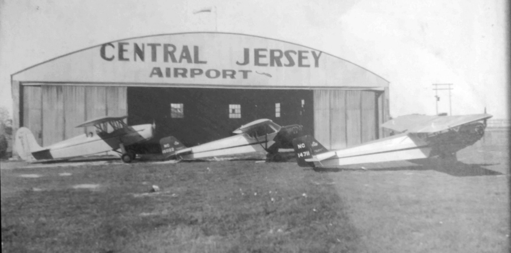
A circa 1938 photo of a Fairchild F-22 & 2 Taylor E-2 Cubs in front of the Central Jersey Airport hangar (courtesy of Al Bennett Jr.).
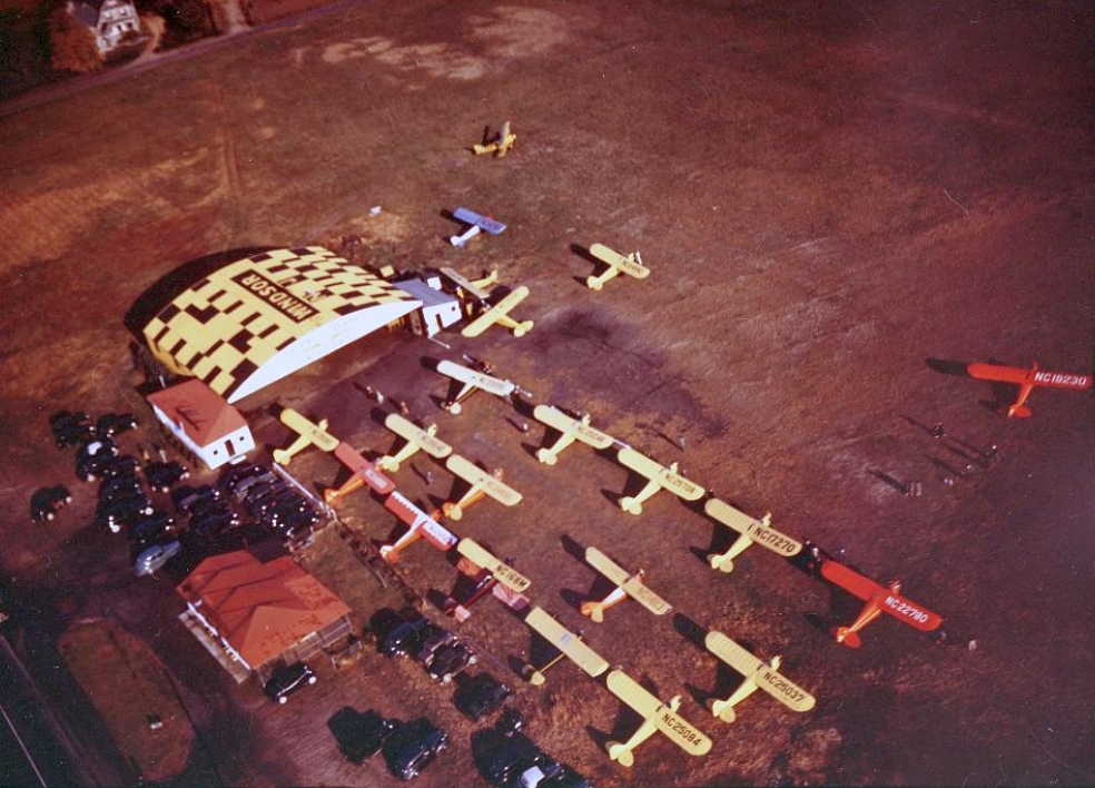
A circa 1940 aerial view looking northeast at the Central Jersey Windsor Airport hangar (courtesy of Alan Moore) showed 21 single-engine monoplanes & biplanes.
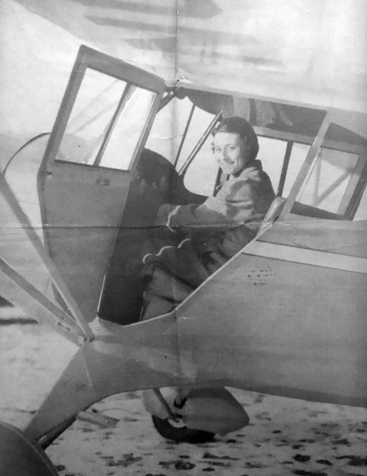
An undated photo from a 3/10/40 article of Lida Dey DeRoche inside an unidentified plane at Central Jersey Airport (courtesy of Brenda MacMurray).
The original caption: “With the hope of gaining her wings soon, Lida De Roche is pictured in an airplane at Central Jersey Airport, where she is a student pilot.”
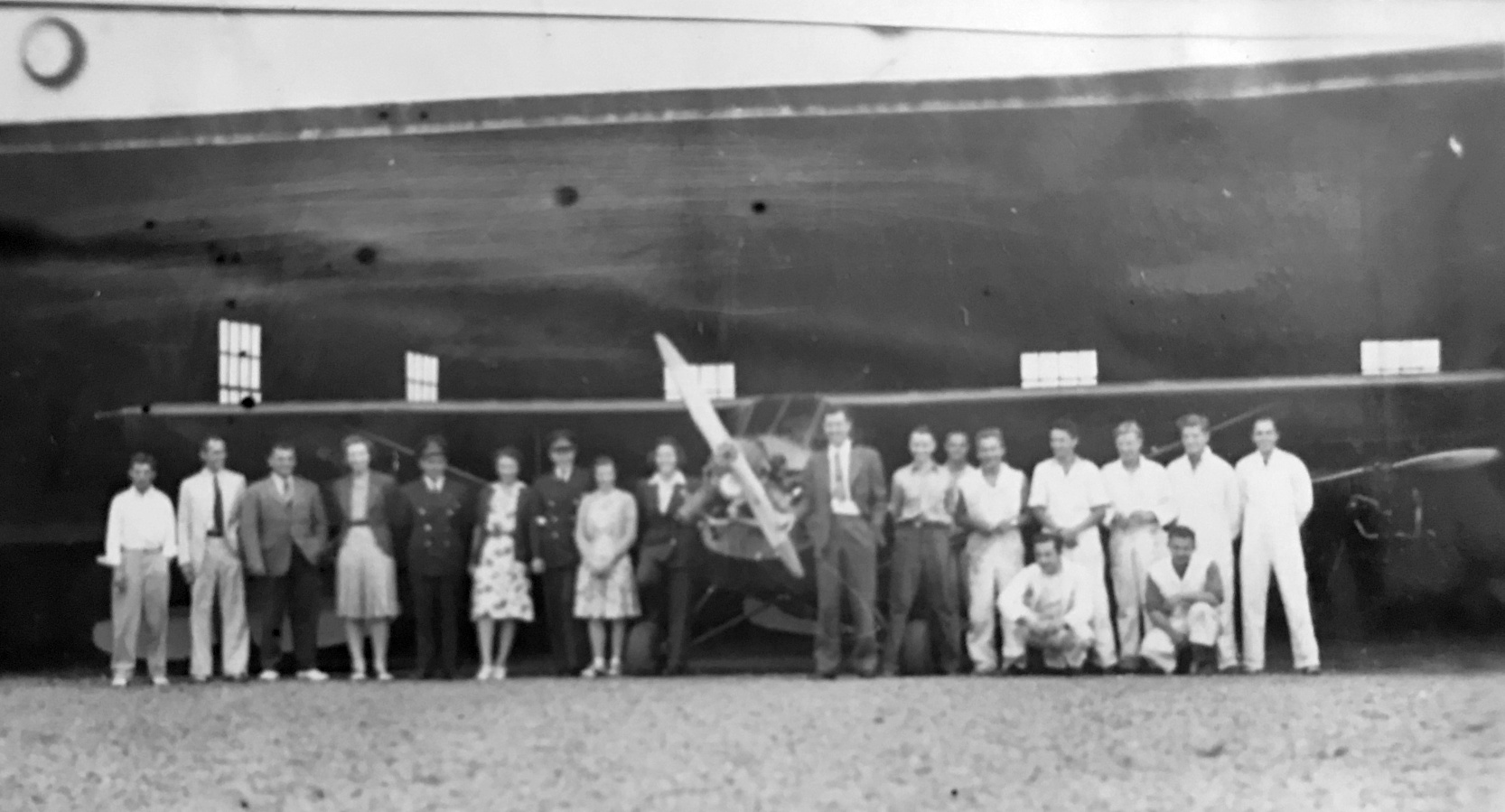
A circa 1940 photo of an unidentified group in front of several aircraft inside a Central Jersey Airport hangar (courtesy of Brenda MacMurray).
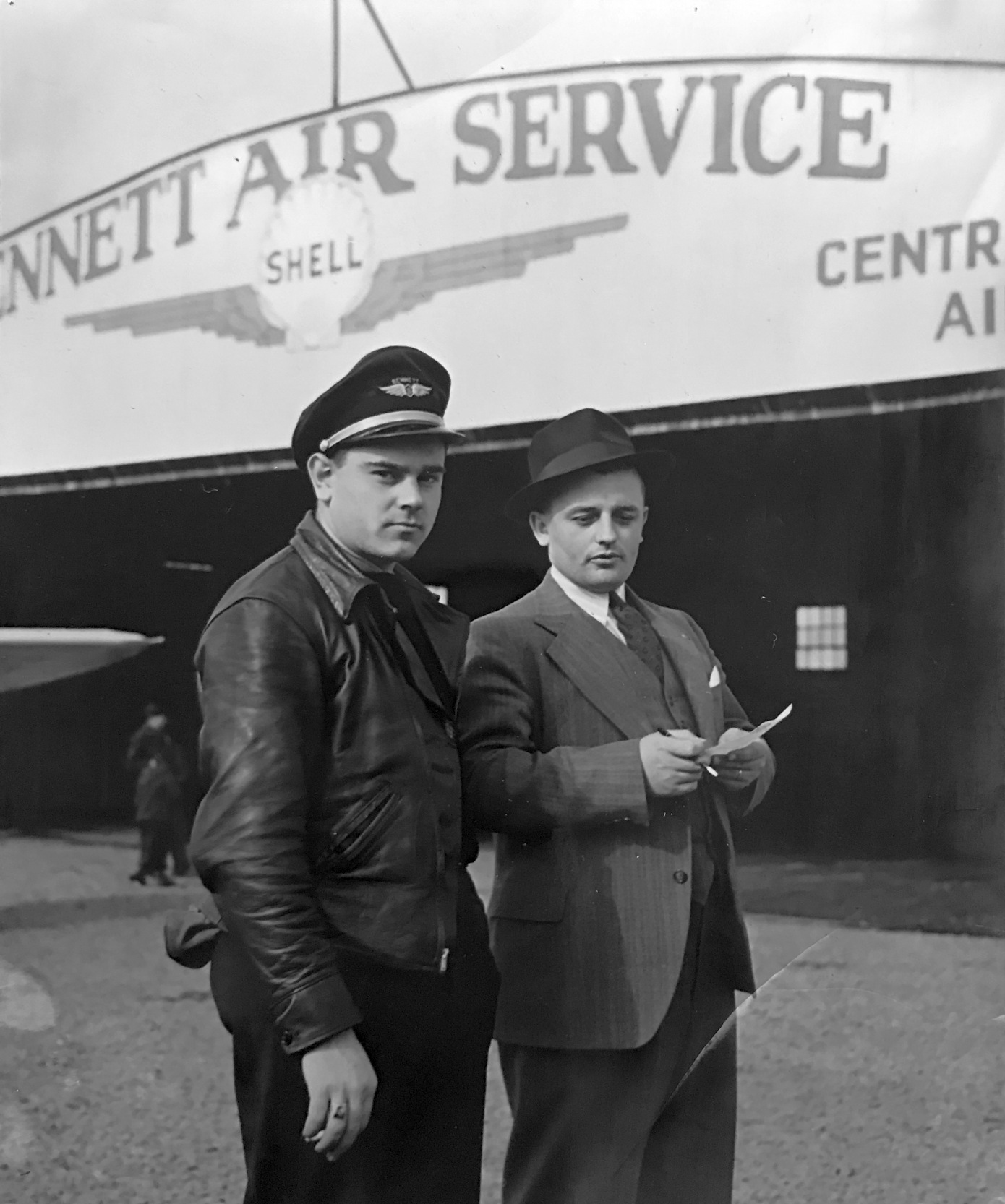
A circa 1940 photo of 2 men in front of Central Jersey Airport's Bennett Air Service hangar (courtesy of Brenda MacMurray).
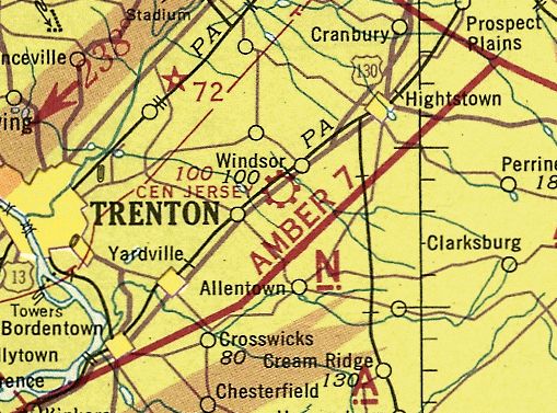
The last aeronautical chart depiction which has been located of Central Jersey Airport was on the November 1942 NY Sectional Chart (courtesy of Ron Plante).
It depicted Central Jersey as a commercial/municipal airport.
According to Jim Stanton, “Central Jersey Airport was likely closed immediately after the Pearl Harbor attack
(all civilian flying was banned along the coastal areas except for activity such as Civil Air Patrol).”
Central Jersey Airport was no longer depicted on the May 1943 NY Sectional Chart (courtesy of Ron Plante) or subsequent charts.
According to Jim Stanton, “Central Jersey Airport apparently did not reopen after the war.”
A 1947 aerial view showed Central Jersey Airport's checkerboard-roofed hangar on the north side, but no aircraft were visible on the field.
Jim Stanton reported of Central Jersey Airport, “I drove by the location many times; I believe the first time was around 1962.
A NJ historian confirmed that the hangar was still there when he moved to the area around 1970.”
A 1979 aerial view still showed Central Jersey Airport's former hangar on the north side.
Jim Stanton reported of Central Jersey Airport, “I believe the hangar was there in the early 1980s.”
A 1984 aerial view showed Central Jersey Airport's former hangar had been removed by that point.
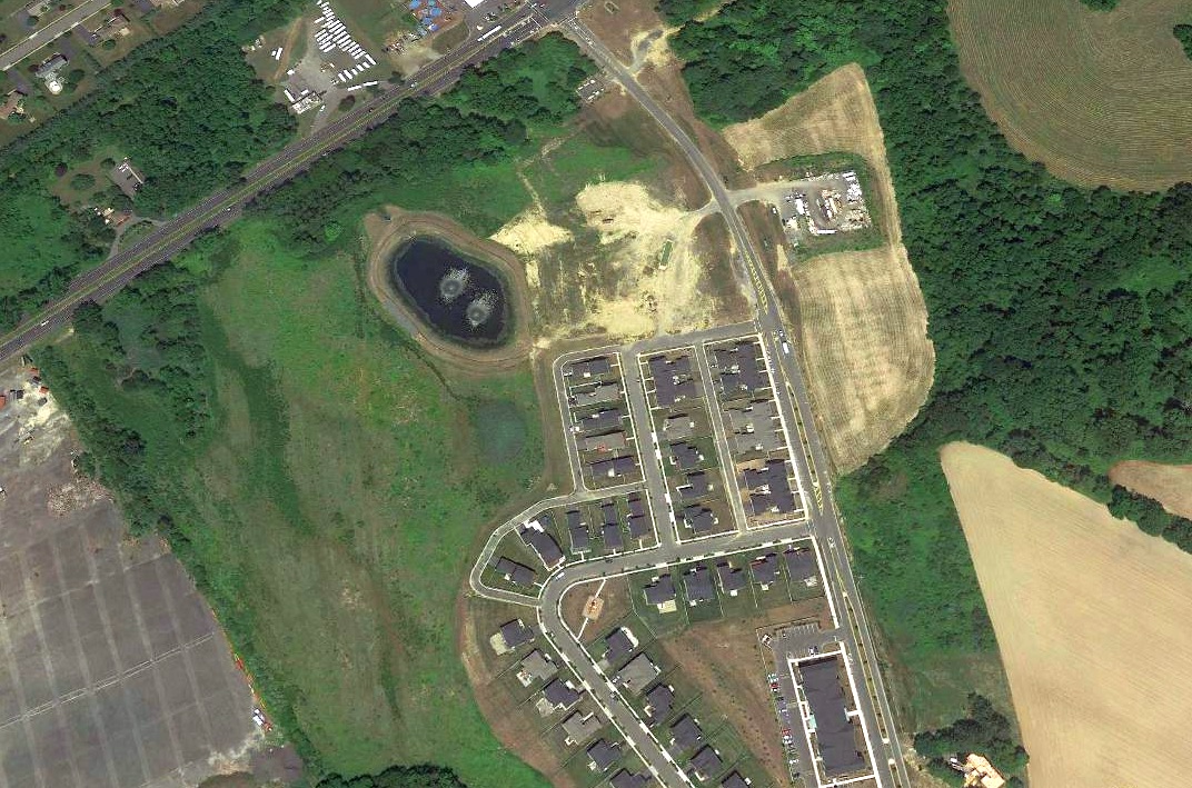
A 2018 aerial view looking north did not show any trace of Central Jersey Airport.
The site of Central Jersey Airport is located southwest of the intersection of Route 130 & Gordon Road.
____________________________________________________
Mercer County Airport (original location) / Trenton-Mercer Airport, Trenton, NJ
40.28, -74.83 (Northeast of Philadelphia, PA)
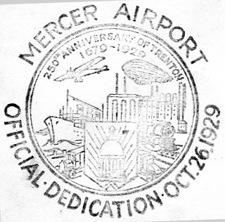
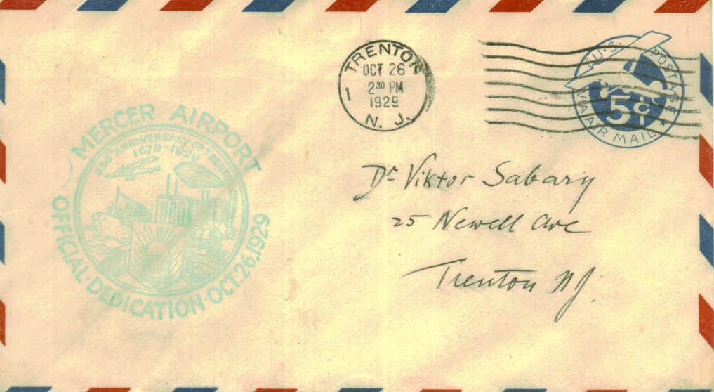
A postmark commemorated the 10/26/29 Dedication of Trenton Mercer Airport (courtesy of the Hamilton Historical Society, via Mark Hess).
The original Mercer County Airport was located adjacent to the northwest side of the present-day Mercer County Airport.
A postmark commemorated the 10/26/29 Dedication of Trenton Mercer Airport.
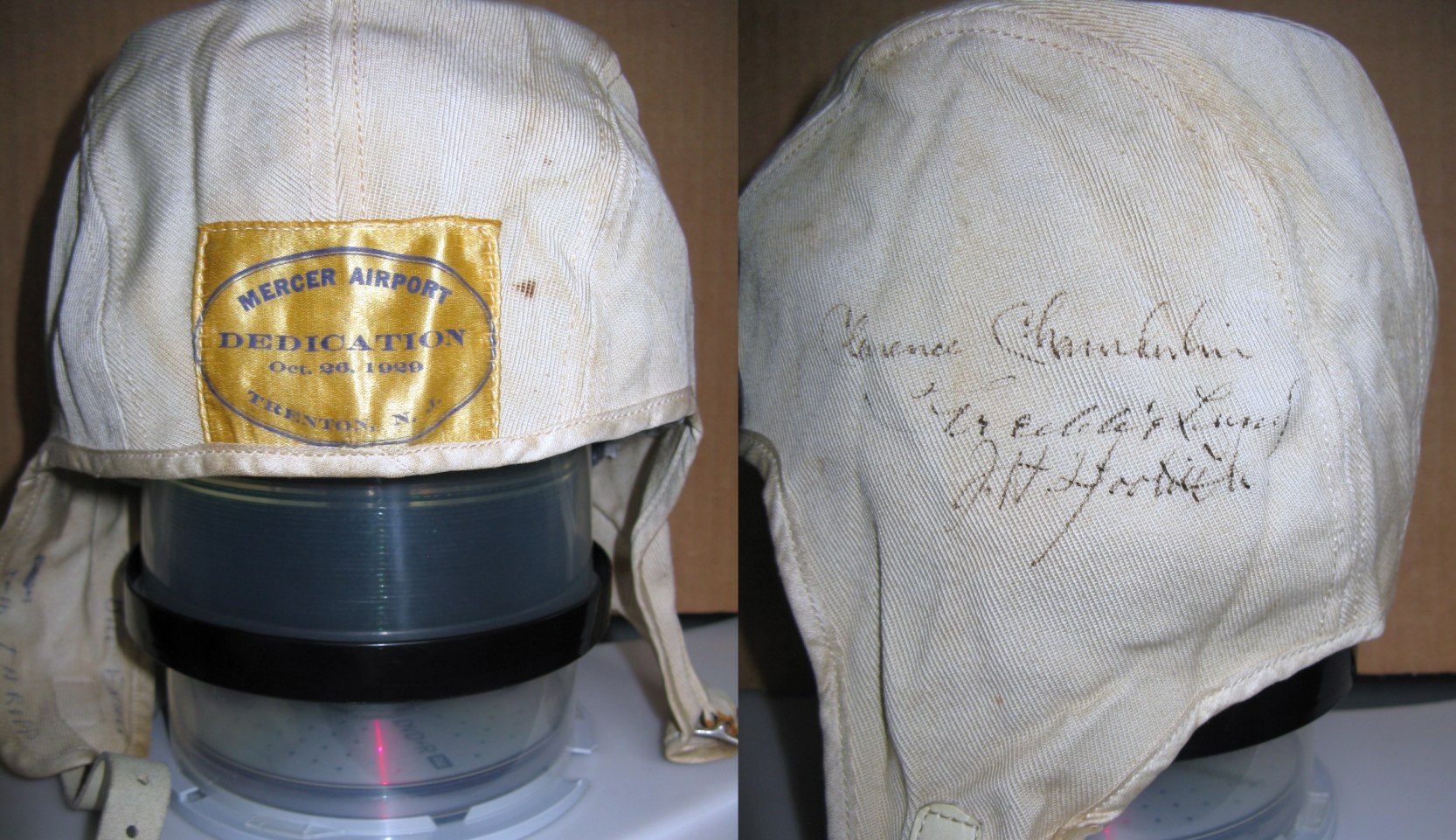
Two 2019 photos by Bill Engle of “a cloth flying helmet, from the 1929 Mercer Airport Dedication.
It was given to my Dad by Jack (John) Thropp who I believe worked at the airport.
It’s autographed by Clarence Chamberlin & Jimmy Doolittle who were both present at the dedication.
There’s an additional signature between the 2 men, but I haven’t been able to figure out who or what the signature refers to.
The helmet was compliments of Switlik Manufacturing Company, a Trenton parachute manufacturer.”
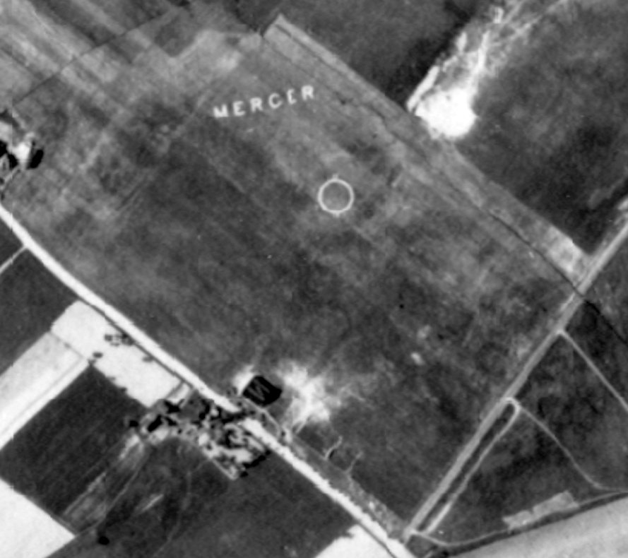
The earliest depiction which has been located of Mercer Airport was a 1930 aerial view.
It depicted Mercer Airport as an open grass field with a single hangar on the southwest side,
an airport circle marking in the center of the field, and the word “Mercer” prominently written in the grass along the northern edge.
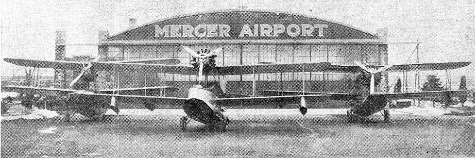
An undated photo from the 1/3/31 Trenton Advertiser (courtesy of Tony Richardson) depicted 3 Keystone amphibians in front of the Mercer Airport hangar.
It was captioned “Air yachts from Keystone plant fill Mercer Airport hangar to capacity.
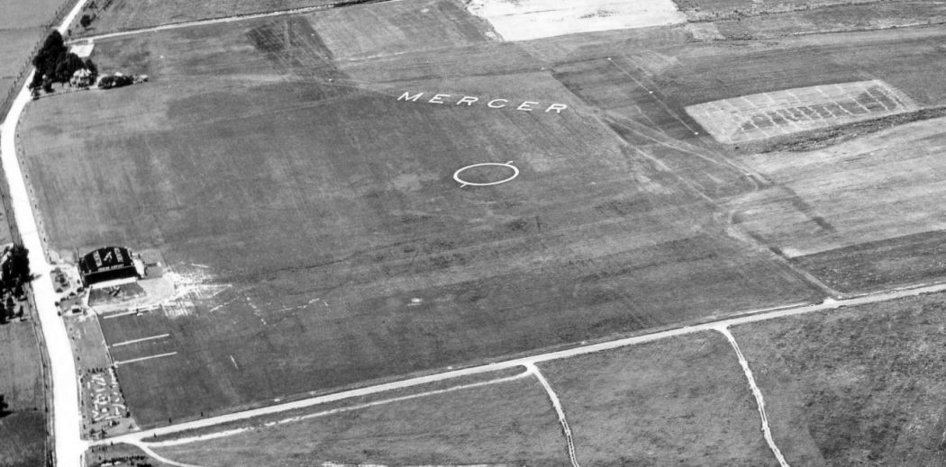
A 8/18/31 aerial view looking north depicted Mercer Airport as an open grass field with a single hangar on the west side,
an airport circle marking in the center of the field, and the word “Mercer” prominently written in the grass along the northern edge.
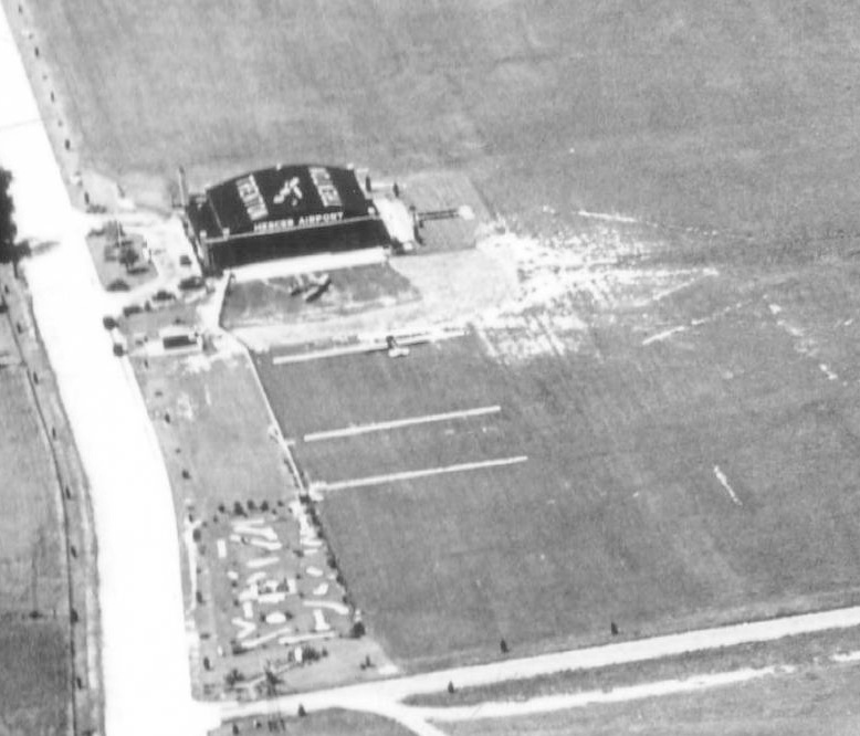
A closeup from the 8/18/31 aerial view looking north at the Mercer hangar, showing 2 aircraft in front of the hangar.
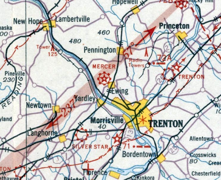
The earliest aeronautical chart depiction which has been located of Mercer Airport was on the August 1932 NY Sectional Chart, which depicted it as a commercial/municipal airport.
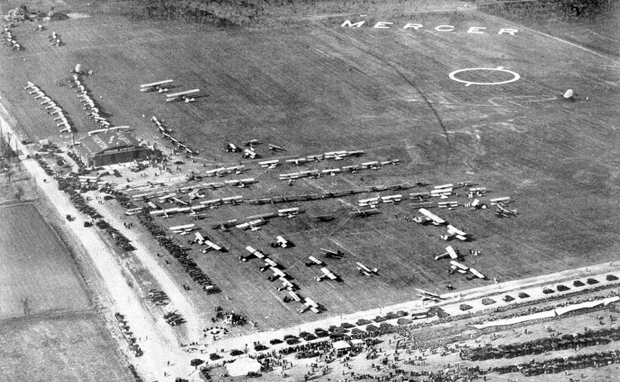
A 1934 aerial view looking north depicted Mercer Airport during some type of air show,
with large numbers of aircraft & spectators on the field (courtesy of the Hamilton Historical Society, via Mark Hess).
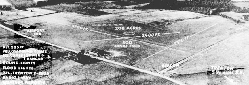
An undated aerial view looking north at Mercer Airport
from a circa late 1930s Airfield Directory Company Airfield Directory (courtesy of the Hamilton Historical Society, via Mark Hess).
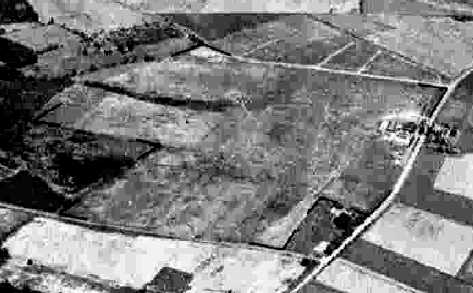
A 6/21/41 aerial view looking south at “Mercer County Airport (Old)” from the 1945 AAF Airfield Directory (courtesy of Bob Rambo).
It depicted the “Mercer County Airport (Old)” as an open grass field with some small buildings on the west side.
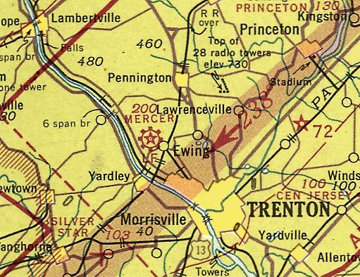
The November 1942 NY Sectional Chart (courtesy of Ron Plante) depicted Mercer as a commercial/municipal airport.
Michael Darling reported, “Mercer Airport was the base for the Trenton detachment of the Civil Air Patrol during the war,
of which my grandfather James Darling was an officer.”
The 1945 AAF Airfield Directory (courtesy of Scott Murdock) described “Mercer County Airport (Old)” as a 305 acre rectangular property
having 2 sod runways, measuring 2,500' northeast/southwest & 2,400' east/west.
The field was said to have 3 hangars, the largest of which was a 120' x 40' metal structure.
Mercer County Airport was described as being owned by private interests, but “Not in operation”.
It may have been temporarily closed during WW2, like many other small civilian airports.
The original Mercer County Airport was not depicted on the January 1945 NY Sectional Chart (courtesy of Ron Plante),
presumably due to its closure during WW2.
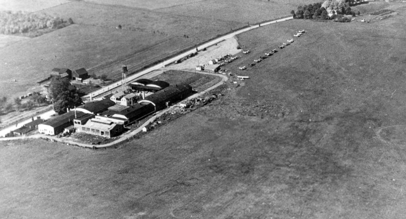
The last photos which have been located of the original Mercer Airport included a circa 1946-49 aerial view looking west by CAP Sgt. W. Egge (courtesy of Bruce Reid).
It depicted a dozen light aircraft parked to the northwest of the hangars.
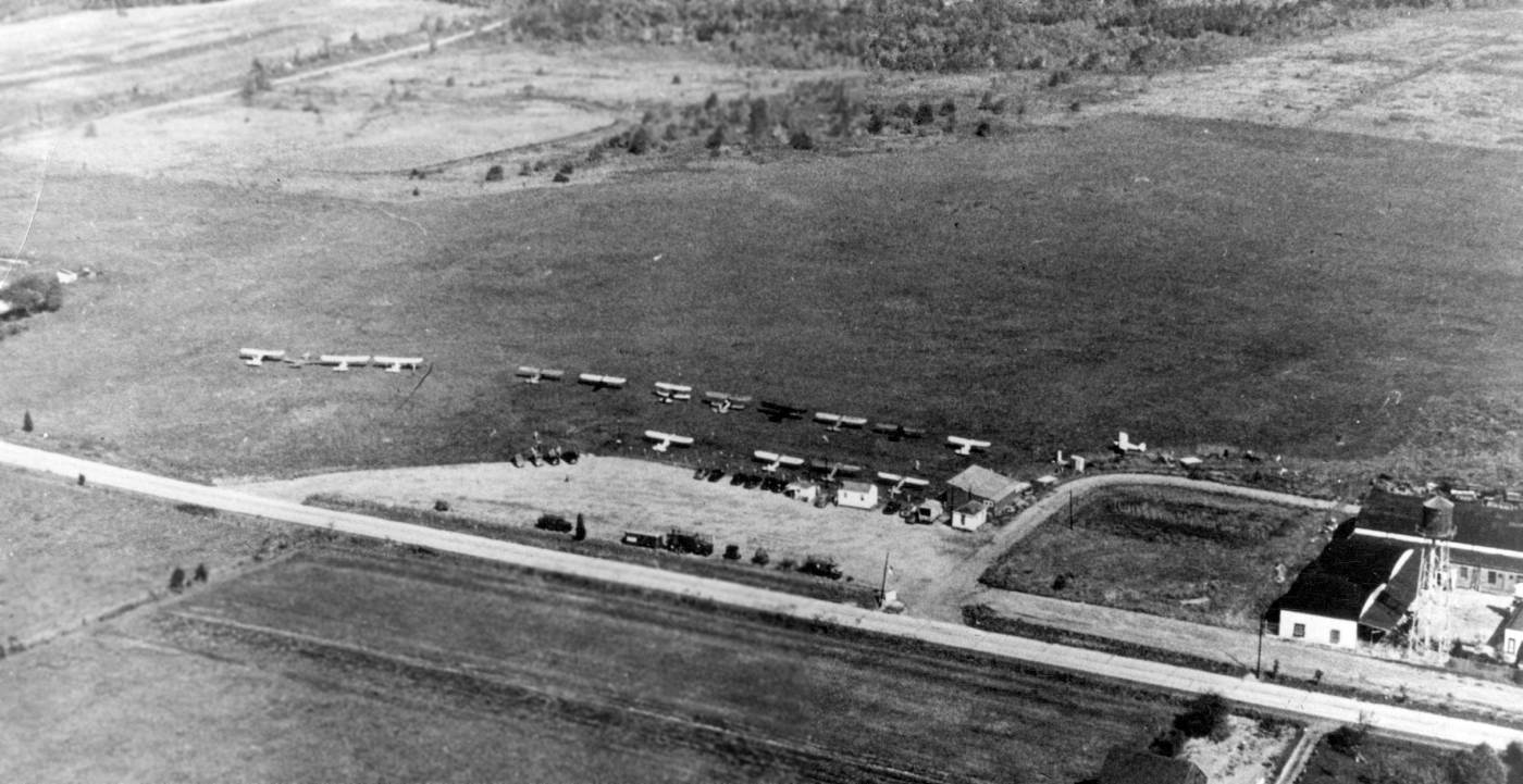
The last photos which have been located of the original Mercer Airport included a circa 1946-49 aerial view looking east by CAP Sgt. W. Egge (courtesy of Bruce Reid).
It depicted a dozen light aircraft parked to the northwest of the hangars.
Michael Darling reported, “Mercer Airport in Trenton was a small grass strip run by my grandfather [James Darling] in the 1940s – 50s.
The county leased the old Mercer Airport out to different operators; he operated it with a couple of partners from just after WWII until it became the country club.”
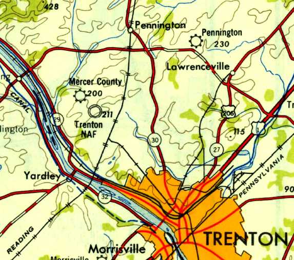
Mercer County Airport, as depicted on the 1947 USGS topo map.
A 1947 aerial photo depicted several light aircraft parked along the west side of the original Mercer County Airport.
The original Mercer County Airport was once again depicted on the July 1949 NY Sectional Chart (courtesy of Ron Plante).
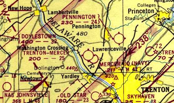
The last aeronautical chart depiction which has been located of Trenton-Mercer Airport was on the 1950 NY Sectional Chart,
which depicted “Trenton-Mercer” as having a 2,500' unpaved runway.
The original Mercer County Airport was presumably closed at some point between 1950-53,
as a 1953 aerial view showed a closed “X” symbol added over the circle marking in the center of the airfield.
The airfield remained clear, and the complex of hangars & buildings on the west side remained intact, but the field was devoid of aircraft.
The original Mercer County Airport was no longer depicted on the July 1955 Philadelphia Local Aeronautical Chart (courtesy of Chris Kennedy).
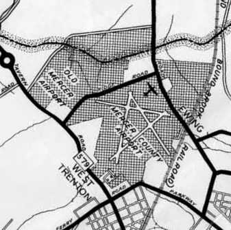
The last depiction which has been located of the original Mercer Airport was on a 1956 Mercer County map (courtesy of Micheal Darling).
A 1957 aerial view showed the complex of hangars & buildings on the west side of the original Mercer County Airport remained intact,
but several new roads had been built across the former airfield.
A 1958 aerial view showed that a golf course had begun to be constructed over the majority of the site of the original Mercer County Airport.
A 1979 aerial view showed the complex of hangars & buildings on the west side of the original Mercer County Airport remained intact.
The hangars on the west side of the site of the original Mercer County Airport were evidently removed at some point between 1979-95,
as a 1995 aerial view showed several new office buildings having been built on the site.
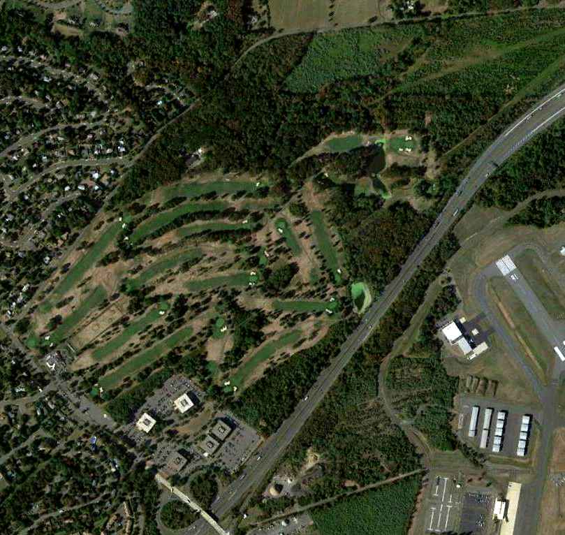
A 9/21/10 aerial photo did not show any trace of the original Mercer County Airport, with a golf course covering the site.
Note the runways of Trenton-Mercer Airport, immediately adjacent to the southeast.
The site of the original Mercer County Airport is located north of the intersection of Interstate 95 & Bear Tavern Road,
adjacent to the northwest side of Trenton-Mercer Airport.
____________________________________________________
Mahalchik Airfield, Chambers Corners, NJ
40.03, -74.728 (Northeast of Philadelphia, PA)
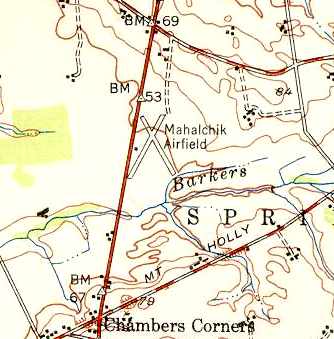
Mahalchik Airfield, as depicted on the 1949 USGS topo map.
Mahalchik Airfield was not yet depicted on a 1940 aerial photo,
nor listed among active airfields in the 1945 AAF Airfield Directory (courtesy of Scott Murdock).
Scott Roberts recalled, “This was a small privately-owned field started after the war [WW2] by John Mahalchik,
who went on to become a county resident of some note.
John Mahalchik was a B17 & B24 instructor pilot during WWII,
and earned the nickname 'Lucky' by being the sole survivor of an aircraft crash, I think it was in South America.
I remember him telling stories about flying there for booze & beef runs!”
According to Doug Wright, “John Mahalchik was a hermit & collector of military junk
who ran for Congress & backed up his convictions with a shotgun.
There is a magazine called 'Weird New Jersey' that did an article about John.”
Mahalchik Airfield was evidently established at some point between 1945-49,
as it was not yet depicted at all on the 1945 NY Sectional Chart.
The earliest depiction which has been located of the Mahalchik Airfield was on the 1949 USGS topo map.
It depicted the field as having two 1,900' runways, intersecting in an “X” shape.
A single small building was depicted on the west side of the field.
Scott Roberts recalled, “He populated the airport with small military surplus trainers.
Sometime in the late 1940s (I think he said 1949) a hurricane struck NJ, and most of his aircraft & his hangars were destroyed.
While the airport remained in place, John Mahalchik came to create a name for himself in the county for his surplus militaria scrapyard - he collected anything & everything.
One side of the runway was soon bordered by 1940s staff cars, there were trucks,
Navy K-type blimp cars (one of which is now restored & in the National Museum of Naval Aviation) and even 2 locomotives!”
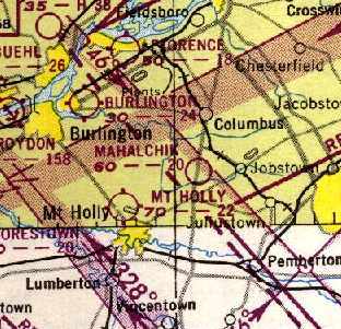
The 1950 NY Sectional Chart (courtesy of Mike Keefe).
depicted Mahalchik as having a 2,000' unpaved runway.
The earliest photo that has been located of the Mahalchick Airfield was a 1953 aerial view.
It depicted the field as having a single northeast/southwest unpaved runway,
with John Mahalchick's scrapyard on the west side of the field.
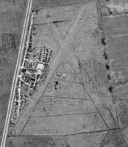
A 1956 aerial view depicted Mahalchick Airfield as having 2 unpaved, very sharply-defined runways,
with the northwest/southeast runway having been added at some point between 1953-56.
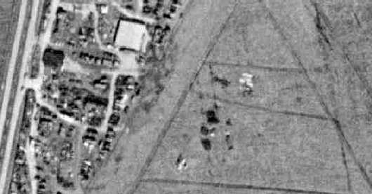
A closeup from the 1956 aerial photo appeared to depict one aircraft, at the bottom-center.
Scott Roberts recalled, “He had a bit of a hard time from the late 1950s, battling with the township & county,
and allegedly the mafia, whom he said burned his house down when he was in jail for taxes one time,
because they wanted his land to build a race track.
I can't corroborate these stories, but that's what he told me!”
According to Doug Wright, “This guy lived inside a jumbo teepee after the locals torched his house.”
Scott Roberts recalled, “When he was in jail (county, for taxes I believe - although someone paid his taxes every year, anonymously!)
and his house was burned down, he got out, and had nowhere to go.
His wife had left at that point, I think.
So he went to the township, and got a look at building codes, as they refused to let him rebuild his house
(he had all sorts of 'disagreements' with local officials).
Finding what he needed to know, he spent a few days assembling materials, both from his own stockpile, and the local dump.
At 5 pm that Friday evening he started constructing the 'tin teepee' out old 2x4s & scrap metal.
He finished just before 8 am on the following Monday morning.
The township building inspector showed up almost immediately,
demanding he remove it, because it didn't meet building codes.
Mahalchik then challenged him to show exactly where this building was illegal -
it seems this type structure was completely outside of the written codes, so a legal loophole!
The township corrected this error soon after, but the building, such as it was, was not subject to it, being preexisting!
John Mahalchik lived there the rest of his life.
I actually was invited in once or twice – as you might expect, it was a true hermit's dwelling.
No interior walls, heat provided by one small woodstove,
whatever rubbish at hand used as fuel, no running water, and only minimal electricity.
While most of the place was in disarray, I do remember quite clearly one piece of artwork -
a framed pencil drawing of a pair of USAF wings about 6 inches across.
Despite all else he was, he was a pilot.”
Scott Roberts recalled, “I do know the field was usable through the 1950s - a friend of mine, another military aviation nut -
landed there one day, jumped out & asked him (about the surplus he was accumulating), 'This #### for sale?' with a big grin.
Apparently Mahalchik enjoyed his enthusiasm, because he got a good laugh from him.”
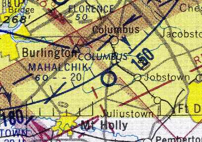
The last chart depiction which has been located of the Mahalchik Airfield was on the January 1958 NY Sectional Chart (courtesy of Chris Kennedy).
It depicted the field as having a 2,000' unpaved runway.
Scott reported, “My friend, Steve Roberts landed there.
He said he landed there in about 1958-59, flying a PA-11 Cub on one of his student pilot cross country flights.
John Mahalchik signed his logbook as having landed.
He said the runways were meticulously maintained at the time,
grass cut well, and clearly identifiable from the air 20 miles away.
He remembers a 'very distinctive' tetrahedron, and the runway markers were beautifully made -
he seems to recall them being cut in half & painted 55 gallon drums.
The rest of the property was in well maintained shape -
with the beginnings of the junk collection in well defined areas, well off the runways.
But no other aircraft seemed to be present. But it was so beautiful he was compelled to land.
He also remembers the 2 locomotives, and lots of military motorcycles - Harleys, Indians, etc.”
Luther recalled, “My step-grandfather was Andrew Mahalchik, John Mahalchik's father.
I remember we stayed at the junkyard sometime around 1960 for an overnight visit. It was a neat place to be as a kid.
His house was under construction I guess, I remember the floor was not complete. His family was still together at that time.
Uncle John was an Air Force pilot during the Korean war. He was an interesting man & at the same time hard to understand.
I still think about him when I drive down the highway.”
The Mahalchik Airfield was evidently closed at some point between 1958-63,
as it was no longer depicted at all on the January 1963 NY Sectional Chart (according to Chris Kennedy).
A 1963 aerial photo showed that the 2 runways were considerably decayed –
they were no longer the sharply-outlined strips as seen in the 1956 aerial photo.
The Mahalchik Airfield was no longer depicted at all on on the 1969 topo map.
A 1970 aerial photo showed that the large building (hangar?) just west of the runway intersection
had been removed at some point between 1963-70.
The northeast/southwest runway was sharply-defined,
but there was no longer any recognizable outline of the former crosswind runway.
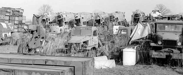
An undated photo of what appears to be 7 Navy K-class blimp gondolas at Mahalchik Airfield.
“
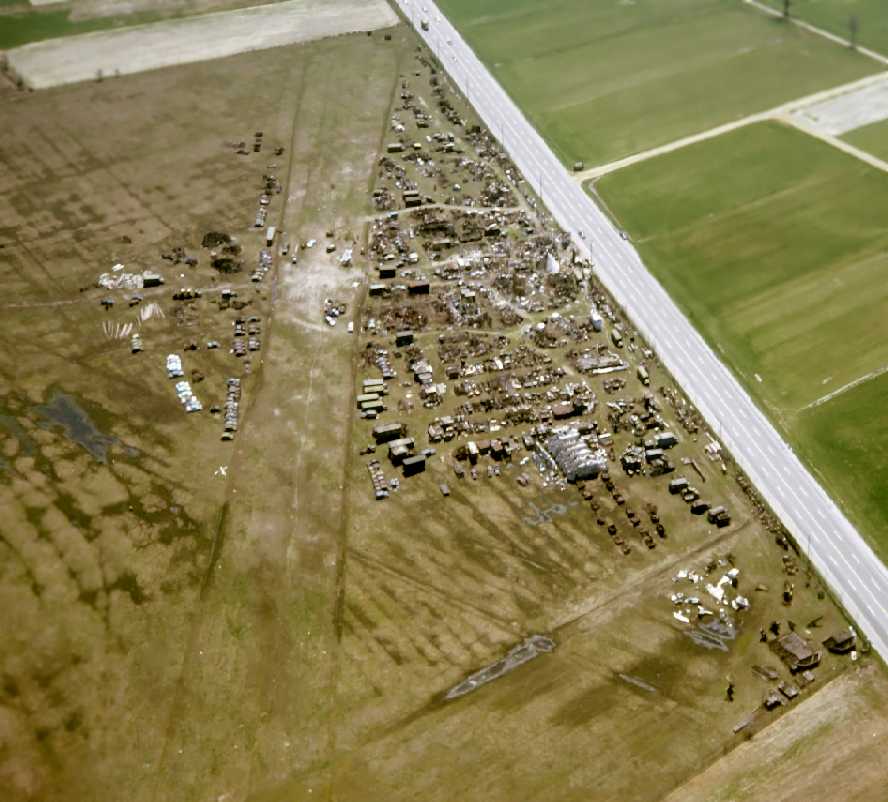
A 1970s aerial view by Rich Kolasa (courtesy of Scott Roberts) looking southeast at Mahalchik Airfield,
showing the 2 grass runways & remains of numerous aircraft, trucks, etc.
Note the infamous “Tin Teepee” midway along the road.
Scott Roberts recalled, “You can see why I loved to hang out there when I was younger!
John Mahalchik was a very guarded person by the time I met him.
He would typically be somewhere on the property, and you'd have to honk to get his attention.
He would come to the front gate, and ask what you were looking for,
and if he thought he had it, he would guide you in, sell it to you, and then guide you out.
If he didn't have what you needed, or if he just plain didn't like you, he'd send you on your way.
I had the privilege of being able to stop by, and once he knew I was there, have free run of the place.
I could wander where ever I liked, and look at whatever stuff I wanted. It was really neat close up, too.”
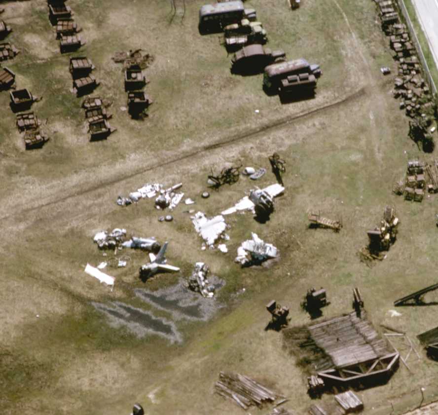
A 1970s aerial view by Rich Kolasa (courtesy of Scott Roberts) of components of some unidentified jet aircraft.
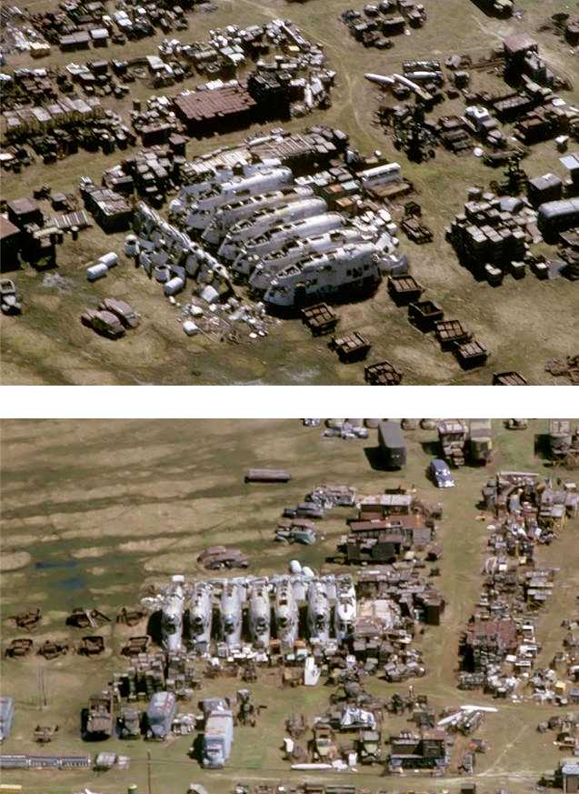
A 1970s aerial view by Rich Kolasa (courtesy of Scott Roberts) of the control cars from 7 WW2-era K-type Navy airships.
However, according to Scott Roberts, “John used to fly his Cessna 150 out of there, long after he stopped being listed as an airport.
For several decades until his passing in the late 1980s this personal scrap drive continued.
Afterwards all he had accumulated was sold off - mostly to recyclers probably,
but a lot of neat things went all over the world - including a CG4A Waco glider.
One thing many people failed to notice when touring the yard during the auction were the little white pyramids, the remaining markers of the runway.
His airplane was also sold at the auction.”
According to Doug Wright, “The great irony is that his collection of what was considered to be trash eventually fetched something like $3 million after his death.”
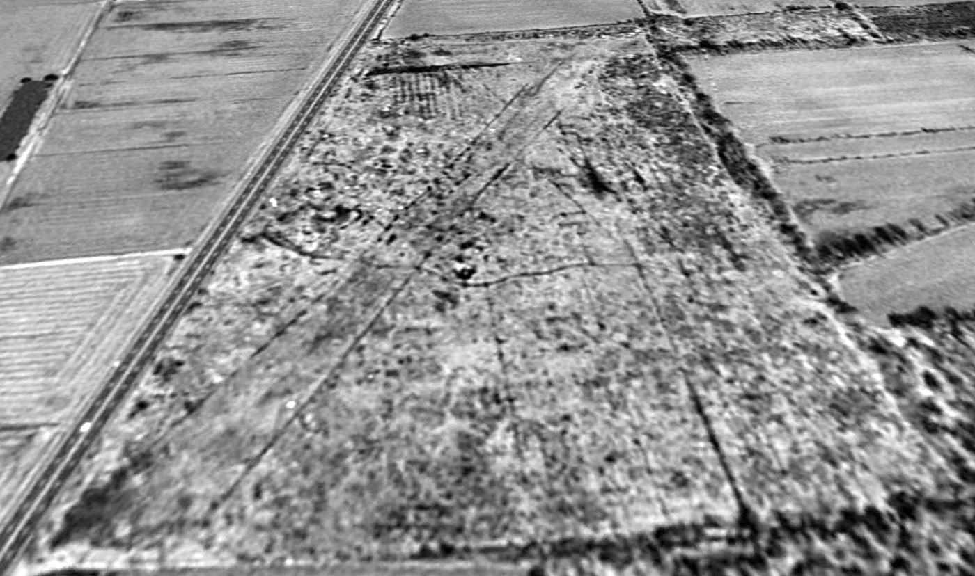
A 1995 USGS aerial view looking north showed the outlines of both former Mahalchik runways were still recognizable.
Scott Roberts observed, “Also noticeable are all the interlocking paths on the property: for years there was all sorts of machinery, vehicles, etc. piled along them.
Most of it is gone - but the traces still remain.”
Scott Roberts reported in 2005, “The land remains undeveloped.”
An 8/26/08 aerial photo still showed the recognizable outline of the runway.
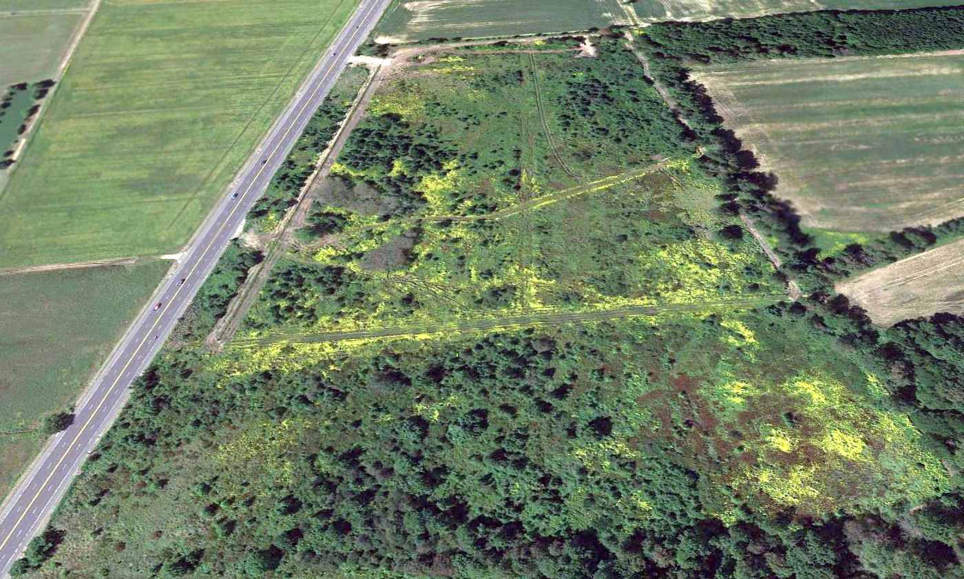
A 2013 aerial view looking north showed several new paths had been carved onto the property, erasing the last traces of Mahalchik Airfield.
Ray Verner reported in 2013, “The land is vacant. It was recently purchased & fenced using telephone poles as posts, presumably to graze cattle.”
The site of Mahalchik Airfield is located on the east side of Route 206, north of its intersection with Monmouth Road.
____________________________________________________
Or if you prefer to contact me directly concerning a contribution (for a mailing address to send a check),
please contact me at: paulandterryfreeman@gmail.com
If you enjoy this web site, please support it with a financial contribution.
____________________________________________________
This site covers airfields in all 50 states.